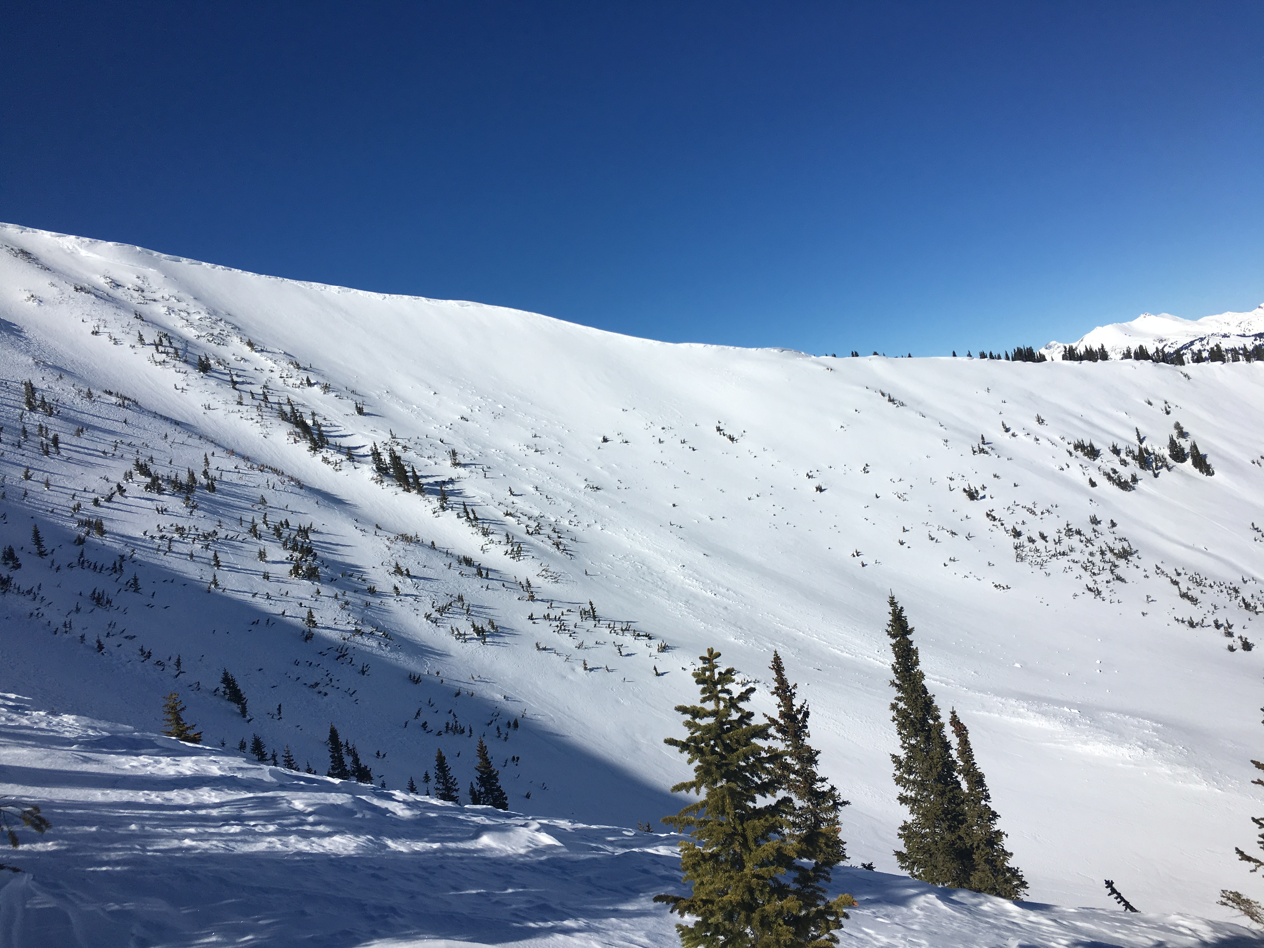
Below Treeline Obs Snodgrass-Gothic Zone

CB Avalanche Center2018-19 Observations

Location: Crested Butte Area
Date of Observation: 02/01/2019
Name: Tim Brown

Subject: Below Treeline Obs Snodgrass-Gothic Zone
Aspect: East, South West, West, North West
Elevation: 9,400-11,000′

Avalanches:

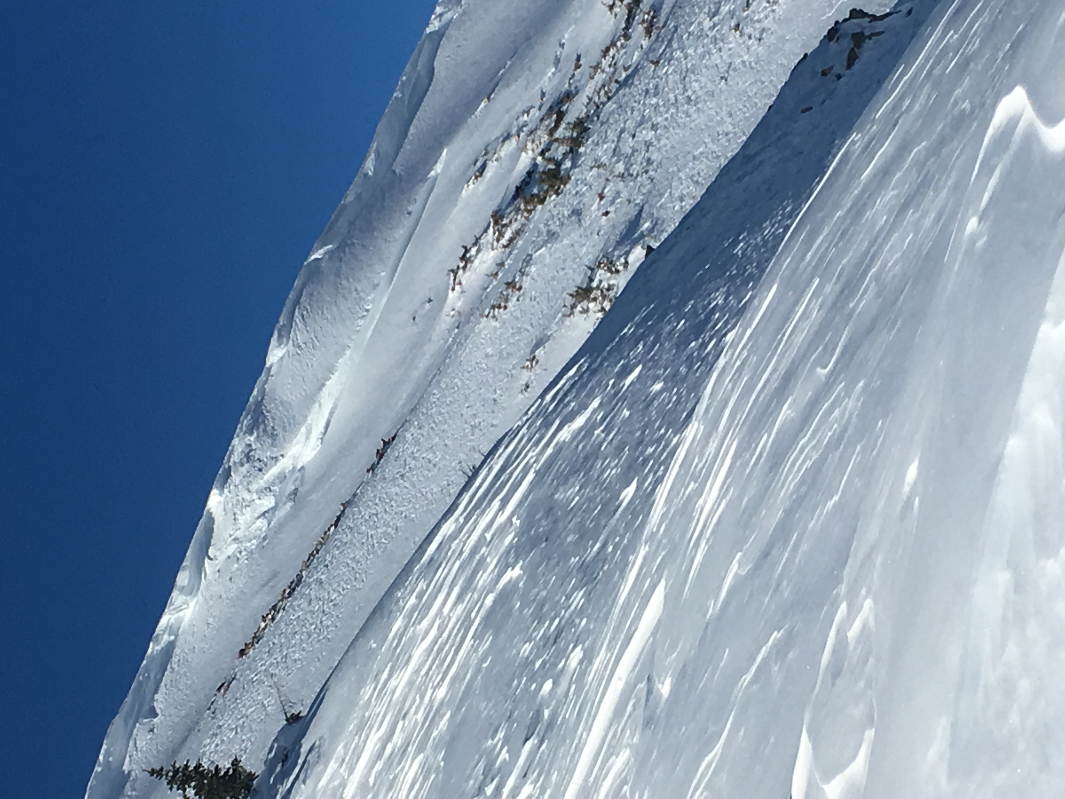
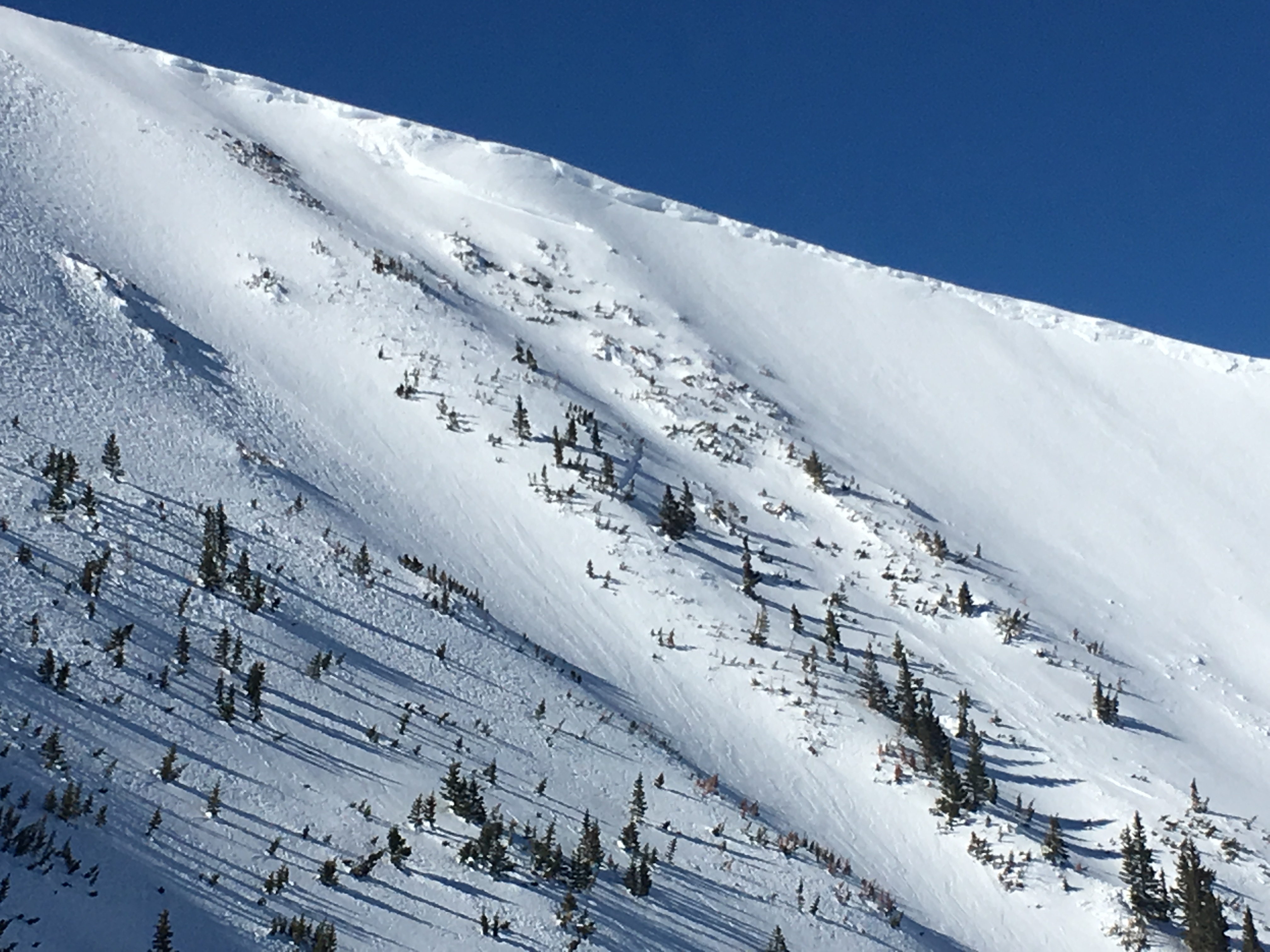
no new avalanches, cracking or collapsing

Weather: Bluebird day with intense solar radiation, clear skies all day, warm (>0C at 11,000′ at noon), CALM in am, LIGHT winds from NW in afternoon, no blowing snow.

Snowpack: Snow depth varied from ~100cm on Westerly aspects to ~160cm on East aspects in open terrain below treeline. The entire snowpack is mostly faceted throughout this elevation band, but the mid-pack was more supportive on the deeper, East-facing slopes. East aspects harbored three distinct layers of buried surface hoar (5cm, 45cm and 70cm below the surface) under fist hard, 4 finger hard and 1 finger hard slabs, respectively. Despite these concerning layers, snowpack tests (CTN, ECTX) failed to produce positive results on an East-facing 32 degree open slope at 10,900′ with foot penetration of 45cm and ski penetration of 30cm. Continuous crust-facet combinations were present in the top 30-60cm on 30 degree Southwest-facing slopes without much recent loading, but absent on lower-angle West-facing slopes ~10,600′. The top 10-20cm became moist on steeper sun-exposed slopes below treeline today.
Photos:
Red Coon Glades

CB Avalanche Center2018-19 Observations

Location: Kebler Pass Area
Date of Observation: 02/01/2019
Name: Will Nunez

Subject: Red Coon Glades
Aspect: South East, South, South West
Elevation: 9,000-11,700

Avalanches:

One small wet loose sluff
old, R2 D2 persistent slab, Red Coon Bowl see photo

No other signs of instabilities

Weather: Wx:
Clear, lots of solar, warm, calm

Snowpack: Sx:
HS ranged from 90-120cm
Surfaces Forms: suncrusts with small facets, some surface hoar on shaded aspects
Hand pit reveled the 1/15 crust facet combo layer is still present in Red Coon Glade and higher up just below the coon summit.

Photos:

Schuylkill Ridge

CB Avalanche Center2018-19 Observations

Location: Crested Butte Area
Date of Observation: 02/01/2019
Name: TC

Subject: Schuylkill Ridge
Aspect: North East
Elevation: 9,200-11,400

Avalanches:

Lots of old crowns all around, but nothing new (besides the one on Baldy). Minor sloughing in the upper 10-15 cm of the snowpack entering from the ridge. Also had some sloughing on the steep benches lower down on the slope that almost wanted to step down deeper into the snowpack.

Weather: Ridiculously nice. Below zero on the valley floor increasing to balmy on the ridge. Blue sky, bright sun, no wind.

Snowpack: Intended to ski the northern ridge line of Birthday bowl. Dug a quick pit just below the ridge to evaluate the upper snowpack. HS was 205 cm with evidence of wind loading. A quick compression test resulted in a sudden collapse about 15 cm down on the 7th tap from the wrist (CT7) followed by another collapse at 30 cm on the 2nd tap from the elbow (CT12). The weak layers were presumably buried surface hoar. These results sent us looking for less committing lines and more protected entrances. Skied fast, silky powder on the northern edge of Thanksgiving bowl and in Birthday bowl. Great skiing, but the snowpack feels a little sketchy moderate.
Photos:

Mountain Weather for 11,000ft

CB Avalanche CenterWeather

Date: 02/01/2019

Enjoy the last day for uninterrupted sunshine, before high clouds begin to stream in ahead of our next storm slated for late Saturday evening and into Super Bowl Sunday. Strong inversions with double-digit below zero valley temperatures and ridgetop temperatures at 5am around 20ºF will start us out. Winds are nearly calm this morning, but look for them to increase slightly during the day as the large dome of high pressure pushes eastward. Sunday’s storm looks warm and moist, with the potential for battling a rain-snow line with the initial part of the storm. More snowfall numbers tomorrow but looking 5-10” and another stronger, colder storm hot on its heels for the new work week.

  • Today

    High Temperature: 30-35
    Winds/Direction: 0-10/WNW
    Sky Cover: Clear
    Irwin Snow: 0
    Elkton Snow: 0
    Friend’s Hut Snow: 0

  • Tonight

    Low Temperature: 15-20
    Winds/Direction: 5-15/W
    Sky Cover: Mostly Clear
    Irwin Snow: 0
    Elkton Snow: 0
    Friend’s Hut Snow: 0

  • Tomorrow

    High Temperature: 30-35
    Winds/Direction: 5-15/WSW
    Sky Cover: Increasing clouds
    Irwin Snow: 0
    Elkton Snow: 0
    Friend’s Hut Snow: 0

snow surveys and obs

CB Avalanche Center2018-19 Observations

Location: Crested Butte Area
Date of Observation: 01/31/2019
Name: ADB

Subject: snow surveys and obs
Aspect:
Elevation: BTL

Avalanches:

See pic of old slab near the yurt on CB Nordic. This slide occurred during the natural storm cycle we experienced in the last 10 days? I have never seen this small 40 foot convex slope slide while doing surveys between January and May. SS-U-R1-D1. Maybe this was remotely triggered from grooming operations 50 feet away? Aspect is E/SE. It’s away from the groomed track but we think we used to ski down that to get to the snow course 4 years ago.

Weather: Clear and calm. cold temperatures in the morning with near freezing in the sun in early afternoon.

Snowpack: Crested Butte Snow Course-Town elevation: depth of snow ranged between 33 and 41 inches; snow water equivalent is about 6. 2 inches. ground is moist.
Keystone Snow Course (bottom of Red Lady Glades): snow depth ranged between 33 and 43 inches; snow water equivalent is about 10 inches. Snow is more consolidated and dense than town.
Sidenote: Please don’t hike up the mine road to access Red Lady Bowl or the Glades. There’s heavy equipment moving snow. Thanks!!! ADB
Photos:

Irwin Cat Ski Obs

CB Avalanche Center2018-19 Observations

Location: Kebler Pass Area
Date of Observation: 01/30/2019
Name: IG

Subject: Irwin Cat Ski Obs
Aspect:
Elevation:

Avalanches:

Avalanche observations: Larger Anfo shots were able to pull out shallow windslabs, running Â3⁄4 of the way down track. Only significant slide was out of Spool below Left Eye. Anfo AB pulled refrigerator hs chunk and it gouged into deeper layers mid track. HS-AE-R2-D1.5 Also, no significant propagation outside of effective range of explosive. Hand shots had cratered with no results.
Lone Wolf HS-AE-R1-D1- U (cm x m x m)

Weather: Relentless strong guests out of the WSW, nearing extreme at 1600. Sunny and chilly, minimal solar impact.

Snowpack: Minimal snow transport, more stiffening then loading. Windward surfaces were smooth and grabby, but still able to find adjacent quality textured snow. Protected terrain was skiing well.

Photos:

Mountain Weather for 11,000ft

CB Avalanche CenterWeather

Date: 01/31/2019

The pattern from yesterday continues to persist with a ridge to our west and a cold trough to our east. This leaves Crested Butte in a WNW flow with cold valley bottoms and moderate temperatures at mountain locations. Expect the possibility of gusty ridge top winds today with high-level clouds working into the area this afternoon. Clouds will be on the increase for Friday as the ridge to the west is slowly displaced eastward. This will bring a change in wind direction with the prevailing direction from the SW and warmer temperatures.

  • Today

    High Temperature: 22-27
    Winds/Direction: 5 to 15, W
    Sky Cover: Clear
    Irwin Snow: 0
    Elkton Snow: 0
    Friend’s Hut Snow: 0

  • Tonight

    Low Temperature: 5 to 10
    Winds/Direction: 3 to 13, W
    Sky Cover: Clear
    Irwin Snow: 0
    Elkton Snow: 0
    Friend’s Hut Snow: 0

  • Tomorrow

    High Temperature: 24 to 29
    Winds/Direction: 3 to 13, W
    Sky Cover: Partly Cloudy
    Irwin Snow: 0
    Elkton Snow: 0
    Friend’s Hut Snow: 0

Skier triggered slide- Baldy

CB Avalanche Center2018-19 Observations

Location: Paradise Divide Area
Date of Observation: 01/30/2019
Name: Eric Murrow

Subject: Skier triggered slide- Baldy
Aspect: South
Elevation: 11,000′ – 12,500′

Avalanches:

Skier triggered avalanche on Mount Baldy south bowl. It was triggered midslope; skier caught and carried into the basin. Skier deployed airbag and was not fully buried and was not injured. Crown estimated to be 1 to 2 feet thick.

Weather: Bluebird, light winds

Photos:

Mountain Weather for 11,000ft

CB Avalanche CenterWeather

Date: 01/30/2019

Crested Butte continues to sit between the frigid, arctic air mass in the central portion of the US and the ridge of high-pressure to our west. This means the area will continue to sit under WNW flow. Temperatures at valley bottoms will remain cold, but mountain temperatures above the inversion will warm into the 20’s. A stronger Pacific storm will likely push our current pattern out of the way on Saturday and usher in a stormy period.

  • Today

    High Temperature: 22 to 27
    Winds/Direction: 10 to 20, WNW
    Sky Cover: Clear
    Irwin Snow: 0
    Elkton Snow: 0
    Friend’s Hut Snow: 0

  • Tonight

    Low Temperature: 5 to 10
    Winds/Direction: 10 to 20, W
    Sky Cover: Clear
    Irwin Snow: 0
    Elkton Snow: 0
    Friend’s Hut Snow: 0

  • Tomorrow

    High Temperature: 24 to 29
    Winds/Direction: 5 to 15, W
    Sky Cover: Clear
    Irwin Snow: 0
    Elkton Snow: 0
    Friend’s Hut Snow: 0