Date of Observation: 04/14/2021
Name: Zach Kinler Eric Murrow
Zone: Southeast Mountains
Location: Wolverin Basin, Mount Emmons
Aspect: North, North East, East, North West
Elevation: 8,900′ – 11,400′
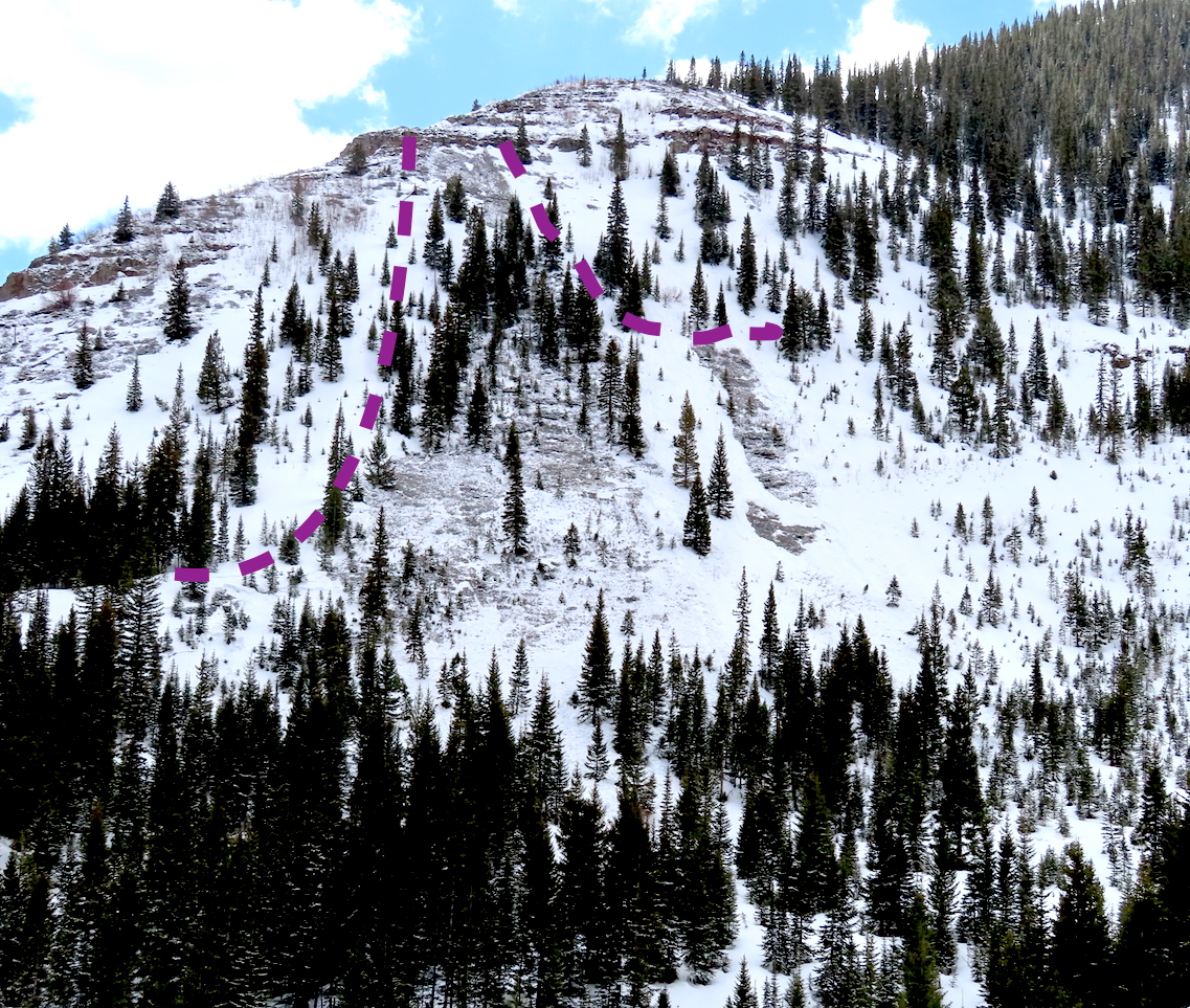
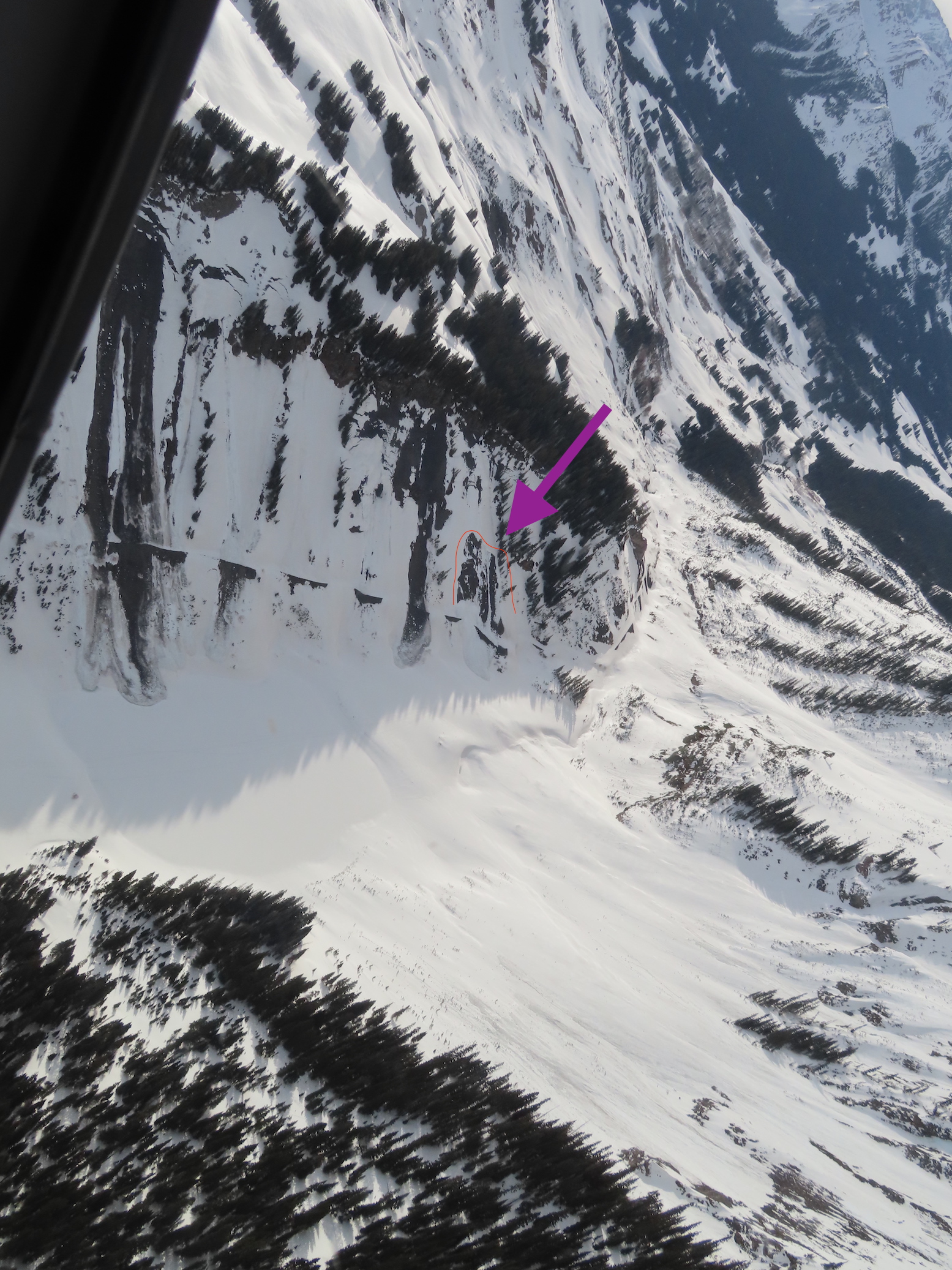
Avalanches: Observed two unreported Wet Slabs on a northwesterly aspect below treeline from the big warm up during the first week of April. Intentionally triggered a couple of Wet Loose avalanches on northeast slopes below treeline D1 to D2 in size. The D2 was able to gouge to the ground, low elevation slope at 9,800′.
Weather: About an inch of new overnight. Partly cloudy skies, mild air temps, and light winds with moderate gusts on alpine ridges.
Snowpack: Largely traveled on northerly slopes near and below treeline. Shaded slopes at 10,000′ appeared to have meltwater drain very near basal depth hoar, but depth hoar was still angular with little evidence of meltwater infiltration (see photo). As we climbed higher near treeline meltwater on a northeast slope had only moved down around 20cm from the surface (see photo). Shaded slopes above 9,600′ feet still have structures to produce Wet Slab avalanches once the meltwater faucet gets turned back on later this spring. Surface refreeze below around 11,000′ was pretty superficial with wet snow grains lingering just below the crust. We descended a short east-facing slope near treeline around 130pm and found quality corn skiing without too much concern for wet avalanche activity. Cloud cover and winds seemed to keep sunny slopes at upper elevations cooler and prevented them from getting too wet.


-
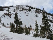
- Several intentionally triggered wet loose, D1-D1.5. East 10,000′

-
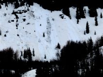
- 2 intentionally triggered loose wet avalanches NE, 9,800′. Lookers left slide gouged to the ground and was D2 in size.

-
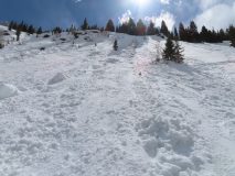
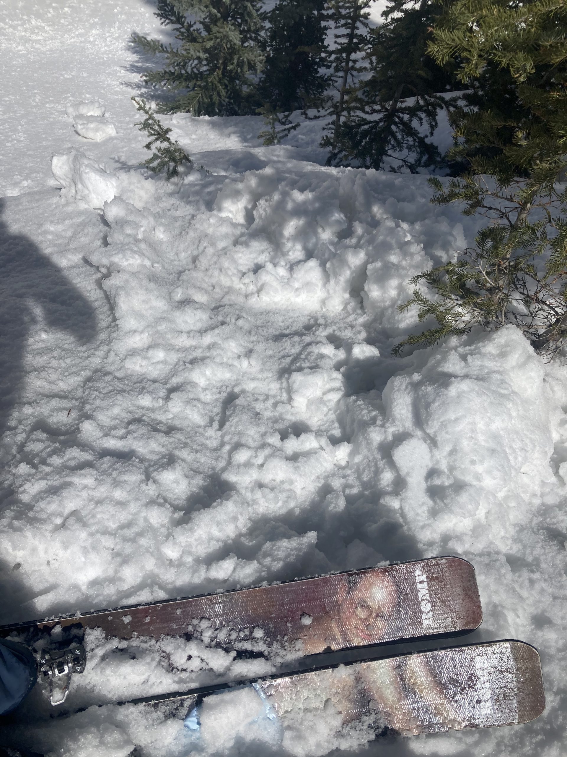
- Looking up from the debris pile from largest of the loose wet avalanches.

-
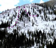
- Un-reported wet slabs from last weekends cycle, NW BTL.