Current Snow Coverage Pictures

CB Avalanche CenterCBAC Observations

Date of Observation: 11/17/2021
Name: Evan Ross

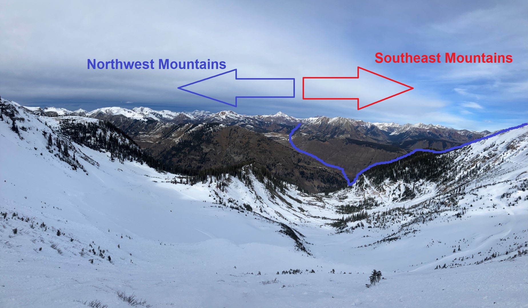
Zone: Southeast Mountains
Route Description: Denver to Gunnison

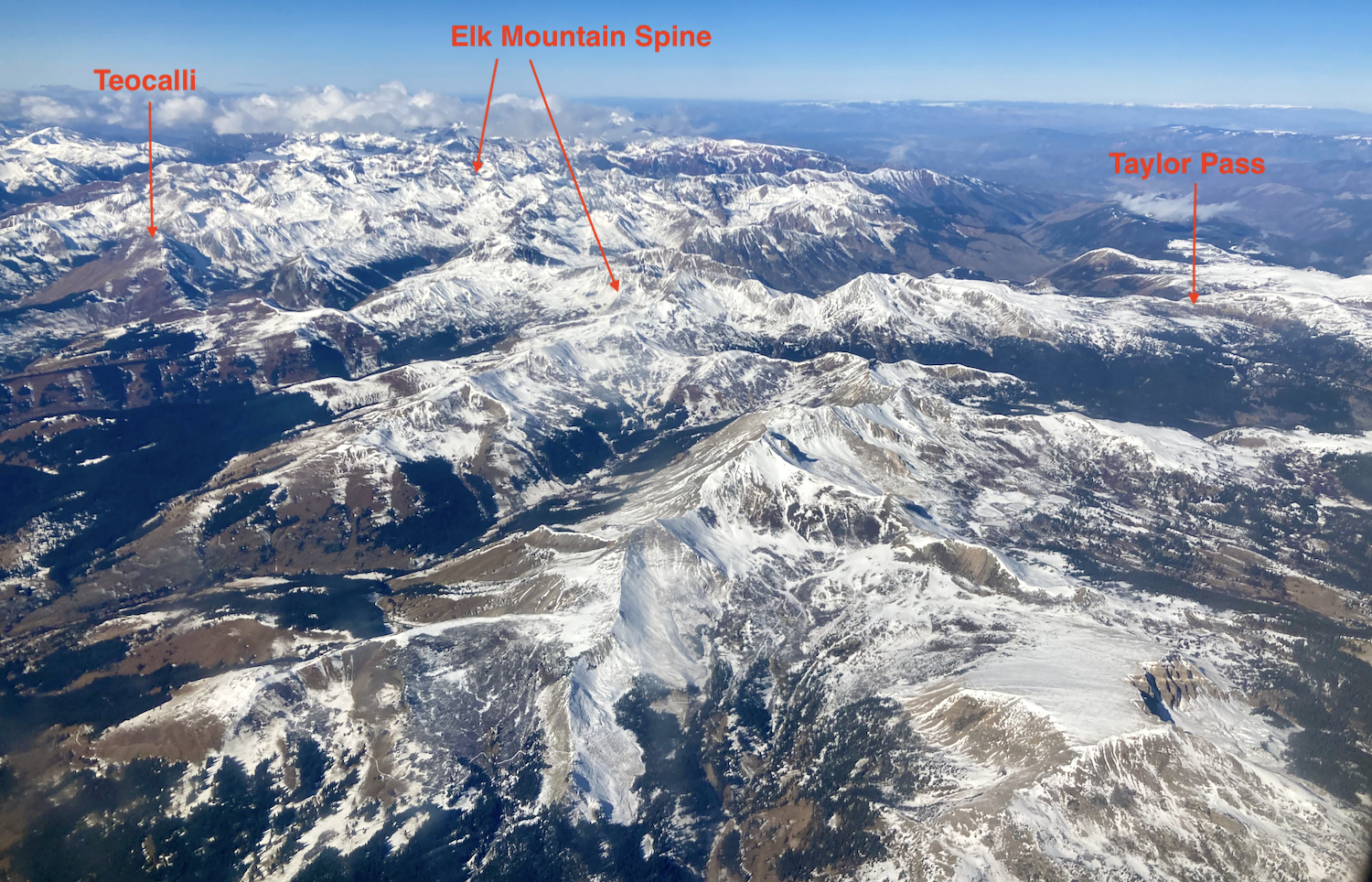
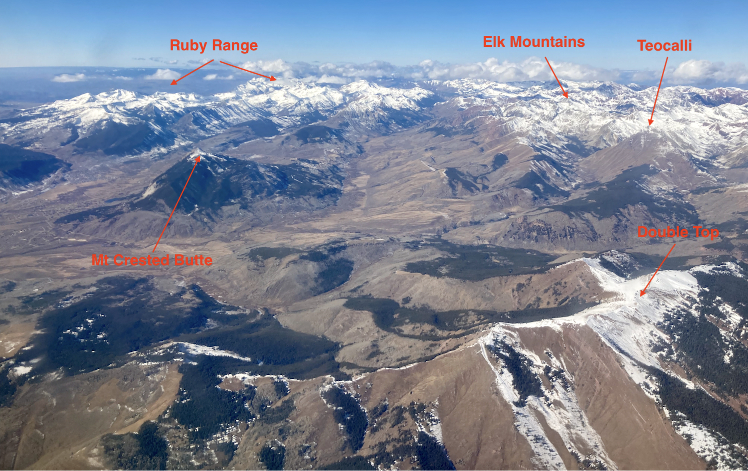
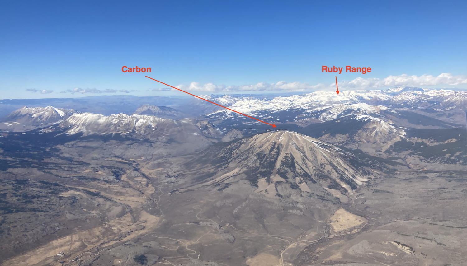
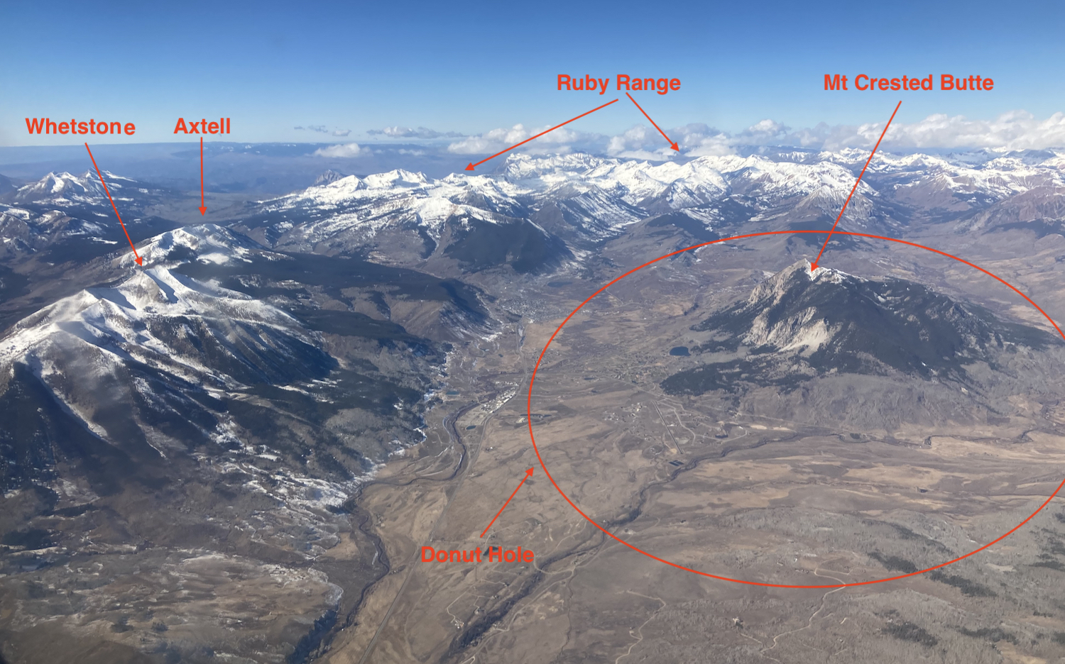
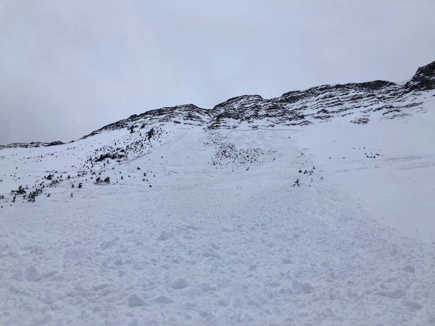
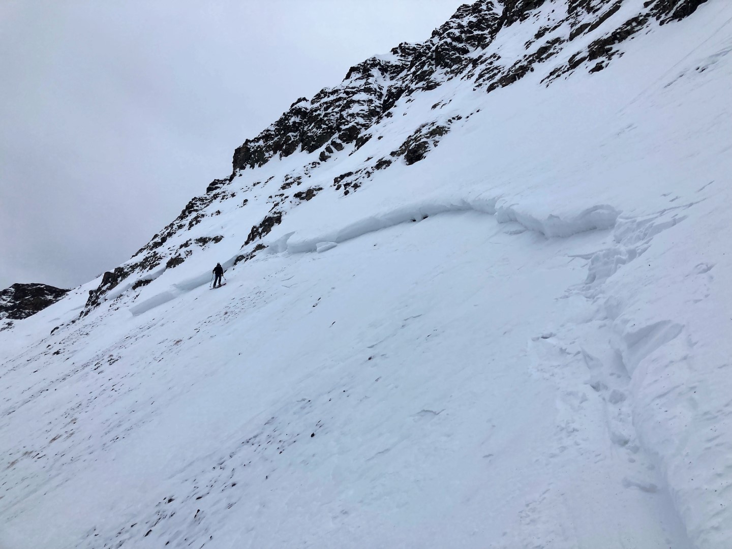
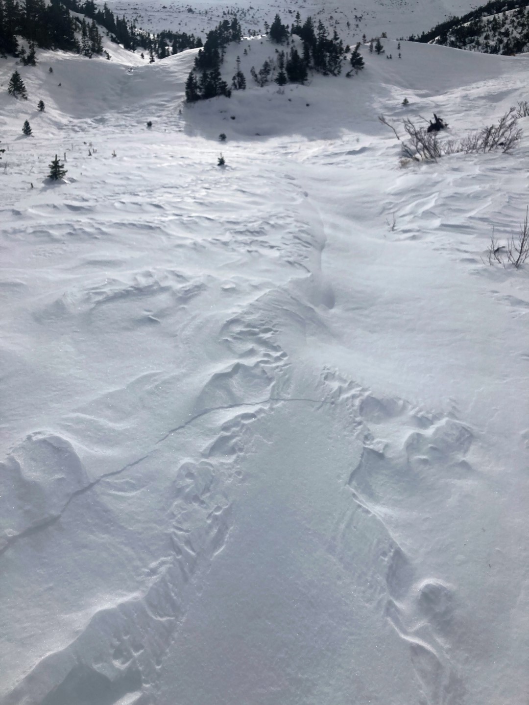
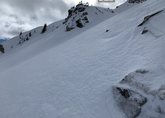
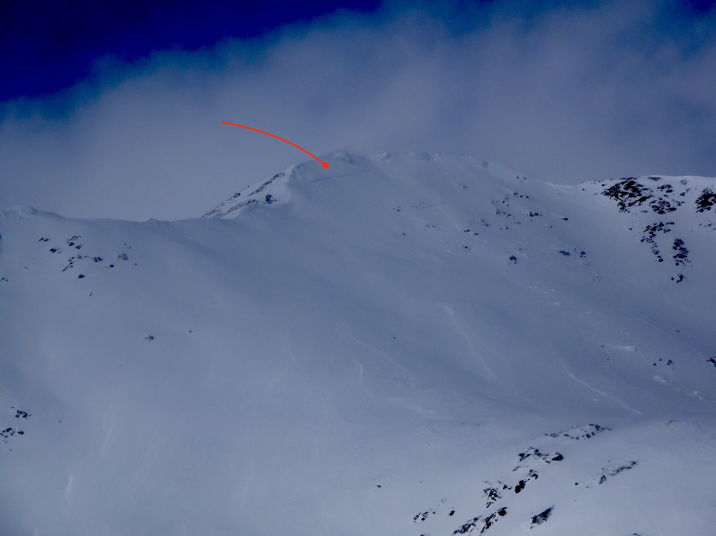
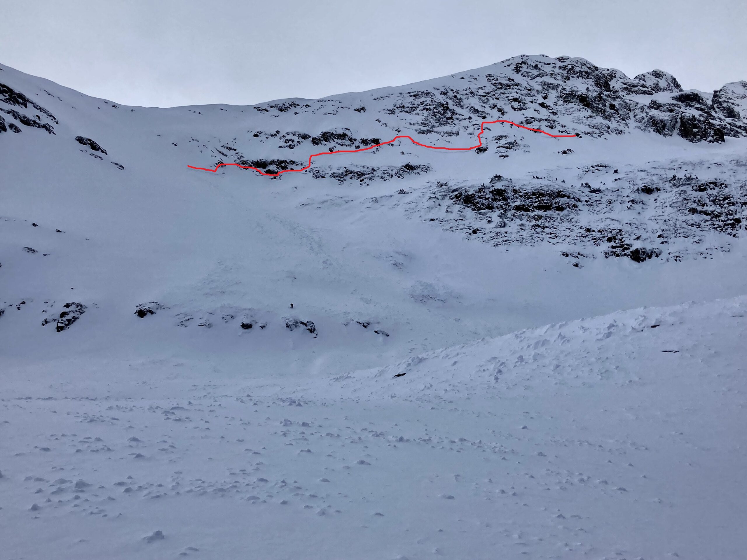
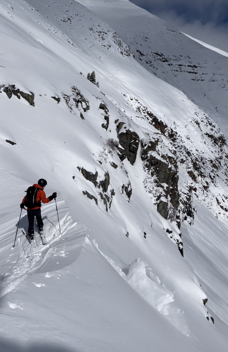
Snowpack: As we head into another period without a notable storm, here are some pictures to help keep track of the current snow coverage. There are a few key ingredients driving the current snow coverage. Elevation, aspect, and location.

Elevation: The valleys are dry. Snow coverage is most consistent above treeline along the spines of the mountain ranges. Many near treeline elevations are fairly dry, or have patchy shallow snow, except for the snow belts along the Ruby Range and Elk Mountain.

Aspects: Northerly and easterly aspects have the best coverage across the board. The Ruby Range of course has the best coverage around the compass when compared to the other mountains. The spine of the Elk Mountains also looked to have coverage on all aspects at upper elevations. Then as you got closer to Star Pass, Taylor Pass, and further east you could see west aspects becoming blown out and south aspects looking thinner or more patchy.

Location: The spine of the Ruby Range of course wins out for the best looking and most consistent coverage. The Spine of the Elk Mountains also had consistent coverage at its western end, then thinner or more specific located snow coverage as you moved further east towards Taylor Pass.

Photos:

Checking out a large crown in Redwell Basin

CBACCBAC Observations

Date of Observation: 11/16/2021
Name: Zach Guy and Eric Murrow

Zone: Northwest Mountains
Route Description: Redwell Basin. Traveled on northerly aspects to 12,000 ft.

Observed avalanche activity: No
Avalanches: Conducted a crown profile of a previously reported slab avalanche in Redwell Basin. The avalanche broke as a hard slab on 2mm facets near the ground, up to 5 ft deep on a windloaded bowl below a cliff band. We measured debris piles up to 9 feet deep. See photos.
Weather: Few clouds increased to overcast. Moderate swirling winds in the basin with strong gusts and periods of blowing snow. A short pulse of light snowfall passed this afternoon.
Snowpack: Below 10,000 feet, the snowpack is moist and less than 6″ deep. Above that, the snowpack transitioned to unsupportive facets, 1 to 2.5 mm in size, generally fist hard, and less than 2 feet deep. In short, it’s a rotten, sugary mess that will be a serious weak layer issue in the future. Previously wind loaded terrain is the only place where we could find any kind of slab. We experienced a couple of shallow, localized collapses in a wind drifted ravine. Otherwise, we traveled in weaker, trapdoor snow with no signs of instability, just dodging sharky rocks.

Photos:

5007

High and dry

CBACCBAC Observations

Date of Observation: 11/15/2021
Name: Zach Guy

Zone: Northwest Mountains
Route Description: Upper Peeler and Oh-Be-Joyful Basin. Traveled on a variety of aspects from 10,000 to 12,000 ft.

Observed avalanche activity: Yes
Avalanches: Nothing new except a few harmless wet loose sluffs from the last couple days on steep southerlies. Noted a few more previously undocumented D1.5 to D2 sized naturals that ran during last week’s cycle.
Weather: Warm, clear skies, light winds.
Snowpack: No signs of instability. A couple of stability tests on east aspects produced non-propagating results on the Nov 9 crust/facet layer, down 14″ to 18″. This layer appears to be gaining strength compared to pits in similar locations last week. Total snow depths near and above treeline average 3 to 4 feet on shady aspects, and a foot or less on sunny aspects. Snow surfaces vary widely, from hard wind board and sastrugi on wind-affected slopes, wet grains on SE to SW aspects, and surface hoar and/or near surface facets in wind-protected, shady cirques.

Photos:

5006

Natural avalanche in Redwell Basin

CBACCBAC Observations

Date of Observation: 11/12/2021
Name: Eric Murrow

Zone: Northwest Mountains
Route Description: This observation was texted to CBAC from a group that was on top of Schuylkill Ridge.

Observed avalanche activity: Yes
Avalanches: Recent avalanche in Redwell Basin on Mount Emmons.  Northeast aspect above treeline.

Weather:
Snowpack:

Photos:

5005

Lots of northwest wind and more storm snow than expected

CBACCBAC Observations

Date of Observation: 11/12/2021
Name: Eric Murrow

Zone: Northwest Mountains
Route Description: Poverty Gulch underneath sunny side of Mineral Point over towards Angel Pass

Observed avalanche activity: Yes
Avalanches: Observed one recent natural avalanche below the summit of Augusta. Big enough to carry but not bury a person.
Weather: Strong winds in the morning relentlessly transported and stiffened snow near and above treeline. Winds subdued some in the afternoon. East and southeast aspects appeared to receive the most continued loading.
Snowpack: We ascended terrain facing southeast through east through northeast to 11,900′. Storm totals reached up to ~18″ near treeline (hard to measure as all terrain traveled was open and heavily affected by the wind). Dug a test profile on a drifted southeast feature at 11,000 feet with 3 feet of drifted snow resting on a melt/freeze crust without any result. A test profile on a north feature at 11,900′ showed moderate propagating results at the new/old interface which consisted of 1mm facets (see image). The slab was around 50cm thick and 4finger hard. Immediately following the test profile the slope collapsed as we walked away.  These test results and signs of instability steered us towards safer, lower angled options.

We moved through many drifted features that faced east and southeast looking for Wind Slab formation and found two locations that shot cracks up to 75 feet. The most reactive places were generally the stiffest and most supportive drifts.

Photos:

[/gravityforms]
5004

Impressive storm totals and avalanche activity on Owen

CBACCBAC Observations

Date of Observation: 11/12/2021
Name: Zach Guy

Zone: Northwest Mountains
Route Description: Traveled on south to east to northeast aspects on Owen to 12,800′

Observed avalanche activity: Yes
Avalanches: A couple of small wind slabs ran today on east aspects above treeline, breaking in just today’s drifted snow. Several large slab avalanches ran off of NE and E aspects of Mt. Owen during the midweek storm. These all appeared to fail on or near the storm interface, about 18″ to 24″ deep. Some of these failed across terrain and in locations that aren’t typical for wind slabs…hinting at our developing persistent slab problem. See photos.
Weather: Strong northwest winds and active blowing snow this morning at all elevations. Winds transport died down this afternoon as scattered clouds developed. No recent precip.
Snowpack: We measured settled storm totals from the midweek storm up to 20″ in sheltered terrain. Significant fresh drifting occurred last night, with new 4F drifts up to 18″ thick. Snow depths on easterly aspects were 4 to 5 feet. We did not observe any signs of instability underfoot apart from some minor localized cracking in fresh drifts. A stability test on an east aspect ATL produced moderate propagating results below a 20″ soft slab, failing in 1mm facets below the 11/9 melt-freeze crust (See photo).

Photos:

5003

Small natural avalanches

CB Avalanche CenterCBAC Observations

Date of Observation: 11/12/2021
Name: Ben Pritchett

Zone: Souteast Mountains
Route Description: Observations from near Crested Butte

Observed avalanche activity: Yes
Avalanches: Two small natural avalanches released on a pair of east to southeast facing-slopes above treeline. One broke in Coon Basin (east), and another off the saddle in Mt. Baldy’s southeast face.
Weather: Efficient wind transport this morning. Cinnamon weather station shows north northwest winds averaging around 35mph, with a peak gust to 70.

Photos:

5001

Two natural avalanche obs

CBACCBAC Observations

Date of Observation: 11/11/2021
Name: Eric Murrow

Zone: Northwest Mountains
Route Description: East end of Baldy Mountain

Observed avalanche activity: Yes
Avalanches: From the pavement, I spotted 2 naturals along Scarp Ridge. A D2 and a D1.5 in Peeler Basin. Visibility was poor, but both avalanches appeared to only involve recent storm snow.
Weather: Partly to mostly cloudy skies. West-northwesterly winds were blasting snow into the atmosphere in the AM but relaxed and were only drifting on and off by the PM.
Snowpack: Storm totals were about 10″ at 12,000 feet. We avoided the most obvious drifted, northerly terrain features in the area, but did stomp on a few small slopes around 12K that faced north without signs of instability. No signs of instability on wind-sheltered slopes facing east near and just above treeline.

Photos:

[/gravityforms]
4999

Quieting down

CBACCBAC Observations

Date of Observation: 11/11/2021
Name: Zach Guy

Zone: Northwest Mountains
Route Description: Southern Ruby Range. Traveled mostly on east and west aspects to 11,800 ft.

Observed avalanche activity: No
Avalanches: Dropped a loveseat-sized cornice on a suspect leeward slope. It produced only sluffing.
Weather: Light westerly winds with occasional light transport on high peaks. Few clouds increased to broken skies. No precip.
Snowpack: We found minimal signs of wind drifting and minimal signs of instability, in stark contrast to yesterday’s tour. Settled storm totals here range from 8″ to 14″. The new snow is on the faceted or crusty interface well described in previous observations. Total snow depth near treeline is generally about 18″ to 24″ deep.

Photos:

4998

Remote triggered wind slabs

CBACCBAC Observations

Date of Observation: 11/10/2021
Name: Zach Guy

Zone: Northwest Mountains
Route Description: Traveled on east and northeast aspects of Mt. Baldy to 12,000 ft.

Observed avalanche activity: Yes
Avalanches: A handful of natural activity ran during last night’s snowfall, mostly small, with one longer running D2. We remotely triggered a couple of small pockets of wind slab from about 30 feet away, and remotely triggered a larger D1.5 wind slab that was about 50 feet wide and ran about 600 feet over rocks.
Weather: Light snowfall. Light to moderate northwest winds with short periods of drifting snow.
Snowpack: 6″ to 8″ of new storm snow over a generally weak and faceted snowpack (.5 – 1.5mm facets) mixed with a few crusts on more easterly aspects. Fresh drifts up to 2 feet thick. We noted consistent collapsing and shooting cracks up to 50 feet on every wind loaded feature, along with some shooting cracks where winds have stiffened the snow surface. These all appeared to be failing on the storm interface. In wind-protected areas, we noted only minor cracking. Stability test in a wind-sheltered slope showed no propagation.


[/gravityforms]
4997