Date of Observation: 12/11/2021
Name: Eric Murrow
Zone: Southeast Mountains
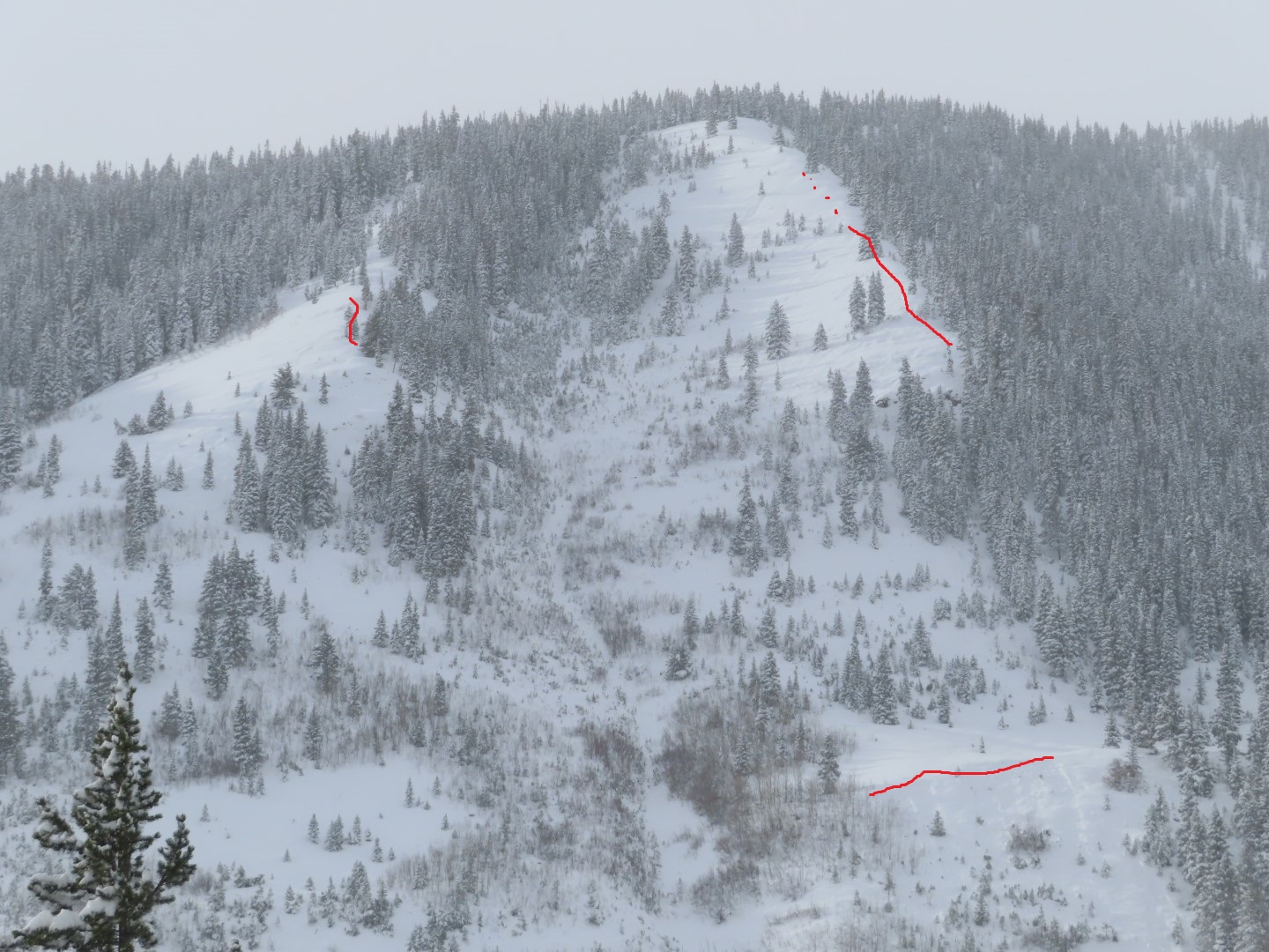
Route Description: Standard up-track on Snodgrass and ridge walk towards Third Bowl.
Observed avalanche activity: Yes
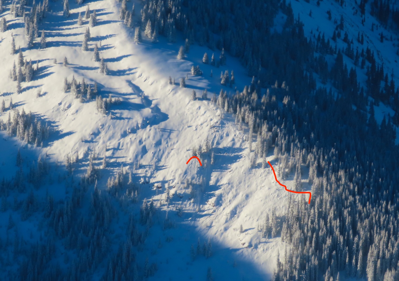
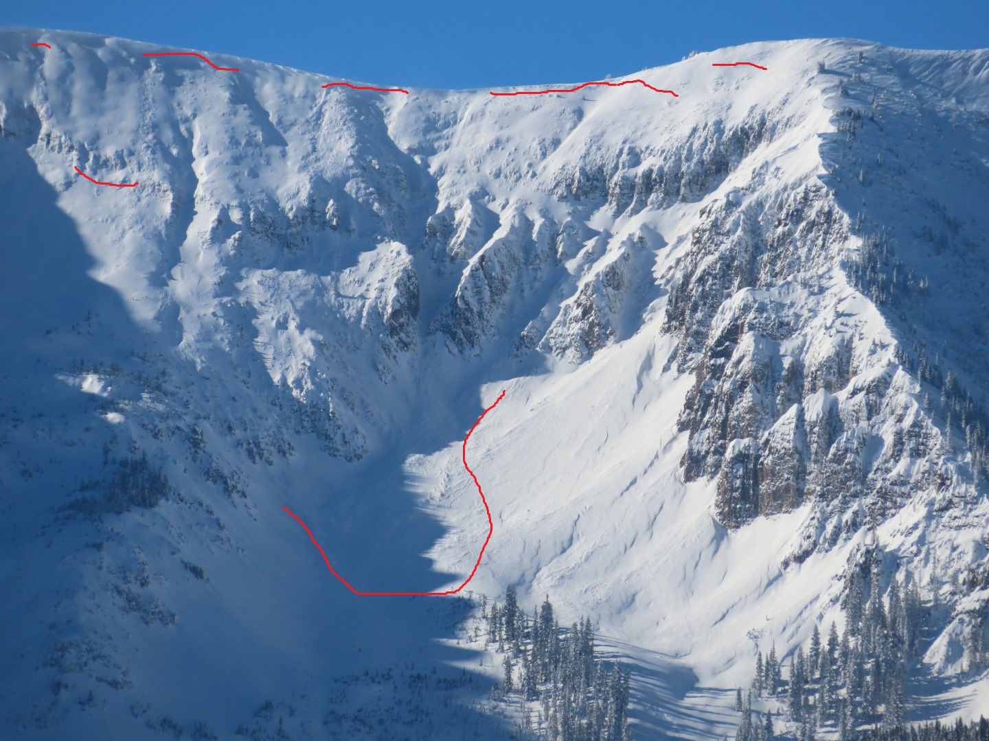
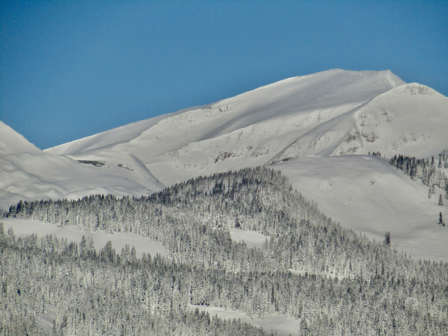
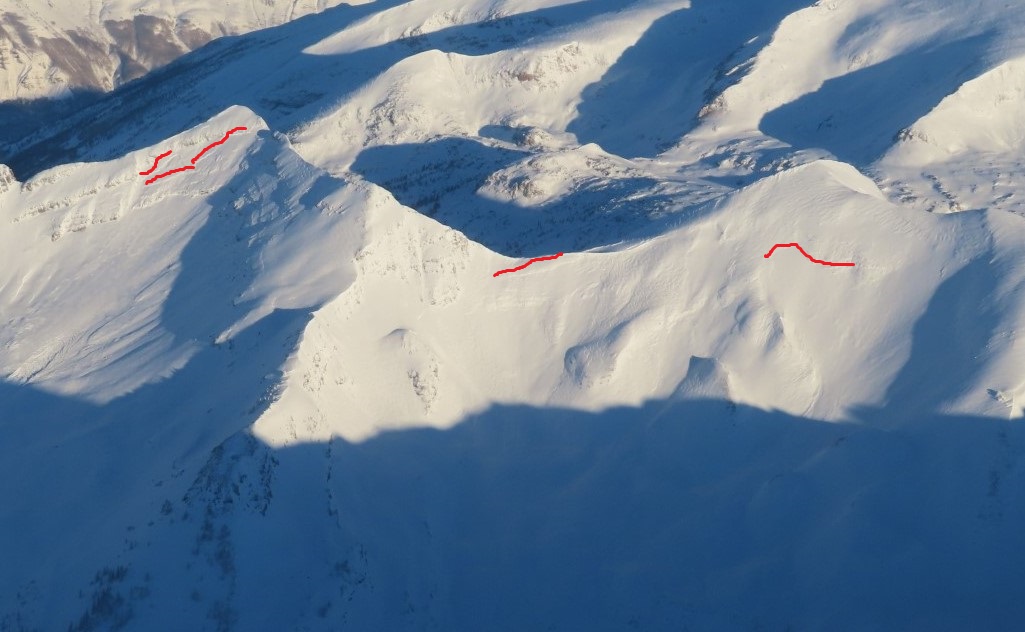
Avalanches: On the north side of Snodgrass, many steep, open features avalanched naturally during the storm. Some ran early with up to 16 inches of refill on bed surface and others failed late with 6 inches of refill.
Weather: Clear skies with cool temperatures and relatively light winds (I was below treeline for my tour, but did observe some drifting occurring above treeline on east, southeast, and south aspects)
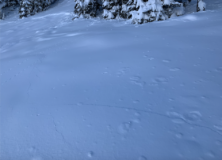
Snowpack: On the north side of Snodgrass, snow depths were around 3 feet deep. Recent storm snow has settled to about 2 feet. Numerous muffled, small collapses while walking across low-angled slopes that had previously collapsed and shattered naturally during the storm. Several large, louder collapses while moving through low-angled northerly terrain without evidence of previous collapsing that traveled up to 100 feet. I dug one profile in a location with an intact snowpack and another on the bed surface of a natural avalanche that ran early in the storm. Northerly-facing slopes that have not avalanched remain very sensitive to the weight of a person.
Photos:
-
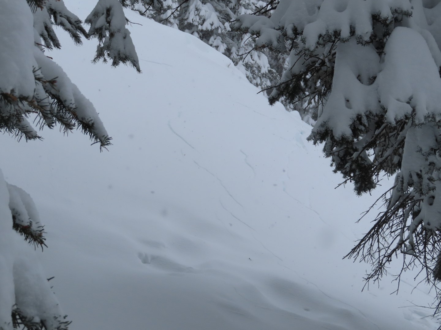
- A natural avalanche that failed late in the storm with about 6-8 inches of snow refilled on bed surface.

-
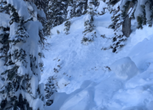
- While approaching the natural avalanche in the background, I got a loud collapse with shooting cracks in the flank.

-
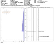
- Profile from an intact northeasterly slope that showed the slab is still very sensitive to the weight of a person.

-
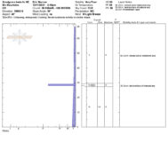
- Profile from the bed surface of an avalanche that ran early in the storm with a healthy amount of snow refilled in the path.

5082