Date of Observation: 12/25/2021
Name: Evan Ross
Zone: Southeast Mountains
Route Description: Up the main track, down the glades.
Avalanches: On the up track, we watched a group trigger a large slab avalanche on a NE to E section of Red Lady Bowl.
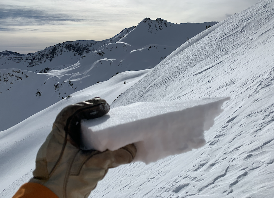
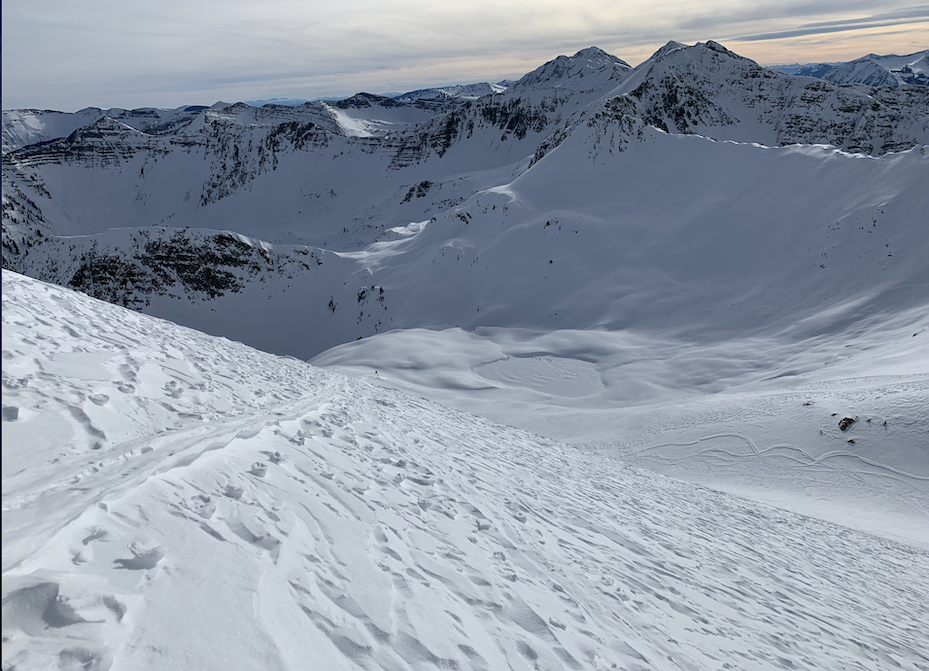
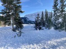
While skiing a low-angle section of Red Lady Glades we triggered a large avalanche on a much steeper east-facing aspect at 11,300ft below treeline. The crown height averaged an estimated 85cm, and varied between an estimated 75cm to 120cm. I dug into the crown on a low angled section of the slope where it pulled back close to the ridge. At that location the slab released on small facets at the 12/23 interface. I’ve watched this slope release a few times now. This was the furthest I’ve seen it run through the flats in the runout.
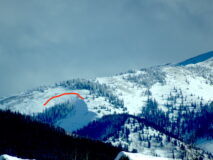
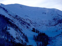
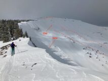
Red Lady Bowl had a natural avalanche that released on from the east-facing lookers left corner of the bowl. This is a heavily wind-loaded terrain feature. The crown was mostly unrecognizable and covered with new snow. The avalanche debris were also difficult to see. The avalanche appeared to run fairly far into the lower angled terrain below the bowl.
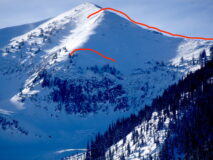
Mt Axtel had several large to very large avalanches released during the last storm. Green Lake Bowl, 4th Bowl, and the Pencil area. Unfortunately, I wasn’t able to get a good view or good picture to more closely examine the crowns or debris piles.
Weather: Mostly cloudy sky and orographic snow showers in the morning, dissipated throughout the day. Few clouds in the evening. Light winds where we traveled. Snow plumes at times on the higher terrain but not consistently loading.
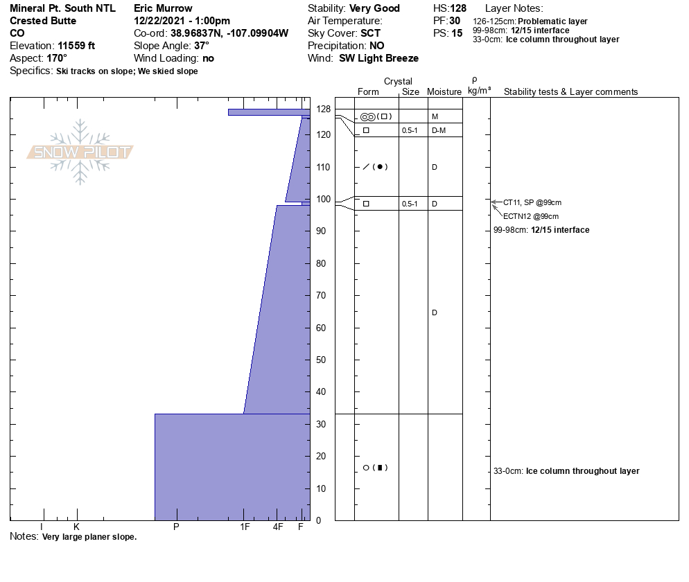
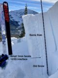
Snowpack: The Santa Slab is fat. We observed no obvious signs of instability given the thick slab, but observed two impressive avalanches release. Dug one pit at on a low angle south-facing slope at 11,000ft. The 75cm Santa Slab was well bonded to the 12/23 crust. No test results above or below the crust. Impressive ski quality. The low angle was ripping.
-
-
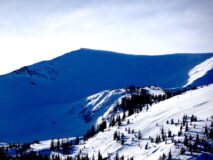
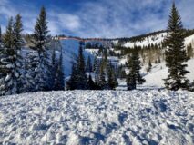
Red Lady Bowl
-
-
East RLG
-

-
3/4th a human sized Santa Slab. South BTL.
-
-
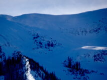
Runout
-
-
East RLG
Estimated avalanche date: 12/24/2021
Number of Avalanches: 1
Location
Location: Mount Emmons
Location Specific:
Start Zone Elevation: BTL: Below Tree Line
Aspect: E
Characteristics
Trigger: Skier
Trigger modifier:
Type: Soft Slab
Failure Plane: New/Old interface
Size
Relative Size: R2 small
Destructive Size: D2.5
Avg. crown height (inches):
Avg. width (feet):
Avg. vertical run (feet):
Involvements
# of people caught:
# of partial burials:
# of full burials:
Additional comments: Red Lady Glades East Aspect BTL.
While skiing a low-angle section of Red Lady Glades we triggered a large avalanche on a much steeper east-facing aspect at 11,300ft below treeline. The crown height averaged an estimated 85cm, and varied between an estimated 75cm to 120cm. I dug into the crown on a low angled section of the slope where it pulled back close to the ridge. At that location the slab released on small facets at the 12/23 interface. I’ve watched this slope release a few times now. This was the furthest I’ve seen it run through the flats in the runout.
Estimated avalanche date: 12/24/2021
Number of Avalanches: 1
Location
Location: Mount Axtell
Location Specific:
Start Zone Elevation: ATL: Above Tree Line
Aspect: E
Characteristics
Trigger: Natural
Trigger modifier:
Type: Soft Slab
Failure Plane: Unknown
Size
Relative Size: R1 very small
Destructive Size: D2 – could bury, injure, or kill a person
Avg. crown height (inches): 33
Avg. width (feet):
Avg. vertical run (feet):
Involvements
# of people caught:
# of partial burials:
# of full burials:
Additional comments: Red Lady Bowl had a natural avalanche that released on from the east-facing lookers left corner of the bowl. This is a heavily wind-loaded terrain feature. The crown was mostly unrecognizable and covered with new snow. The avalanche debris were also difficult to see. The avalanche appeared to run fairly far into the lower angled terrain below the bowl.
Estimated avalanche date: 12/24/2021
Number of Avalanches: 3
Location
Location: Mount Axtell
Location Specific:
Start Zone Elevation: ATL: Above Tree Line
Aspect: NE
Characteristics
Trigger: Natural
Trigger modifier:
Type: Soft Slab
Failure Plane: Unknown
Size
Relative Size:
Destructive Size: D2.5
Avg. crown height (inches):
Avg. width (feet):
Avg. vertical run (feet):
Involvements
# of people caught:
# of partial burials:
# of full burials:
Additional comments: Mt Axtel had several large to very large avalanches released during the last storm. Green Lake Bowl, 4th Bowl, and the Pencil area. Unfortunately, I wasn’t able to get a good view or good picture to more closely examine the crowns or debris piles. Given the estimated slab thickness and size of terrain, these avalanches are estimated to be D3 in size.
Estimated avalanche date:
Number of Avalanches:
Location
Location:
Location Specific:
Start Zone Elevation:
Aspect:
Characteristics
Trigger:
Trigger modifier:
Type:
Failure Plane:
Size
Relative Size:
Destructive Size:
Avg. crown height (inches):
Avg. width (feet):
Avg. vertical run (feet):
Involvements
# of people caught:
# of partial burials:
# of full burials:
Additional comments:
5145