The Crested Butte Avalanche Center is seeking an intern for the upcoming 2022/23 season. Roles include but are not limited to: supervised and independent fieldwork and documentation, writing weekly snowpack summaries, assisting in outreach and education programs, packing and mitigation in municipal avalanche zones, editing fieldwork videos, and various other operational tasks. This mentorship opportunity is unpaid but does include a small stipend. A 3-month commitment is required at a minimum, with an expectation for 2 to 3 full work days per week. Qualified candidates will have a minimum training of Avalanche Pro 1 (or equivalent) and advanced backcountry travel skills. Please send a resume, cover letter, and 3 references to zach(at)cbavy.org by June 24, 2022.
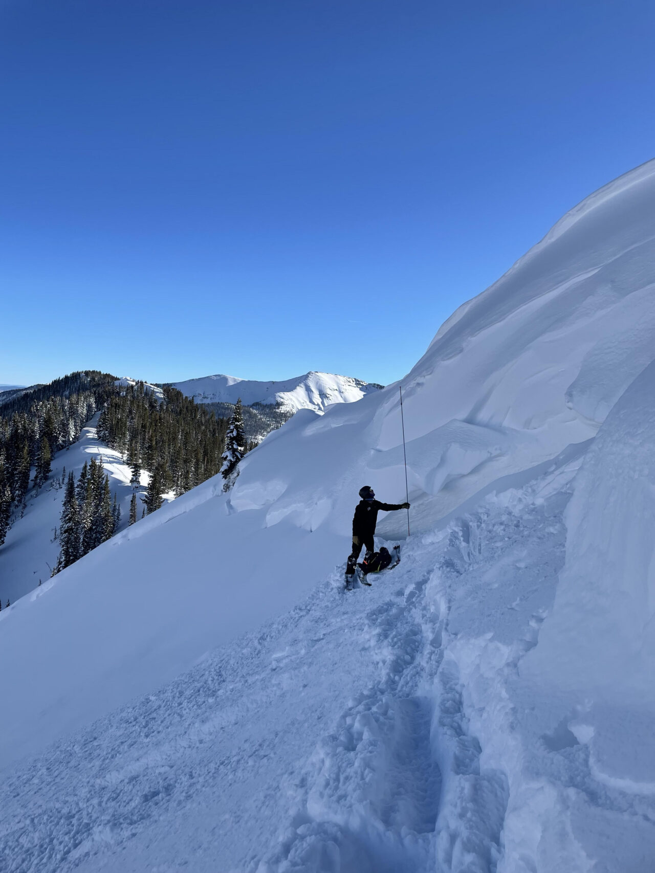
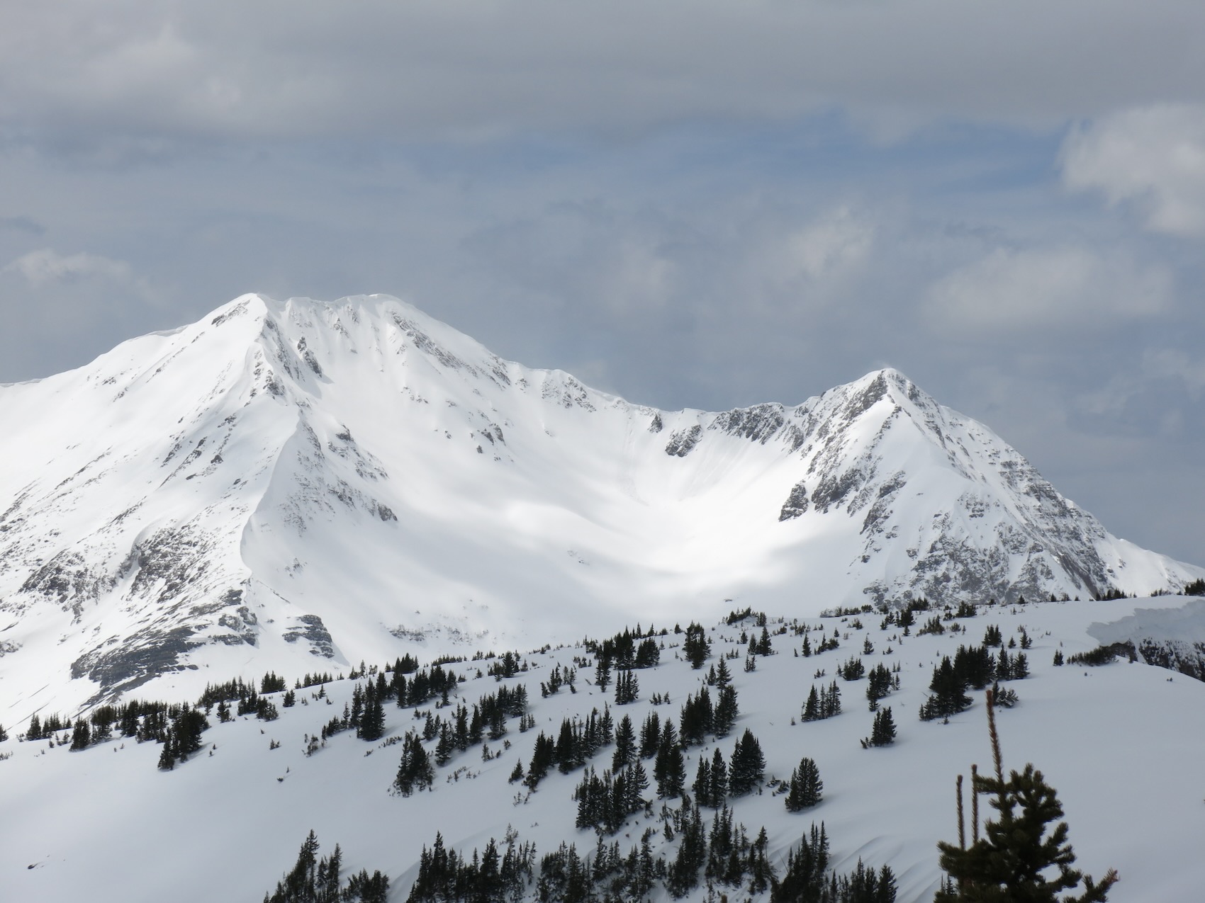
Zone: Southeast Mountains Route Description: Traveled on N and NE aspects of Gothic Mtn, to 11,900′
Observed avalanche activity: Yes Avalanches: A couple of large wet slabs on the north side of Gothic ran during last week’s heat wave, along with what looks like a large wet avalanche near Daisy Pass. Also a few wet loose up to D1.5 in Copper Creek.
Traveled over fairly extensive tree damage on a previously undocumented slide presumably from the holiday cycle. Weather: Sunny, light breeze. Snowpack: Drainage through the snowpack is well established here, even on northerly aspects. Snow surfaces are old, dusty, and sun-textured, with very thin pockets of white snow from the past storm. Given how mature the surface is, it seems that wet loose concerns are isolated to very steep, rocky slopes. Traveled on a few suspect slopes that were past prime and couldn’t get anything to move, despite shin-deep ski and knee-deep boot pen near shallow rocky areas. Cornices still pose a threat above some slopes.
Photos:
A pair of large wet slabs on Gothic. You can also make out a large wet debris pile out by Daisy Pass in the background
Relative Size: R2 small Destructive Size: D2 – could bury, injure, or kill a person Avg. crown height (inches): Avg. width (feet): Avg. vertical run (feet):
Involvements
# of people caught: # of partial burials: # of full burials:
Additional comments: Likely failed sometime during 5/15-5/19 heatwave
Estimated avalanche date: 05/18/2022 Number of Avalanches: 1
Location
Location: Poverty Gulch (Pittsburg, Augusta, Baxter Basin) Location Specific: Start Zone Elevation: NTL: Near Tree Line Aspect: N
Characteristics
Trigger: Natural Trigger modifier: Type: Unknown Failure Plane: Old snow
Size
Relative Size: Destructive Size: D2 – could bury, injure, or kill a person Avg. crown height (inches): Avg. width (feet): Avg. vertical run (feet):
Involvements
# of people caught: # of partial burials: # of full burials:
Additional comments: Seen from a distance, large wet avalanche. Debris pile was broad enough that I’m guessing wet slab. Likely failed sometime during 5/15-5/19 warmup.
Relative Size: Destructive Size: D3 – could destroy a car, wood-frame house, or snap trees Avg. crown height (inches): Avg. width (feet): Avg. vertical run (feet):
Involvements
# of people caught: # of partial burials: # of full burials:
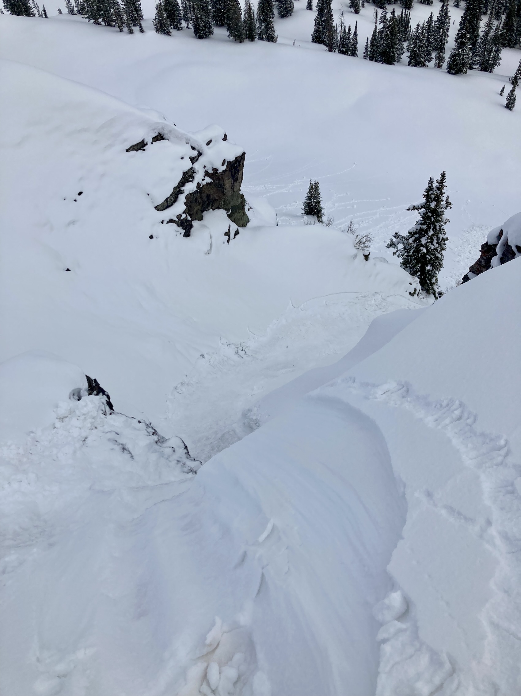
Additional comments: Dozens of downed medium-sized trees below the northernmost path on Gothic that feeds into East River, above pt ~11950. The crown of this slide was not visible during our 1/2 heli flight, so I’m guessing this ran a few days earlier in the storm, sometime during Christmas week.
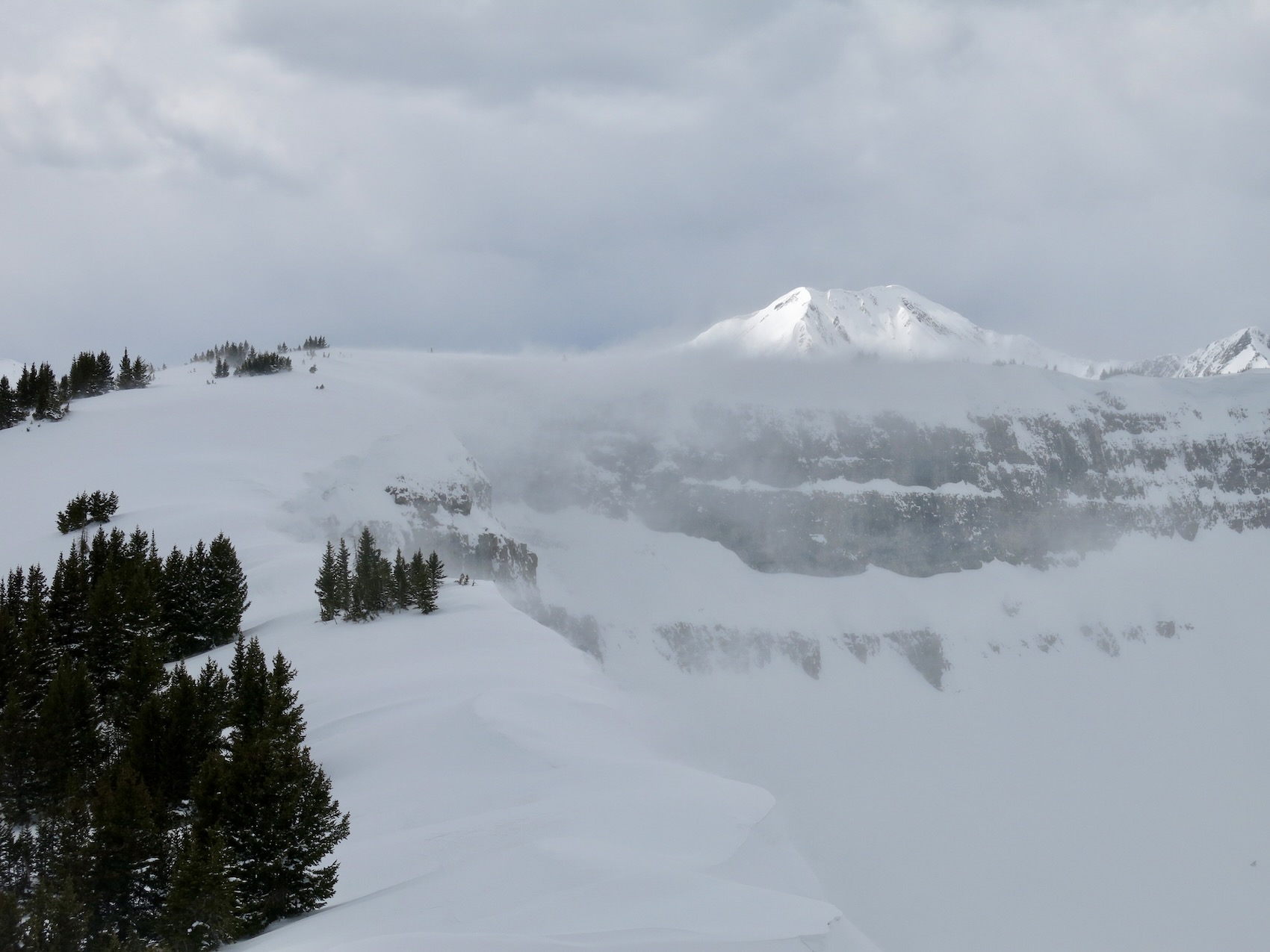
Zone: Northwest Mountains & Southeast Mountains Route Description: Ski tour Mount Axtel in Second Bowl in the morning and pavement avalanche obs in the evening.
Observed avalanche activity: Yes Avalanches: Easily skier-triggered several loose avalanches in the storm snow on Axtel in sheltered terrain. While driving around in the evening I observed evidence of numerous avalanches on Gothic Mountain’s east bowl (most looked to be loose avalanches but a couple below ridge top may have been Wind Slabs – poor vis). Two small Wind Slabs on drifted alpine terrain on Whetstone. Visibility never allowed for good avalanche observations in drifted terrain other than on Axtel, Whetstone, and Emmons. Weather: Light snowfall and moderate winds on Axtel in the AM with 11″ storm snow at 11am. Periods of broken skies around Crested Butte throughout the day with clearing skies above town around sunset. The Ruby Range remained obscured all day. Snowpack: While touring on Axtel, I found a storm density change in the middle of the storm snow that took moderate force to fail in Shovel Tilt Tests; no cracking in sheltered terrain just easily triggered loose avalanches up to D1.5. Bonding between the new snow and the old crust was good in the sheltered terrain I traveled through. I stomped on a few small drifts, up to 16 inches deep, near treeline on Axtel and was able to produce ski-length cracking.
Later in the day at 2pm, I poked into some north-facing slopes near town at 9,000′ and found 7 inches of storm snow that was moist and sticky throughout from the mild air temps at low elevations.
Photos:
Shovel Tilt Test showing density change in the middle of the storm snow. This density chance did not produce cracking in sheltered terrain.
Small natural Wind Slab in Main Bowl of Whetstone.
Small natural Wind Slab in Barcelona Bowl on Whetstone.
Evidence of natural avalanches on Gothic’s east side. Most appeared to be loose but two areas, immediately below the summit, may have been slabs but visibility was too poor to identify crowns.
Relative Size: R1 very small Destructive Size: D1- Relatively harmless to people Avg. crown height (inches): Avg. width (feet): Avg. vertical run (feet):
Involvements
# of people caught: # of partial burials: # of full burials:
Zone: Northwest Mountains Route Description: Kebler Pass area. 9,500ft to 12,000ft. Various aspects.
Weather: Overcast in the morning, partly cloudy for a bit mid-day, before increasing again in the late afternoon. W or SE winds are still blowing snow at upper elevations.
Snowpack: At near and below treeline elevations the snow service got moist or wet on north to east aspects. Mostly just roller balls on northerly facing slopes and not sure at what elevation the snow surface stayed dry. East was the most reactive at these elevations with small loose wet avalanche activity. Didn’t travel above treeline, looking into the ruby range you could see some roller balls or small loose snow avalanches on steep southerly facing slopes with rock outcrops. Found wind slabs up to a foot thick, but couldn’t get any notable results. Many things are blown off or just not loaded. The wind slab problem felt isolated and stubborn at NTL elevations.
Photos:
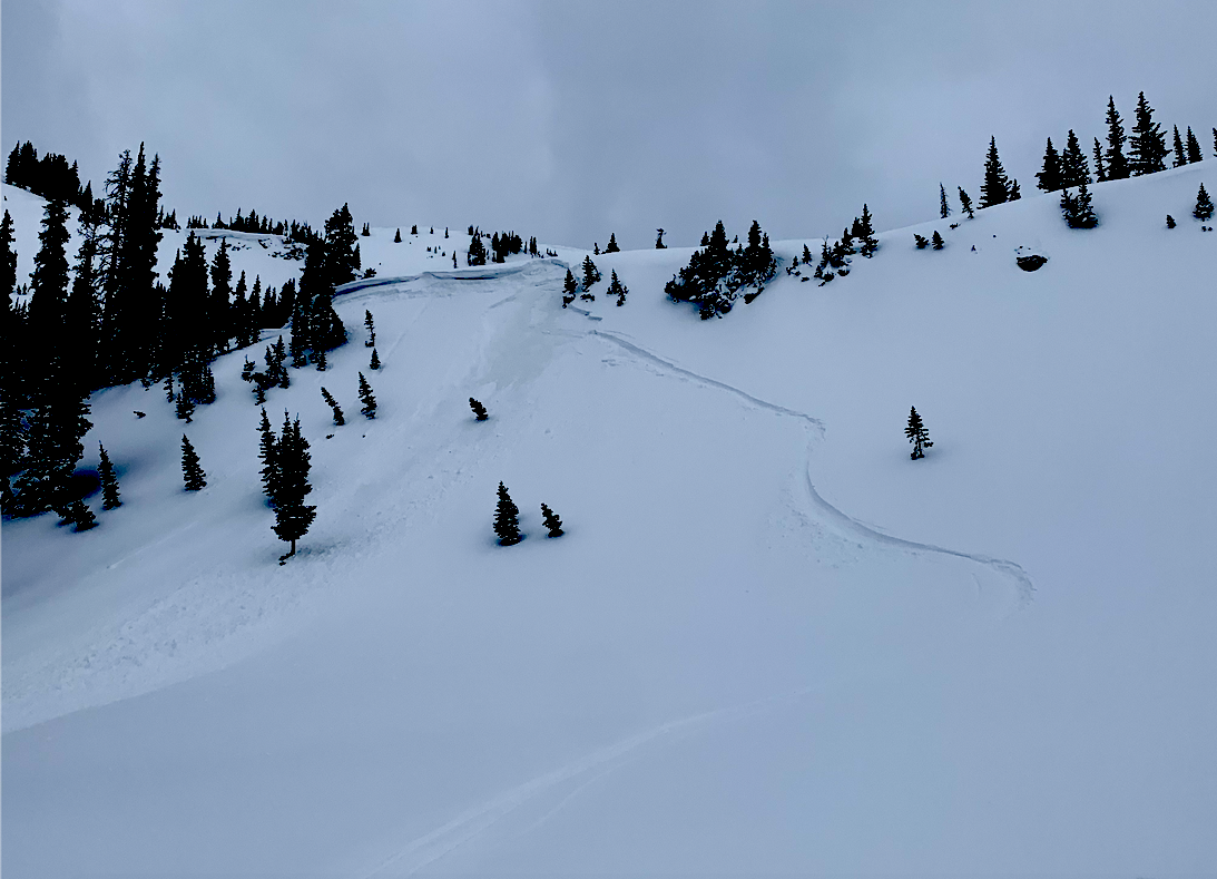
Roller balls and a couple small loose wet looking avalanches on Axtell extended up to the Quill.
Small loose wet. ESE, 11,200ft.
Small loose wet. E 11,200ft.
SE, 11,900ft. No real wind slab and not much loading here.
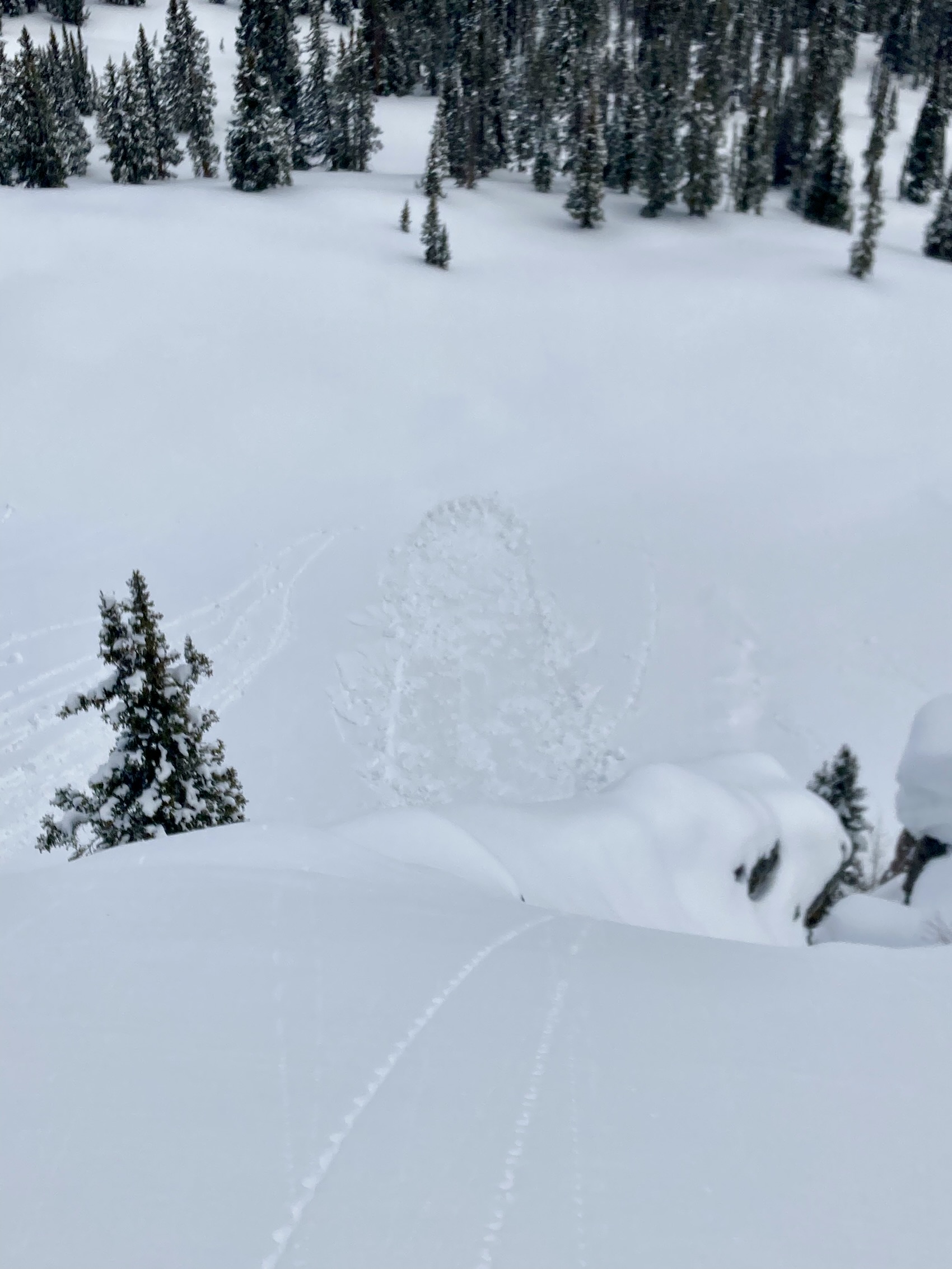
Small cornice fall between Owen and Purple.
Point release avalanches out near E Beckwith.
Wind loading onto the north side of Scarps ridge.
Wind-loaded north at 12,000ft. Recent storm snow capping the old faceted snow surface. No notable results.
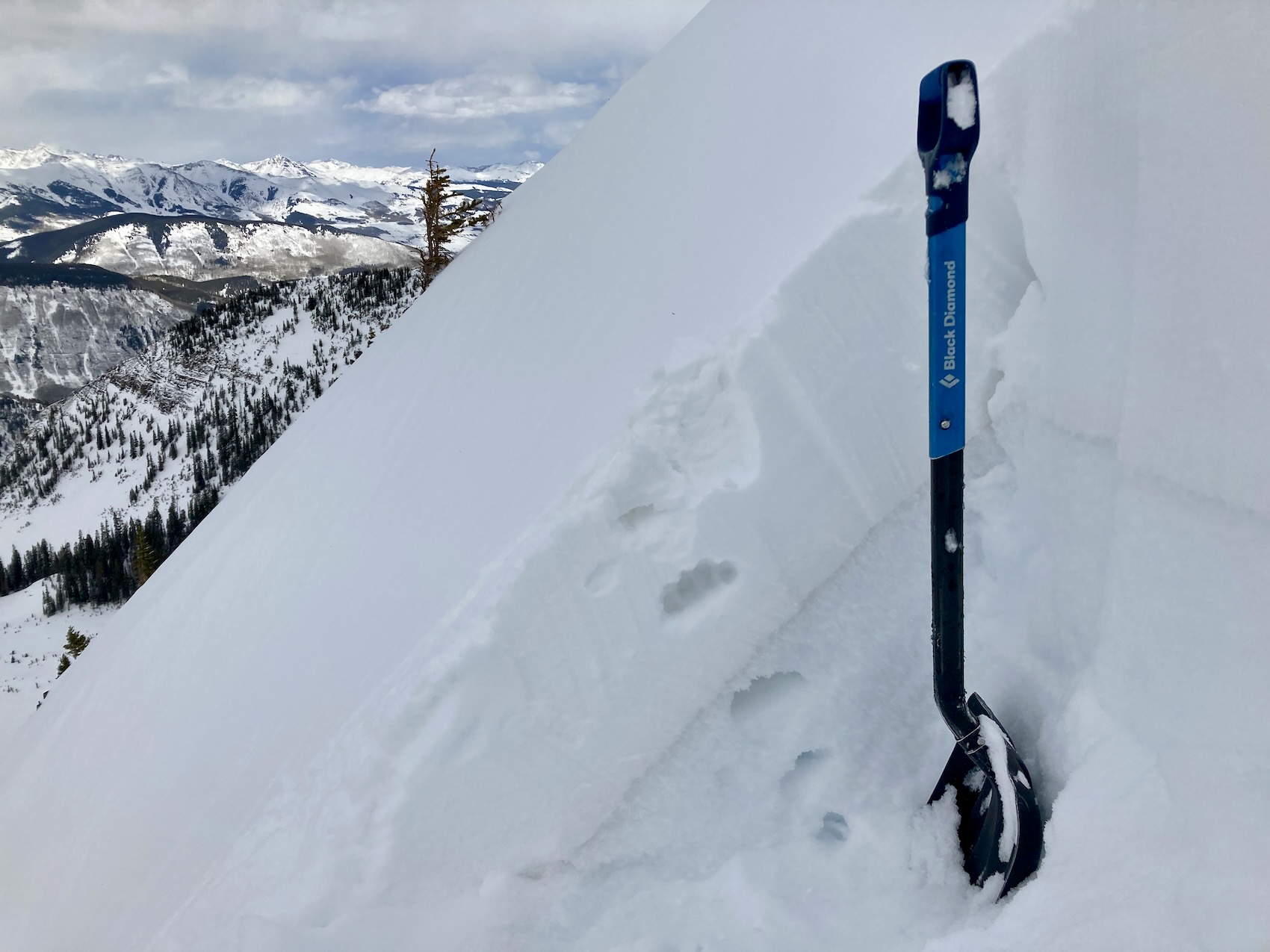
Zone: Northwest Mountains Route Description: Slate River corridor to Purple Ridge.
Observed avalanche activity: No Avalanches: The light was extremely flat which made it difficult to read the terrain. I did not observe any slab avalanches but could see some dusty (brown), narrow bed surfaces on lee slopes at upper elevations. I suspect most of these were small loose avalanches from the previous day. Weather: Overcast skies, no precip, and generally light winds with moderate gusts at ridge top. I observed some loading on to easterly aspects up high. Winds were a bit lighter than expected and fetchs on westerly slopes have become stiff and are running low on transportable snow. Snowpack: I traveled through mostly open terrain at all elevations and found snow surfaces to be noticeably stiffer than the previous day. Numerous hasty hand pits below treeline produce not concerning behavior. The new snow is well bonded to crusts below however shovel tilt tests continue to produce a planar result near the bottom of the storm snow. It took more force today to get a result in shovel tilt tests. Digging in well drifted leeward feature I was not able to get any notable test results even though there is a clear strong over weak structure present (see image). The most drifted terrain had a stiff surface that was supportive to skis. I was not able to produce any shooting cracks or find signs of instability yet chose to avoid the skiing drifted slopes.
Photos:
Shovel Tilt Tests continue to show a weakness near the bottom of the recent snow, but it required more force than yesterday to get it to ‘pop’. Storm snow has settled to about 10 inches in sheltered terrain.
A test profile on a well-drifted easterly slope at 11,500 feet. There is clear strong over weak in the slab, but no concerning test results. The ECT N looks to be at similar spot to storm weakness in sheltered areas.
This image shows my test profile in relation to heavily drifted terrain in the background. I traveled part way up this ridge in the background and was able to probe into the top of the start zone in two places; the structure in the drifted slab felt similar to my profile site.
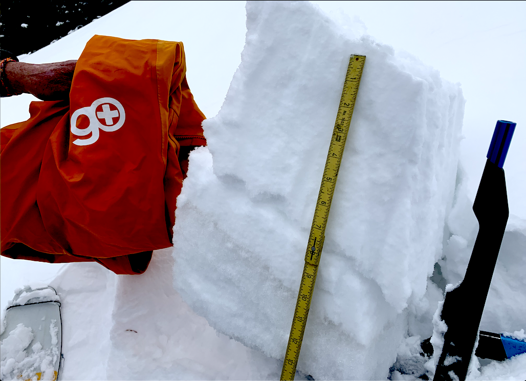
Zone: Northwest Mountains Route Description: Slate River Corridor to Pittsburg. Skied into the basin on east side of Schuylkill Peak.
Observed avalanche activity: Yes Avalanches: I observed a few small loose snow avalanches, two slab avalanches in wind-drifted terrain, and skier triggered two small wind slabs near treeline that were 12 to 18 inches deep. Poor visibility limited views into the Ruby Range. Weather: Overcast skies, cool temperatures, and the constant westerly wind. Occasional light snowfall in the afternoon but no accumulations. During periods of improved visibility, there was a constant stream of blowing snow at upper elevations focusing on the easterly aspects. Snowpack: At 10,500 feet I measured 12 inches of storm snow with 1.1″ SWE near Schuylkill Peak. In sheltered areas, I found storm snow without slab properties but a storm density change near the bottom of storm snow. Sheltered terrain could produce loose avalanches on very steep terrain. As soon as I found drifted terrain, I was able to produce shooting cracks up to 20 feet and easily triggered two small slabs on leeward rolls in the basin. Leeward features had drifts up to 2 feet thick. The triggered avalanches failed on the density change near the base of the storm snow.
Photos:
Shovel Tilt Tests failed with easy taps near the bottom of the storm snow. Bonding between the new snow and old crust appeared decent.
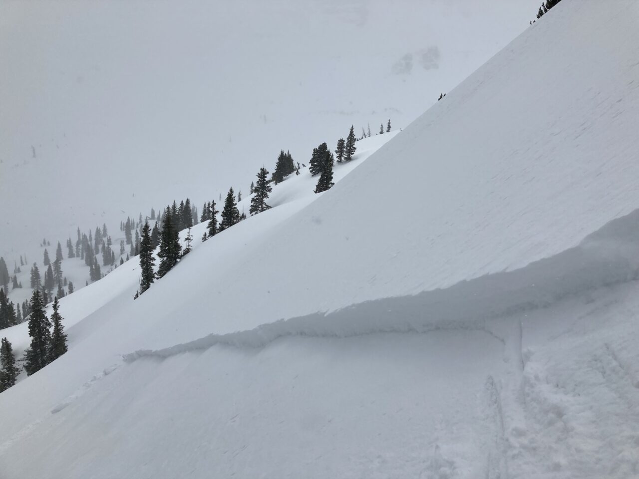
A small skier-triggered slab on a drifted roll.
Another small, intentionally triggered avalanche in drifted snow.
An example of the substantial loading going on at upper elevations on Whetstone in the evening.
More blowing snow at upper elevations focusing on easterly aspects of Augusta and Mineral Point.
I got one good glimpse of a Wind Slab on the east side of Schuylkill Peak. The brown crust below was quiet obvious in the bed surface. I couldn’t tell if it reached large size.
A small natural avalanche on a cross-loaded feature below Schuylkill sub-peak.
Relative Size: R1 very small Destructive Size: D1- Relatively harmless to people Avg. crown height (inches): 16 Avg. width (feet): Avg. vertical run (feet):
Involvements
# of people caught: # of partial burials: # of full burials:
Relative Size: R1 very small Destructive Size: D1.5 Avg. crown height (inches): Avg. width (feet): Avg. vertical run (feet):
Involvements
# of people caught: # of partial burials: # of full burials:
Additional comments: Visibility was poor so uncertain if this reached D2 size. Brief view of crown and the obvious brown crust was exposed on the bed surface.
Relative Size: R1 very small Destructive Size: D1- Relatively harmless to people Avg. crown height (inches): Avg. width (feet): Avg. vertical run (feet):
Involvements
# of people caught: # of partial burials: # of full burials:
Additional comments: Crown drifted in some so I coded for 4/12. Cross-loaded slope below Skooks sub-peak.
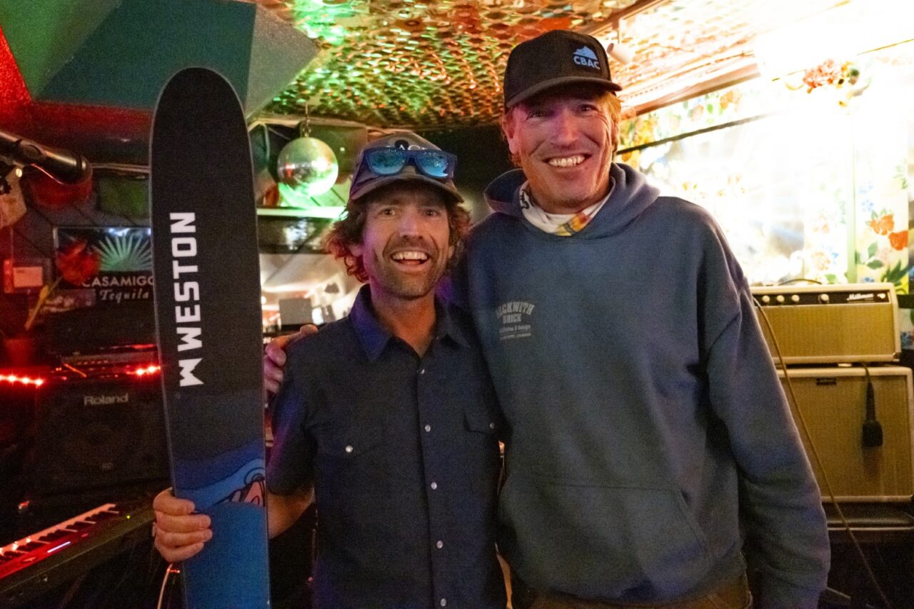
Thanks to everyone for coming out to our appreciation party at the Talk of the Town last Friday! Congrats to Travis Colbert, who won the observation contest earning himself a new pair of Weston skis for submitting the most observations this season.
Observed avalanche activity: Yes Avalanches: In steep terrain near 40 degrees the new snow sluffed easily. Several natural loose snow avalanches in similar terrain. A few small pockets produced a very small slab. All avalanche activity was small in size.
Weather: This was an afternoon tour. Accumulating snowfall continued through the afternoon with a few breaks of clearing weather. Down valley winds were transporting snow, but we were hanging out in mostly wind sheltered areas.
Snowpack: 6 to 7 inches of new snow on average with some settlement through the day with the periods of sun popping out. On NE and E facing terrain the new snow was more noticeably thick and settling quicker. On steep due north facing terrain the riding conditions were the best with a deeper and dryer feel. No real slab avalanche problems were encountered in this mostly wind-sheltered terrain, and loose dry avalanches were the primary problem. Those avalanches were predictable and relatively easy to manage.
Photos:
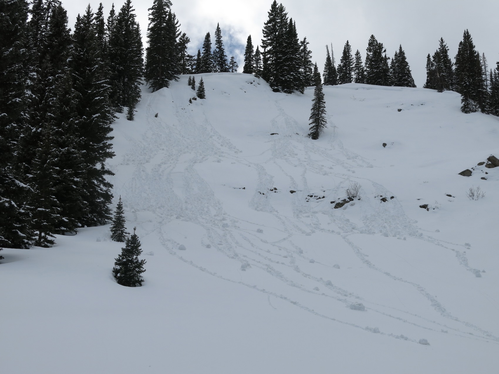
A sluff
Multiple loose snow avalanches piled up where they funneled together.
Steep due north at 11,500ft. Dry new snow capping a thin crust over a thin layer of facets. Not enough snow here for a slab avalanche problem.
Relative Size: R1 very small Destructive Size: D1- Relatively harmless to people Avg. crown height (inches): Avg. width (feet): Avg. vertical run (feet):
Involvements
# of people caught: # of partial burials: # of full burials:
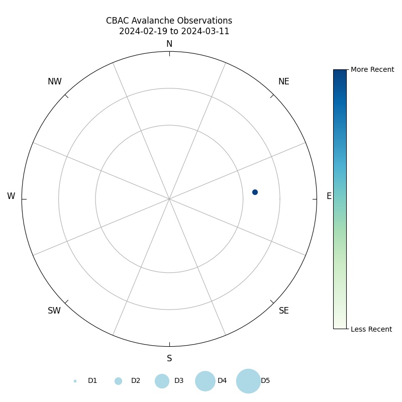
We’re excited to announce the release two new data visualization tools that we have been developing over the winter. These products come from the collaborative volunteer efforts of Reggie Park and Michael Futch. We owe them a huge thank you. Currently, the tools are best suited for desktop computer use. We are working on making them mobile-friendly this summer. The links are accessible from our desktop homepage under the Observations->Avalanches tab on the top menu. Our original avalanche rose, which is mobile-friendly, is still available on the website under the “hamburger” menu.
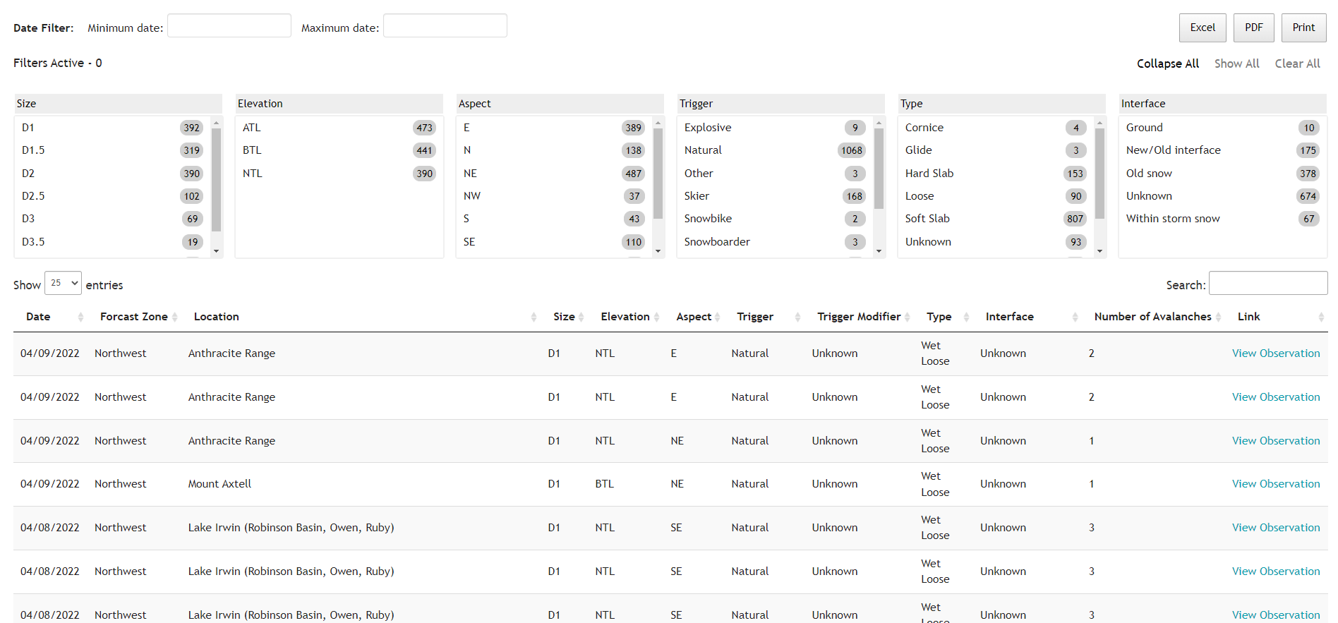
Each dot on the rose represents an observed avalanche. Dots are color-coded by a number of user-selected filters, such as avalanche type, trigger, forecast zone, or failure interface. Dots are sized according to the avalanche’s destructive size, and shaded by how recent they are relative to today. Note that the dots are randomly placed within the aspect/elevation octant that the avalanche originated from. Thus, dot placement is not a precise azimuth or altitude, but rather, a general location within the boundaries of that octant. If you mouse hover over each avalanche dot, it will provide additional information and a link to the original observation. Use the time scale slider to filter by date. Another important caveat is that the rose only shows avalanche activity that we observe and document, which is not a comprehensive tally of backcountry avalanches. Our avalanche observations tend to be biased by the terrain that we have better views of or visit more often. For example, we have very good vantages of a lot of east and northeast facing paths from town, such as Climax Chutes, Happy Chutes, and Schuylkill Ridge, whereas we don’t have as many views of northwest or west facing avalanche terrain, such as the west side of the Ruby Range.
The avalanche table allows you to filter, sort, and search for avalanche activity by any number of variables, such as size, elevation, aspect, etc. You can also export your filtered results as a PDF or excel sheet.
Zone: Northwest Mountains Route Description: Traveled on NE to SE aspects on Mt. Afley to 12,600 ft this morning, and a brief bino tour along Kebler Pass Road mid day.
Observed avalanche activity: Yes Avalanches: Counted a handful of small wet loose avalanches on easterly aspects, a few of which ran yesterday and a few more that ran today, all D1 in size. See photos. Weather: Thin cloud cover began filling in over the Ruby Range by late morning, with cloud cover holding off a little longer over the Anthracites and Axtell. Moderate westerly ridgetop winds. Warm temps. Snowpack: Weaker overnight refreeze that was punchy to boot pen (~10″) on a number of slopes but still supportive to skis. We found ideal corn skiing on SE aspects at 10:30 a.m. By 11 a.m, ski pen was increasing to 5″ or 6″ in wet snow on east facing terrain near treeline. The arrival of thicker clouds by noon seemed to help moderate surface melt. Northeast aspects got moist in the upper 6″ or so, and produced a few small wet loose slides while most slopes on that aspect were too roughed up by previous winds to do much.
Photos:
Small wet loose activity off or Purple Peak (SE aspect) that ran yesterday.
Axtell 2nd bow (NE aspect), ran today
East bowl of AMR (east aspect). I think these ran today.
Near Northwest Bowl of AMR (NE aspect), ran today.
Ski pen was deeper today than yesterday on east aspects, up to about 6″ at 11 a.m.
Relative Size: R1 very small Destructive Size: D1- Relatively harmless to people Avg. crown height (inches): Avg. width (feet): Avg. vertical run (feet):
Involvements
# of people caught: # of partial burials: # of full burials:
Relative Size: R1 very small Destructive Size: D1- Relatively harmless to people Avg. crown height (inches): Avg. width (feet): Avg. vertical run (feet):
Involvements
# of people caught: # of partial burials: # of full burials:
Relative Size: R1 very small Destructive Size: D1- Relatively harmless to people Avg. crown height (inches): Avg. width (feet): Avg. vertical run (feet):
Involvements
# of people caught: # of partial burials: # of full burials:
Relative Size: R1 very small Destructive Size: D1- Relatively harmless to people Avg. crown height (inches): Avg. width (feet): Avg. vertical run (feet):
Involvements
# of people caught: # of partial burials: # of full burials:


