Observed avalanche activity: No Weather: It continues sunless with off and on wind, though none overnight. Almost constant snow except from mid-afternoon Tuesday until night but light snowfall overnight (4″, 0.21″ SWE) and very light density. The 24-hour totals are 9½” new and water 0.61″ with currently 30″ on the ground. Obscured again with basically no current snowfall except for a few flakes while calm. Temperature stays mild after high of 28 and the low, and current, 19. No wind. The new snow is light enough to have a limited effect on snow stability, though snowpack was still collapsing in places late yesterday. And the clouds continue. billy
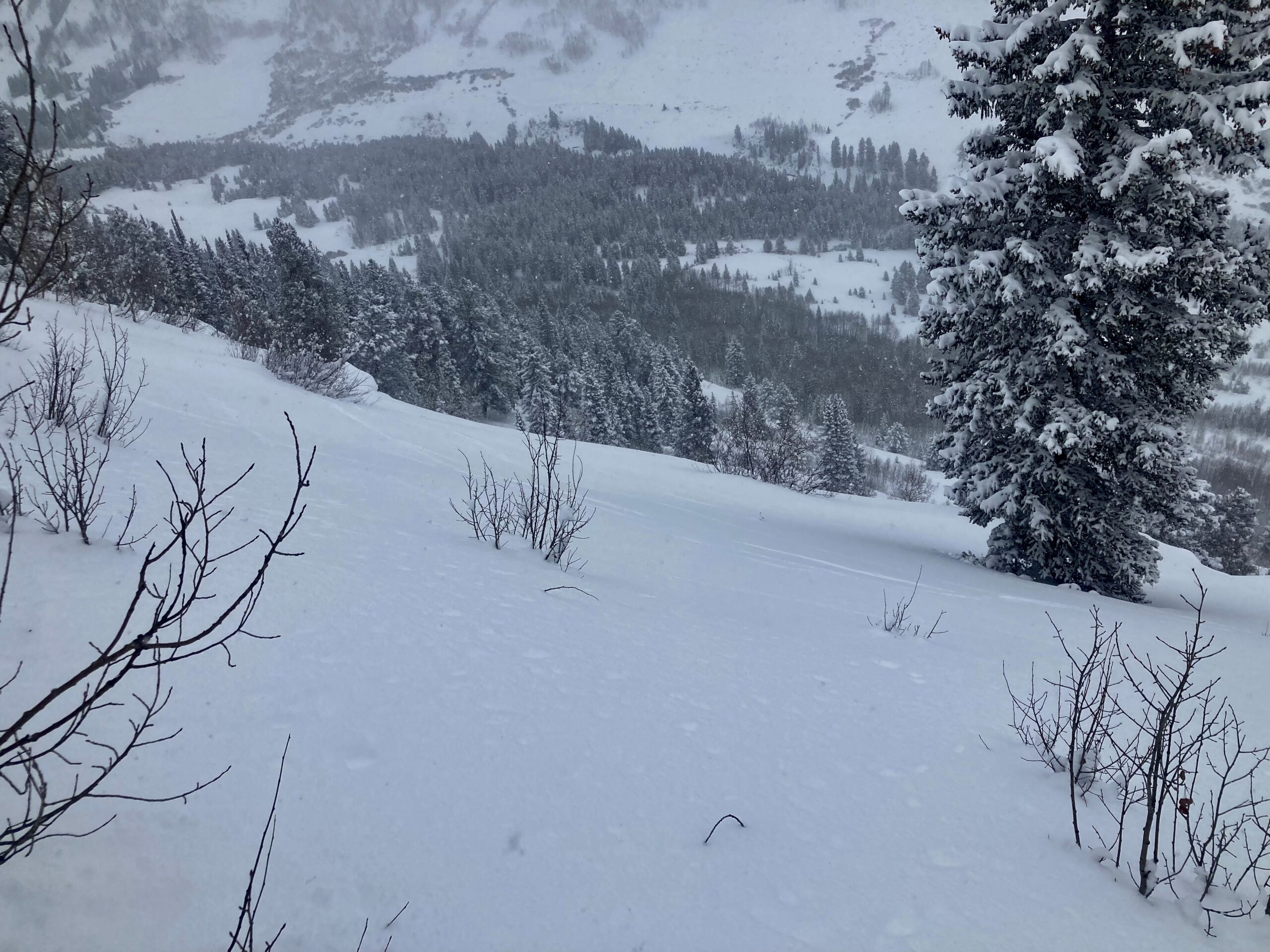
Zone: Northwest Mountains Route Description: Schuylkill Ridge. Traveled on SE, E, NE and N aspects to 11,400′.
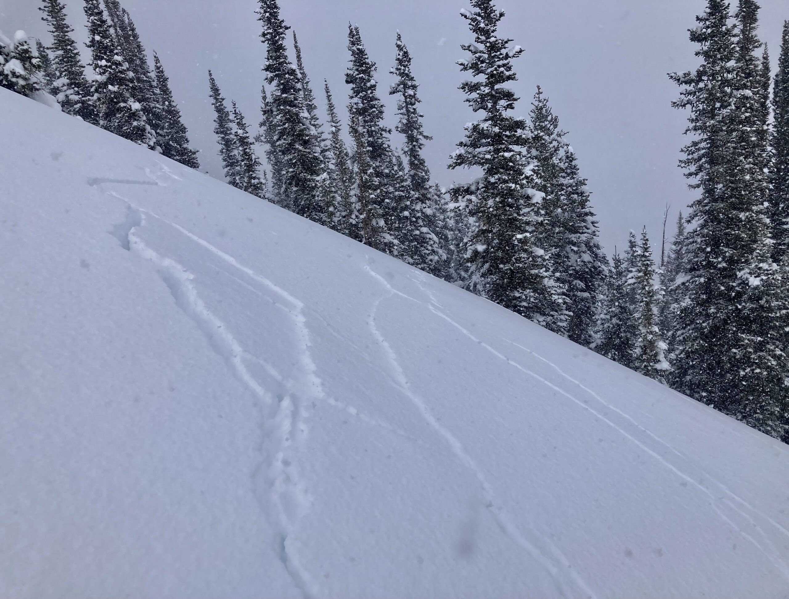
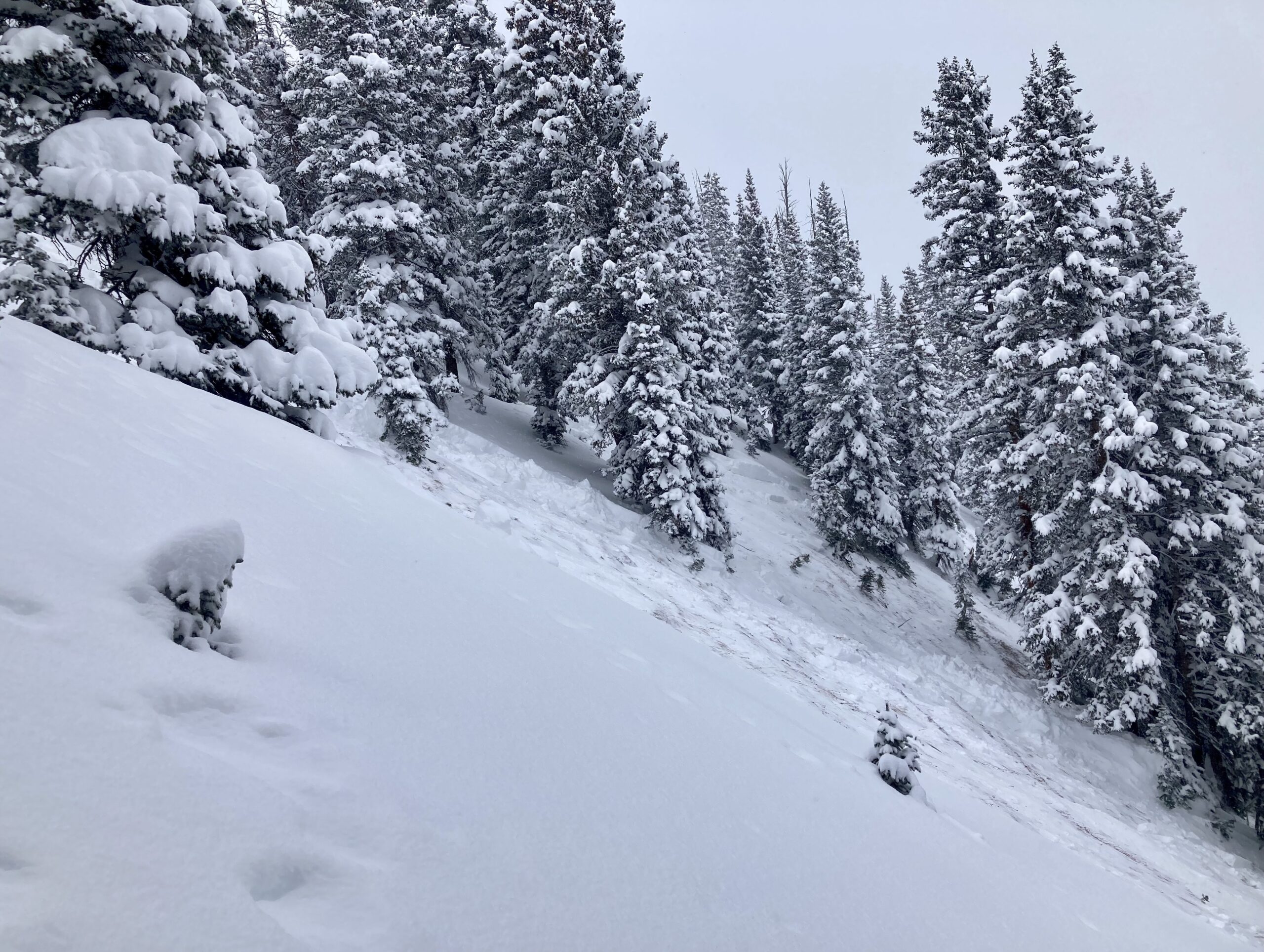
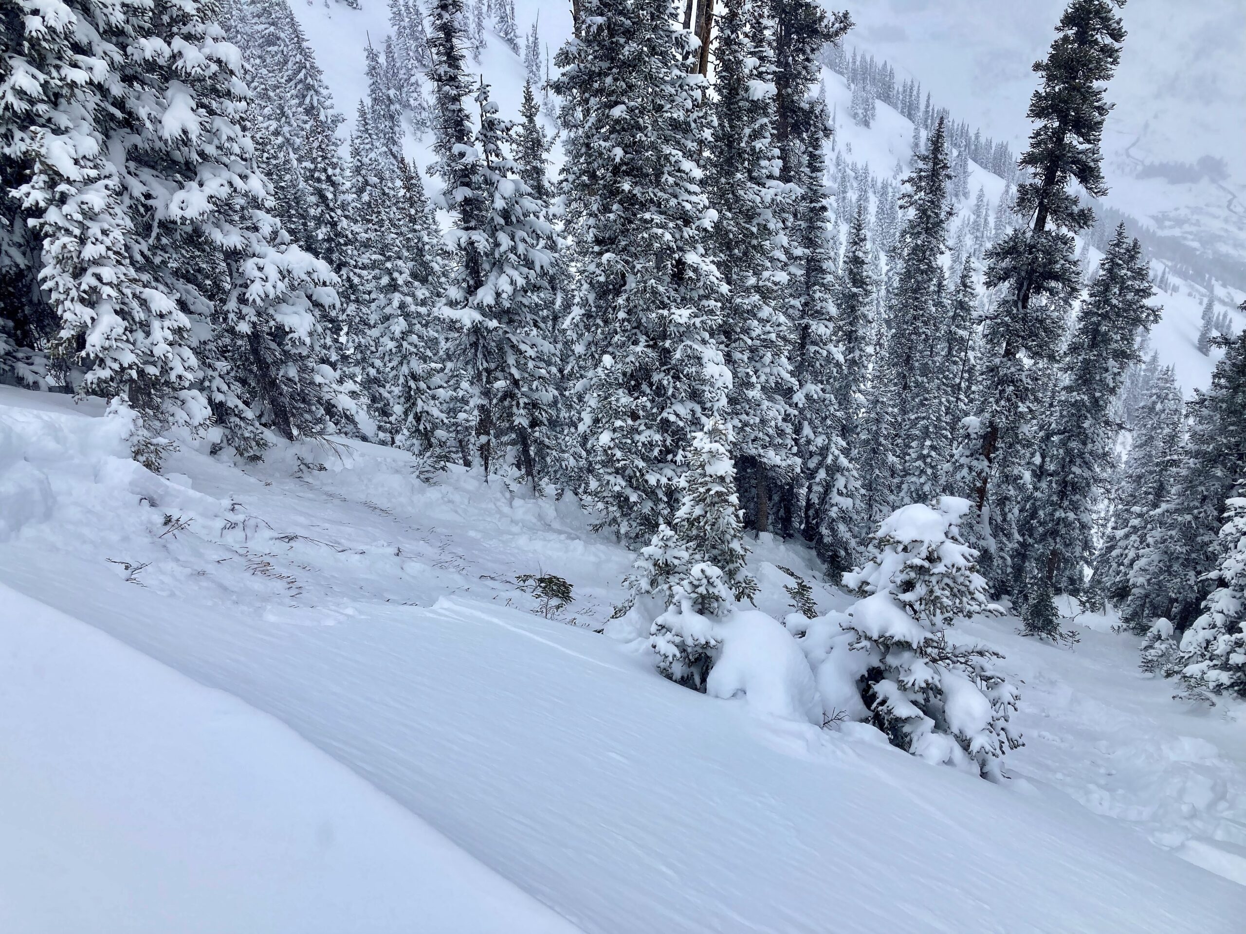
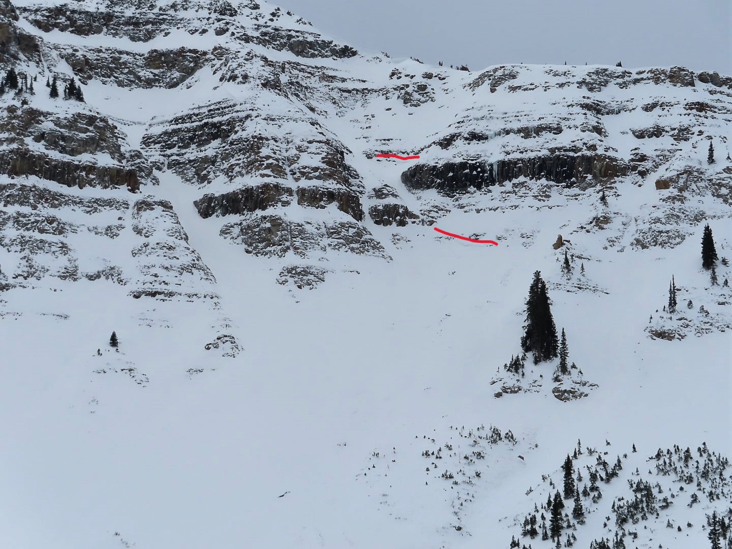
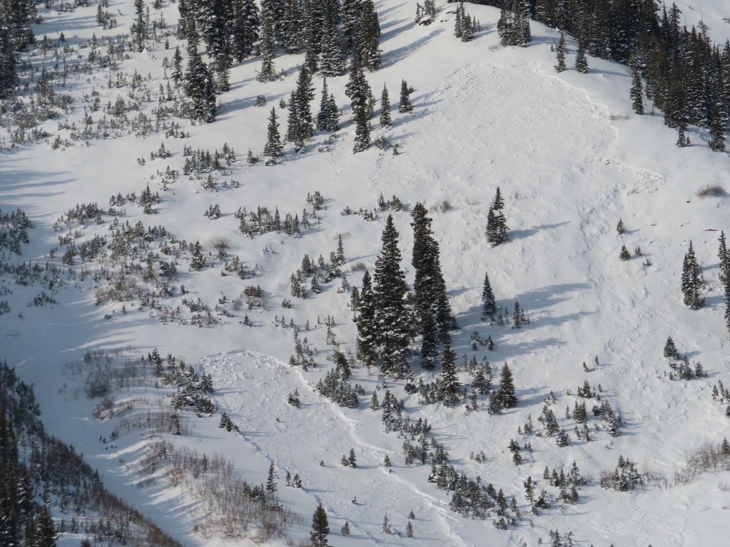
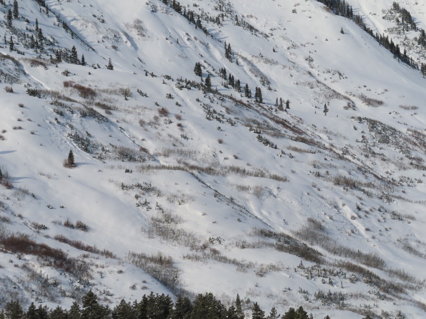
Observed avalanche activity: Yes Avalanches: A pair of large persistent slabs ran naturally this morning in First Bowl, probably sympathetic. From ridgetop, we remotely triggered another large slab in First Bowl which appeared to sympathetically trigger a large slab in Birthday Bowl. Crowns were 2 to 3 feet thick on average, failing on fist hard, large grained facets. Spotted three D1-1.5 natural persistent slabs in Climax Chutes. Numerous skier triggered and natural loose dry avalanches on all aspects below treeline, D1 in size. The light was too flat to see much else. Weather: Snowfall rates tapered by the time we got to the trailhead around 11 a.m. Light to moderate rates this afternoon, with a short period of heavy snowfall. About a foot of low-density snow accumulated since early this morning. Winds were moderate at ridgetop with a decent amount of blowing snow. Snowpack: Widespread collapsing and shooting cracks on everything with old snow at the base, mostly just while skinning and no stomping required. Went to a few frequent flier slopes BTL that rumbled and shattered but didn’t move. NTL suspect slopes produced a mix of shattering but staying put and shattering and releasing. On southerly aspects lacking old snow layers, we saw no evidence of slab instabilities except some cracking in the storm snow near wind drifted terrain. Sheltered terrain sluffed readily in the top 12″ of snow.
Photos:
A suspect BTL slope that rumbled and cracked across the entire slope (about 400 feet wide), but didn’t move.
Let’s try a suspect NTL slope. Still just slumping.
Here we go! Remote triggered D2 in First Bowl from 100 ft away
It looks like it sympathetically triggered this one in Birthday Bowl.
Relative Size: R1 very small Destructive Size: D2 – could bury, injure, or kill a person Avg. crown height (inches): 30 Avg. width (feet): Avg. vertical run (feet):
Involvements
# of people caught: # of partial burials: # of full burials:
Additional comments: First Bowl. 6″ of fluff on the bedsurface, so they definitely ran this morning.
Relative Size: R2 small Destructive Size: D2 – could bury, injure, or kill a person Avg. crown height (inches): 36 Avg. width (feet): Avg. vertical run (feet):
Involvements
# of people caught: # of partial burials: # of full burials:
Additional comments: FIrst bowl. Triggered from ~100 ft away.
Relative Size: R1 very small Destructive Size: D2 – could bury, injure, or kill a person Avg. crown height (inches): 32 Avg. width (feet): Avg. vertical run (feet):
Involvements
# of people caught: # of partial burials: # of full burials:
Additional comments: Appeared to release sympathetically with the remotely triggered First Bowl slide, which was about 300 ft away.
Relative Size: R1 very small Destructive Size: D1- Relatively harmless to people Avg. crown height (inches): Avg. width (feet): Avg. vertical run (feet): 400
Involvements
# of people caught: # of partial burials: # of full burials:
Additional comments: Large enough to bury in a terrain trap.
Observed avalanche activity: Yes Avalanches: A moderately sized slab released ran off the peak area of Gothic yesterday but the new snow is very light so far so shouldn’t affect anything yet. It was about a 2-3 deep fracture facing east northeast running to ground just below the peak but starting at the ridgetop. It ran about 1800 feet but stopped before the run-out zone. Weather: Very wet, dense snow Monday morning before stopping, then starting back near midnight but becoming heavy starting around 5 a.m. today but with a very light density balancing the snow out at 6″ new and water content 0.42″. Snowpack reached 24″. Currently obscured and snowing moderately with only light SW wind, though the wind was strong midnight until stopping around 4 before snow started up.
Date of Observation: 12/05/2022 Name: Zach Guy and Evan Ross
Zone: Northwest Mountains Route Description: Traveled on west facing terrain near and below treeline near Lake Irwin and east facing terran below treeline above Elk Creek.
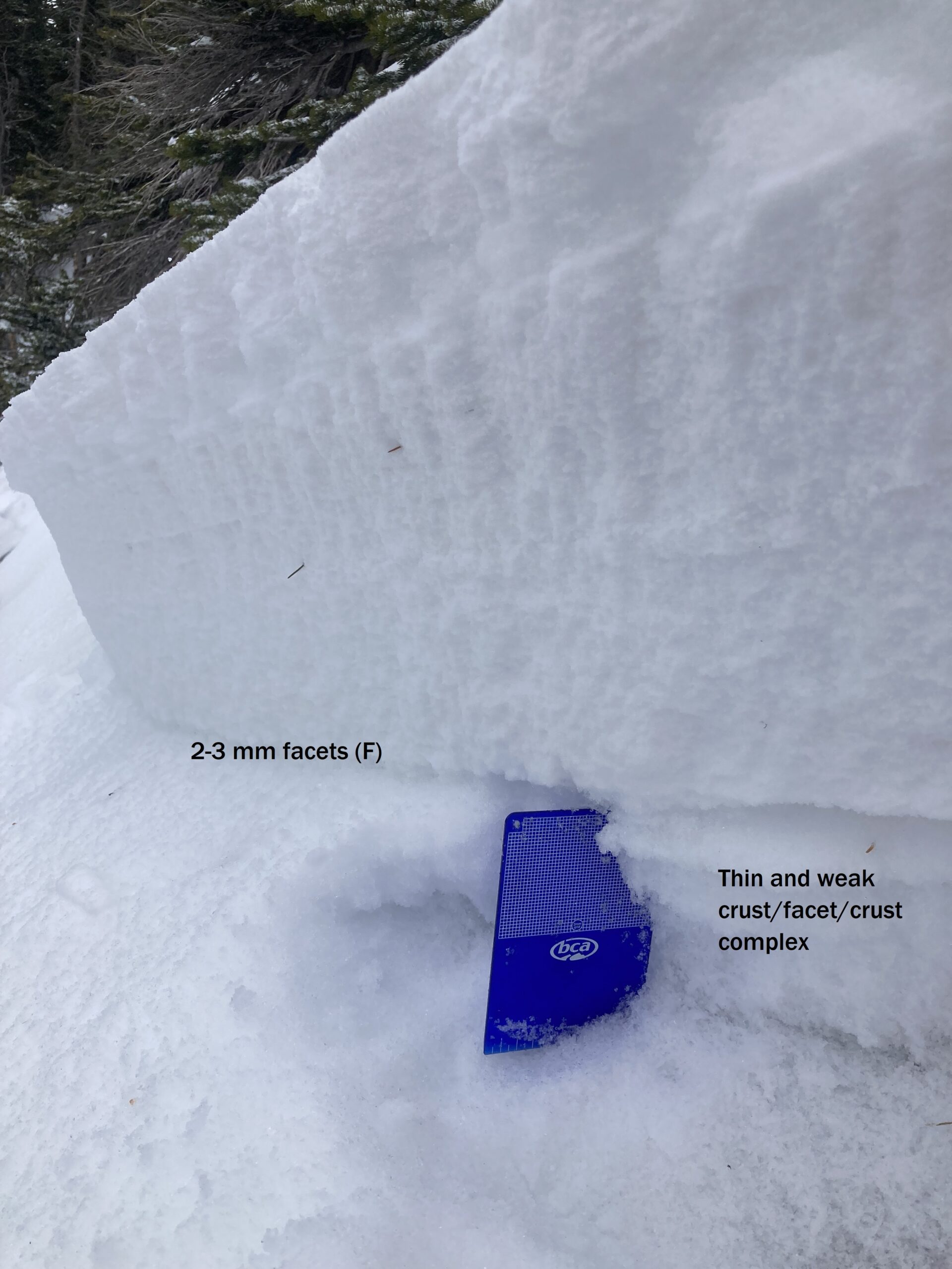
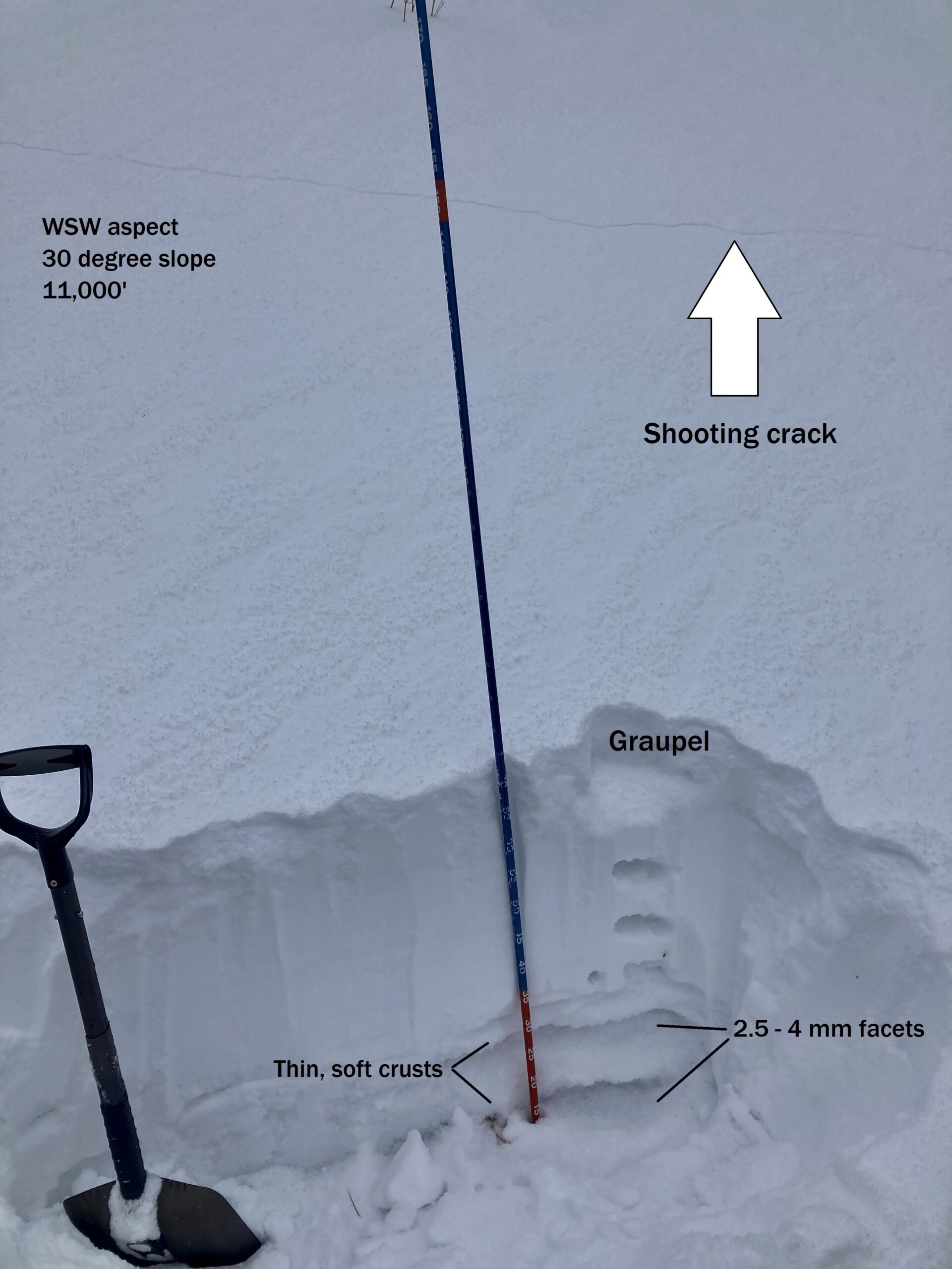
Observed avalanche activity: Yes Avalanches: On west facing terrain at Irwin: We remotely triggered a small persistent slab from about 20 feet away (See video). The soft slab was up to 16″ thick, and failed on the topmost facet layer in stack of several facet/crust layers that were buried a week ago. The other steep slopes that we traveled near had all avalanched previously. Same for east facing terrain in Elk Creek: all of the paths that we approached slid naturally, probably during the Nov 29 storm. Weather: Overcast, light snow and graupel, moderate ridgeline winds with periods of light transport. Mild temps. Snowpack: Frequent collapsing and shooting cracks while breaking trail on west-facing terrain in the 20* to 30* range. The collapses are occurring on thin and weak facet crust sandwiches. Collapses were somewhat less common on east-facing terrain, perhaps because the slabs are thicker, but plenty of collapses nonetheless. There was an impressive amount of graupel in the top 10 cm of the snowpack. The slab continues to get stiffer and more supportive to skis, making for fun and fast skiing on low angle terrain. After clearly identifying that the terrain we were scouting had slid earlier in the week, we felt comfortable riding on those steeper pitches.
Photos:
Crown of remotely triggered slab
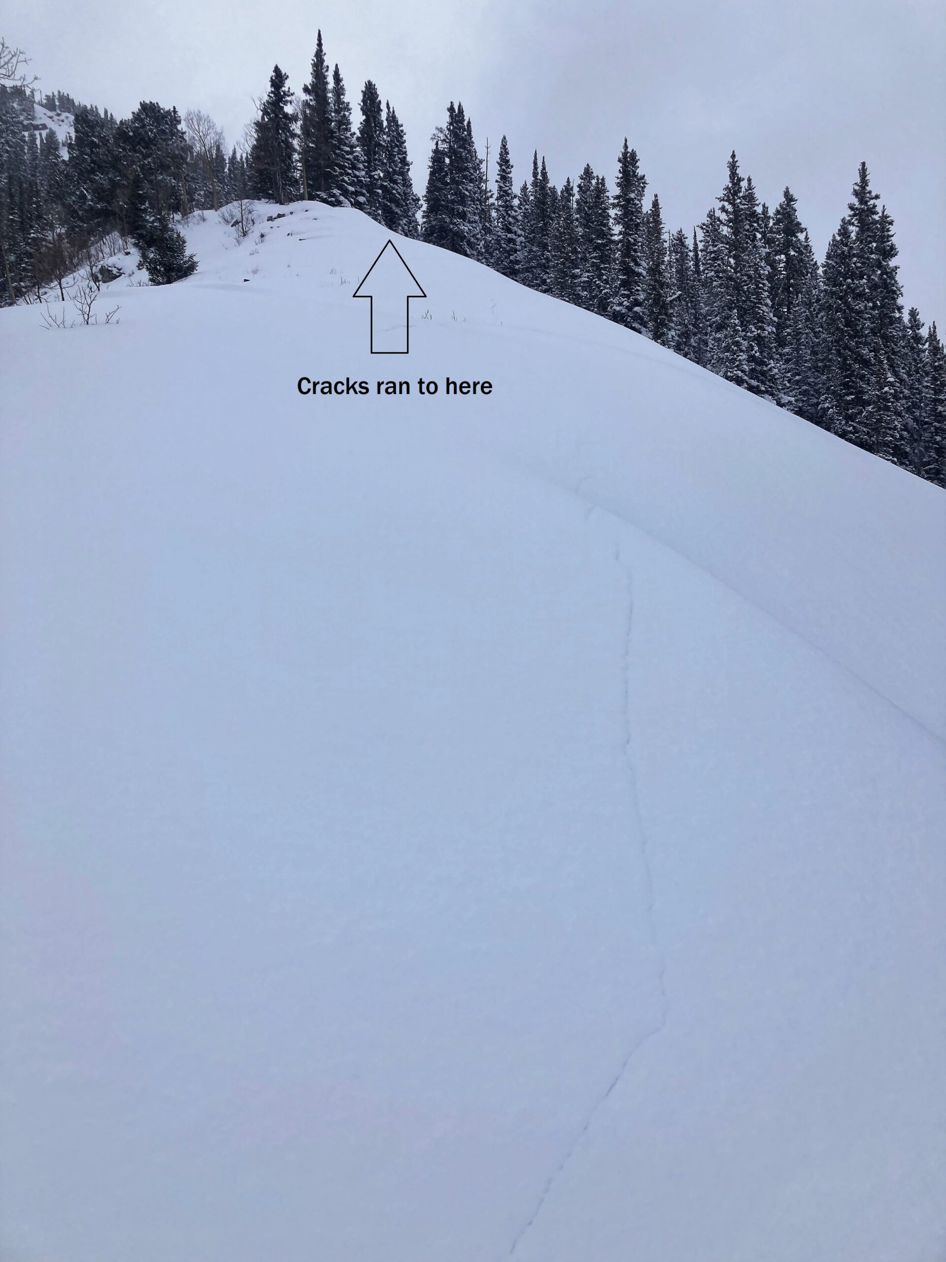
Profile on a slope that produced a large, slopewide collapse and shooting crack.
Profile on a slope that produced a large, slopewide collapse and shooting crack.
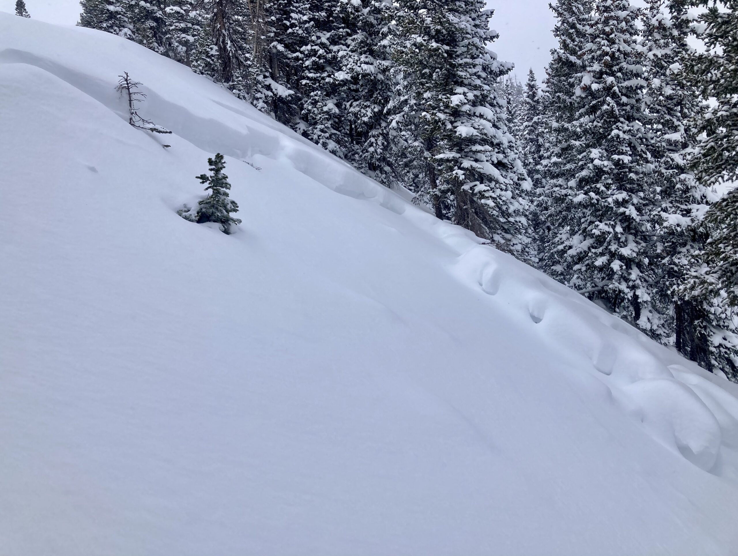
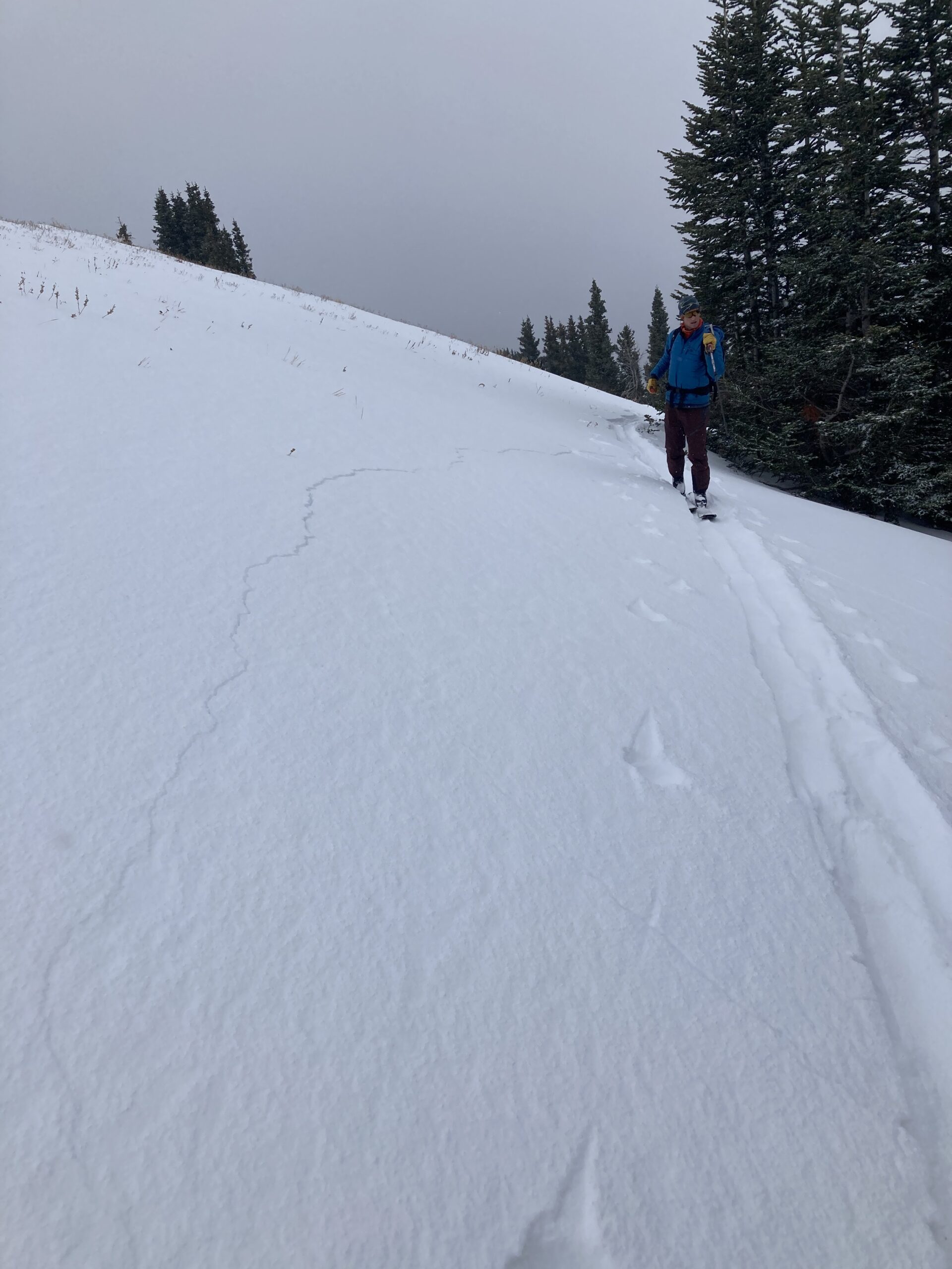
Don’t be distracted by Evan’s perfect skinning form. There’s a shooting crack in the foreground. West facing terrain NTL.
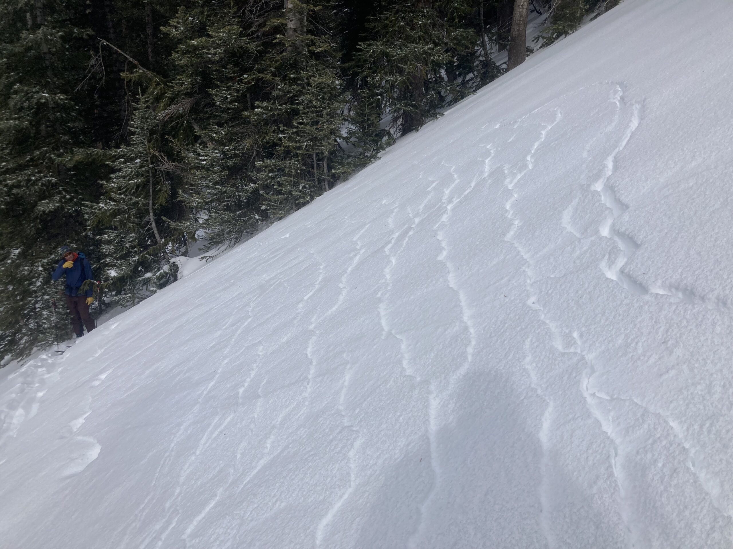
Shooting cracks, west facing terrain BTL
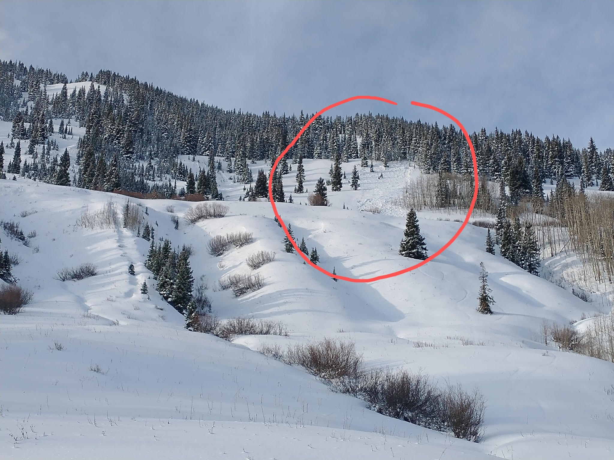
The crowns of previous avalanches are filled in, but we could see debris piled up against trees.
Relative Size: R1 very small Destructive Size: D1- Relatively harmless to people Avg. crown height (inches): 12 Avg. width (feet): 40 Avg. vertical run (feet):
Involvements
# of people caught: # of partial burials: # of full burials:
Relative Size: R2 small Destructive Size: D1.5 Avg. crown height (inches): Avg. width (feet): Avg. vertical run (feet):
Involvements
# of people caught: # of partial burials: # of full burials:
Additional comments: Way Long and Two Chutes, Irwin Westwall. Size and failure date is best estimate; crowns and debris have been subsequently covered by more snow and blown in.
Relative Size: R2 small Destructive Size: D1.5 Avg. crown height (inches): Avg. width (feet): Avg. vertical run (feet):
Involvements
# of people caught: # of partial burials: # of full burials:
Additional comments: Outer Limits, Irwin Westwall. Size and failure date is best estimate; crowns and debris have been subsequently covered by more snow and blown in.
Relative Size: R2 small Destructive Size: D1.5 Avg. crown height (inches): Avg. width (feet): Avg. vertical run (feet):
Involvements
# of people caught: # of partial burials: # of full burials:
Additional comments: Elk Creek, first two paths. Size and failure date is best estimate; crowns and debris have been subsequently covered by more snow.
Observed avalanche activity: No Weather: A little bit of sun yesterday (hooray) as it stayed dry, then cloudy and very warm overnight with light but very dense snow, mostly graupel, with 2″ new and water 0.22″. Wind light to none. There is 19″ of snow on the ground matching this winter’s deepest. Currently a very light snowfall with today’s high 33F (yesterday was 36) and the current 28 after a low of 27. Is it April? –The graupel is making for another weak layer in the snowpack as the current pack continues to collapse.
Observed avalanche activity: Yes Avalanches: A few natural avalanches from east and northeast aspects of Whetstone and Gothic Mountain. The Gothic avalanche clearly is big enough to bury a person(D2) and a couple on Whetstone looked to be large(D2) as well, but visibility was poor so made my best estimates on size. Weather: Mostly cloudy conditions in the early afternoon when I made the observation. Snowpack:
Photos:
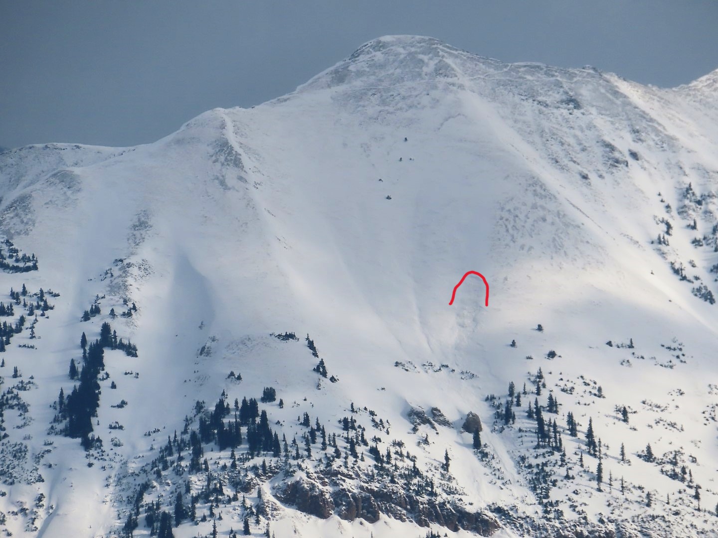
A large natural avalanche on the east side of Gothic Mountain.
A pair of avalanches in Main Bowl of Whetstone (east and northeast aspects). These appear to be large enough to bury a person.
Natural avalanche from a northeast slope near the Claw on Whetstone.
A couple natural avalanches on northeast-facing slopes of Hidden Lake Bowl on Whetstone. My best guess would be large enough to bury a person.
Natural avalanche on northeast feature on down valley end of Whetstone.
Relative Size: R1 very small Destructive Size: D2 – could bury, injure, or kill a person Avg. crown height (inches): Avg. width (feet): Avg. vertical run (feet):
Involvements
# of people caught: # of partial burials: # of full burials:
Additional comments: Hidden Lake Bowl and Main Bowl
Relative Size: R1 very small Destructive Size: D2 – could bury, injure, or kill a person Avg. crown height (inches): Avg. width (feet): Avg. vertical run (feet):
Involvements
# of people caught: # of partial burials: # of full burials:
Relative Size: R1 very small Destructive Size: D2 – could bury, injure, or kill a person Avg. crown height (inches): Avg. width (feet): Avg. vertical run (feet):
Involvements
# of people caught: # of partial burials: # of full burials:
Additional comments: Shady side of east bowl. Coded as as east but likely borderline NE and E. Crowns looked sharp so likely failed after the main snow event on Friday.
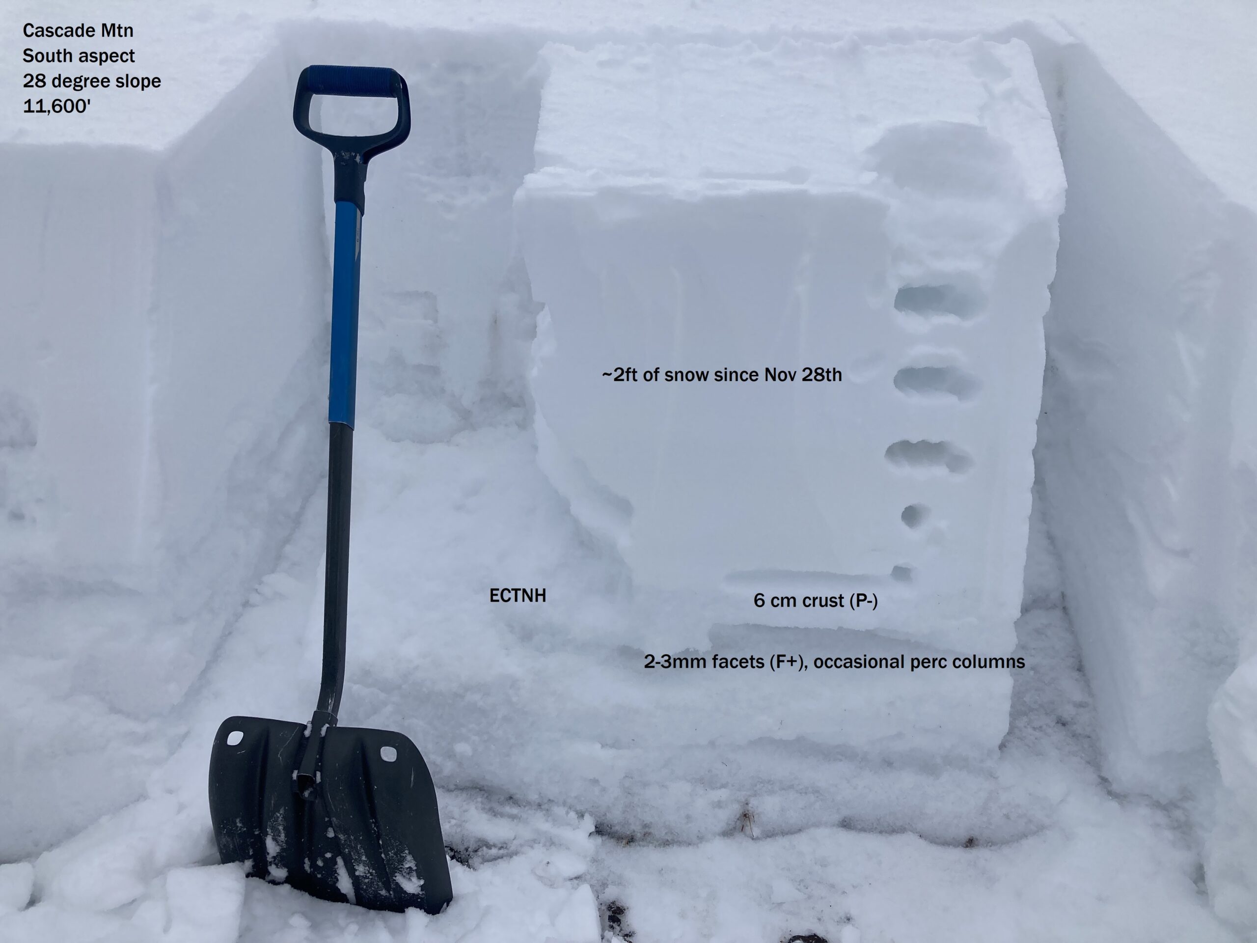
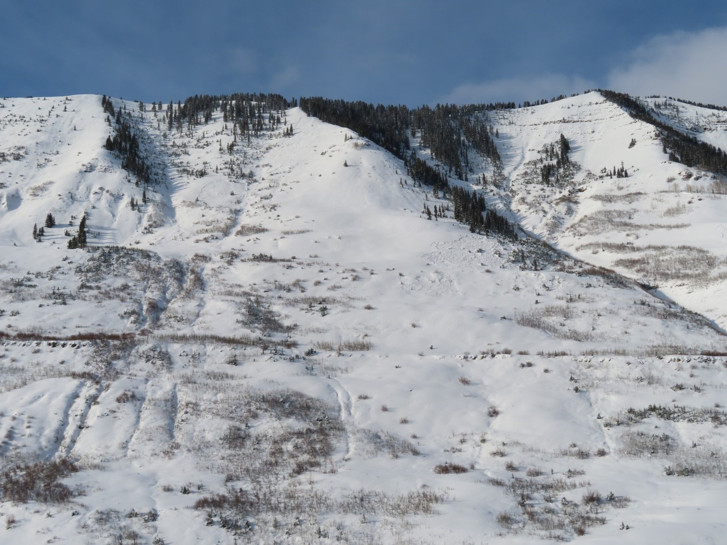
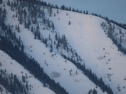
Zone: Northwest Mountains Route Description: Baxter Basin and Cascade Mtn, Traveled on various aspects up to 11700′
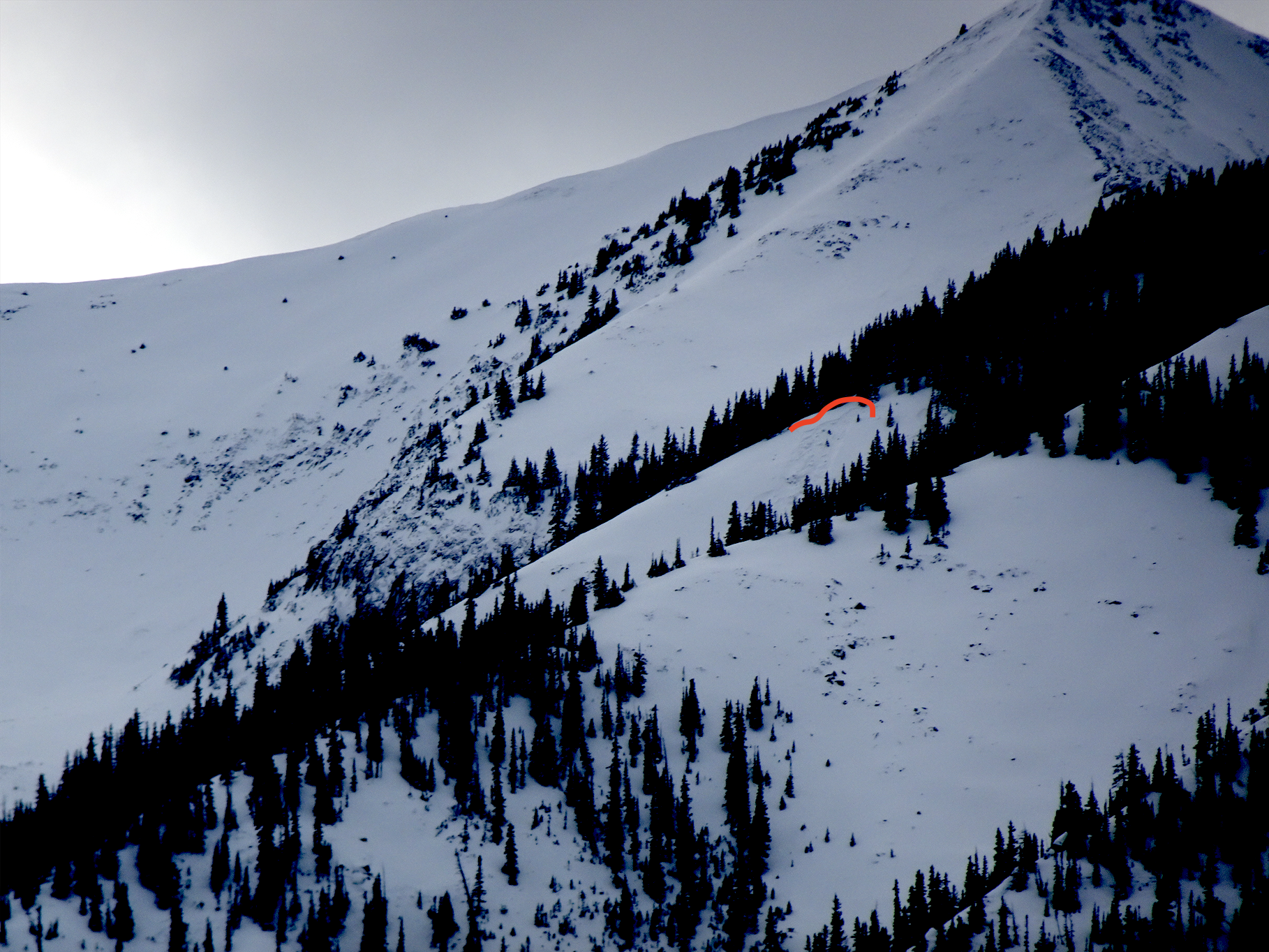
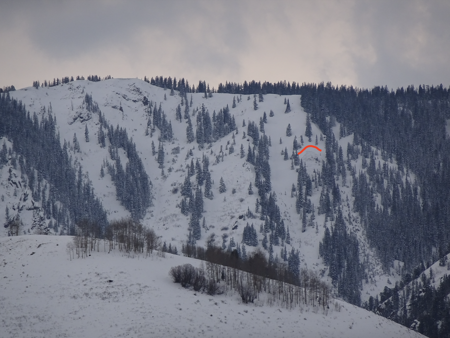
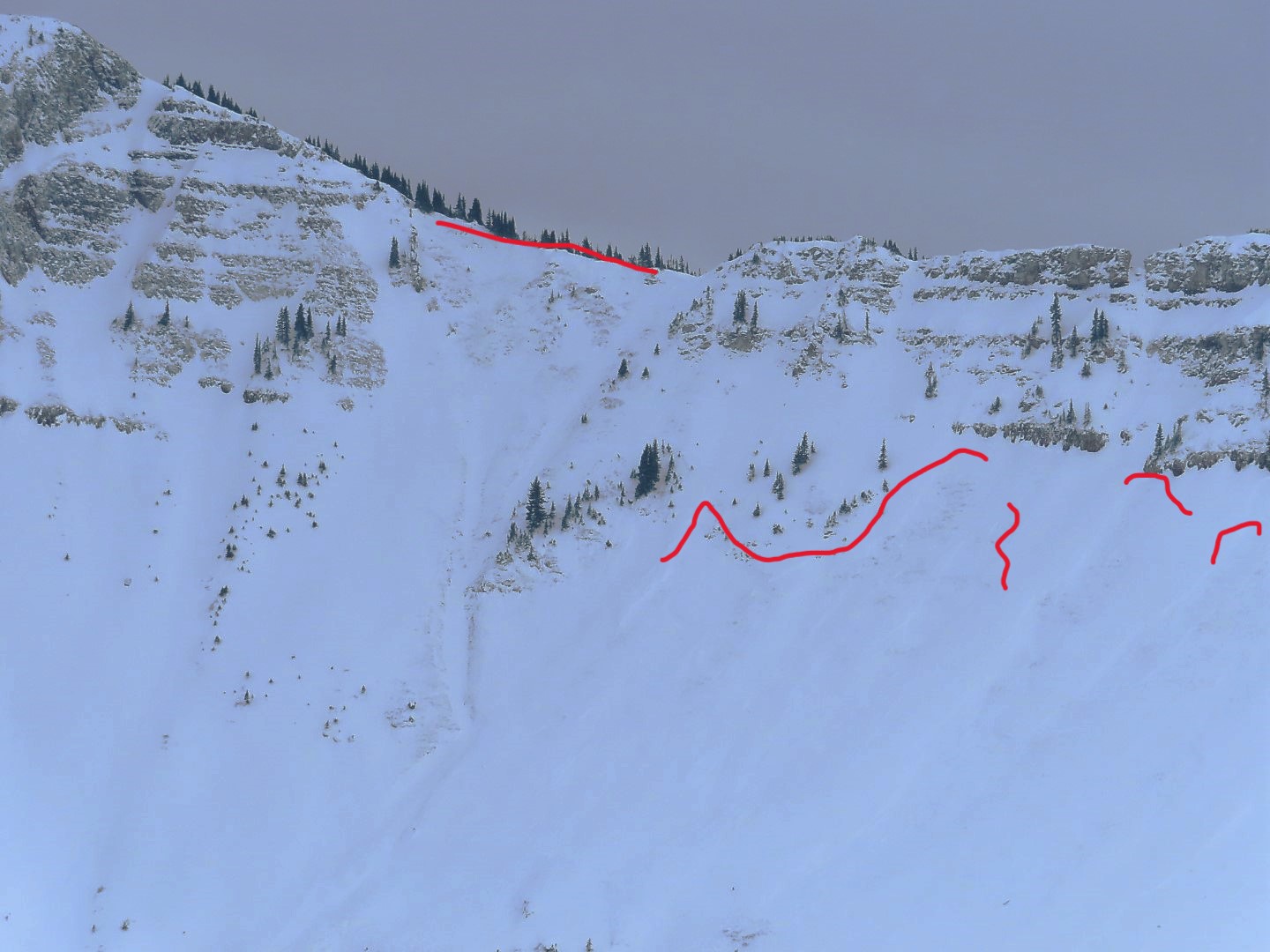
Observed avalanche activity: Yes Avalanches: Numerous natural D1.5 to D2 slabs from the last storm, most on North to East N/ATL, with a couple that rounded to Southeast and South-Southeast aspects. Light was flat so it was hard to make out exact sizes and crown connectivity. See photos. Tried getting some smaller terrain features to release without any luck. Weather: Clouds increased mid-morning. Light winds with light transport at times. Mild temps. Snowpack: Frequent collapses, some localized, some rumbling across entire terrain features. Slabs are generally 2 feet thick and average 4F hard over our well-advertised weak layers. We targeted a pit on a due south slope that held old snow prior to the recent storms. The crust capping the large-grained facets is about 6 cm thick, and tests did not propagate.
Photos:
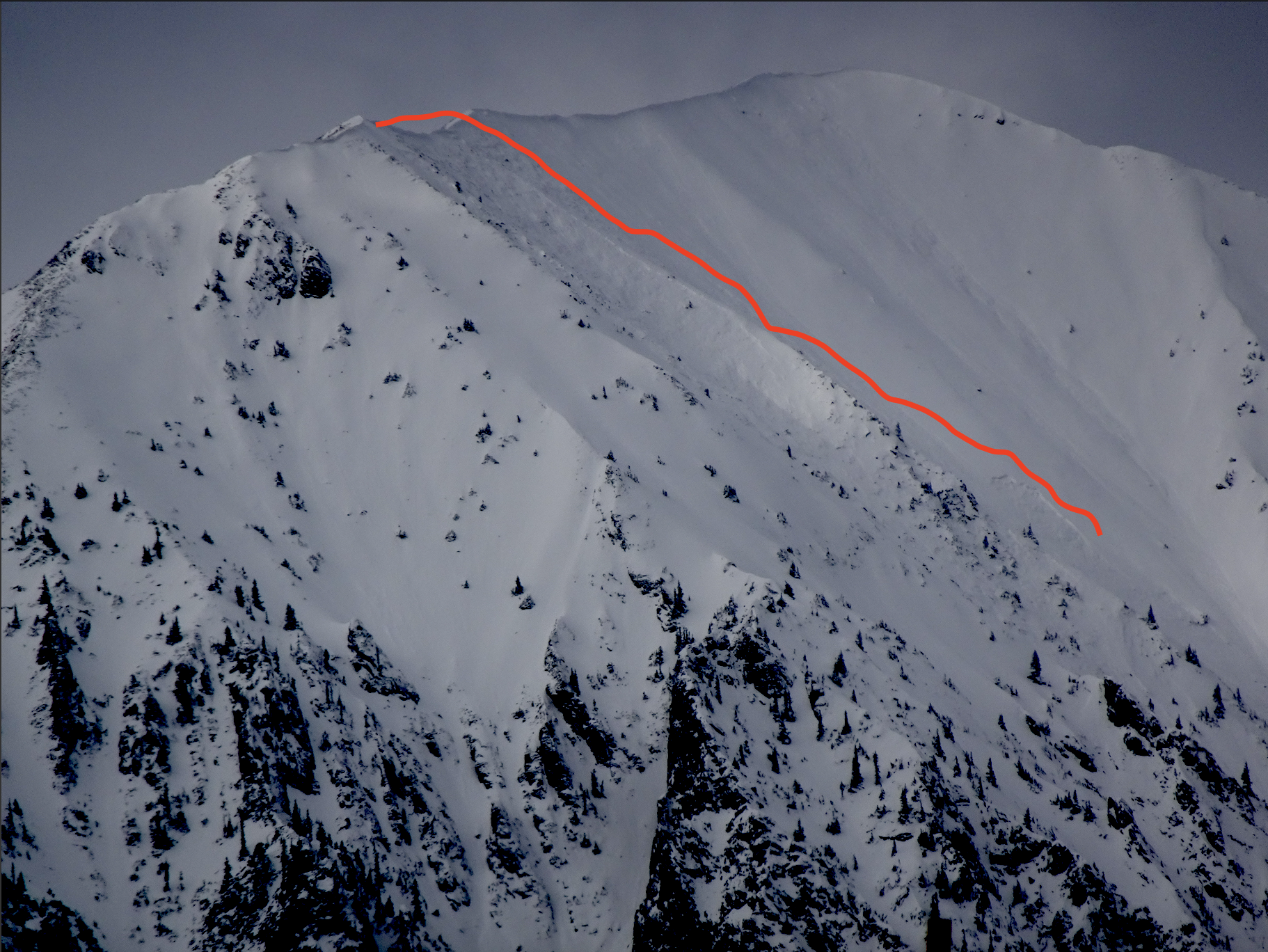
Mineral Point. This avalanche had crowns from SSE to E aspects.
Relative Size: R2 small Destructive Size: D2 – could bury, injure, or kill a person Avg. crown height (inches): Avg. width (feet): Avg. vertical run (feet):
Involvements
# of people caught: # of partial burials: # of full burials:
Zone: Northwest Mountains Route Description: Viewed from Slate River Road
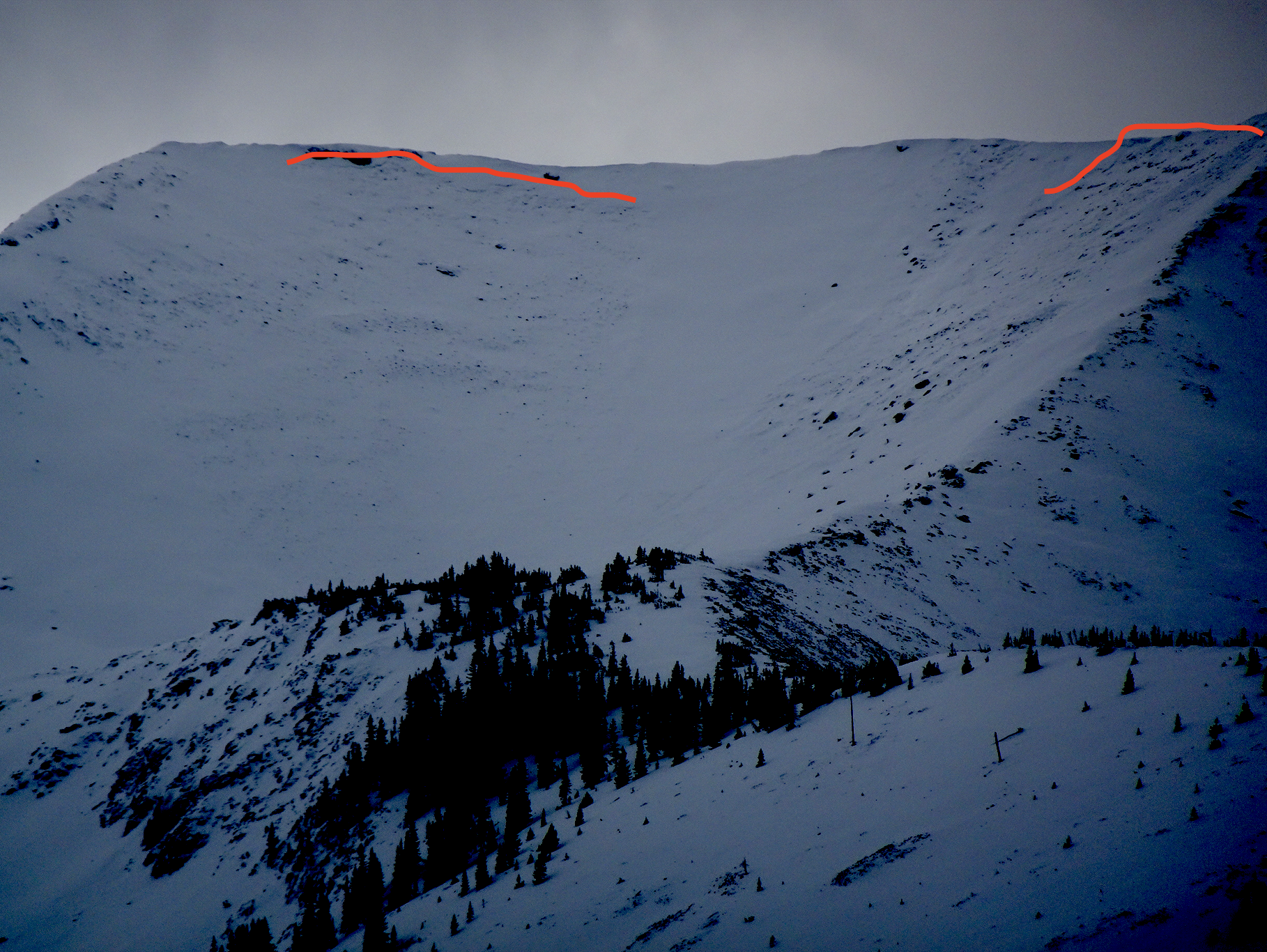
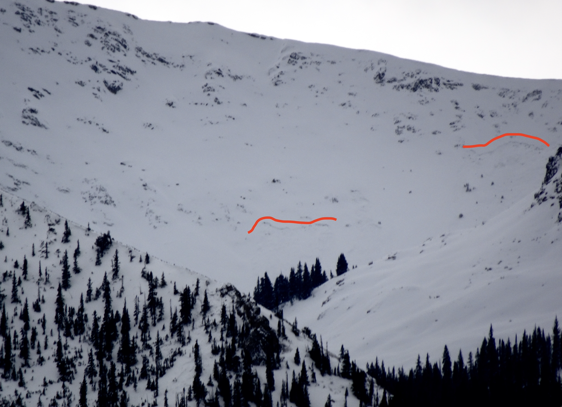
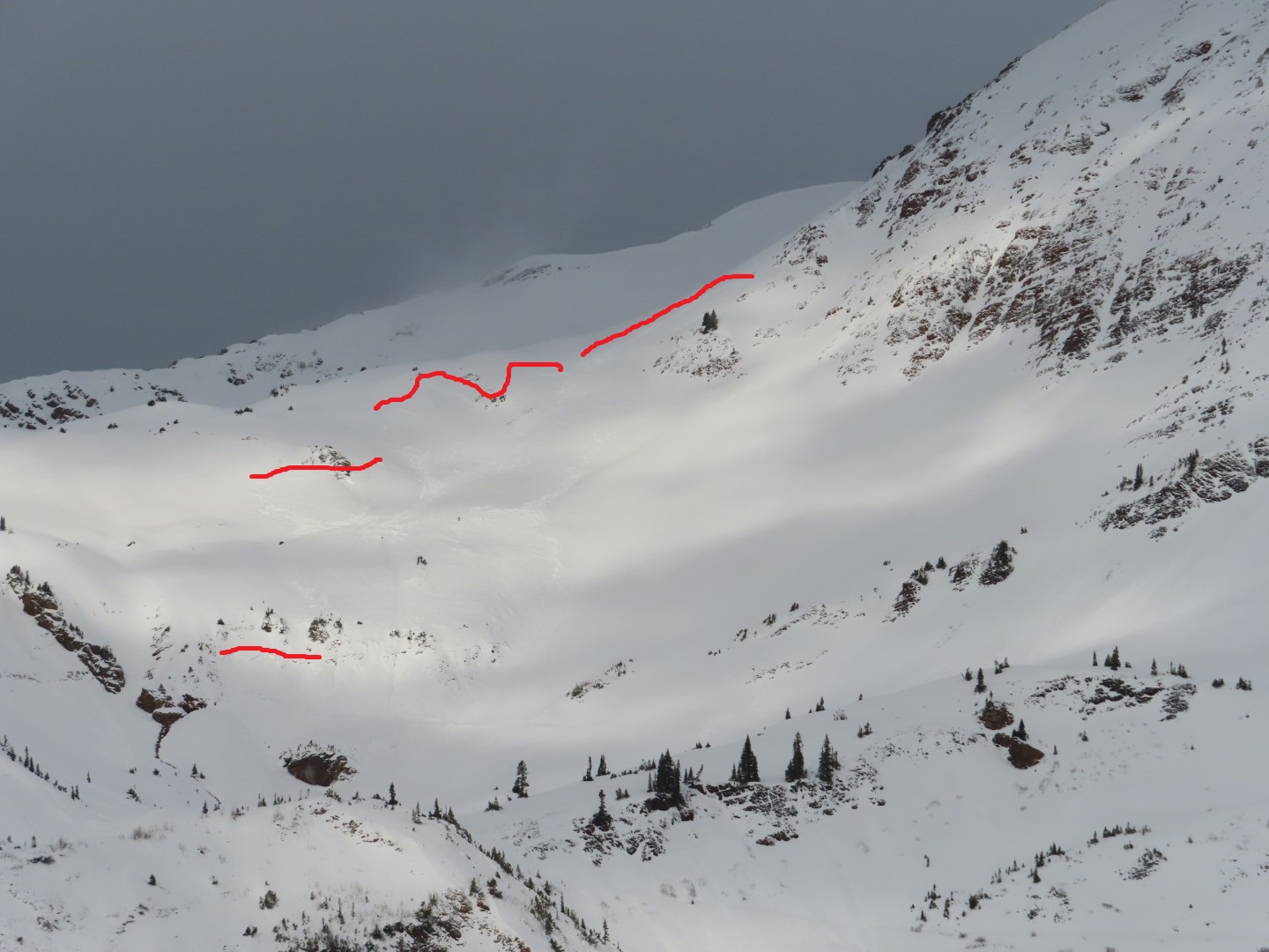
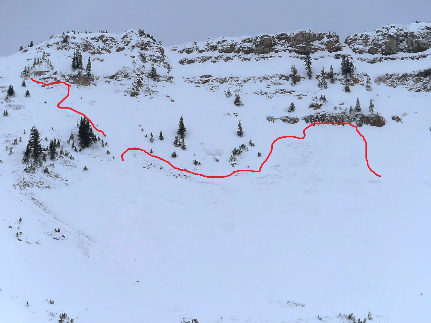
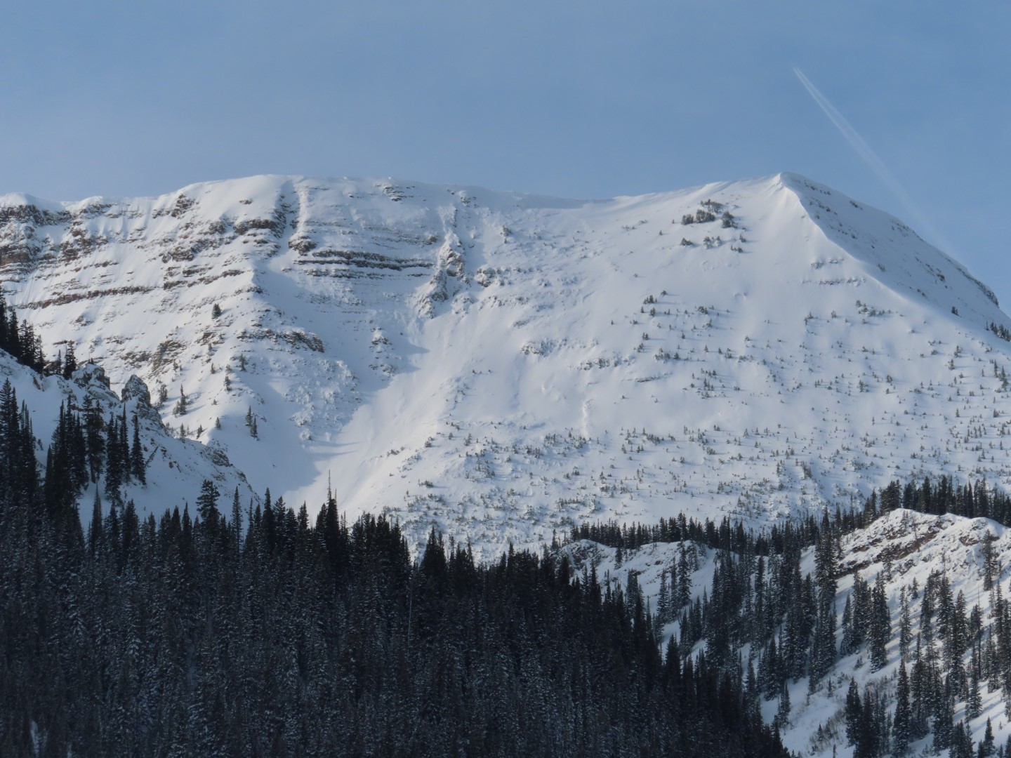
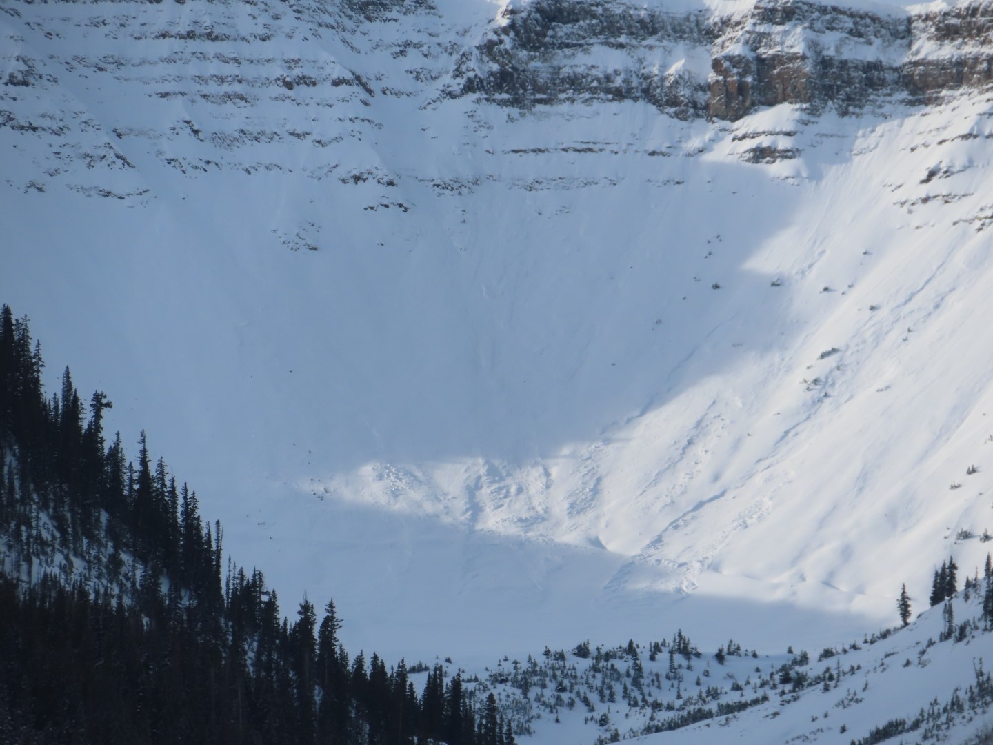
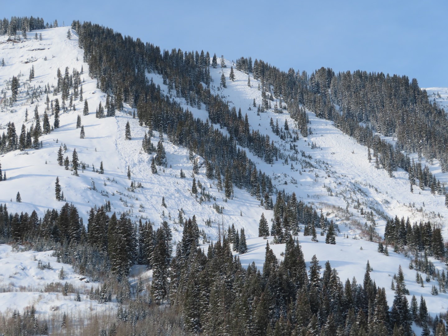
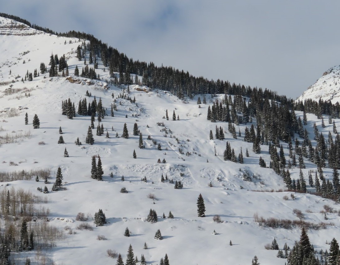
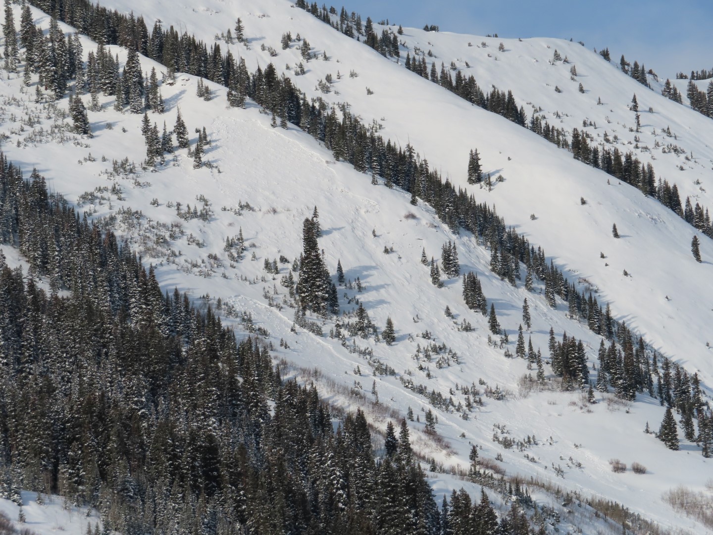
Observed avalanche activity: Yes Avalanches: Numerous recent D1 – D1.5 avalanches on Schuylkill Ridge and a few D2, on E-NE aspects N/BTL. A few D1.5-D2 in Redwell Basin as well. See photos. Looks like most of these ran during the storm on Friday, but a few look crisp enough that they might have run yesterday.
Photos:
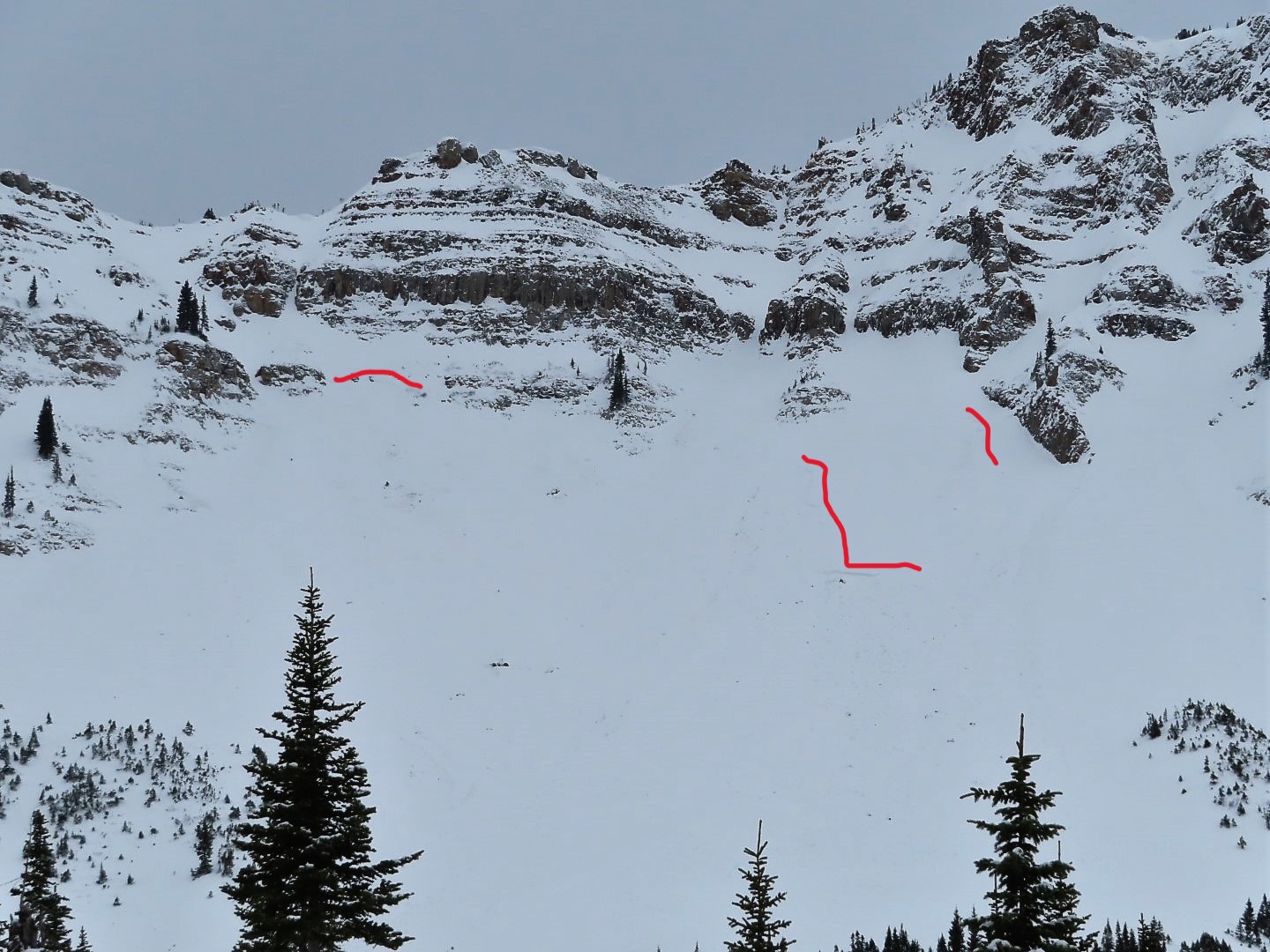
D2 and a couple D1s on Climax Chutes (previously documented)
D2 on The Shield
D1.5s in Redwell Basin
The largest slide on Schuylkill Ridge was out of Thanksgiving Bowl, on the right (D2, previously documented).
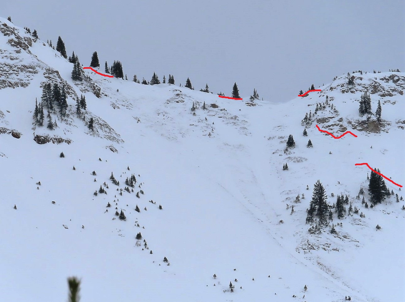
Numerous relatively small persistent slabs on Schuylkill Ridge.
Numerous relatively small persistent slabs on Schuylkill Ridge.
Numerous relatively small persistent slabs on Schuylkill Ridge.
Numerous relatively small persistent slabs on Schuylkill Ridge.
Numerous relatively small persistent slabs on Schuylkill Ridge.
Numerous relatively small persistent slabs on Schuylkill Ridge.
Numerous relatively small persistent slabs on Schuylkill Ridge.
Relative Size: R1 very small Destructive Size: D1- Relatively harmless to people Avg. crown height (inches): Avg. width (feet): Avg. vertical run (feet):
Involvements
# of people caught: # of partial burials: # of full burials:
Additional comments: Many of the rollovers in the Great Wide Open and Pittsburg Roller area.
Relative Size: R1 very small Destructive Size: D2 – could bury, injure, or kill a person Avg. crown height (inches): Avg. width (feet): Avg. vertical run (feet):
Involvements
# of people caught: # of partial burials: # of full burials:
Relative Size: R1 very small Destructive Size: D2 – could bury, injure, or kill a person Avg. crown height (inches): Avg. width (feet): Avg. vertical run (feet):
Involvements
# of people caught: # of partial burials: # of full burials:
Zone: Southeast Mountains Route Description: Viewed from Mt. CB
Observed avalanche activity: Yes Avalanches: A few D1.5 to D2 slides on NE and E aspects of Schuylkill and Climax, N/BTL that ran sometime in the past 2 days. Good views of some alpine terrain without any obvious crowns, hard to say whether the winds smoothed avalanches over or were just too strong to properly load the classic start zones. Weather: Snowpack:
Relative Size: R2 small Destructive Size: D2 – could bury, injure, or kill a person Avg. crown height (inches): Avg. width (feet): Avg. vertical run (feet):
Involvements
# of people caught: # of partial burials: # of full burials:
Relative Size: R2 small Destructive Size: D2 – could bury, injure, or kill a person Avg. crown height (inches): Avg. width (feet): Avg. vertical run (feet):
Involvements
# of people caught: # of partial burials: # of full burials: