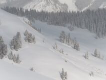
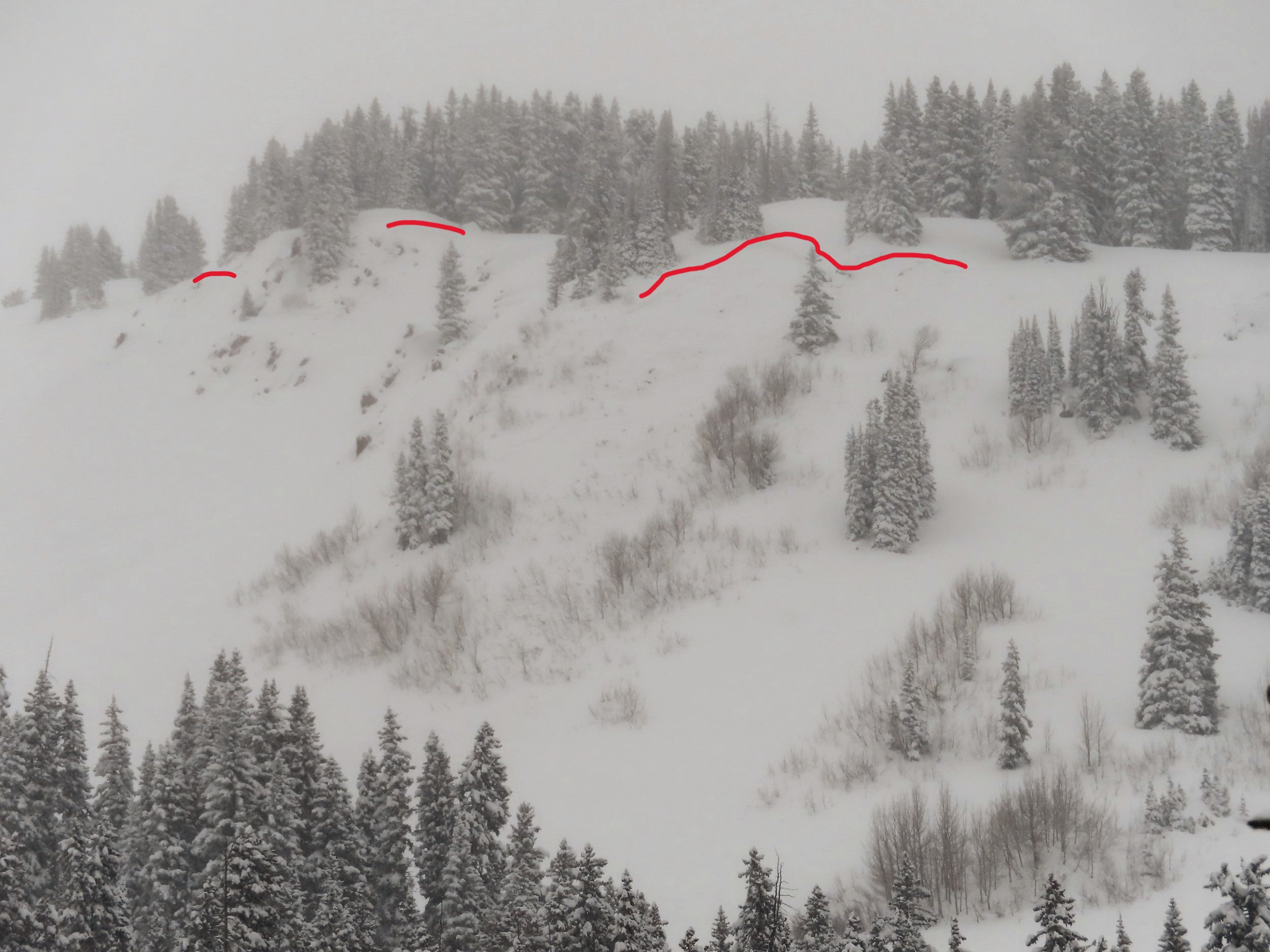
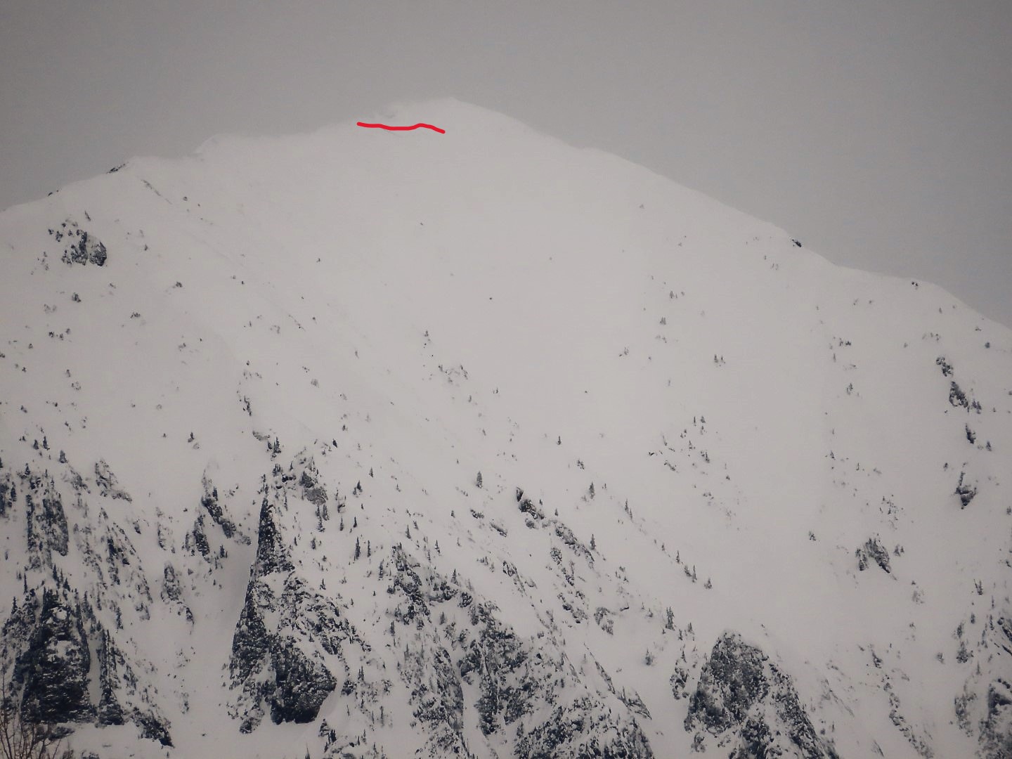
Zone: Northwest Mountains Route Description: Traveled on various aspects off of Elkton Knob, most commonly on west and southwest below treeline.
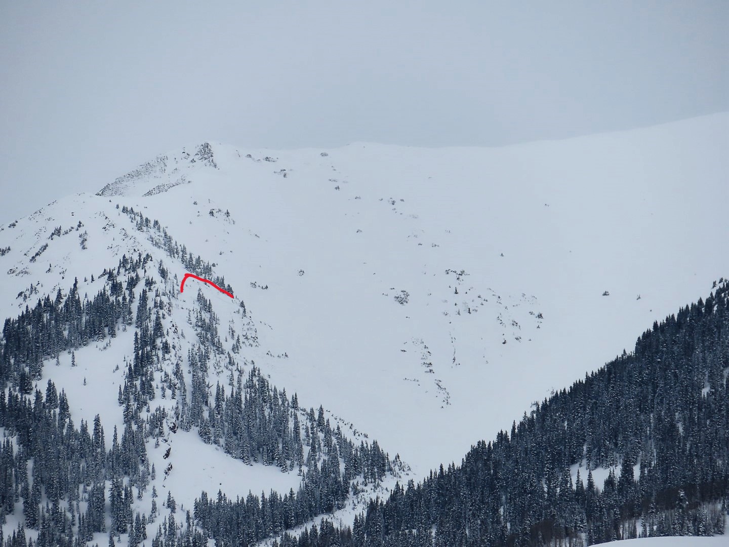
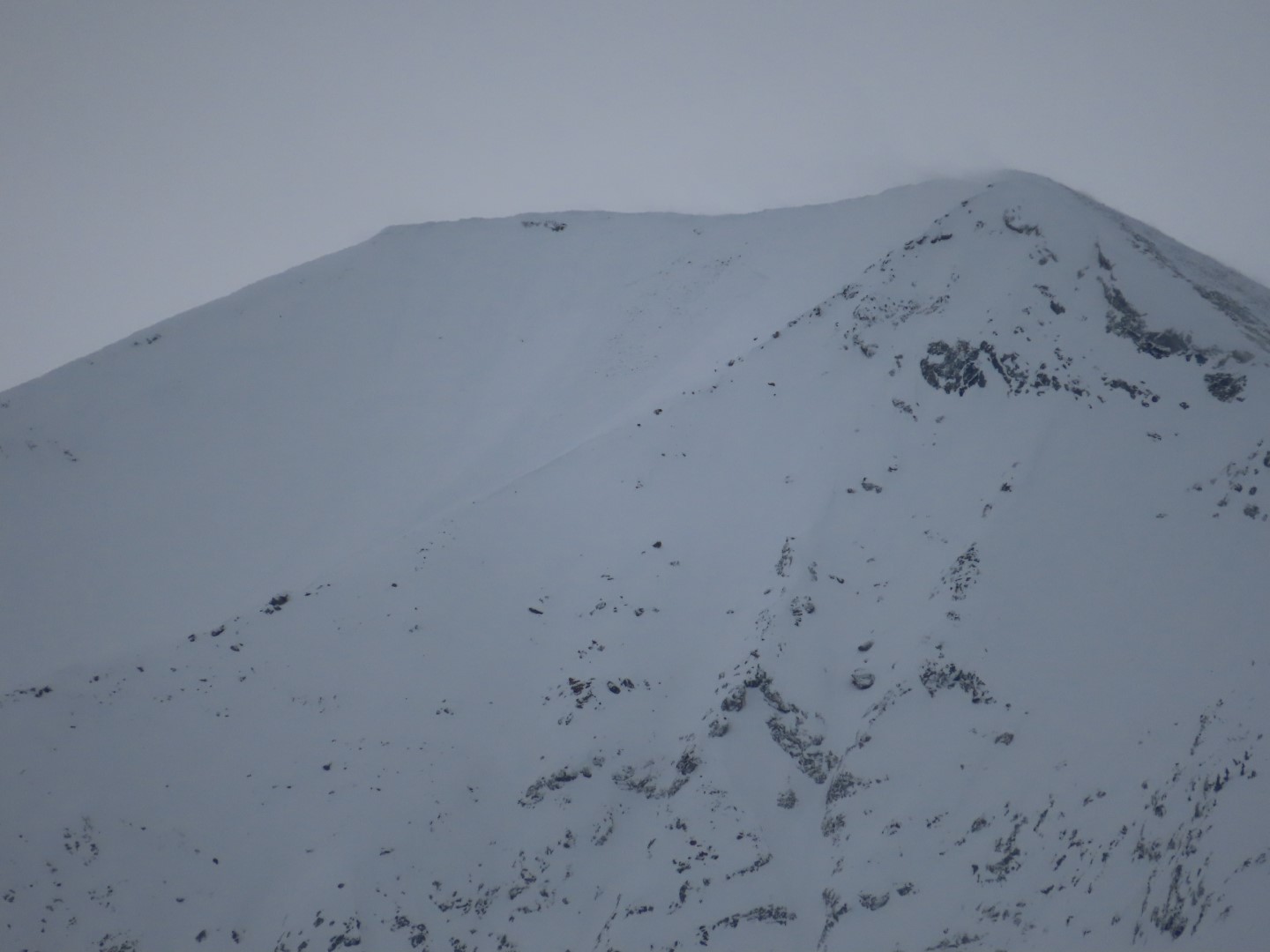
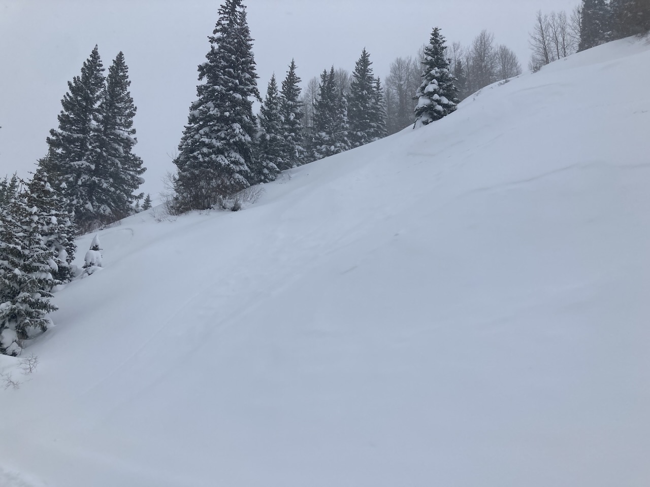
Observed avalanche activity: Yes Avalanches: The Elkton area saw a decent D2 cycle over the weekend on many steep slopes, various aspects. Soft slabs were generally 2 to 3 feet thick, failing on mid-December facets. In contrast, the Purple Palace area appeared to be relatively quiet during the cycle, perhaps because of Arctic Blast wind effects on the weak layer there. I stomped around on top of a couple of small, steep slopes and triggered one persistent slab that was 3 feet thick (4F) over fist hard 1mm facets on a west facing slope. There was also evidence of avalanche activity earlier in the storm on Baldy, Purple Ridge, and Schuylkill Ridge. Light was too flat to see much else. Weather: Light snow showers on and off through the day, with bouts of sunshine too. Light to moderate ridgetop winds with blowing snow off of Mt. Baldy. Snowpack: Fairly quiet while breaking trail and skinning. We got one collapse and chatted with another group in the same area that got several large collapses and shooting cracks. Slabs are consolidating and ski pen is now ankle deep, making for good turns on the low angle.
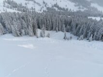
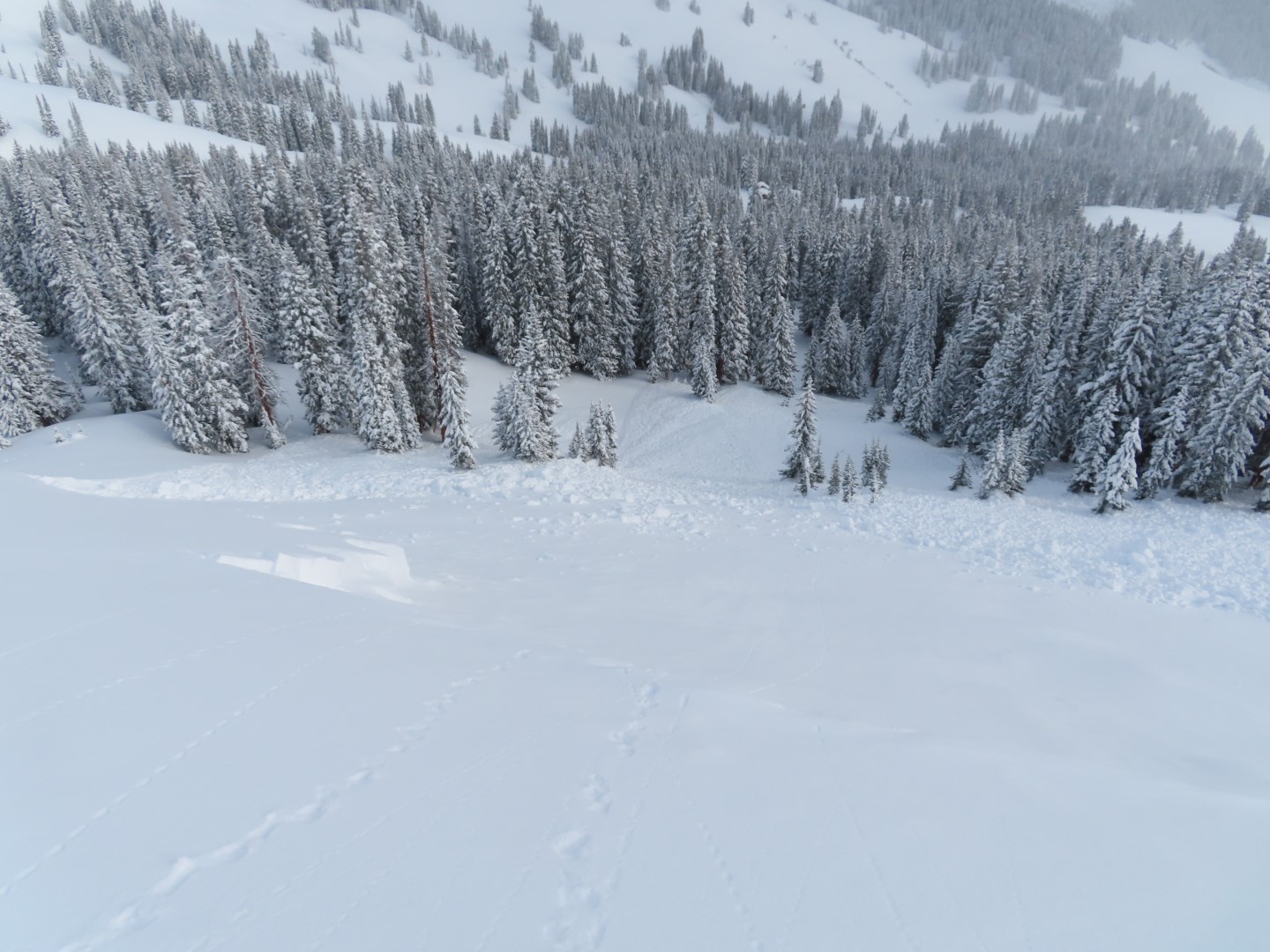
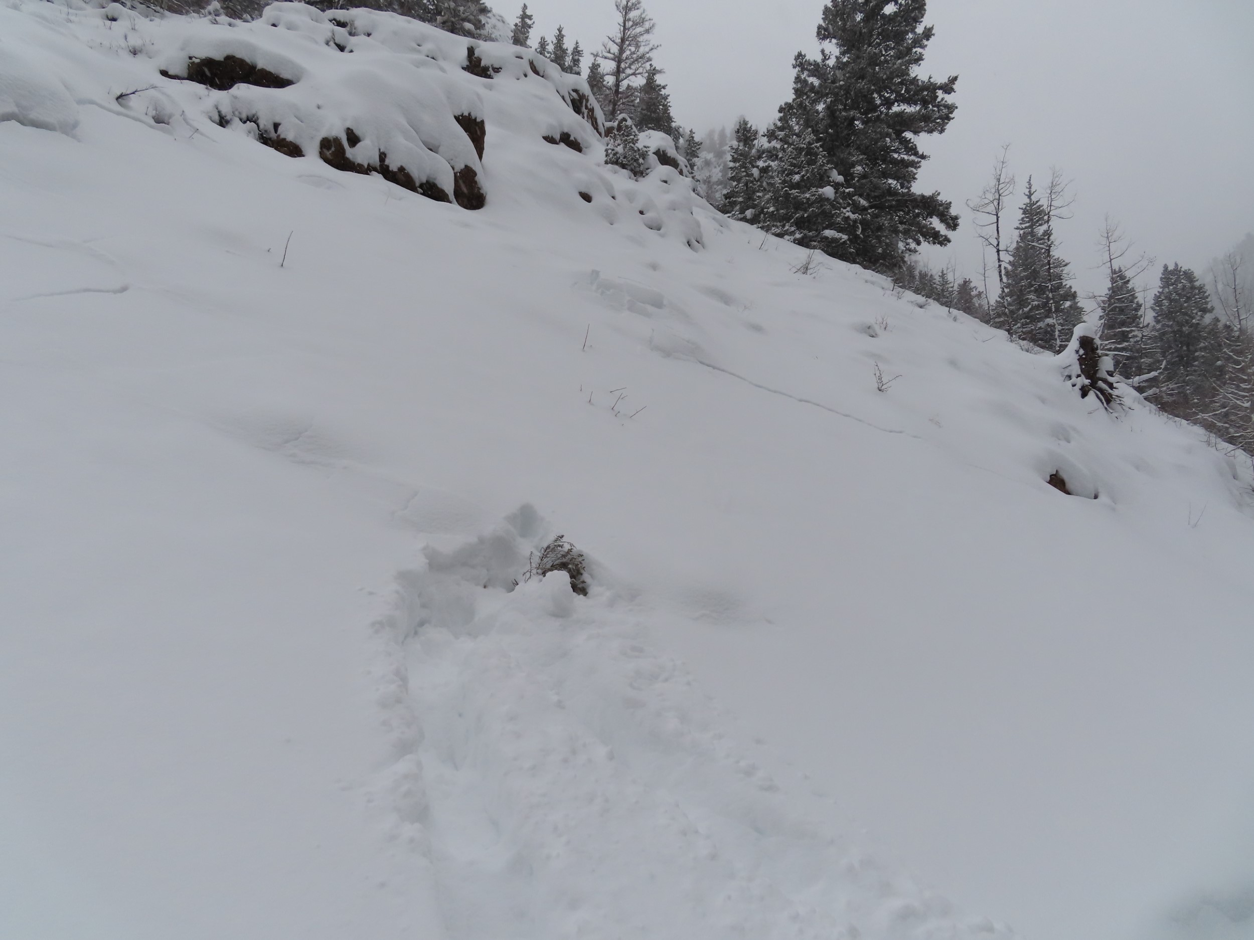
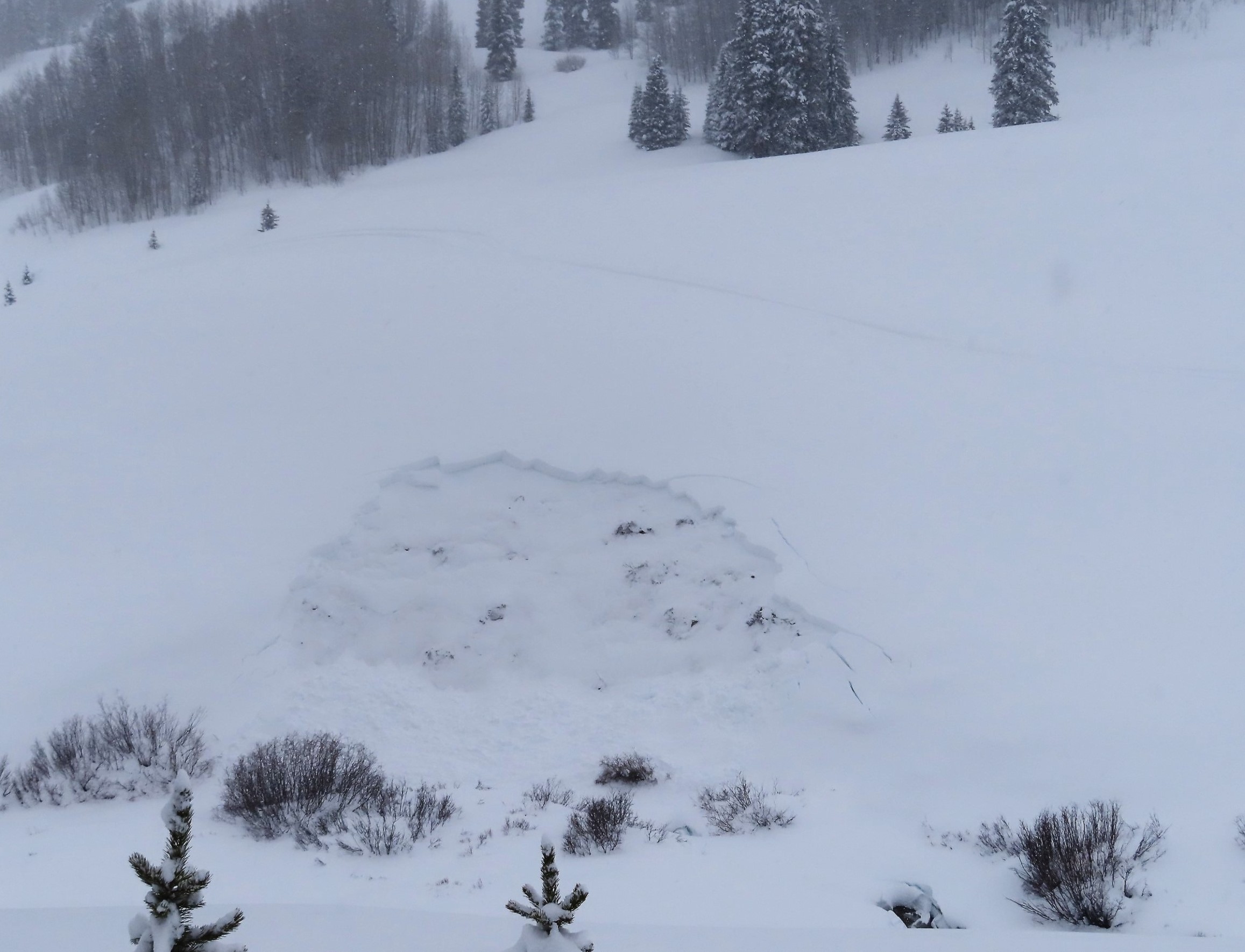
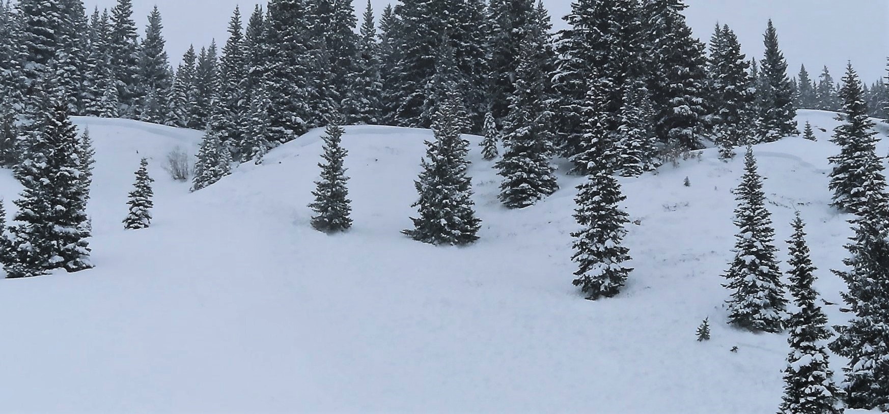
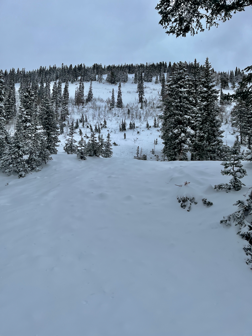
Photos:
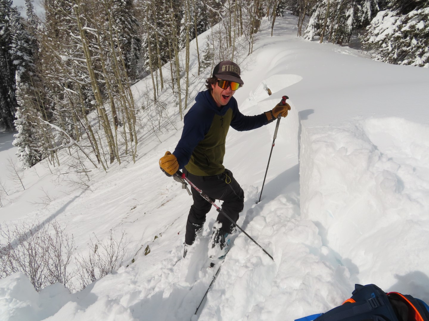
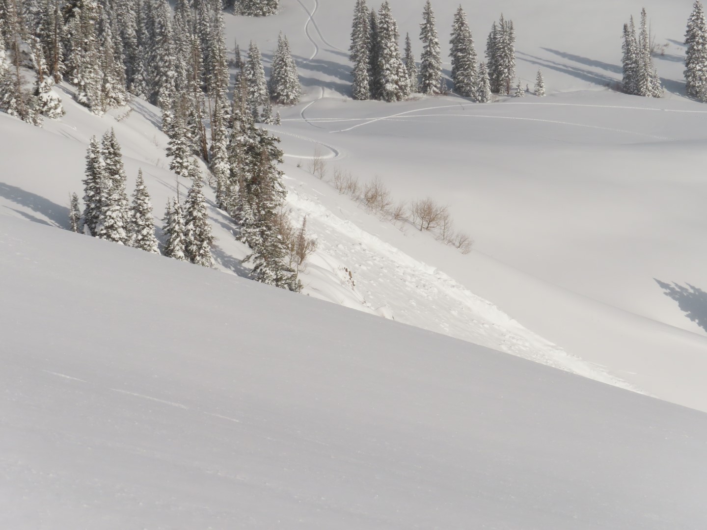
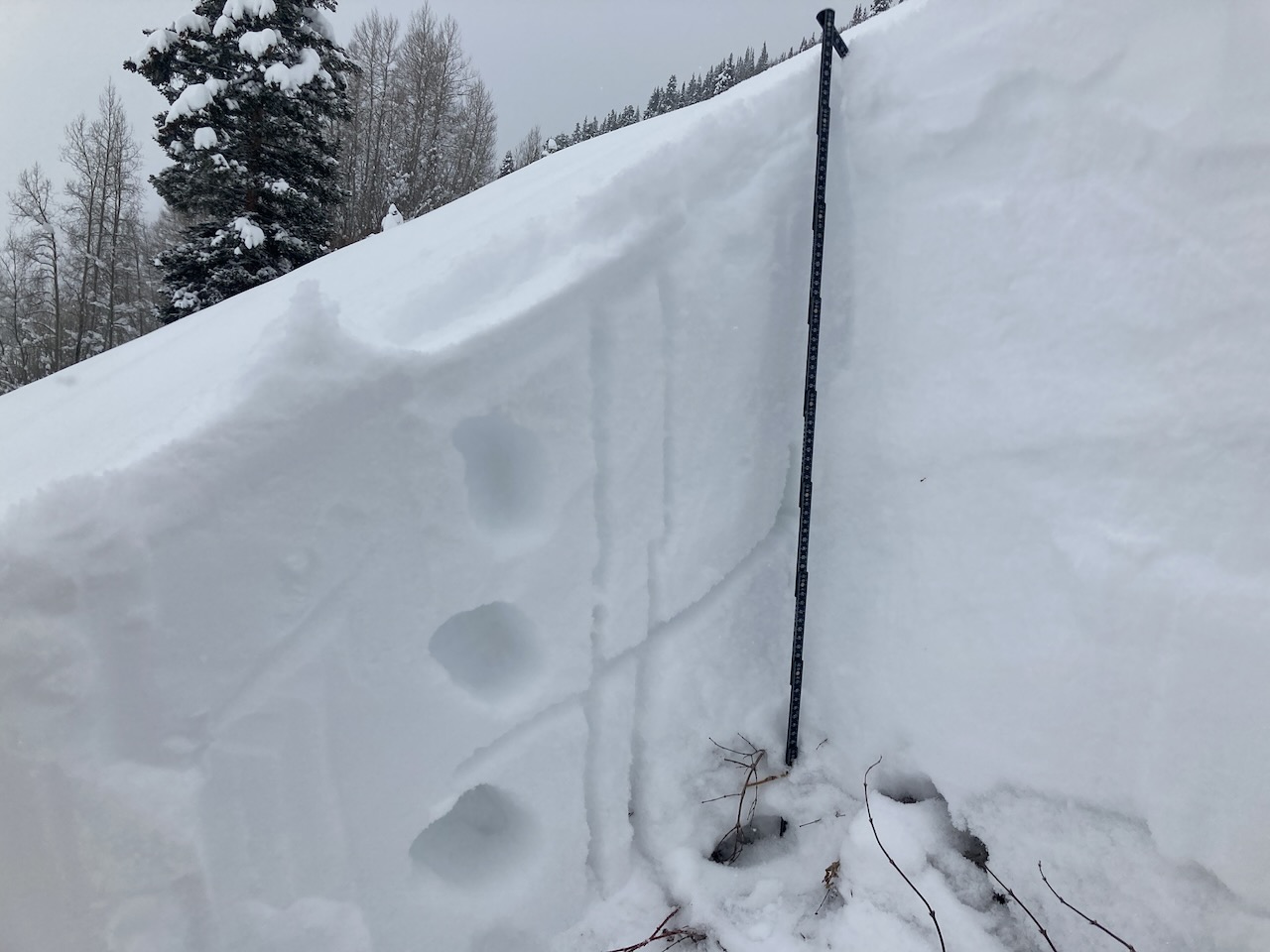
Intentionally ski triggered this 3-foot persistent slab.
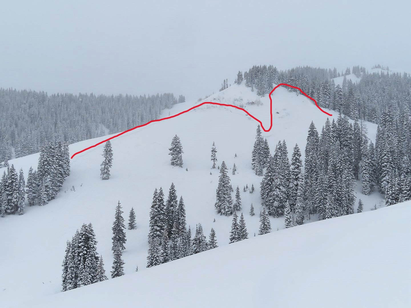
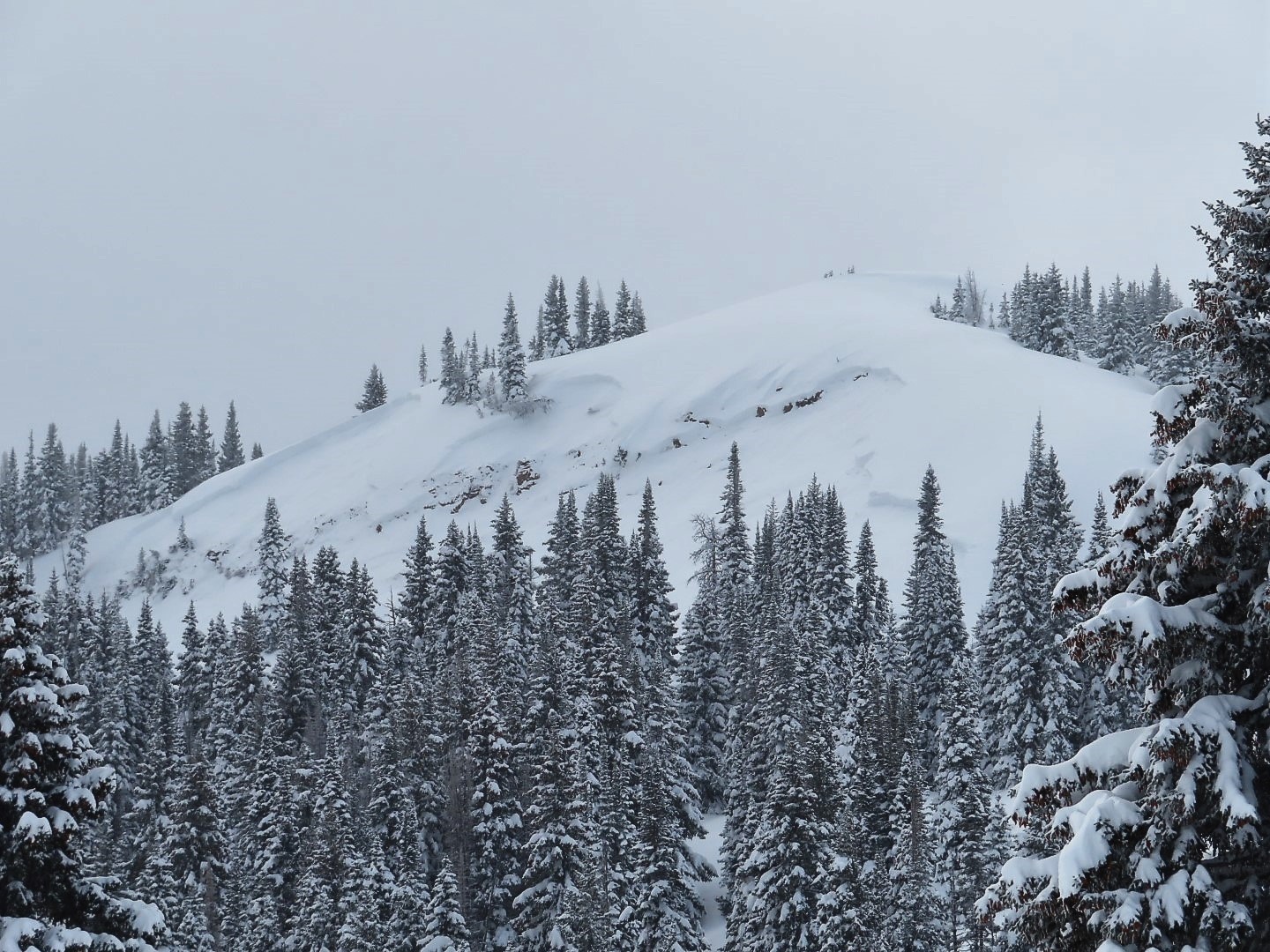
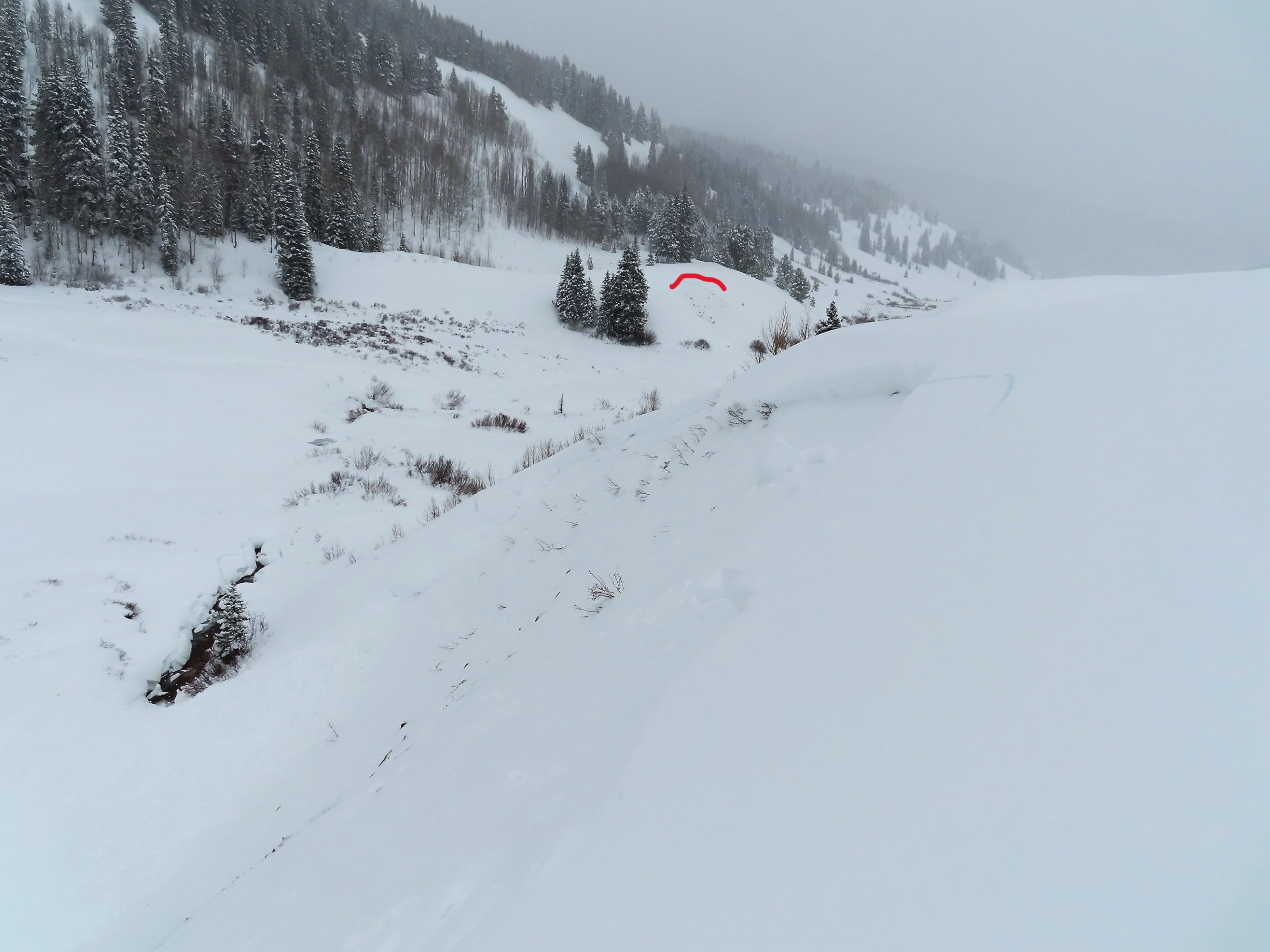
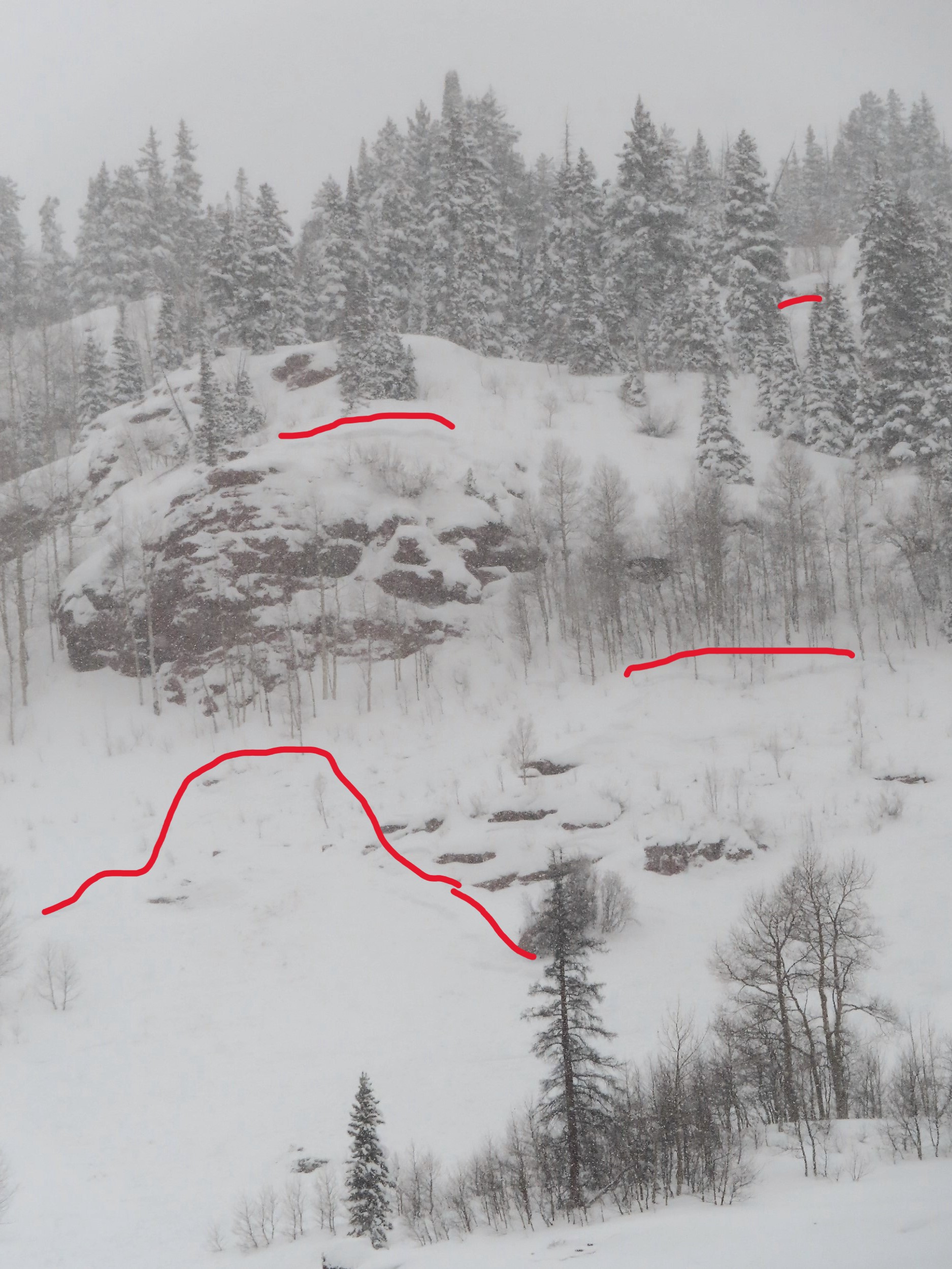
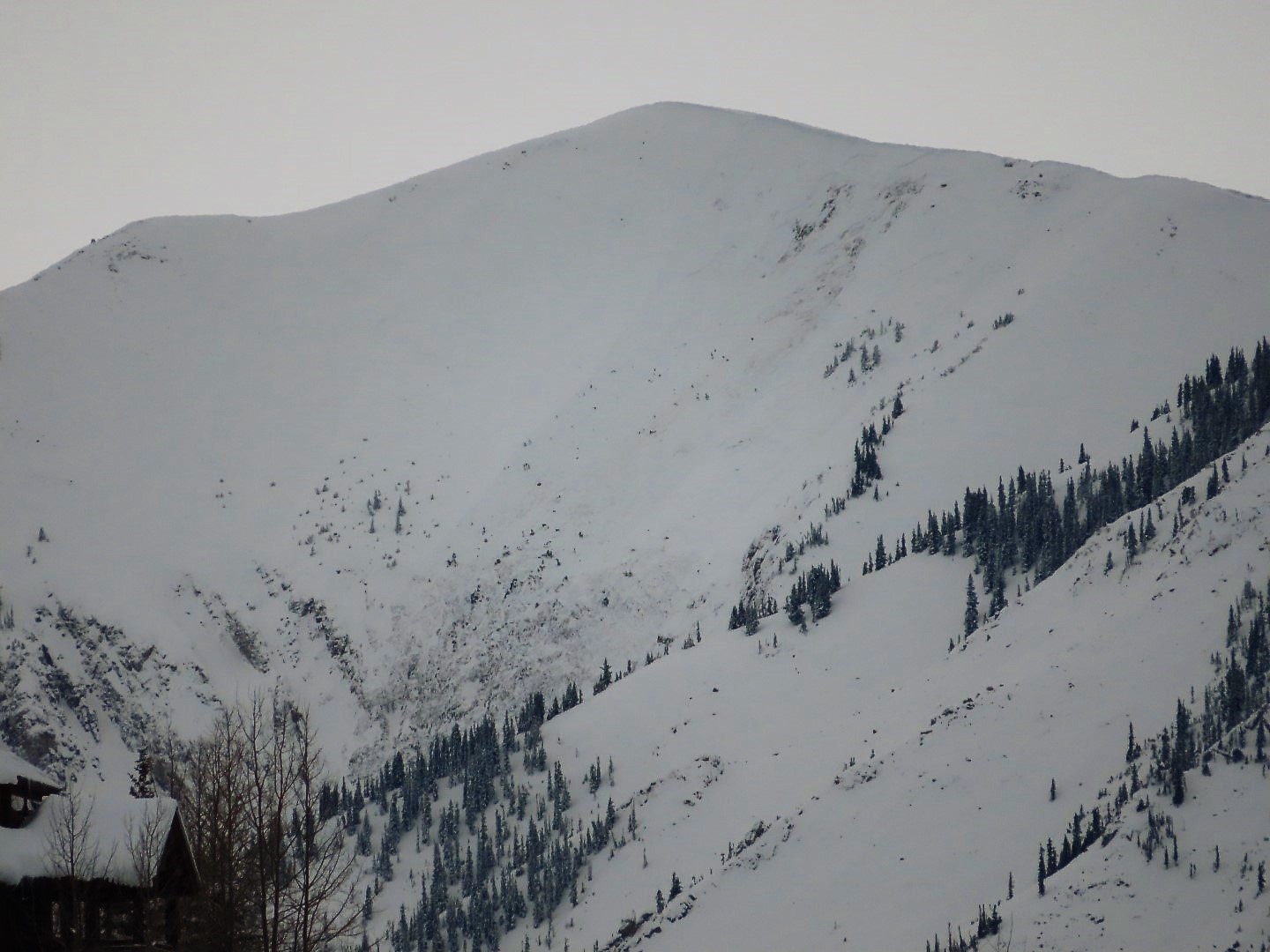
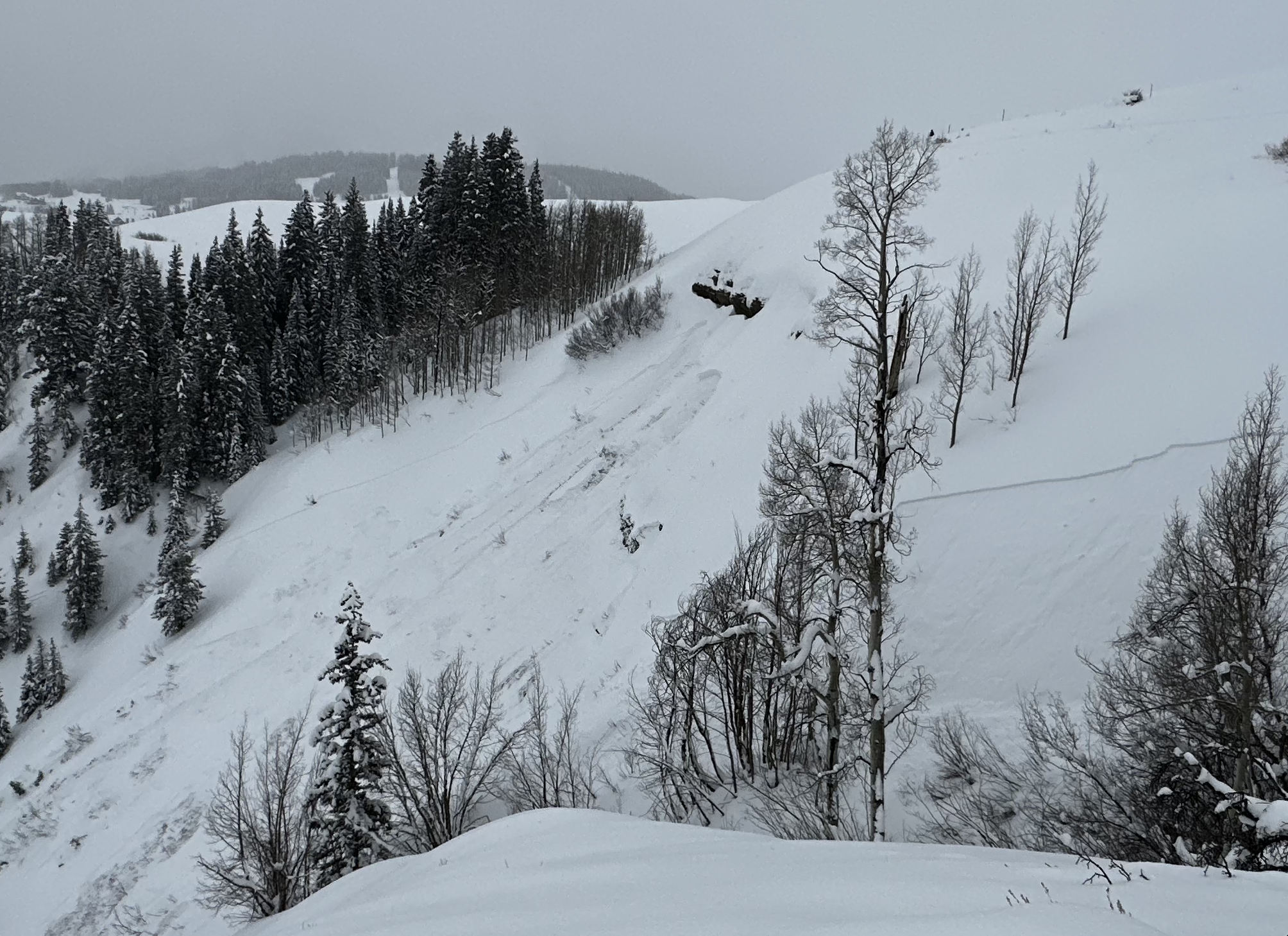
The widest avalanche in the Elkton area, may have been D2.5. East facing
Near Elkton. East facing.
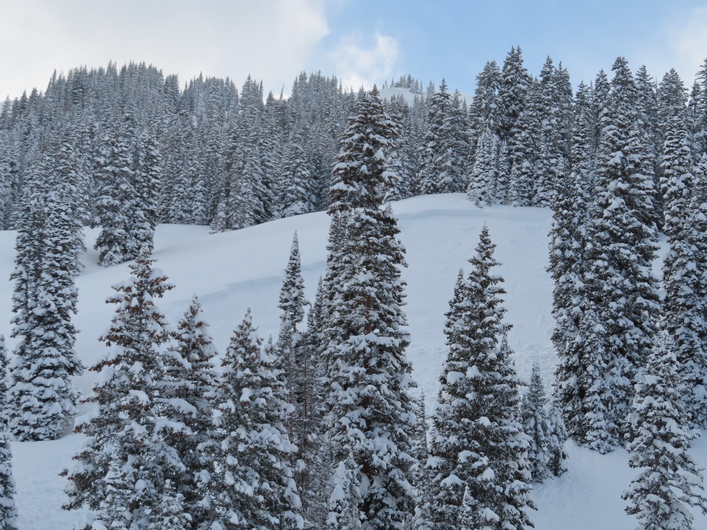
A south facing slab near Elkton Knob
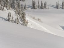
A pair of avalanches that might have been remotely triggered. (I think one was reported already)
South facing avalanches near Paradise Divide
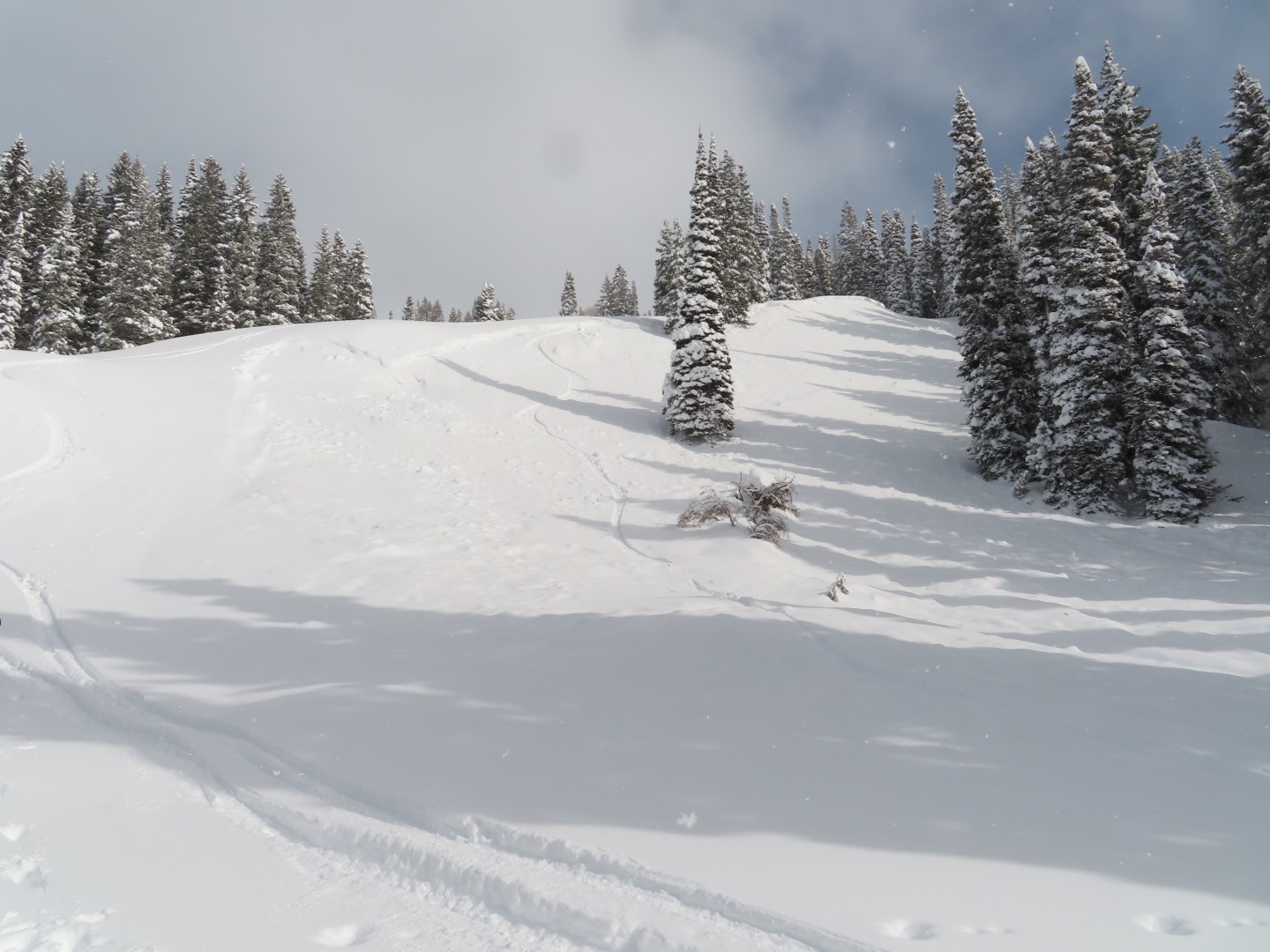
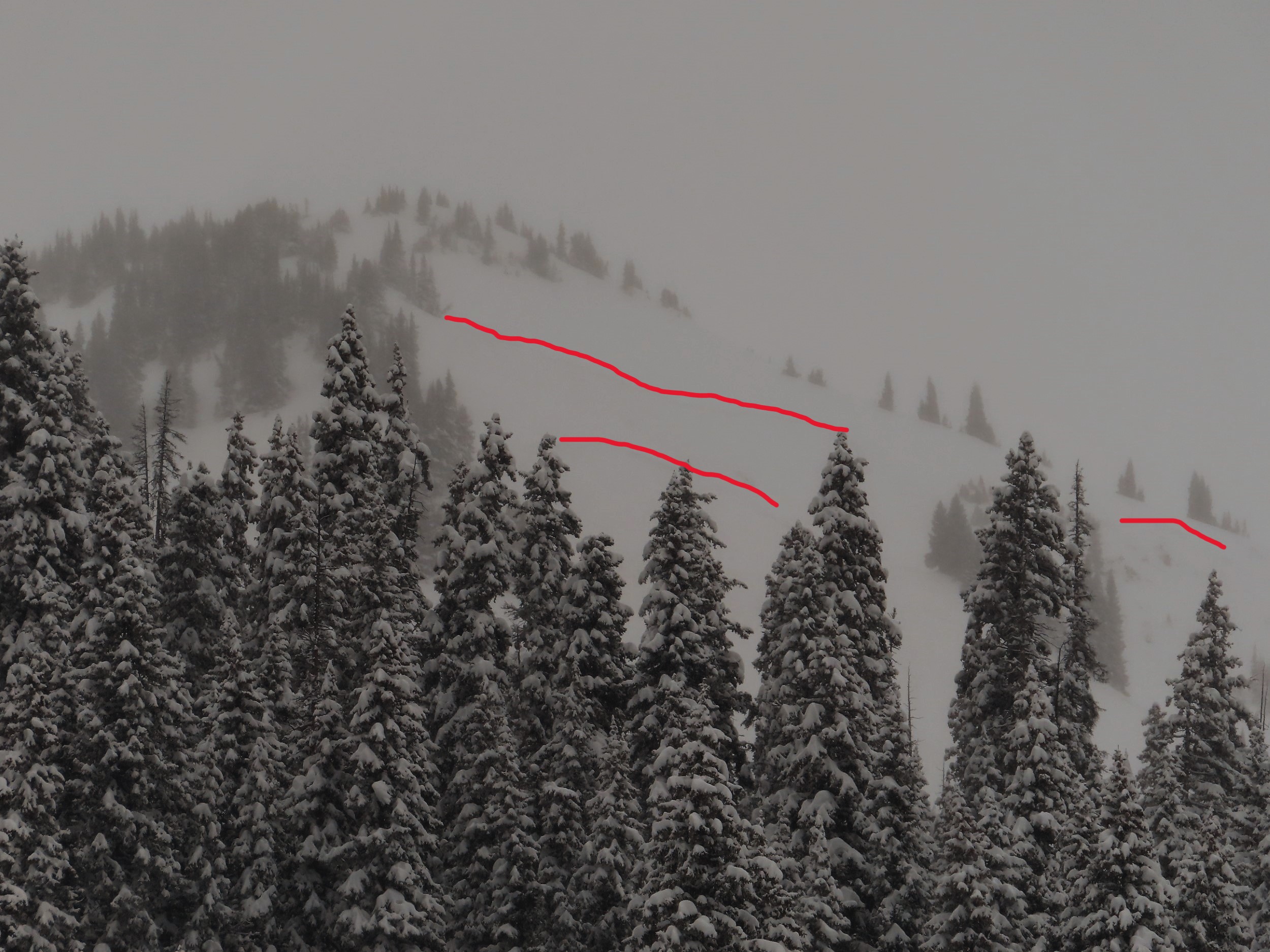
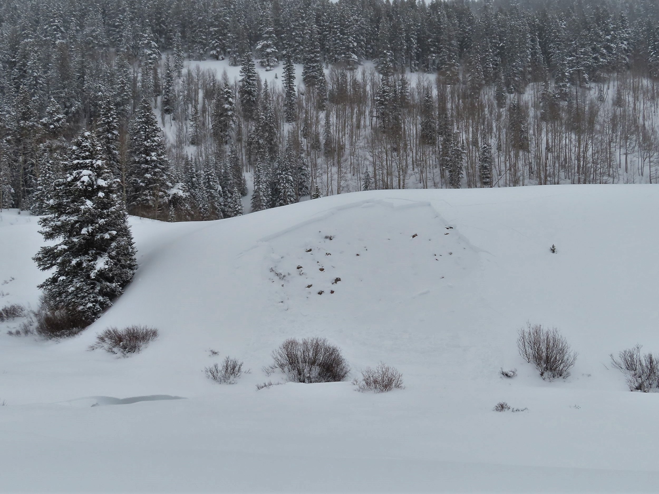
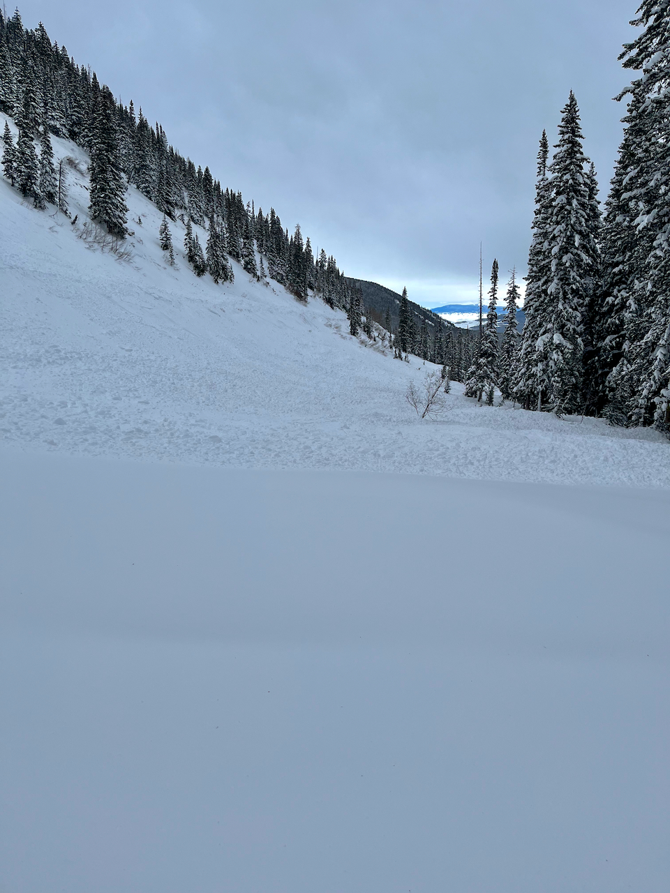
Persistent slab on a southwest facing slope BTL.
Persistent slab on a southwest facing slope BTL.
Persistent slab on a southwest facing slope BTL.
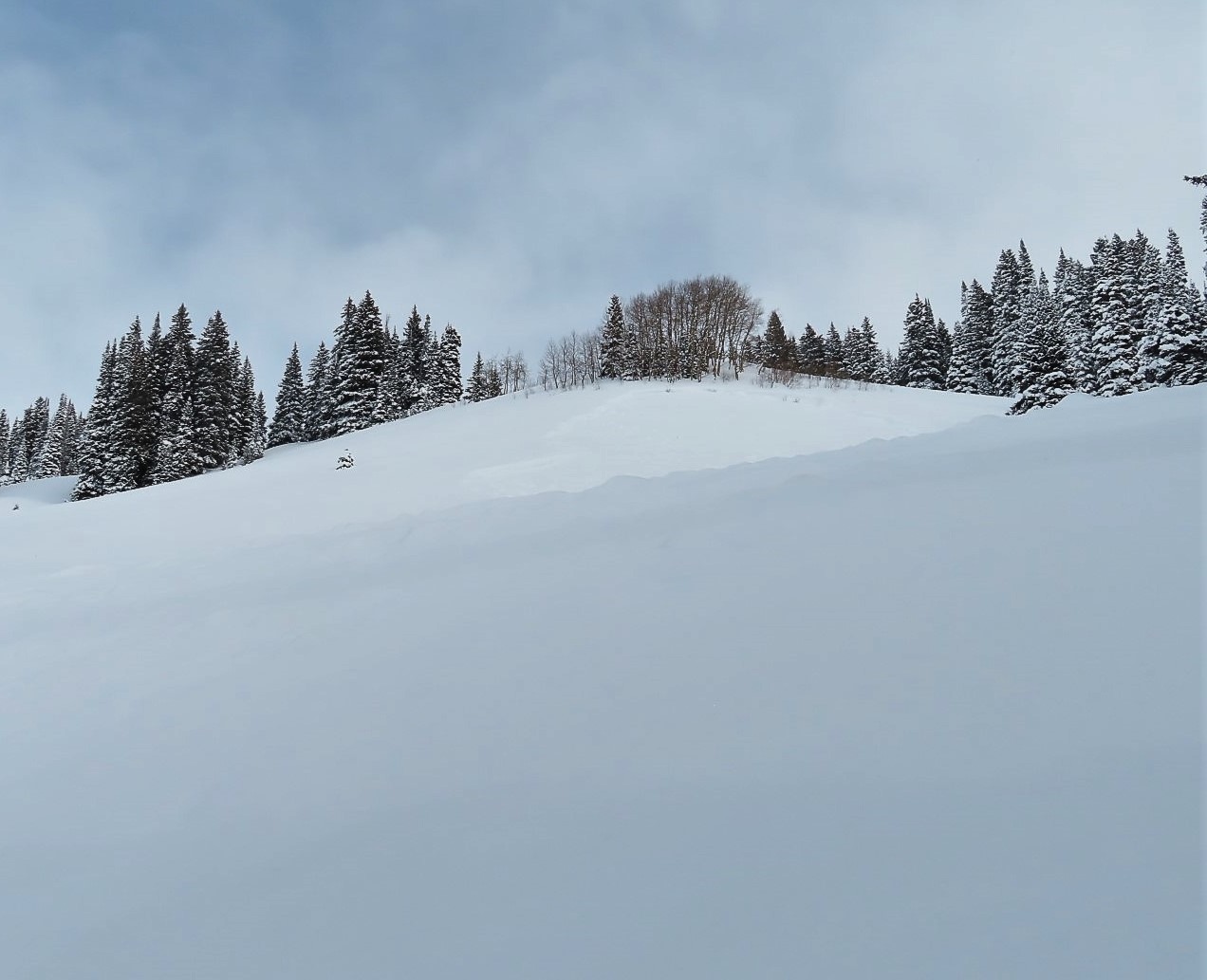
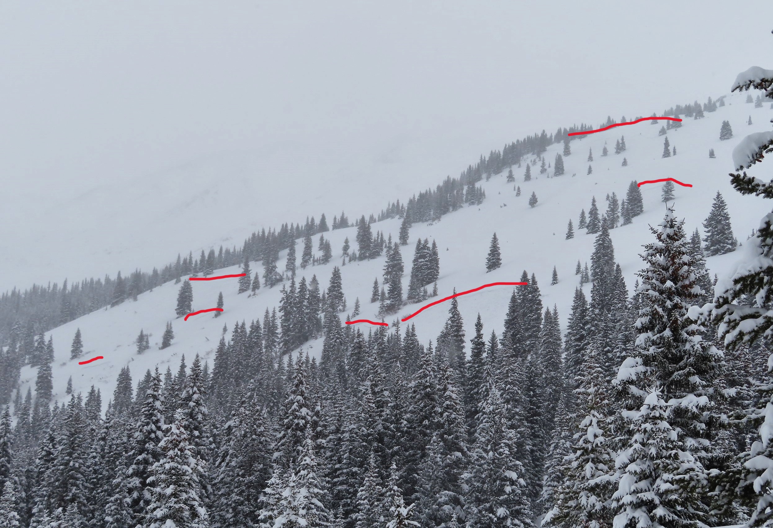
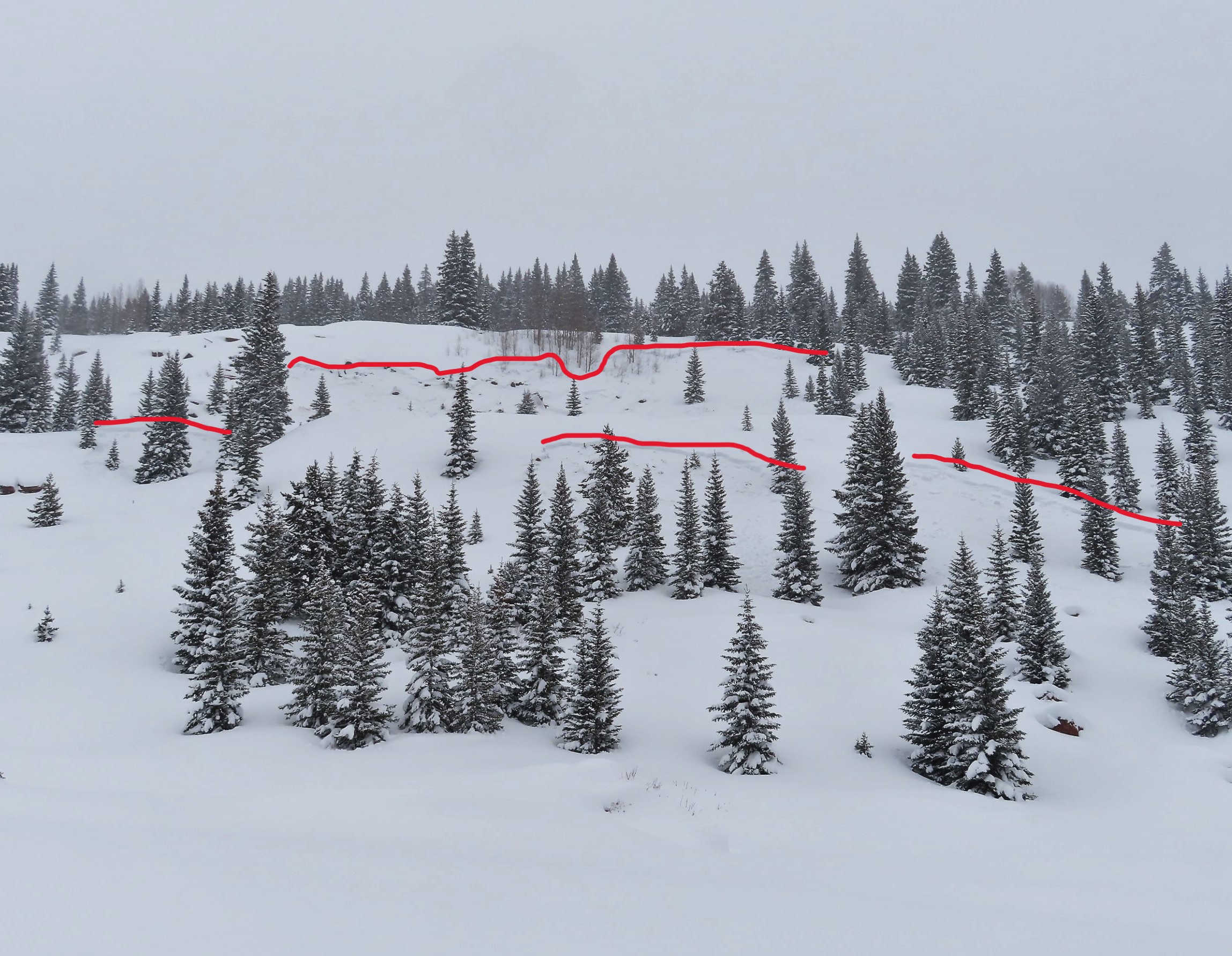
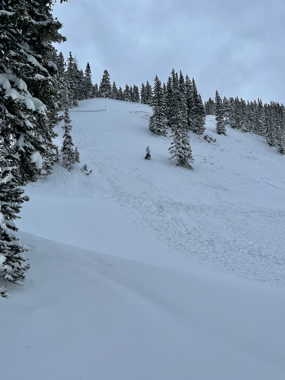
Elkton Knob persistent slab.
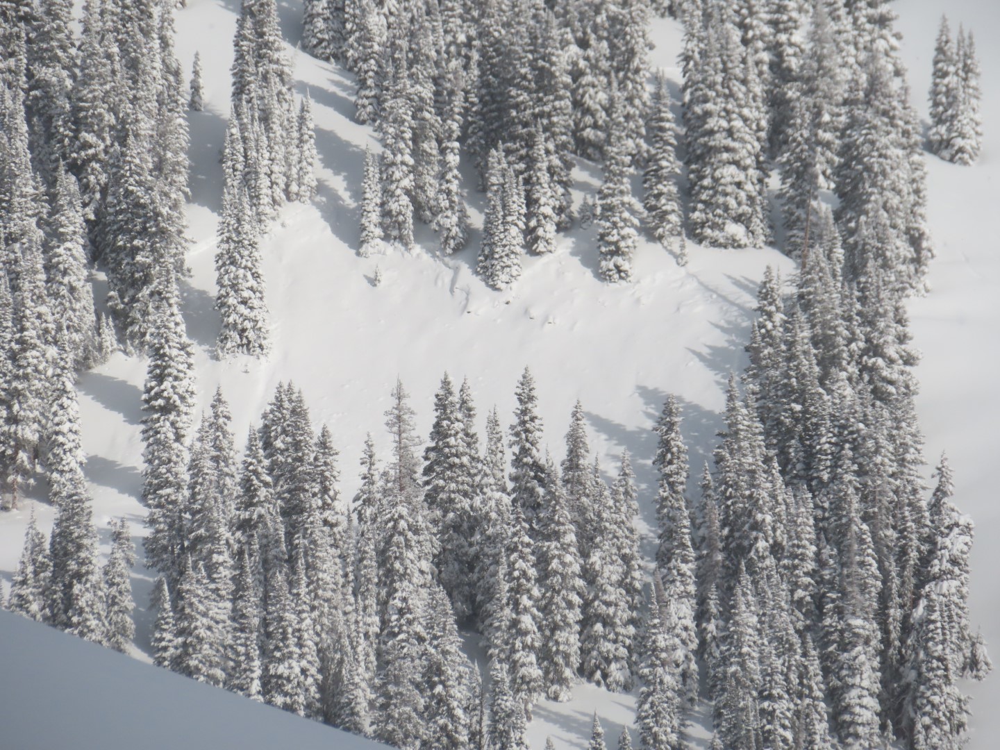
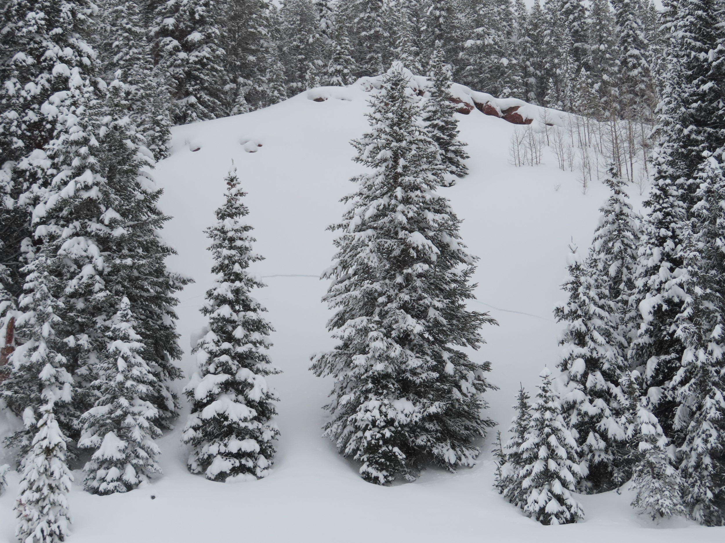
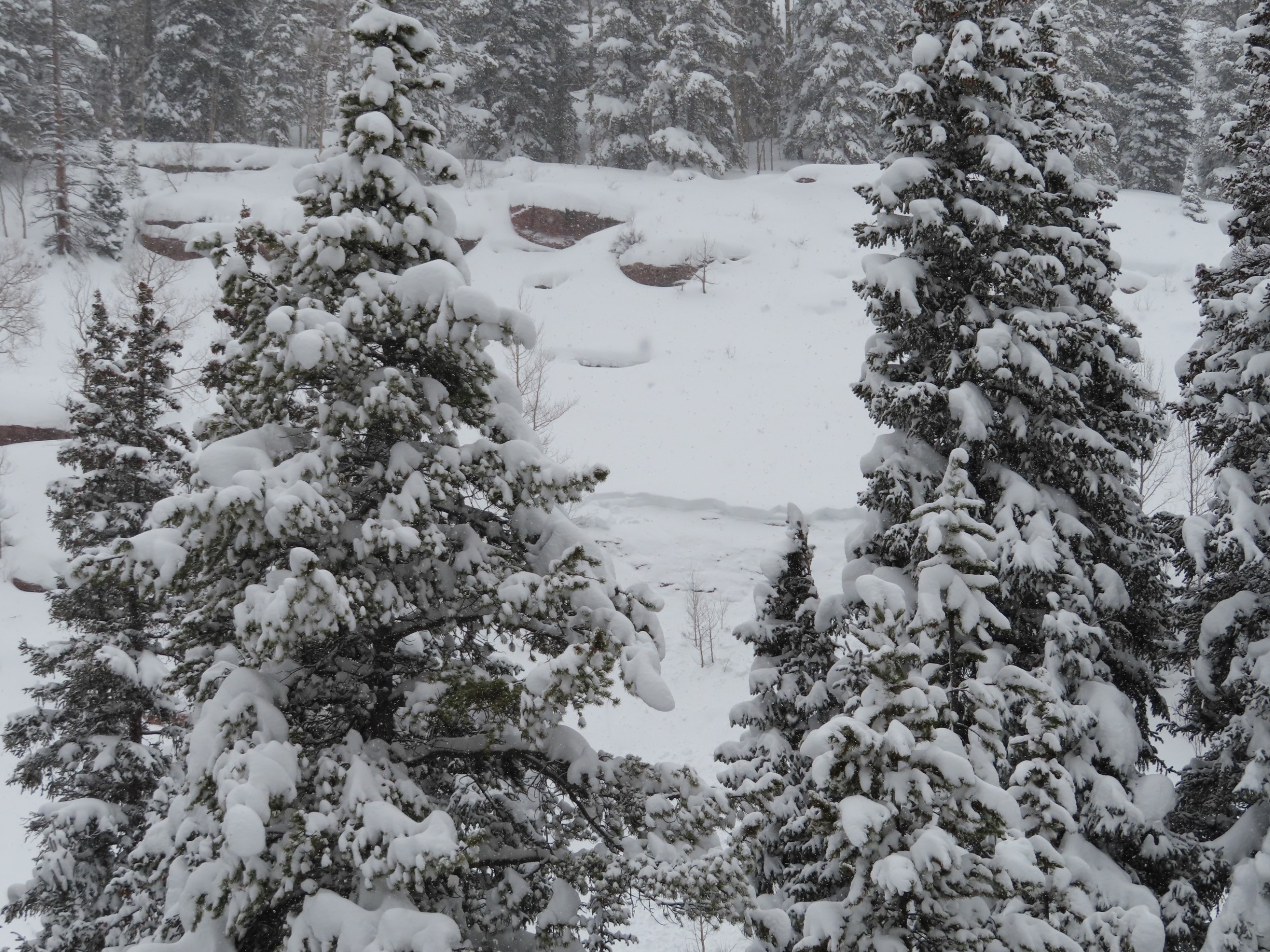
Looking down at the debris from the Elkton Knob slide
Relative Size: R2 small Destructive Size: D2 – could bury, injure, or kill a person Avg. crown height (inches): Avg. width (feet): Avg. vertical run (feet):
Involvements
# of people caught: # of partial burials: # of full burials:
Additional comments: 3X Just below Paradise Divide, 1 X Elkton Knob
Relative Size: R3 medium Destructive Size: D2 – could bury, injure, or kill a person Avg. crown height (inches): Avg. width (feet): Avg. vertical run (feet):
Involvements
# of people caught: # of partial burials: # of full burials:
Additional comments: One was maybe a 2.5. Widely propagating.
Relative Size: R3 medium Destructive Size: D2 – could bury, injure, or kill a person Avg. crown height (inches): Avg. width (feet): Avg. vertical run (feet):
Involvements
# of people caught: # of partial burials: # of full burials:
Relative Size: R2 small Destructive Size: D2 – could bury, injure, or kill a person Avg. crown height (inches): Avg. width (feet): Avg. vertical run (feet):
Involvements
# of people caught: # of partial burials: # of full burials:
Additional comments: 2 x Elkton Knob, 1 x Top of the World
Weather: Cloudy with light snow much of Sunday but very dense, then light snow into the night with wind at times and some snow movement. The 24 hour snow total was just 4″ with again a very dense water content of 0.45″. The snowpack is at winters deepest of 47″. Currently a little bit of clearing with a light SW wind with the temperature at the 24 hour low of 21F after a high of 29F. December was 2% above average in snowfall and 33% above in water from snow. billy
Observed avalanche activity: Yes Avalanches: Widespread Touchy Storm Slabs yesterday 12/31. There was a notable natural avalanche cycle on the Upper Upper West Wall that produced 3-5 large avalanches. This terrain has not been mitigated or skied this season and was predominantly scoured down to rock prior to 12/28. Lingering Storm Slabs were more resistant to explosive and skier testing in our core westerly terrain today. However, easterly start zones that were previously Unreactive reached a tipping point: a single hand charge cleared out almost all of Candies and Sonic to the ground (SS-AE-R2-D2-G FC (100cm x 75m x 150m)). This is southeasterly terrain from about 12k. We also had a small but impressive natural event today on The Crotch apron in a recently wind loaded pocket (HS-N-R2/D1.5-O/G 50-100 cm x 10m x 40m). This is SSW terrain at 11.8k and ran O/G with a crown of 1m at its apex. Snowpack: We received 45″ of snow with 3.5 inches of water over two storm cycles since 12/28. The second cycle was notable for very warm temps, multiple riming events that laid down thin friable crusts at lower elevations, and several hardness inversions in the new snow.
Relative Size: R2 small Destructive Size: D2 – could bury, injure, or kill a person Avg. crown height (inches): Avg. width (feet): Avg. vertical run (feet):
Involvements
# of people caught: # of partial burials: # of full burials:
Zone: Southeast Mountains Route Description: Snowmobiled Cement Creek to the base of Hunter Hill.
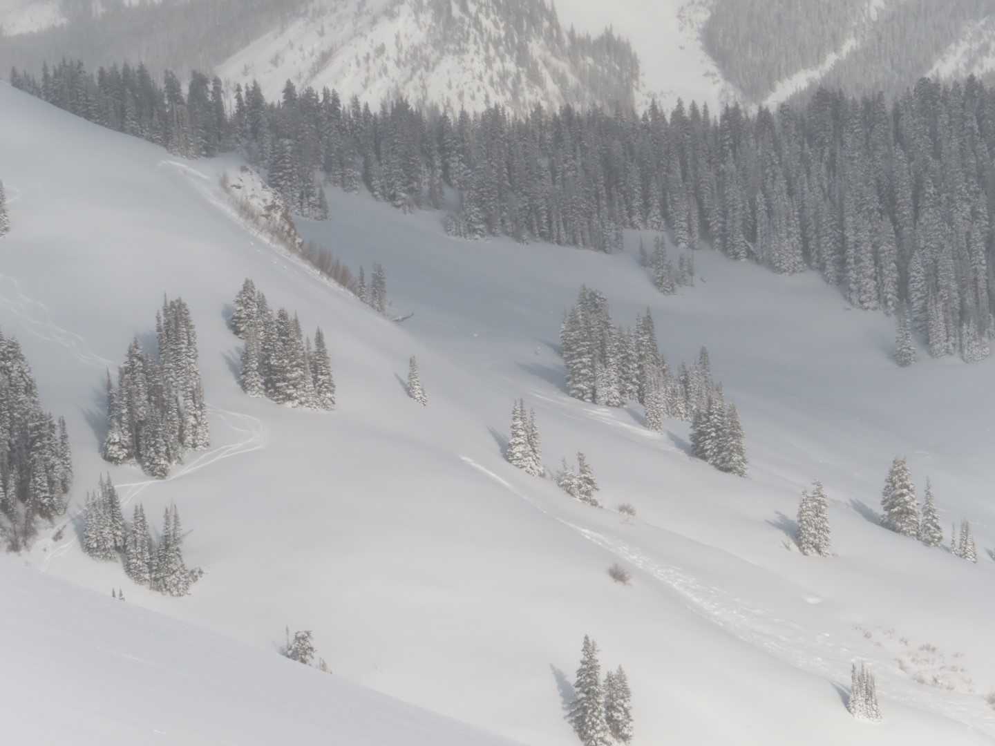
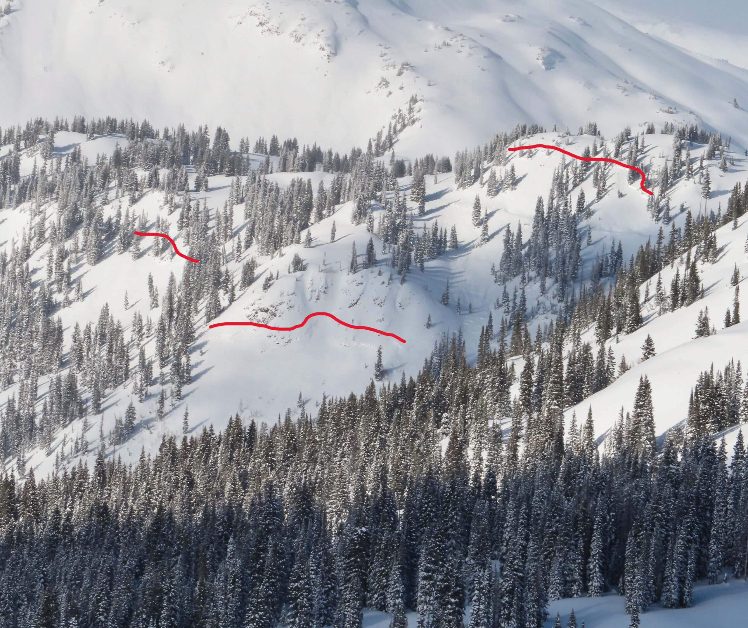
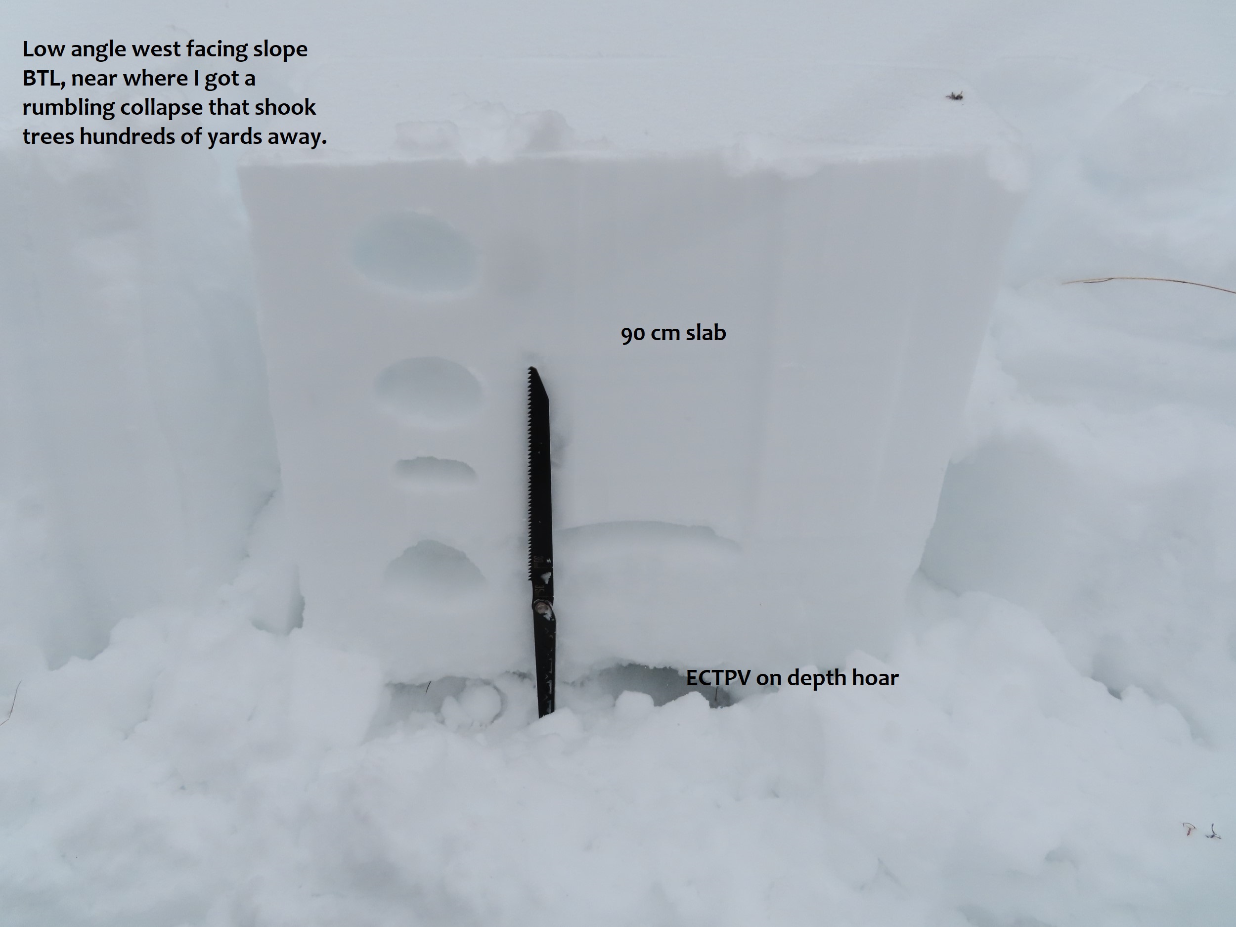
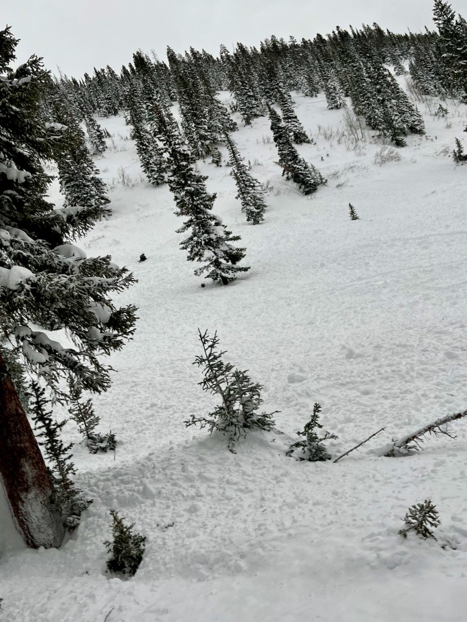
Observed avalanche activity: Yes Avalanches: Widespread and ongoing natural and remotely triggered persistent slab activity that appeared to start last night and go through today, localized to Upper Cement Creek (east of Deadman’s Trailhead). In that upper basin, almost every single steep slope that we rode near remotely avalanched if it hadn’t already gone naturally. Dozens of small creek beds released, and we triggered about half a dozen larger slopes just riding in the flats. More natural avalanches than I could count. Crowns were generally about 2 feet thick, and most appeared to fail on the mid-December facet layer. Small terrain features produced D1-1.5s, and larger terrain produced D2s. Avalanches were occurring on all aspects, which are generally E, SE, W, and NW below treeline in this basin. Couldn’t see the alpine. Weather: Light snowfall with a few moderate pulses. Calm winds below treeline. Snowpack: This might have been one of the most widespread, touchy persistent slab days I’ve ever experienced in my career; truly fascinating and blatantly dangerous. Human triggering felt almost certain. Riding into open slopes consistently produced rumbling collapses with trees shaking hundreds of yards away, shooting cracks opening on moderate angled slopes, and almost everything steeper than 35 degrees would slide. Collapses occurred on mid-December facets and depth hoar, which are now in the bottom 3rd of the snowpack below a 60 to 90 cm slab. Tests produced sudden collapses on isolation in the depth hoar (ECTPV). Near the trailhead, I watched a small dog step off the road and trigger a shooting crack across a slope. In Lower Cement, slabs are thinner (~30 cm), and better anchored by ground roughness, sagebrush, etc, thus the danger was less threatening.
Photos:
A dog triggered these shooting cracks near the trailhead.
One of numerous remotely triggered avalanches.
One of numerous remotely triggered avalanches.
Natural avalanches, Upper Cement Creek
Natural avalanches, Upper Cement Creek
Natural avalanches, Upper Cement Creek
Upper Cement. Potentially remote triggered, or fresh natural.
We saw many rumbling collapses and shooting cracks.
Relative Size: R2 small Destructive Size: D2 – could bury, injure, or kill a person Avg. crown height (inches): Avg. width (feet): Avg. vertical run (feet):
Involvements
# of people caught: # of partial burials: # of full burials:
Relative Size: R2 small Destructive Size: D2 – could bury, injure, or kill a person Avg. crown height (inches): Avg. width (feet): Avg. vertical run (feet):
Involvements
# of people caught: # of partial burials: # of full burials:
Relative Size: R2 small Destructive Size: D2 – could bury, injure, or kill a person Avg. crown height (inches): Avg. width (feet): Avg. vertical run (feet):
Involvements
# of people caught: # of partial burials: # of full burials:
Observed avalanche activity: Yes Avalanches: Several large avalanches covered Ohio Pass Road. One of these ran yesterday reported by a group of snowmobilers. Unclear whether it was triggered or natural. The other two ran this morning.
Photos:
One of several avalanches that ran near Ohio Pass on steep southwesterly-facing terrain, burying the groomed snowmobile route between the Ohio Creek Valley and Kebler Pass
One of several avalanches that ran near Ohio Pass on steep southwesterly-facing terrain, burying the groomed snowmobile route between the Ohio Creek Valley and Kebler Pass
One of several avalanches that ran near Ohio Pass on steep southwesterly-facing terrain, burying the groomed snowmobile route between the Ohio Creek Valley and Kebler Pass
One of several avalanches that ran near Ohio Pass on steep southwesterly-facing terrain, burying the groomed snowmobile route between the Ohio Creek Valley and Kebler Pass
Relative Size: R3 medium Destructive Size: D2 – could bury, injure, or kill a person Avg. crown height (inches): Avg. width (feet): Avg. vertical run (feet):
Involvements
# of people caught: # of partial burials: # of full burials:
Relative Size: R3 medium Destructive Size: D2 – could bury, injure, or kill a person Avg. crown height (inches): Avg. width (feet): Avg. vertical run (feet):
Involvements
# of people caught: # of partial burials: # of full burials:
Estimated avalanche date: 01/01/2023 Number of Avalanches: 1
Location
Location: Mount Whetstone Location Specific: Start Zone Elevation: ATL: Above Tree Line Aspect: NE
Characteristics
Trigger: Natural Trigger modifier: Type: Hard Slab Failure Plane: Ground
Size
Relative Size: R3 medium Destructive Size: D3 – could destroy a car, wood-frame house, or snap trees Avg. crown height (inches): Avg. width (feet): Avg. vertical run (feet):
Involvements
# of people caught: # of partial burials: # of full burials:
Additional comments: Barcelona Bowl. Size estimated, couldn’t see runout
Relative Size: R2 small Destructive Size: D2 – could bury, injure, or kill a person Avg. crown height (inches): Avg. width (feet): Avg. vertical run (feet):
Involvements
# of people caught: # of partial burials: # of full burials:
Additional comments: Baby Bowl. Size estimated, couldn’t see runout
Relative Size: R2 small Destructive Size: D2 – could bury, injure, or kill a person Avg. crown height (inches): Avg. width (feet): Avg. vertical run (feet):
Involvements
# of people caught: # of partial burials: # of full burials:
Observed avalanche activity: Yes Avalanches: Few small storm slabs.
Weather: Overcast. Light down-valley winds in the afternoon. Snowing S1 to S2
Snowpack: Quick tour, mostly targeting some NE slopes BTL in lower Elk Creek. Other than a few small storm slabs, nothing notable in the lower Elk Creek area or near the road on Kebler. Traveled on several small test slopes, and near-defined avalanche terrain with no obvious signs of instability.
ENE, 31-degree slope, BTL that does see wind-loading. HS 153. The recent storm interfaces were down about 15cm and 25cm. December 20th was down about 70cm. ECTP 3 on the lower storm interface. ECTN 24 on 12/20. The 12/20 interface was very thin and difficult to see in the pit wall, but still defined 1mm NSF on the card.
Relative Size: R1 very small Destructive Size: D1- Relatively harmless to people Avg. crown height (inches): Avg. width (feet): Avg. vertical run (feet):
Involvements
# of people caught: # of partial burials: # of full burials:
Relative Size: R1 very small Destructive Size: D1- Relatively harmless to people Avg. crown height (inches): 6 Avg. width (feet): Avg. vertical run (feet):
Involvements
# of people caught: # of partial burials: # of full burials:
Zone: Southeast Mountains Route Description: Near town. 9,100ft. ENE.
Observed avalanche activity: No
Weather: Overcast. Calm winds. Lull in the snow this morning, otherwise snowing most of the day.
Snowpack: Skinning was horrible in the upside-down upper snowpack. Didn’t travel through much terrain, but no notable obvious signs to instability. Targeted one quick profile on a 36-degree, 90cm, ENE slope at about 9,100ft. The thick portion of the storm slab was only about 3cm, with soft snow above and below. Shovel tilts easily produced results in the upper 15cm of the snowpack. The December facets are still large and prominent, but the snowpack is still generally soft and soft. A small storm slab in this terrain would have easily gouged and entrained the weak snowpack if the slope was steep enough.
Zone: Southeast Mountains Route Description: Nordic skied first mile of Gothic Road. Walked few hundred feet below the road to get above a steep northeast-facing slope.
Observed avalanche activity: Yes Avalanches: Remote triggered an avalanche on a northeast-facing slope. Did not hear the collapse, but saw the powder cloud form out the bottom. It broke in three places and as it ran entrained much of the generally weak snowpack. Weather: S2 snowfall from 1130 to1. Winds light with little evidence of recent blowing snow on roadway. Snowpack:
Photos:
This was triggered from well above the cliff. This avalanche ran into a terrain trap below, but given the volume of entrainment as the slab ran, I think it could have buried a person without the terrain trap.
Relative Size: R1 very small Destructive Size: D2 – could bury, injure, or kill a person Avg. crown height (inches): Avg. width (feet): Avg. vertical run (feet):
Involvements
# of people caught: # of partial burials: # of full burials:
Additional comments: Small end D2 but could have buried a person. Much of the volume was from entertainment as it ran through a faceted snowpack.
Observed avalanche activity: Yes Avalanches: We triggered several avalanche events with explosives in the process of cleaning up Persistent Slab problems in our easterly zone. Other than that, stability was generally good.
SS-AE-R1-D1-I PP (20cm x 15m x 80m)
HS-AE-R2-D2-I PP (50cm x 20m x 175m) Weather: Snowpack: