Date of Observation: 01/31/2023
Name: Zach Guy
Zone: Northwest Mountains
Route Description: Rec tour on Schuylkill Ridge, northeasterly aspects to 11,400′
Observed avalanche activity: Yes
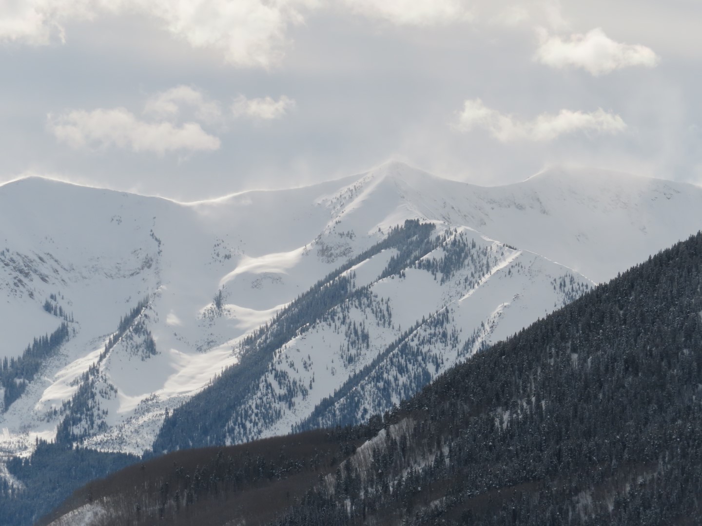
Avalanches: 3 large slab avalanches (D2) in the Great Wide Open that ran late yesterday or last night, about 2-3 feet thick from just below the windloaded ridgeline. 2 other large slab avalanches ran before the last round of snow, I’m guessing during Sunday night’s wind event. Both of those crossed the bench. The slide on Yogi’s covered the existing skin track with ~6 ft of debris. Plus a number of other slab avalanches D1 to D1.5 at all elevations that ran during the storm, and evidence of other activity in the alpine that is drifted over again. See photos.
Weather: Clear, cold, calm winds.
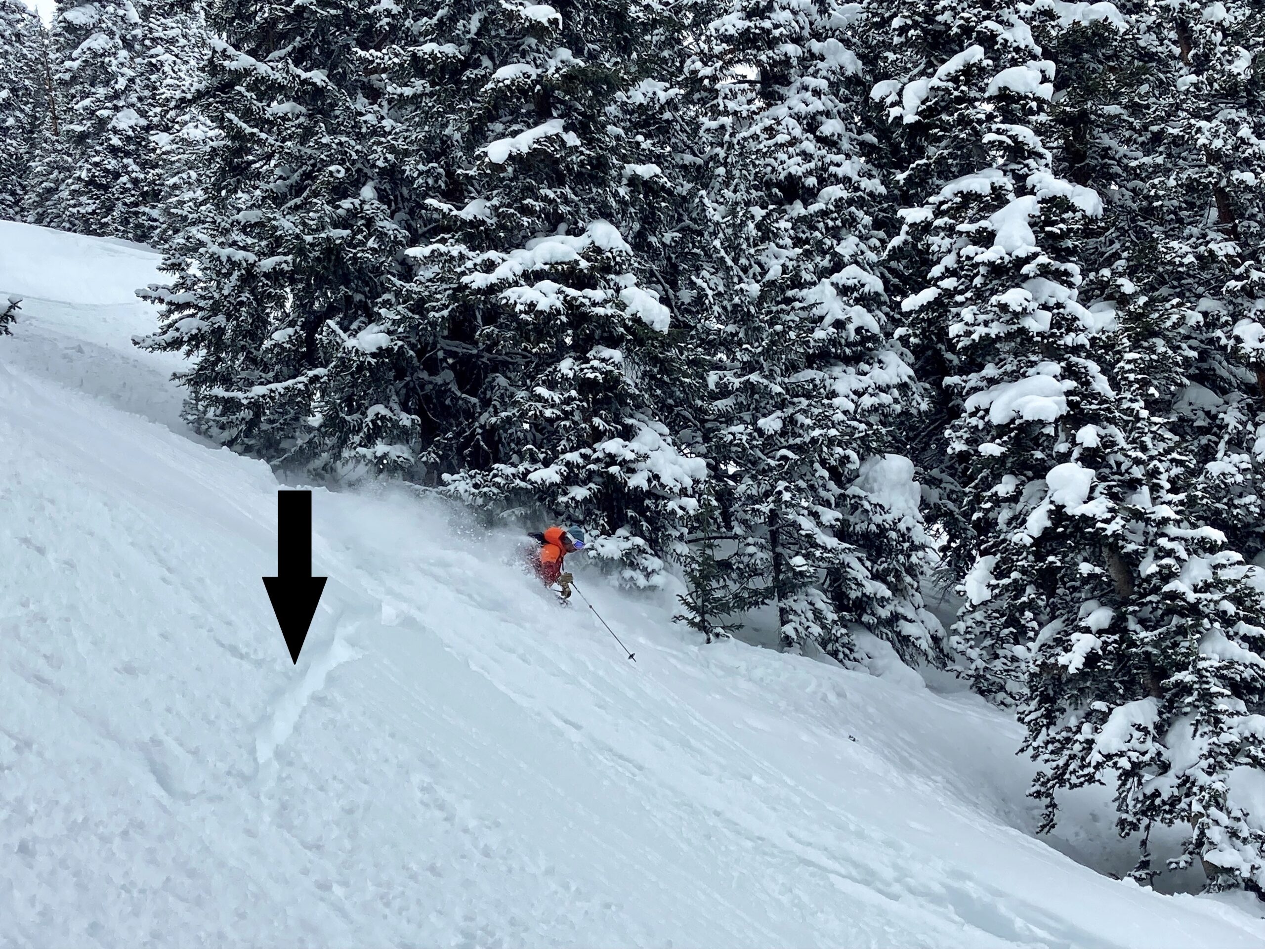
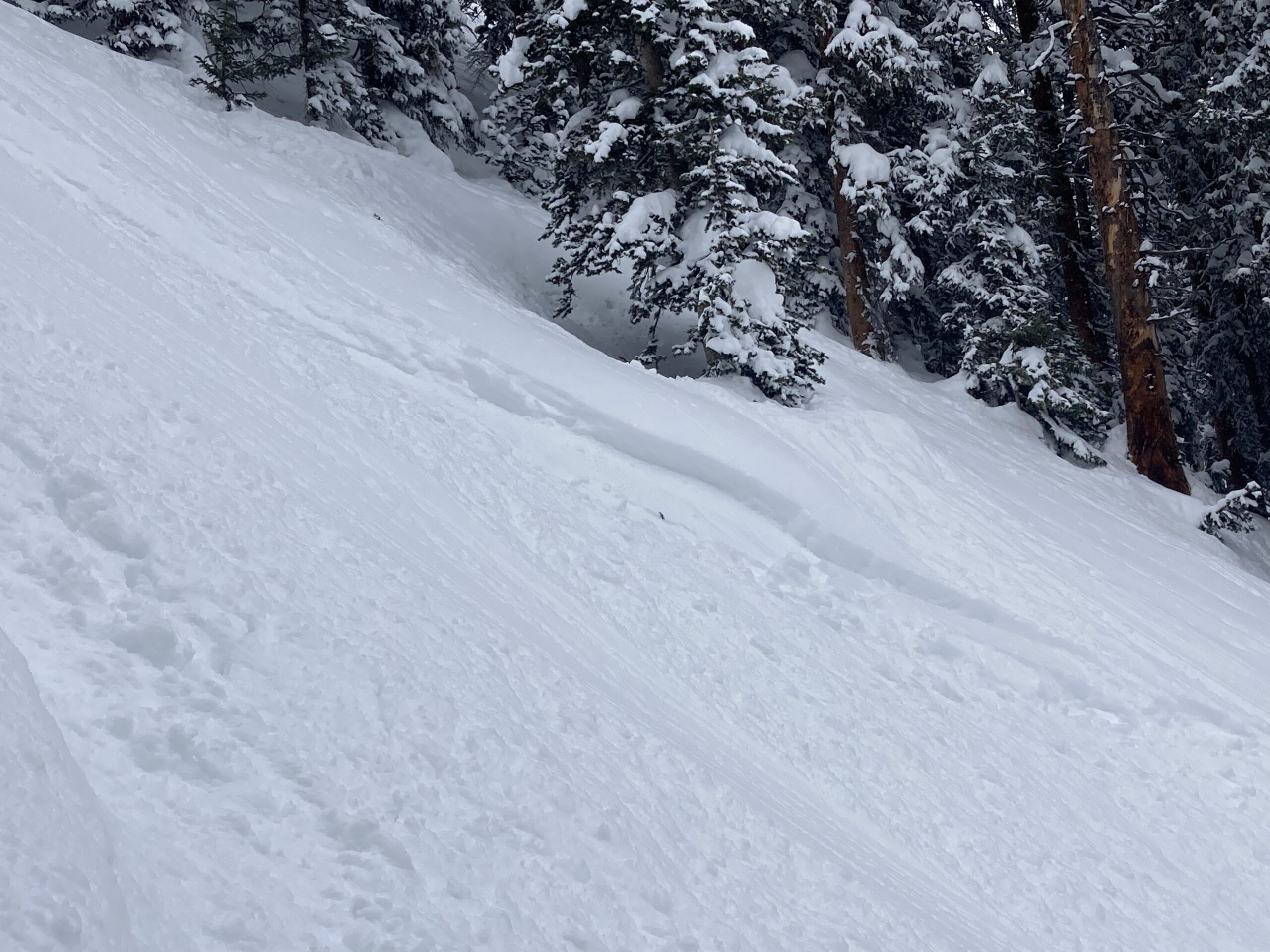
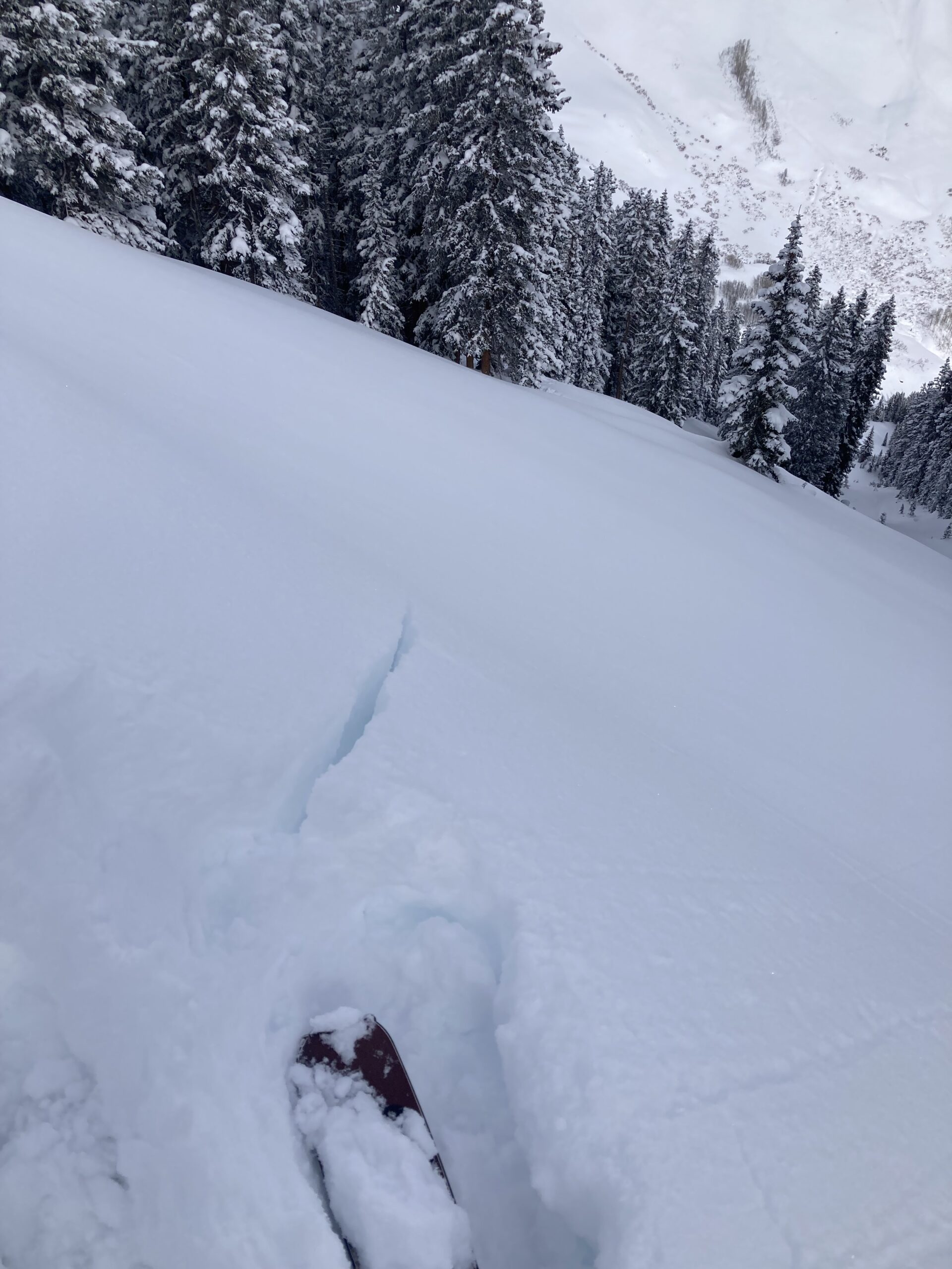
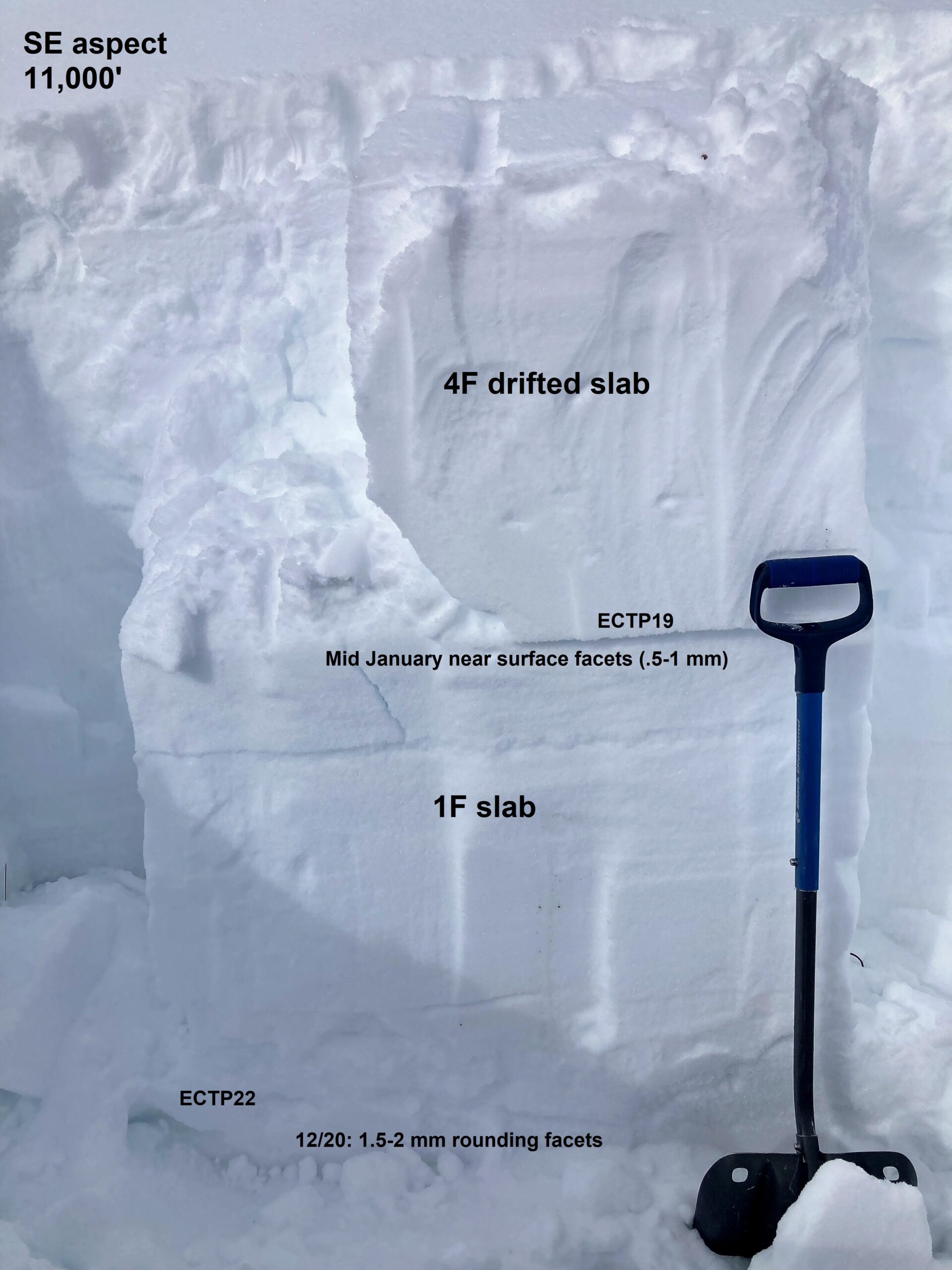
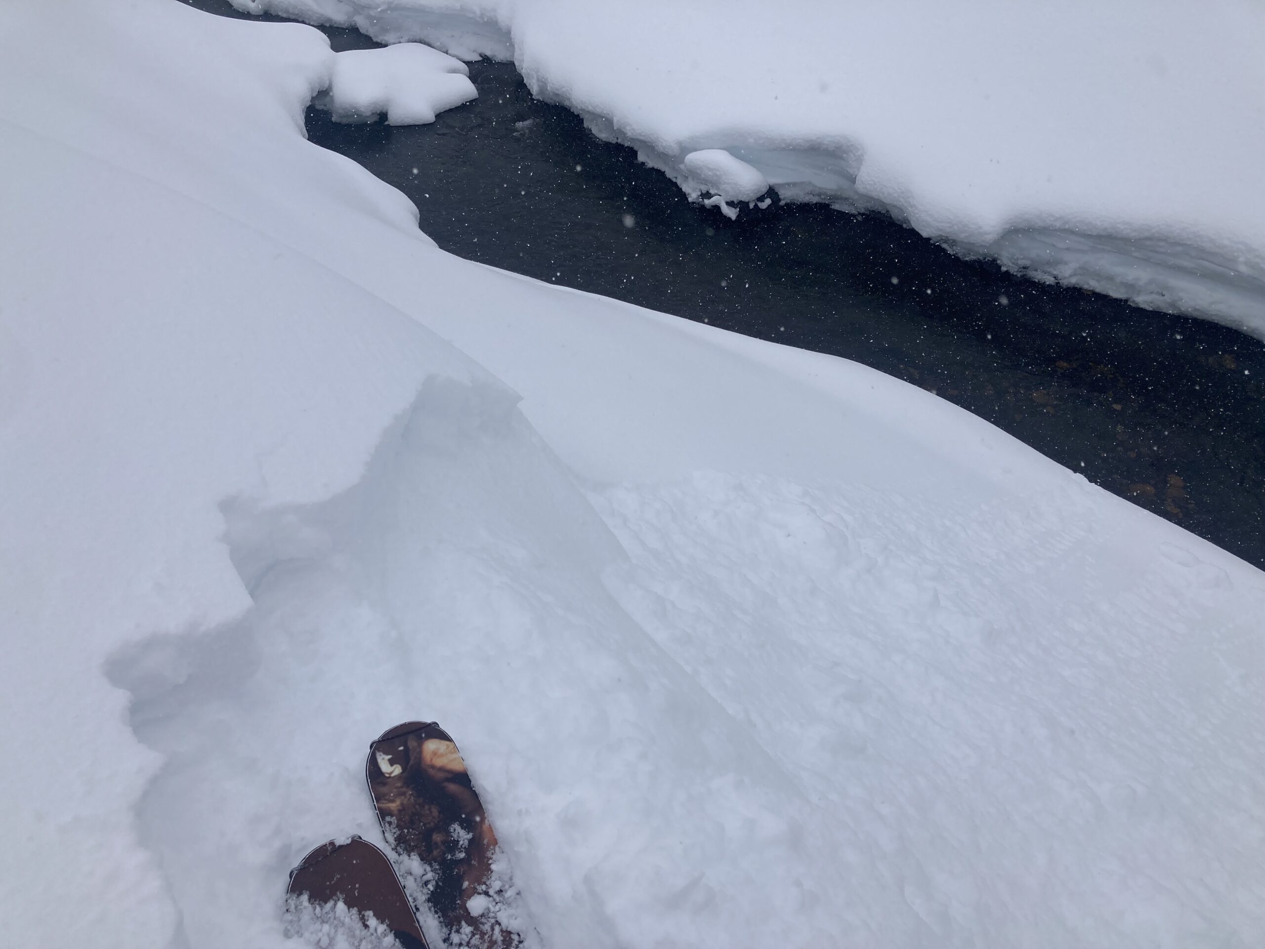
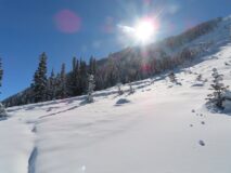
Snowpack: In wind-sheltered terrain, undercutting steep slopes and skinning abov produced cracks up to 5′ long, about 16″ deep on the storm interface. Otherwise, no signs of instability; ski cut a few steeper rollovers without results.
Photos:
-

-
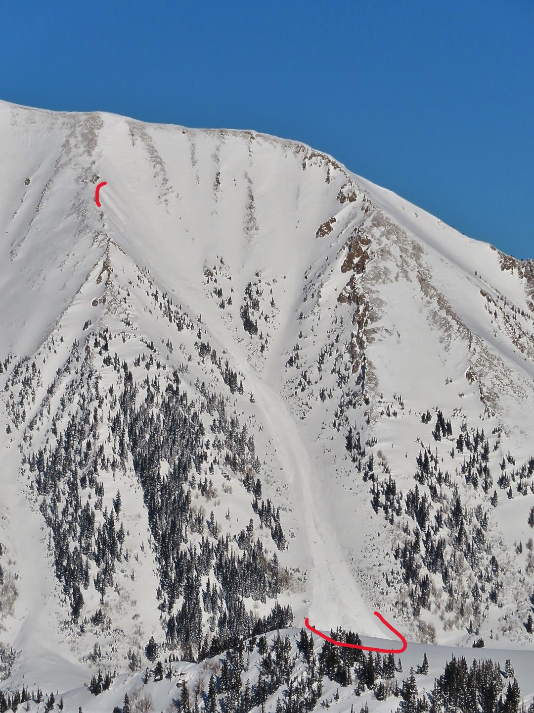
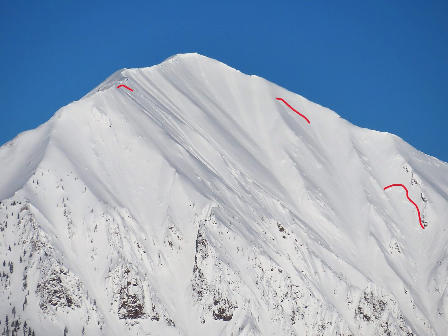
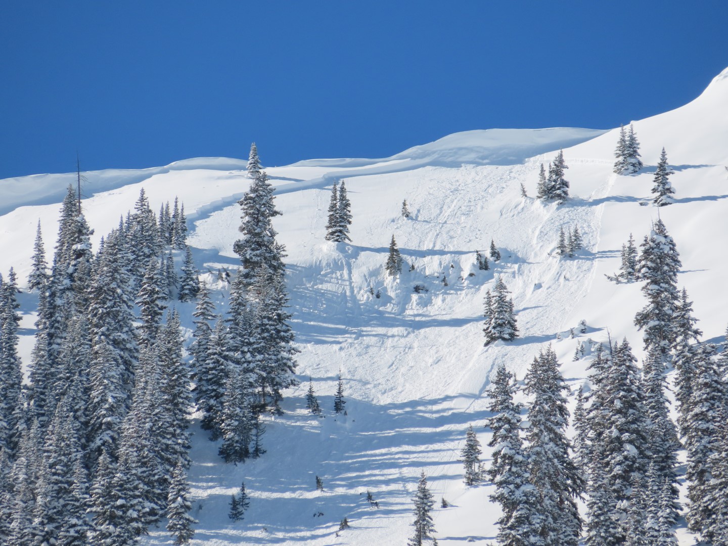
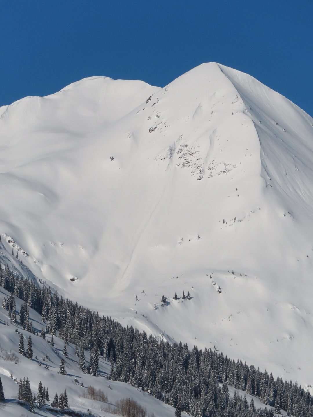
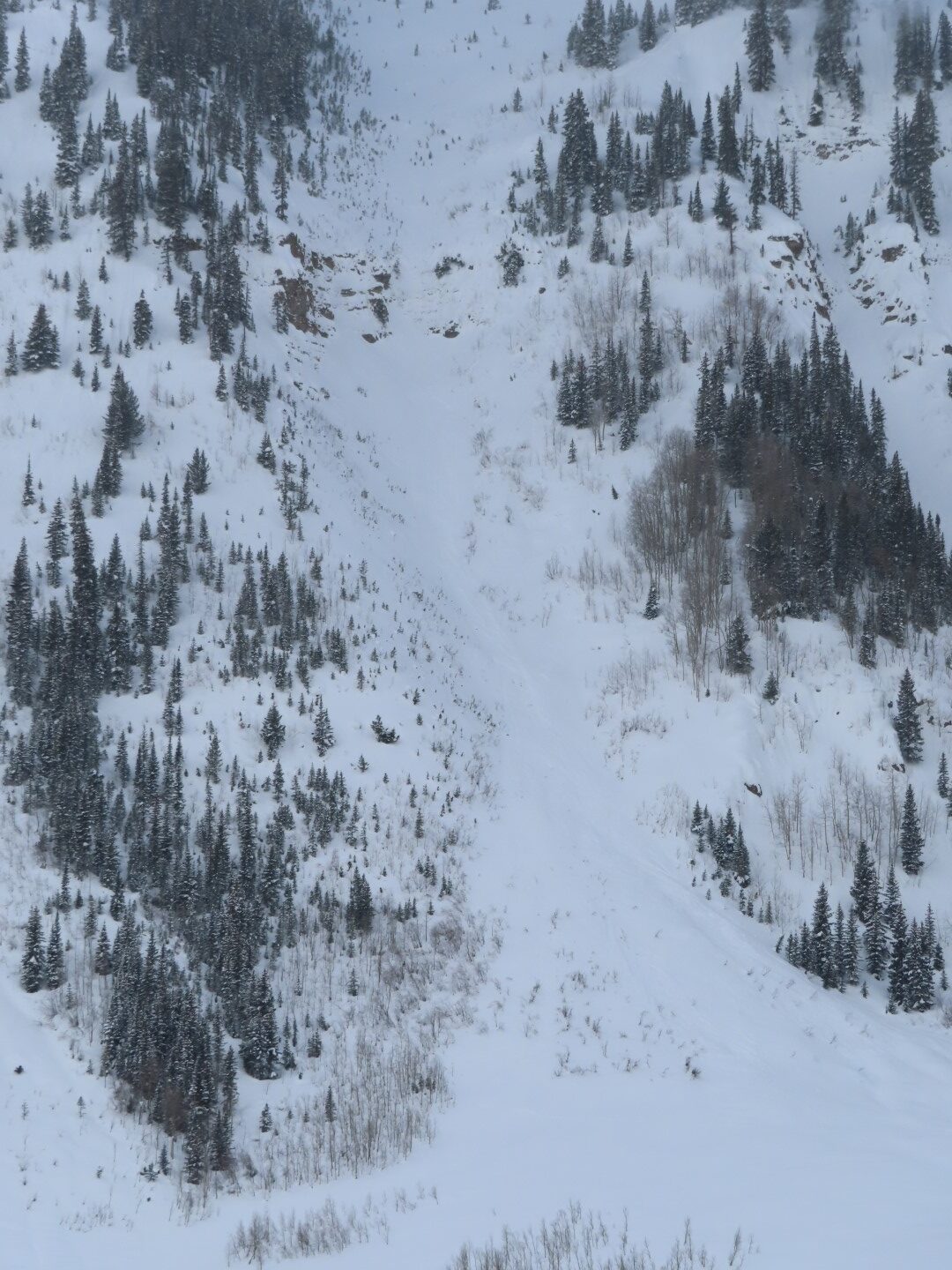
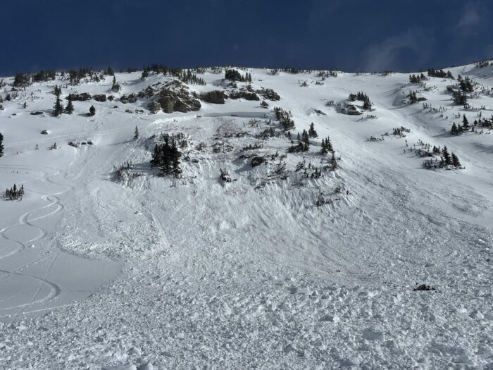
Several large natural recent storm slabs on Schuylkill Ridge, all of which ran to or past the bench (D2)
-

-
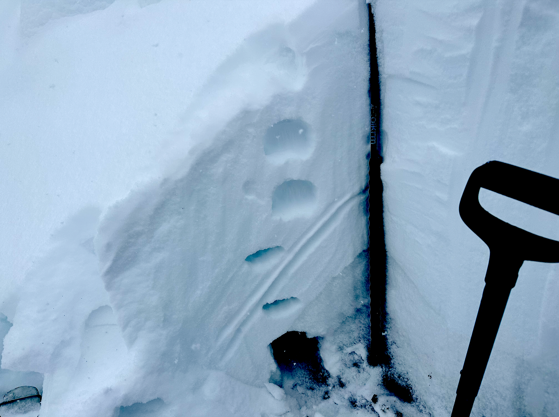
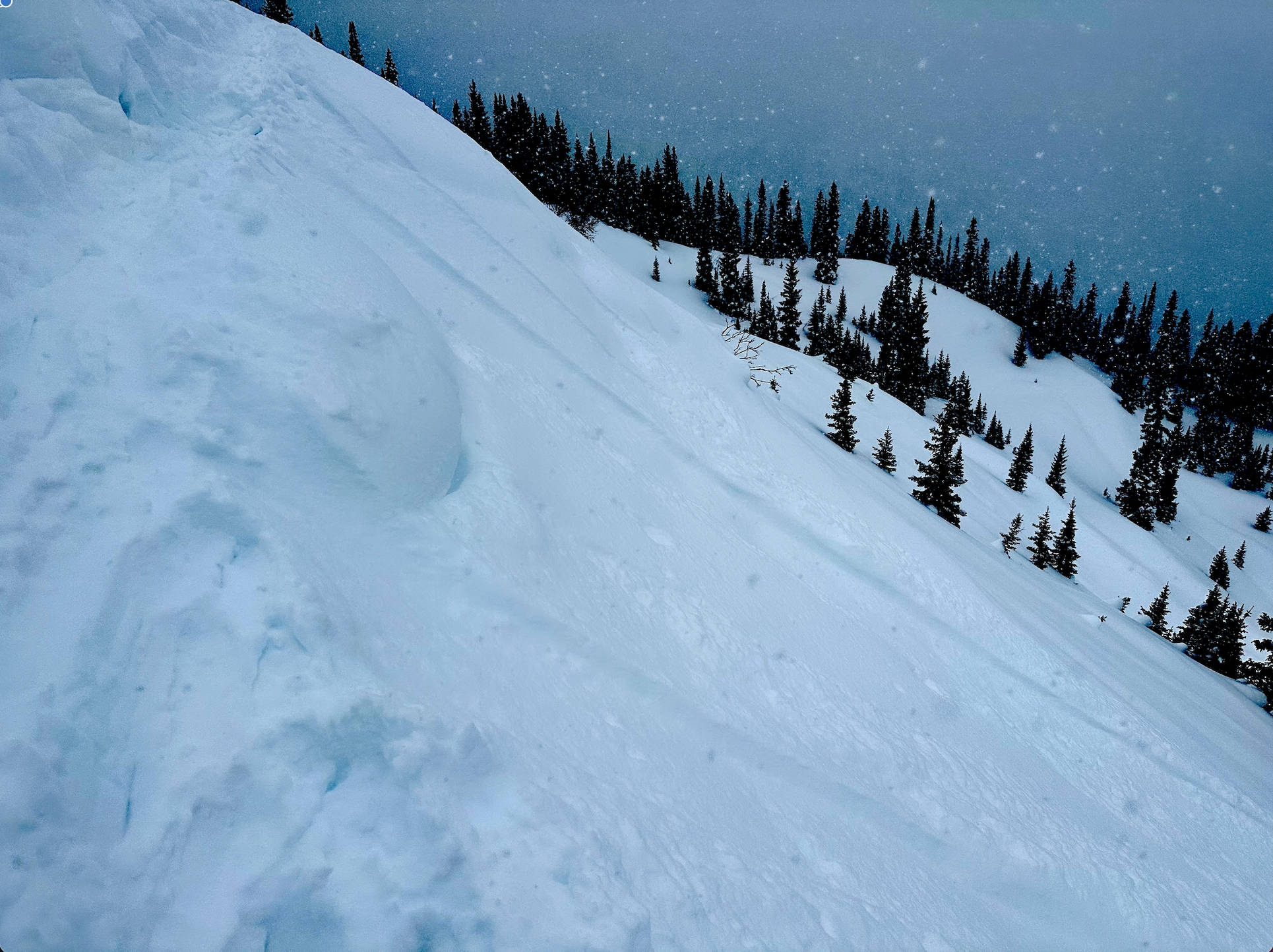
Zoom in on one of the crowns, looked to be about 2-3 ft thick.
-

-
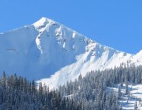
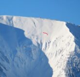
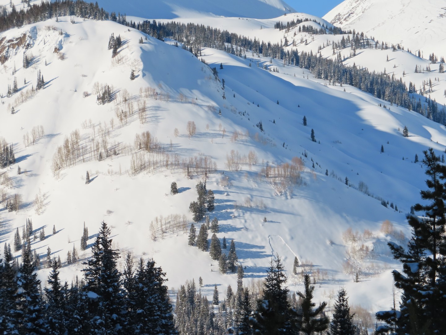
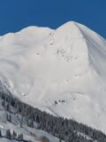
Another large debris pile further up valley on Schuylkill Ridge
-

-
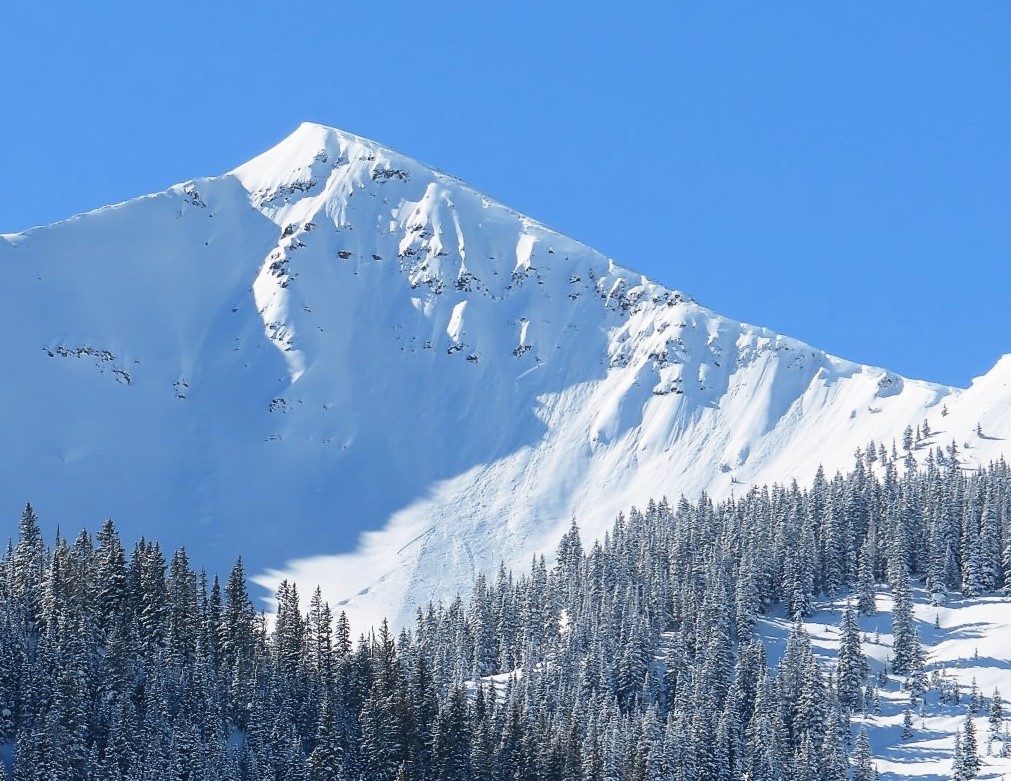
Looking at the debris below the Great Wide Open
-
-
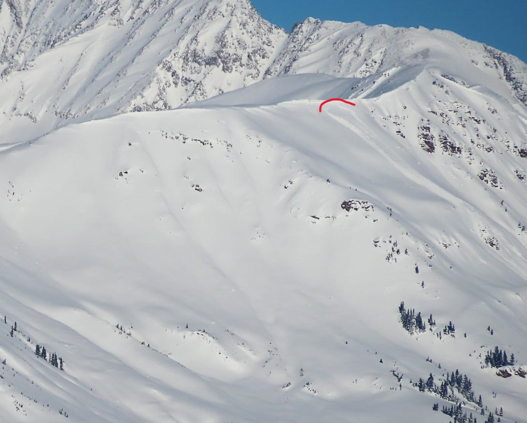
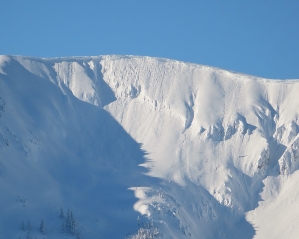
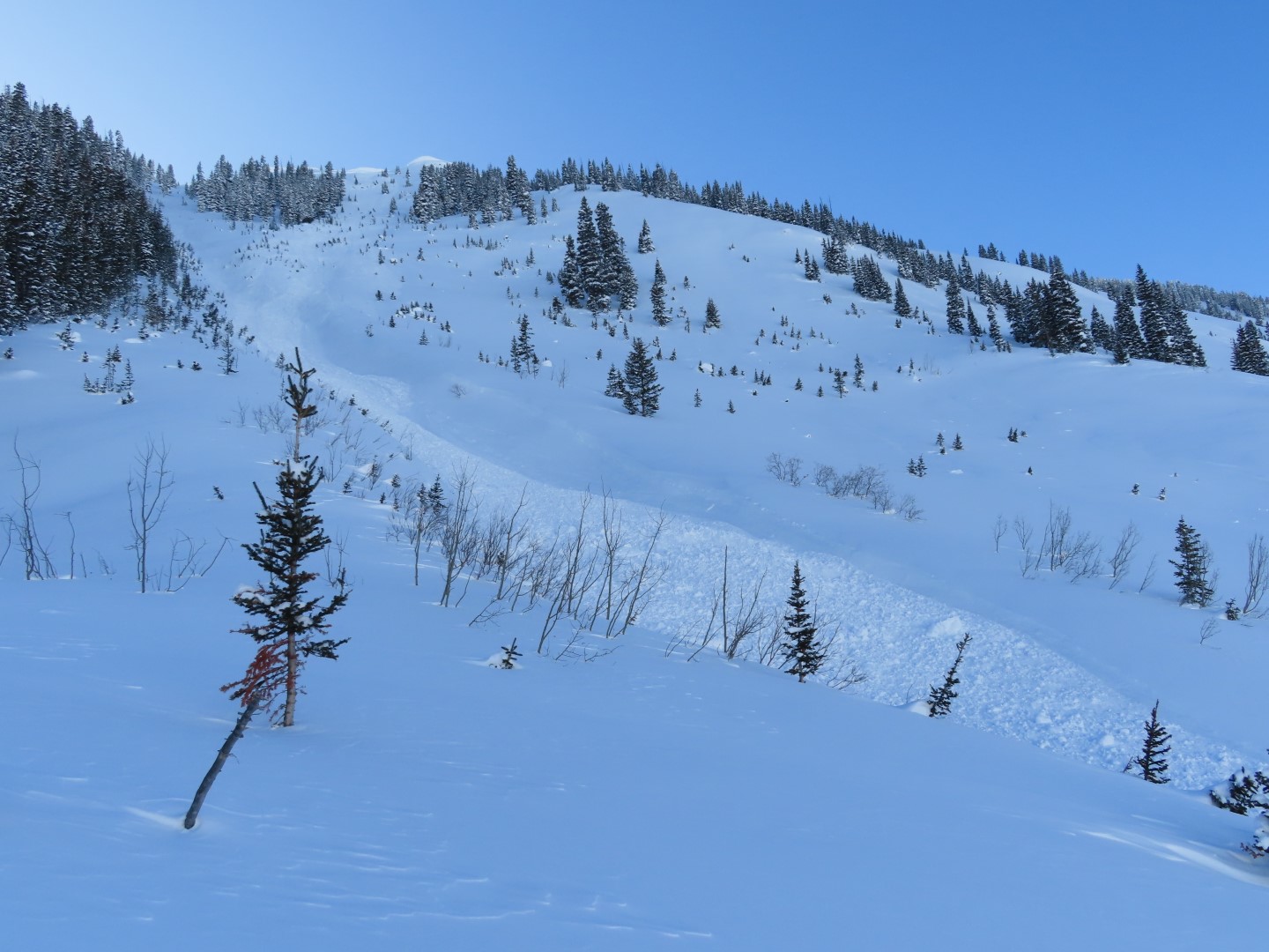
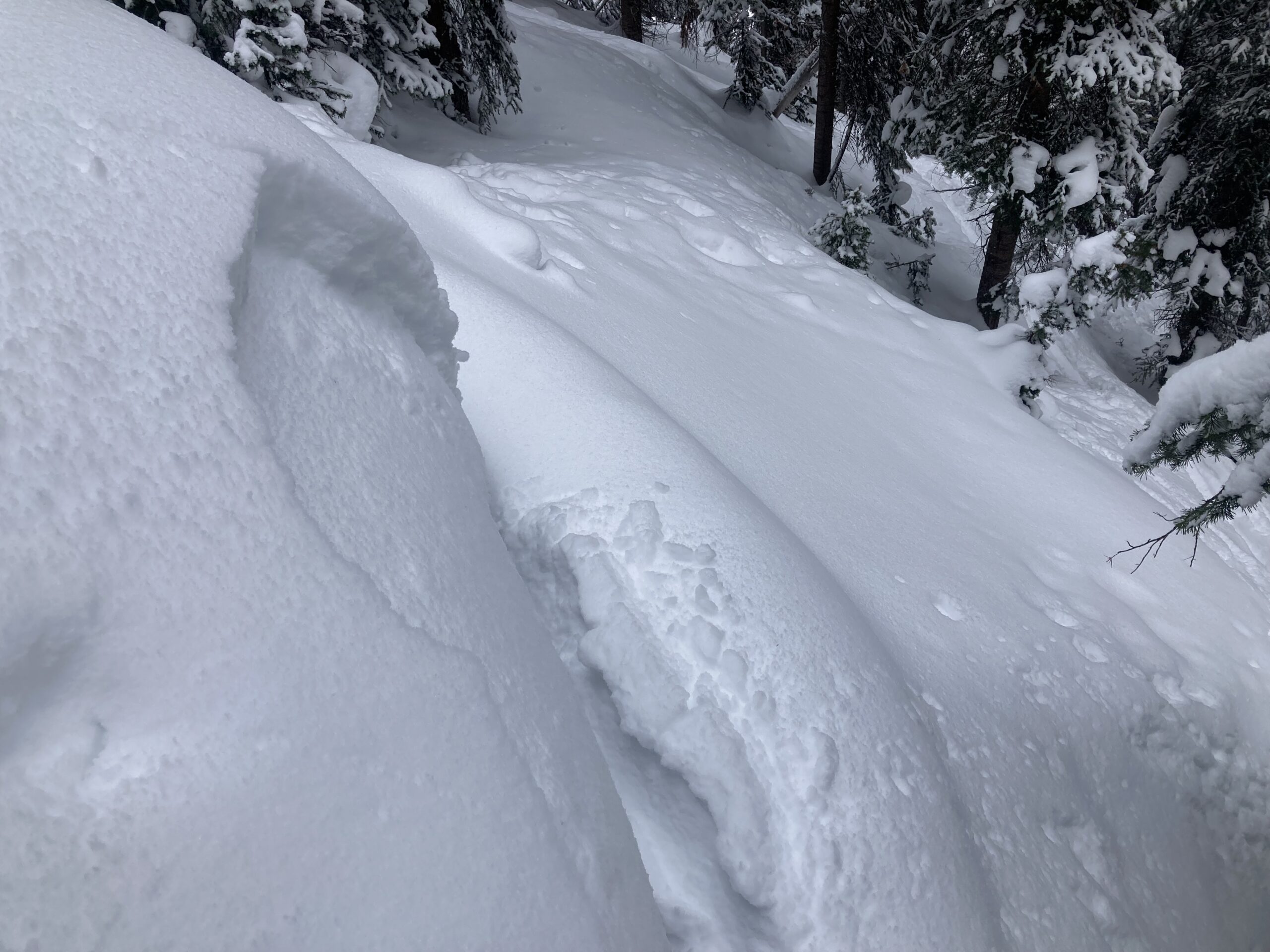
Older large avalanche that crossed the bench below Yogi’s, burying an existing skin track with 6′ of debris. I’m guessing this ran Sunday night.
-

-
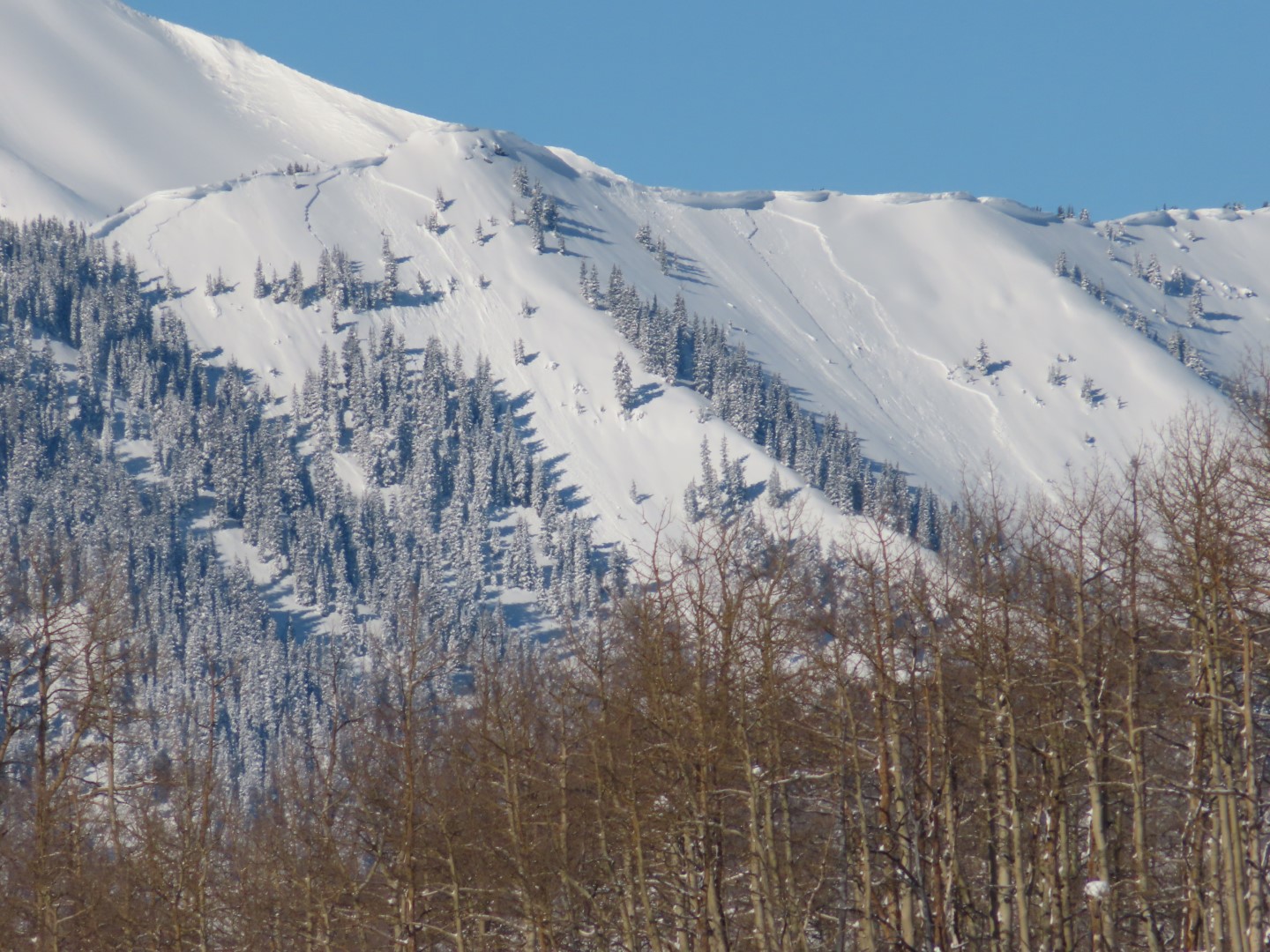
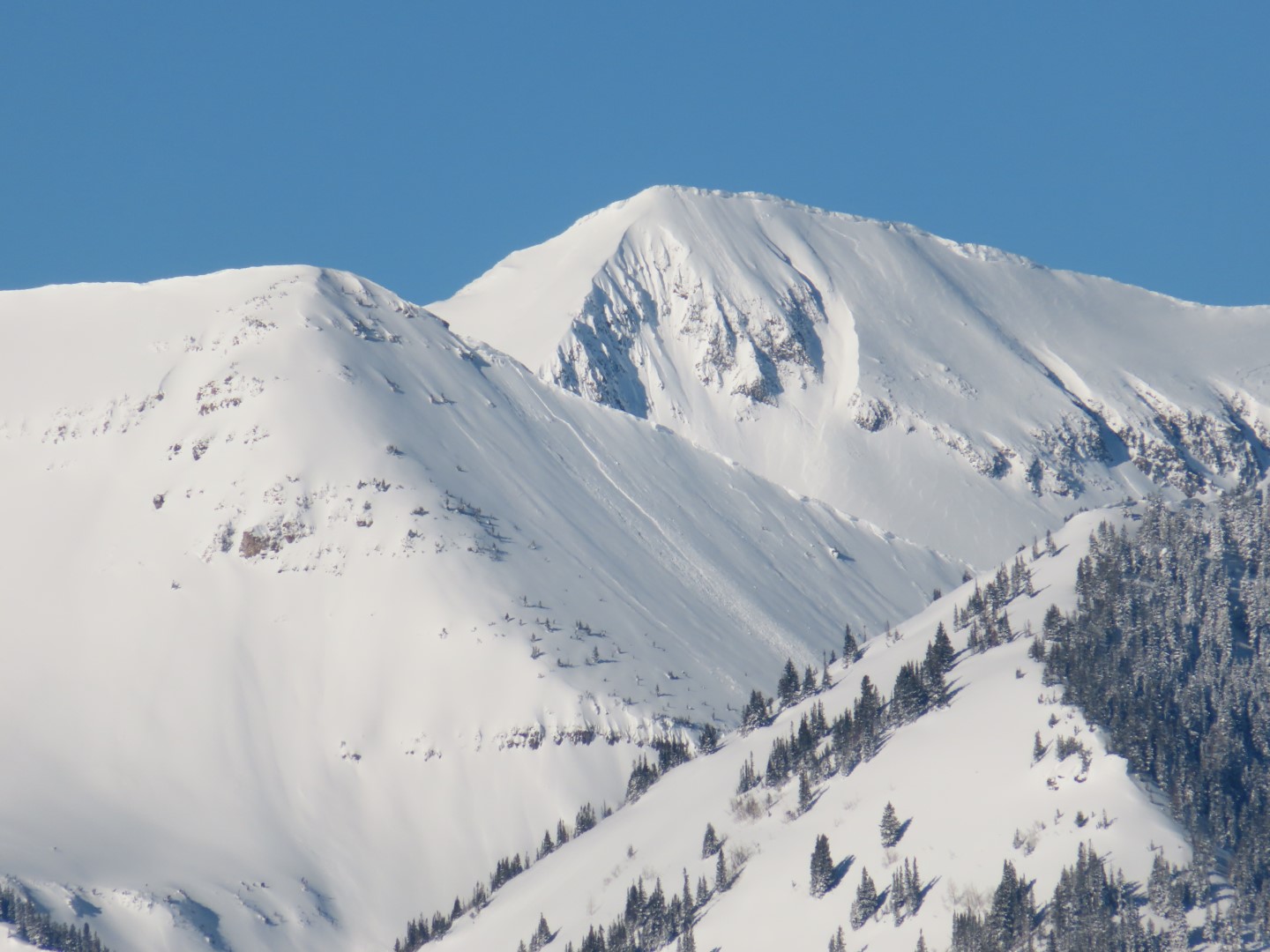
A few wind drifted slabs on Peeler and Afley
-

-
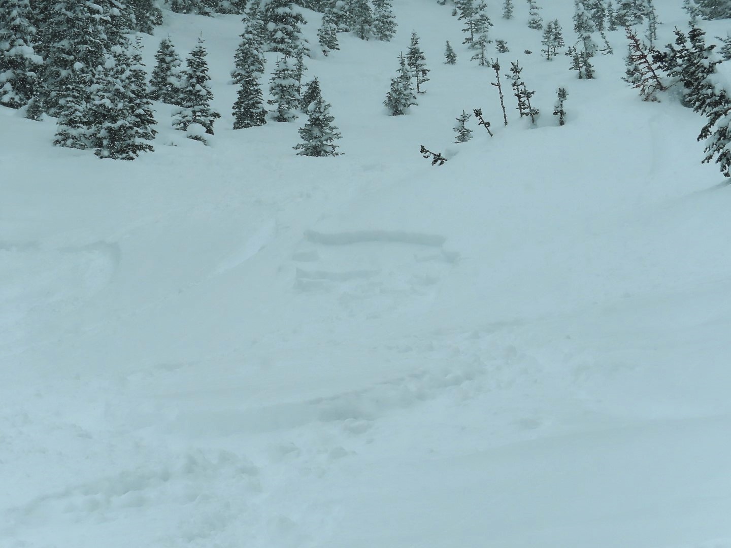
A natural storm slab below treeline near Pittsburg
-
-
A loose dry avalanche on Mineral Point.
Estimated avalanche date: 01/30/2023
Number of Avalanches: 3
Location
Location: Schuylkill Ridge
Location Specific:
Start Zone Elevation: NTL: Near Tree Line
Aspect: NE
Characteristics
Trigger: Natural
Trigger modifier:
Type: Soft Slab
Failure Plane:
Size
Relative Size: R2 small
Destructive Size: D2 – could bury, injure, or kill a person
Avg. crown height (inches): 30
Avg. width (feet):
Avg. vertical run (feet): 1500
Involvements
# of people caught:
# of partial burials:
# of full burials:
Additional comments: Great Wide Open x 3. Crowns were 2-3 ft deep, guessing they failed on storm interface but did not verify. Very little snow on debris or bed surface, may have run early Tuesday.
Estimated avalanche date: 01/29/2023
Number of Avalanches: 2
Location
Location: Schuylkill Ridge
Location Specific:
Start Zone Elevation: NTL: Near Tree Line
Aspect: NE
Characteristics
Trigger: Natural
Trigger modifier:
Type: Soft Slab
Failure Plane:
Size
Relative Size: R2 small
Destructive Size: D2 – could bury, injure, or kill a person
Avg. crown height (inches):
Avg. width (feet):
Avg. vertical run (feet): 1600
Involvements
# of people caught:
# of partial burials:
# of full burials:
Additional comments: Yogi’s x1 and Great Wide Open x 1. Yogi’s debris had all of Monday’s storm snow on it, so it probably ran Sunday night or Monday morning. Debris pile about 6 to 8′ deep, guessing. Both ran past bench, may have been close to D2.5
Estimated avalanche date: 01/31/2023
Number of Avalanches: 1
Location
Location: Poverty Gulch (Pittsburg, Augusta, Baxter Basin)
Location Specific:
Start Zone Elevation: ATL: Above Tree Line
Aspect: S
Characteristics
Trigger: Natural
Trigger modifier:
Type: Loose
Failure Plane: Within storm snow
Size
Relative Size: R1 very small
Destructive Size: D1.5
Avg. crown height (inches):
Avg. width (feet):
Avg. vertical run (feet):
Involvements
# of people caught:
# of partial burials:
# of full burials:
Additional comments: Solar triggered sluff today.
Estimated avalanche date: 01/30/2023
Number of Avalanches: 3
Location
Location: Oh-Be-Joyful Basin
Location Specific:
Start Zone Elevation: ATL: Above Tree Line
Aspect: NE
Characteristics
Trigger: Natural
Trigger modifier:
Type: Soft Slab
Failure Plane: Within storm snow
Size
Relative Size: R1 very small
Destructive Size: D1.5
Avg. crown height (inches):
Avg. width (feet):
Avg. vertical run (feet):
Involvements
# of people caught:
# of partial burials:
# of full burials:
Additional comments: Peeler Peak x 2, Afley Peak x1
Estimated avalanche date: 01/30/2023
Number of Avalanches: 1
Location
Location: Poverty Gulch (Pittsburg, Augusta, Baxter Basin)
Location Specific:
Start Zone Elevation: BTL: Below Tree Line
Aspect: SE
Characteristics
Trigger: Natural
Trigger modifier:
Type: Soft Slab
Failure Plane:
Size
Relative Size: R1 very small
Destructive Size: D1- Relatively harmless to people
Avg. crown height (inches):
Avg. width (feet):
Avg. vertical run (feet):
Involvements
# of people caught:
# of partial burials:
# of full burials:
Additional comments: Near Pittsburg. Storm slab
5952