Date of Observation: 02/09/2023
Name: Evan Ross
Zone: Southeast Mountains
Route Description: Hunter Creek. 10,000ft to 12,000ft.
Observed avalanche activity: Yes
Avalanches: In Upper Hunter Creek and Brush Creek. All three recent avalanches below have seen recent wind-loading and they all have massive fetches.
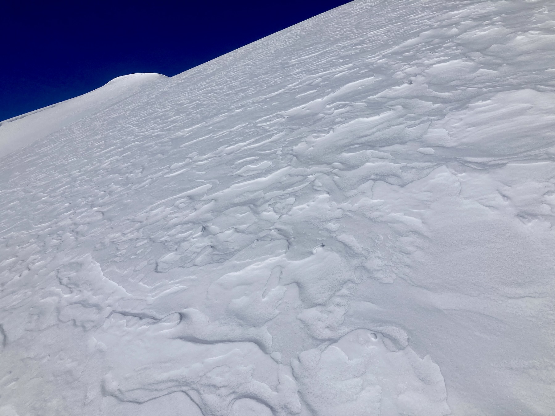
The first wind-loaded test slope I put a track on, produced a result that slightly displaced a small wind slab. This slab didn’t push over the stauchwall. The crown was 4 inches to 2 feet thick and failed on a non-persistent density chance.
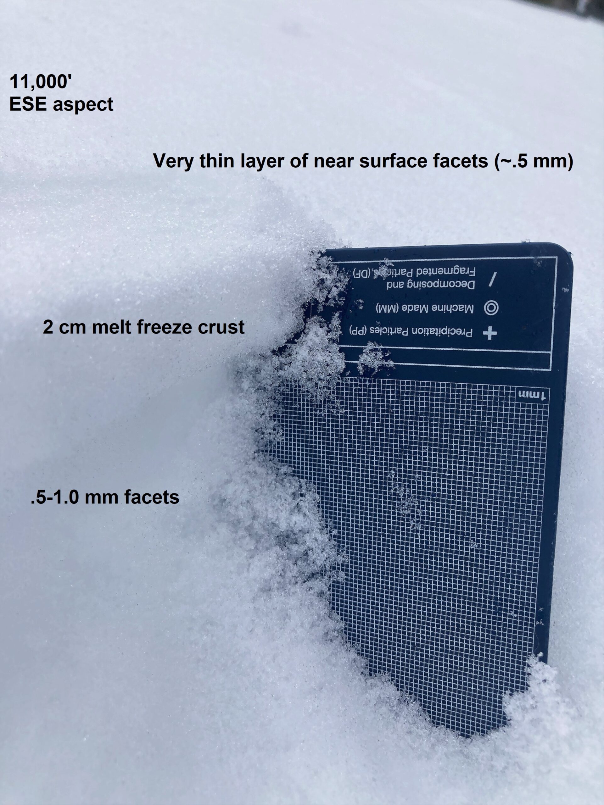
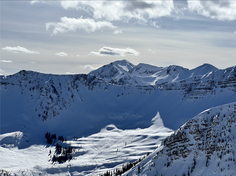
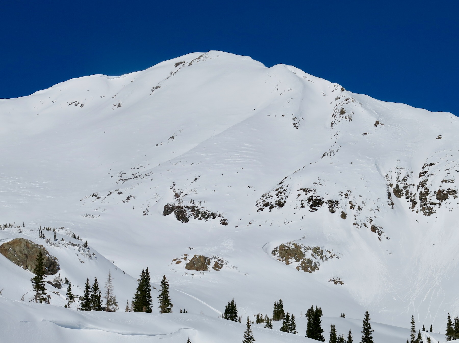
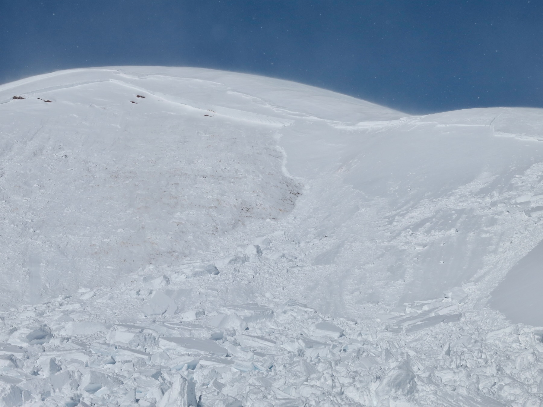
The next test slope was slightly steeper and connected to a much bigger wind-loaded slope. South, 11,800ft. A wind slab released in the upper snowpack, before stepping down into a couple of different more deeply buried weak layers. The resulting avalanche was large in size. The crown height ranged from 1 foot to an estimated 4 or 5 feet. In the section of the crown I could access, the avalanche released on a thin layer of small facets that were atop what looked like an old wind-board. This was about 10cm below the only crust in the upper snowpack. In another area, this avalanche stepped down to the lower half of the snowpack before further gouging to the ground.
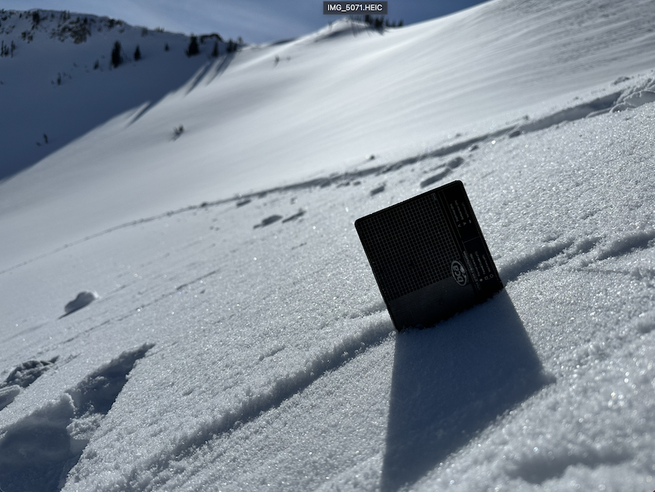
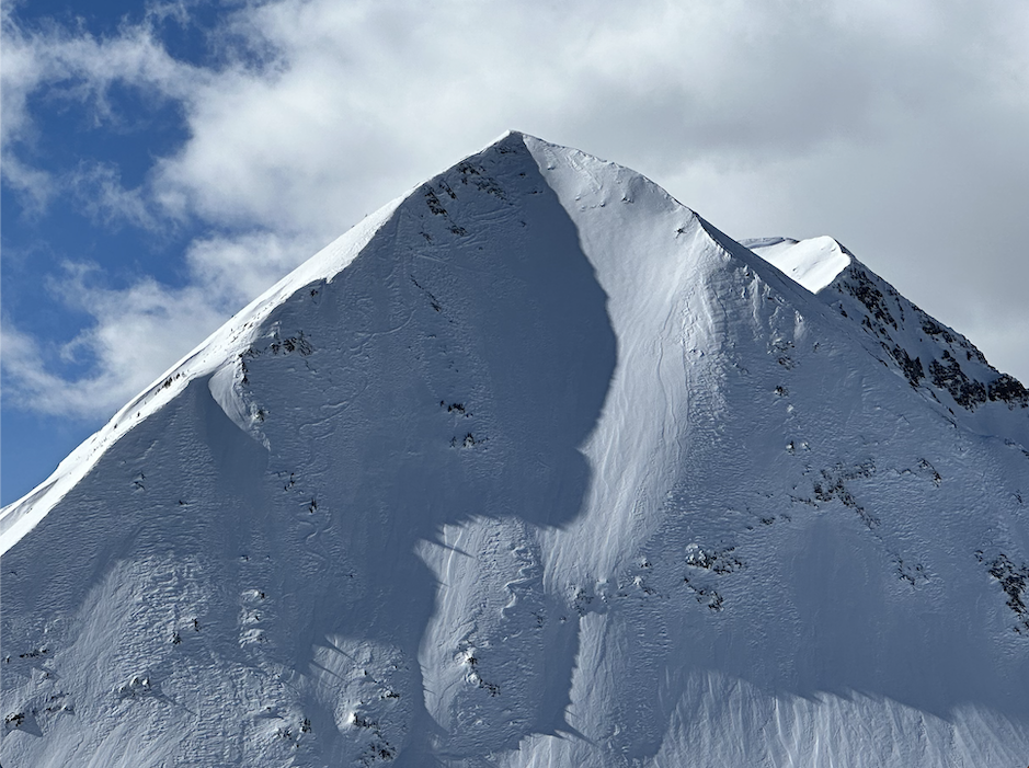
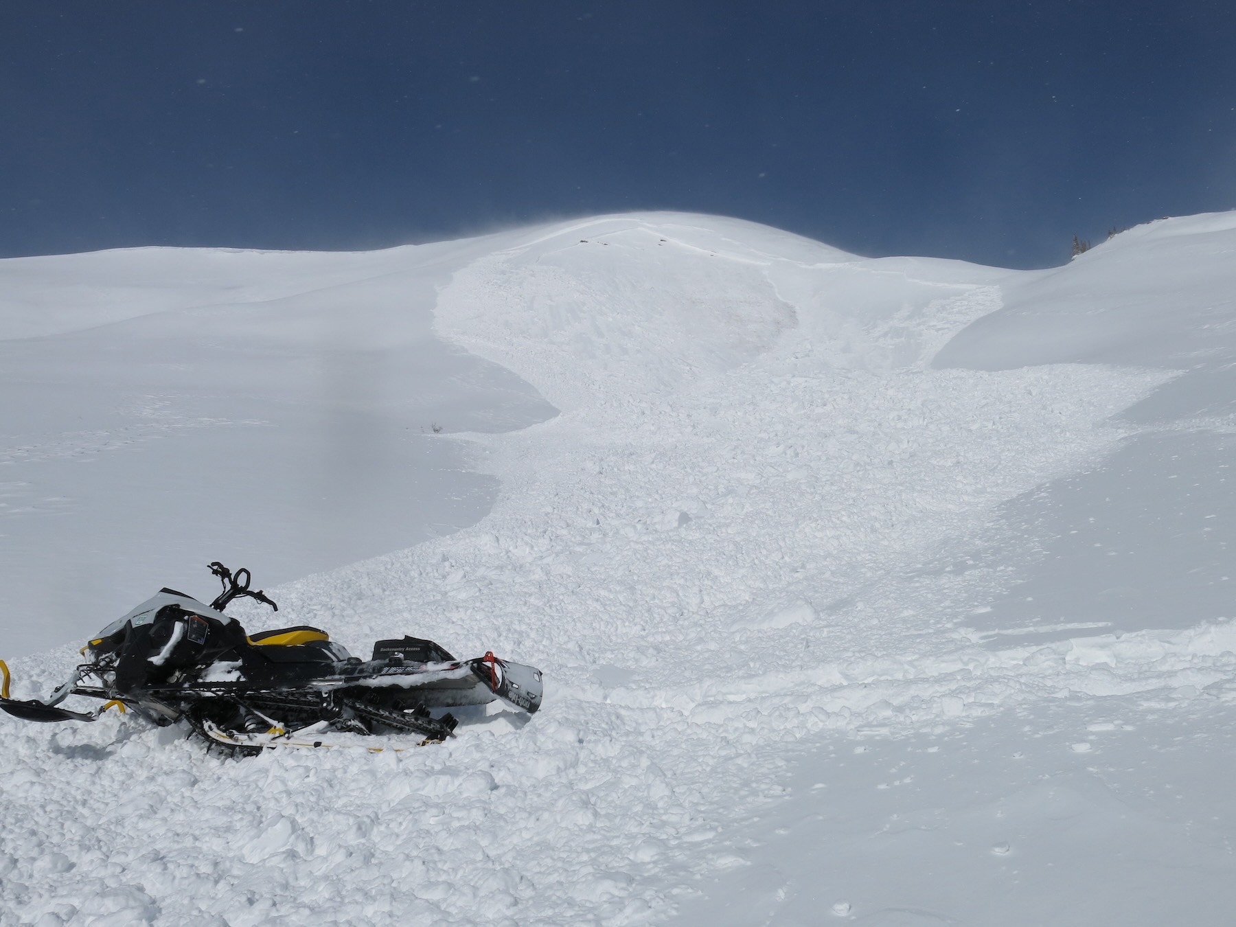
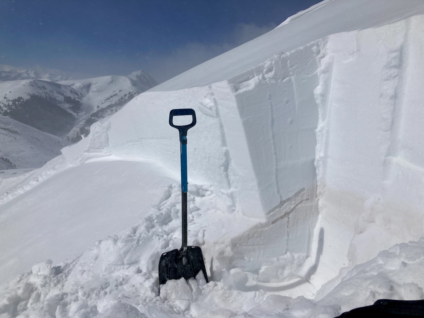
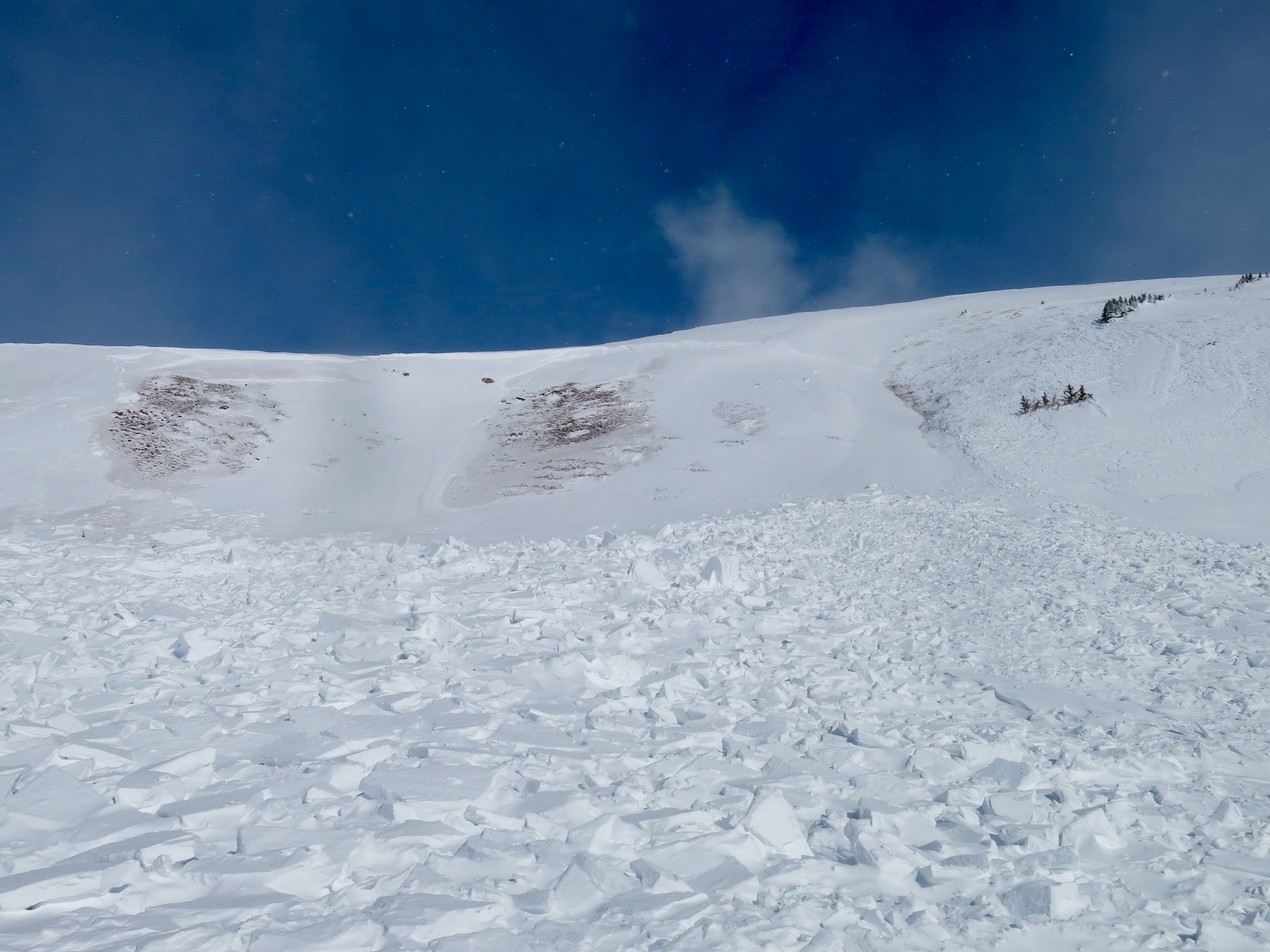
Got a closer look at the previously reported natural avalanche near the top of Hunter Creek. South, 12,000ft. This avalanche appeared to fail similarly to the avalanche described above. The upper crown failed between P-hard snow above K-hard snow. The knife-hard snow had dust blown in on it from the ridge. Like the avalanche above, there appeared to be a thin layer of small faceted grains at this interface. There was 80 to 90cm of snow below the bed surface in the upper crown. Lower down on the slope there were two areas where the avalanche stepped down to near the ground. The upper crown height ranged from 2 feet to around 5 feet.
East, 12,000ft near Timbered Hill. I couldn’t see this avalanche well. It looked like a wind slab that released in the upper snowpack. D1.5. However, it could have been a deeper crown that has been refilling in the last couple of days. I’d estimate it ran around a similar time as the other natural avalanche in upper Hunter Creek.
Weather: Partly Cloudy. Moderate to strong northerly winds at 12,000ft.
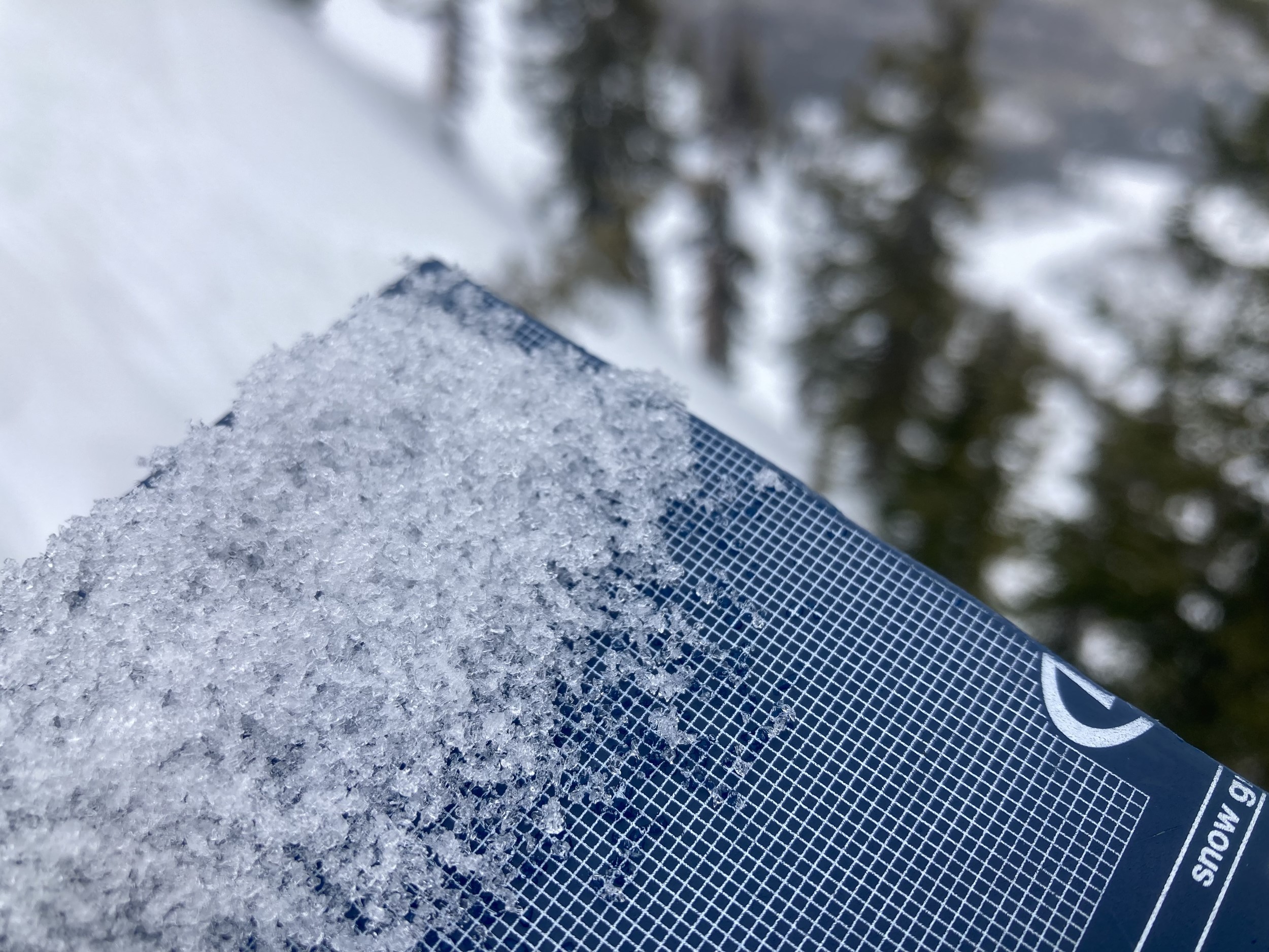
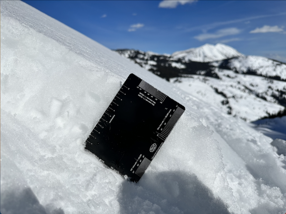
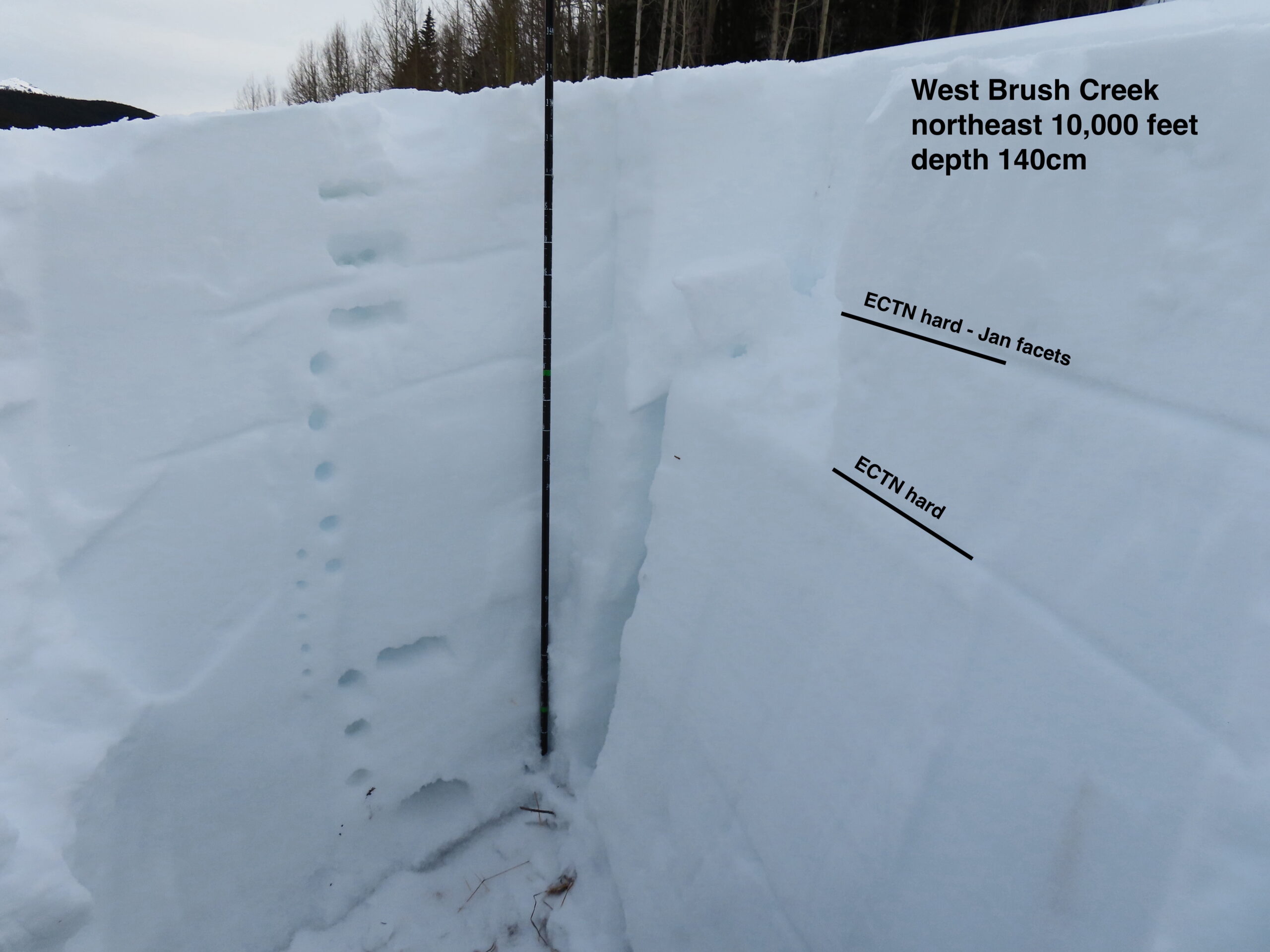
Snowpack: Nice soft snow surfaces at lower elevations. I didn’t spend time noting where surface crusts had formed on sunny lower-elevation slopes. At upper elevations, there are still a few places with nice soft snow surfaces, but the majority of the terrain had wind-boards and hard slabs.
Photos:
-

-
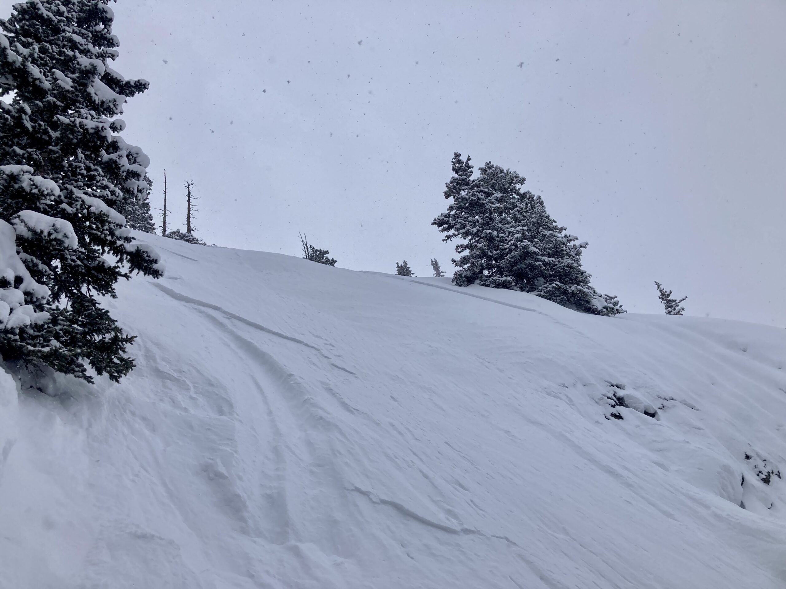
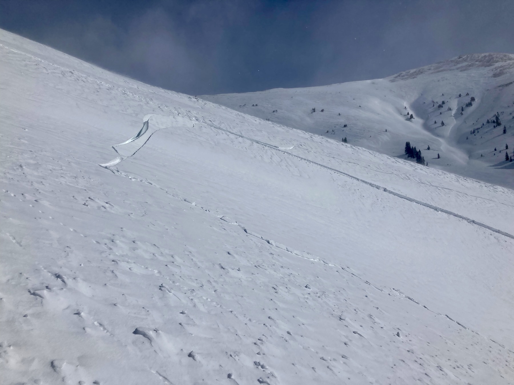
First test slope. Full puzzle piece fracture. Crown, flank, Stauchwall. Not all are visible in this photo.
-
-
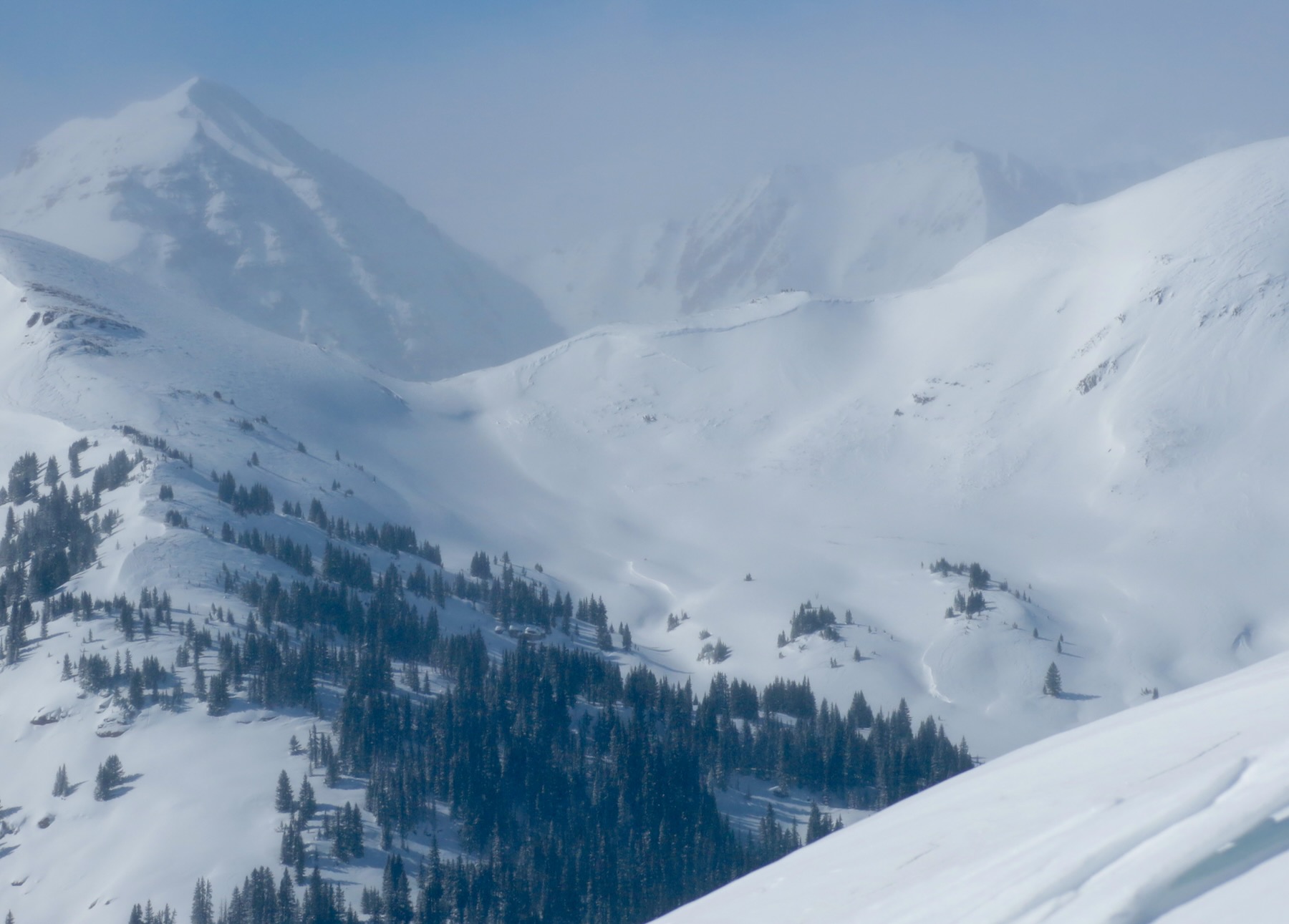
2nd avalanche description. View of the several different crown heights.
-

-
2nd avalanche description. View of the several different crown heights.
-

-
2nd avalanche description.
-

-
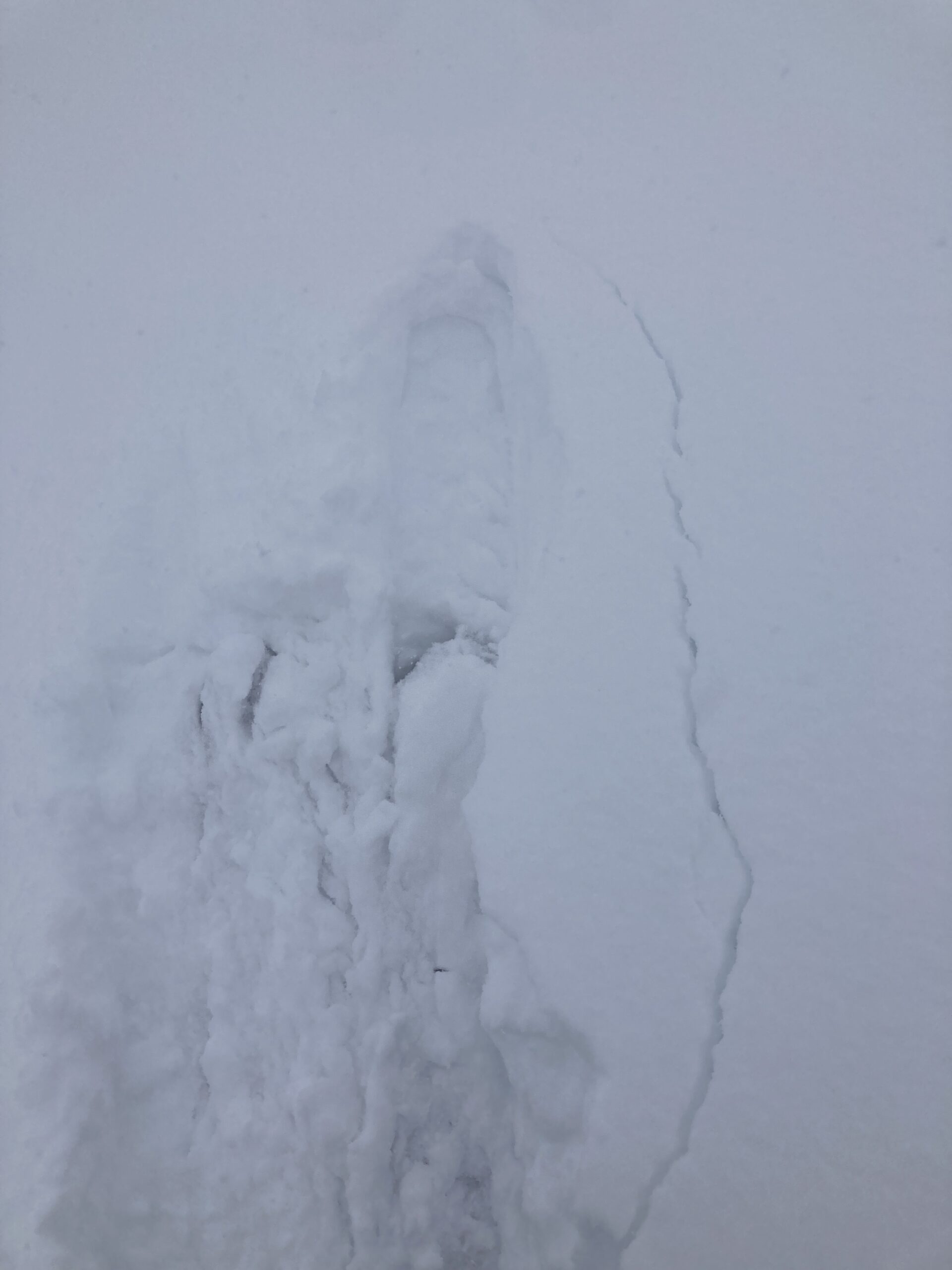
The previously documented natural avalanche in Upper Hunter Creek. Breaking between P hard and K hard snow on a thin layer of facets.
-

-
The previously documented natural avalanche in Upper Hunter Creek. Much of the crown had already filled back in.
-

-
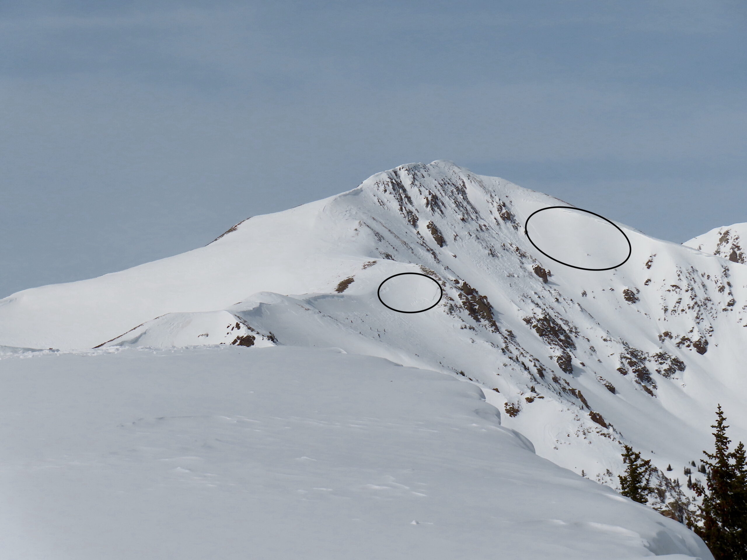
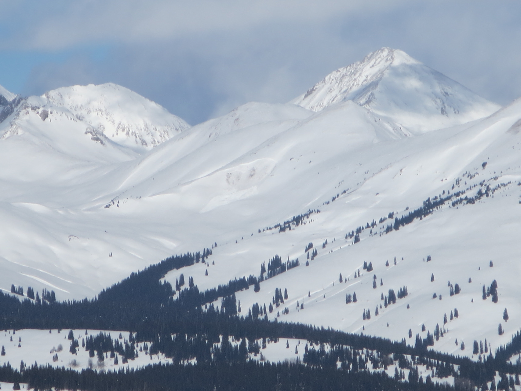
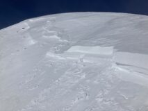
An old natural avalanche on the Timbered Hill Ridgeline.
Estimated avalanche date: 02/09/2023
Number of Avalanches: 1
Location
Location: Cement Creek
Location Specific:
Start Zone Elevation: NTL: Near Tree Line
Aspect: S
Characteristics
Trigger: Snowmobiler
Trigger modifier:
Type: Hard Slab
Failure Plane: Old snow
Size
Relative Size: R1 very small
Destructive Size: D2 – could bury, injure, or kill a person
Avg. crown height (inches): 36
Avg. width (feet):
Avg. vertical run (feet):
Involvements
# of people caught:
# of partial burials:
# of full burials:
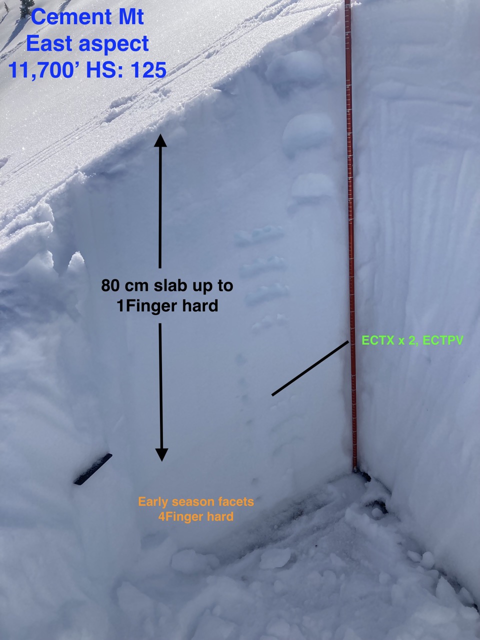
Additional comments: The next test slope was slightly steeper and connected to a much bigger wind-loaded slope. South, 11,800ft. A wind slab released in the upper snowpack, before stepping down into a couple of different more deeply buried weak layers. The resulting avalanche was large in size. The crown height ranged from 1 foot to an estimated 4 or 5 feet. In the section of the crown I could access, the avalanche released on a thin layer of small facets that were atop what looked like an old wind-board. This was about 10cm below the only crust in the upper snowpack. In another area, this avalanche stepped down to the lower half of the snowpack before further gouging to the ground.
Estimated avalanche date: 02/07/2023
Number of Avalanches: 1
Location
Location: East Brush Creek (Star Pass, Friends Hut)
Location Specific:
Start Zone Elevation: ATL: Above Tree Line
Aspect: E
Characteristics
Trigger: Natural
Trigger modifier:
Type: Unknown
Failure Plane: Unknown
Size
Relative Size: R1 very small
Destructive Size: D1.5
Avg. crown height (inches):
Avg. width (feet):
Avg. vertical run (feet):
Involvements
# of people caught:
# of partial burials:
# of full burials:
Additional comments: East, 12,000ft near Timbered Hill. I couldn’t see this avalanche well. It looked like a wind slab that released in the upper snowpack. D1.5. However, it could have been a deeper crown that has been refilling in the last couple of days. I’d estimate it ran around a similar time as the other natural avalanche in upper Hunter Creek.
5983