Date of Observation: 04/11/2023
Name: Zach Guy
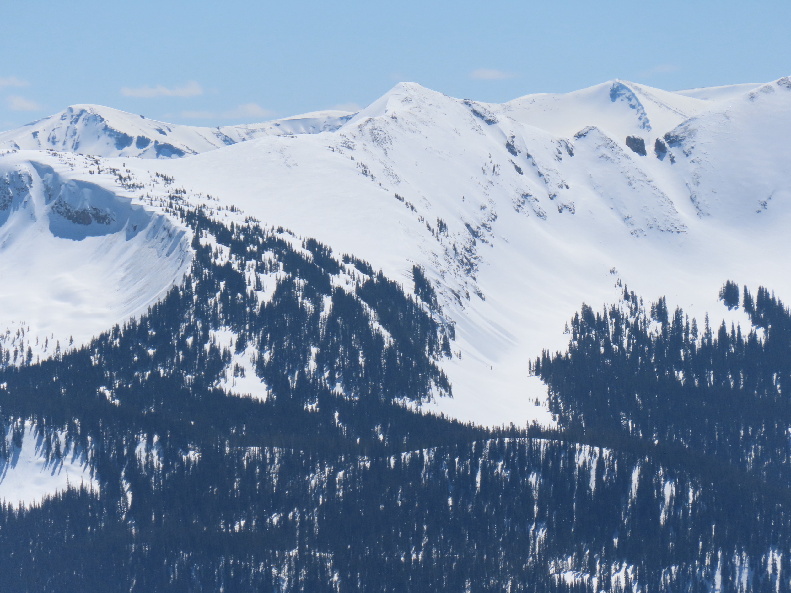
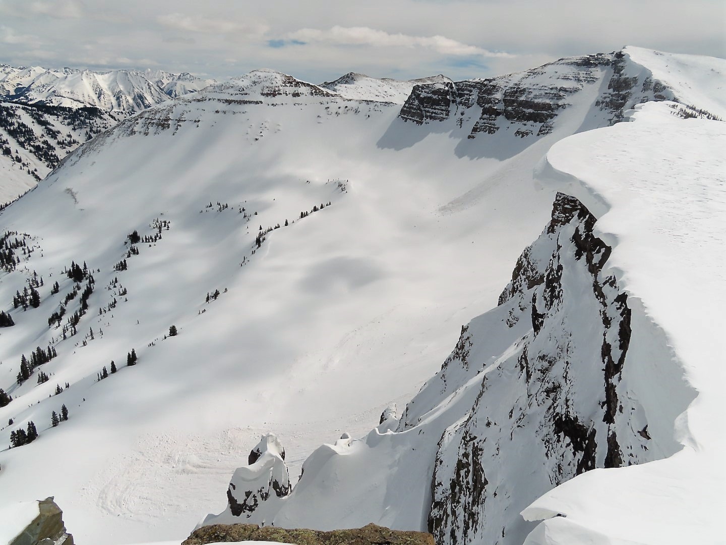
Zone: Southeast Mountains
Route Description: Viewed from CB
Observed avalanche activity: Yes
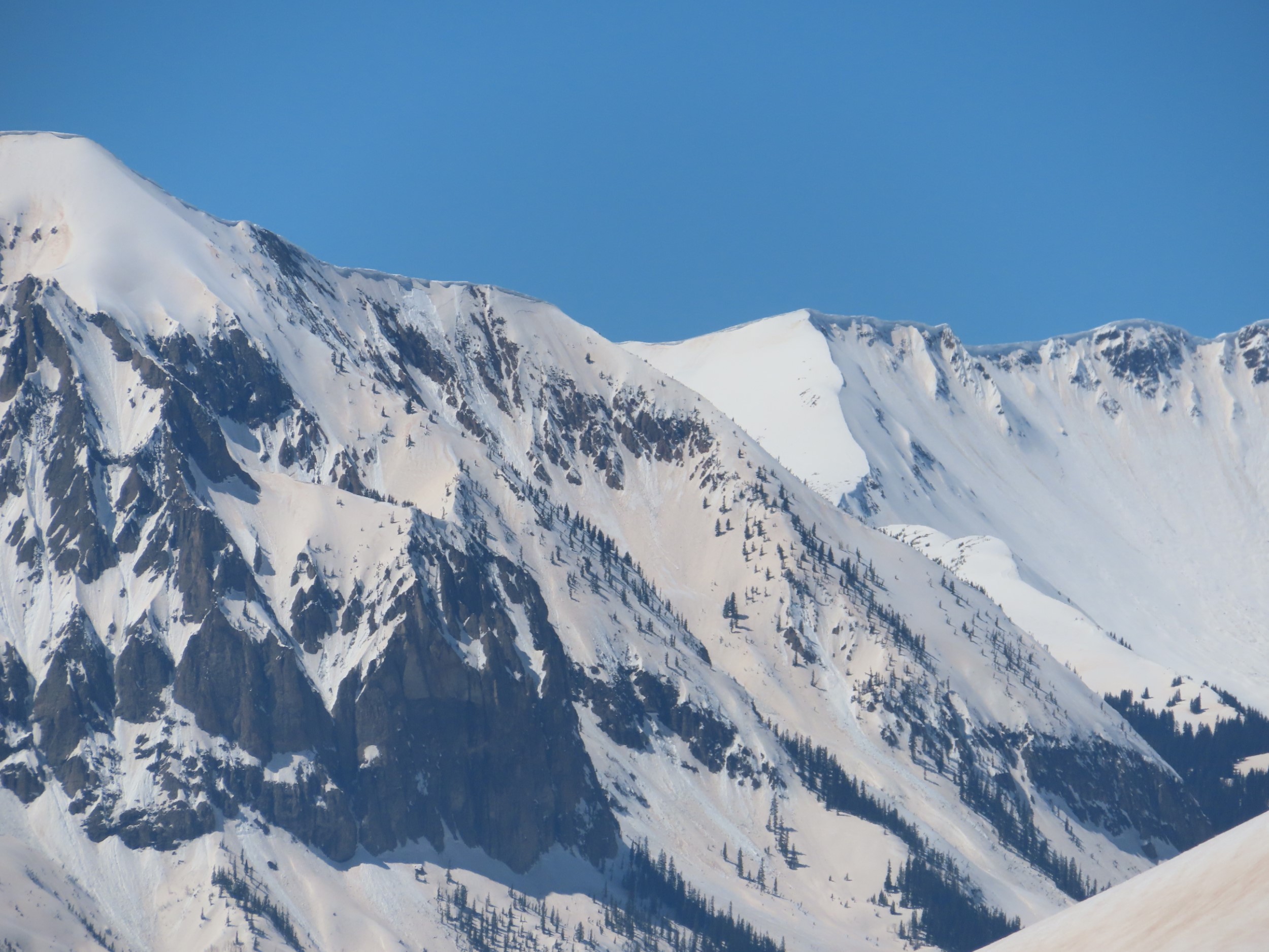
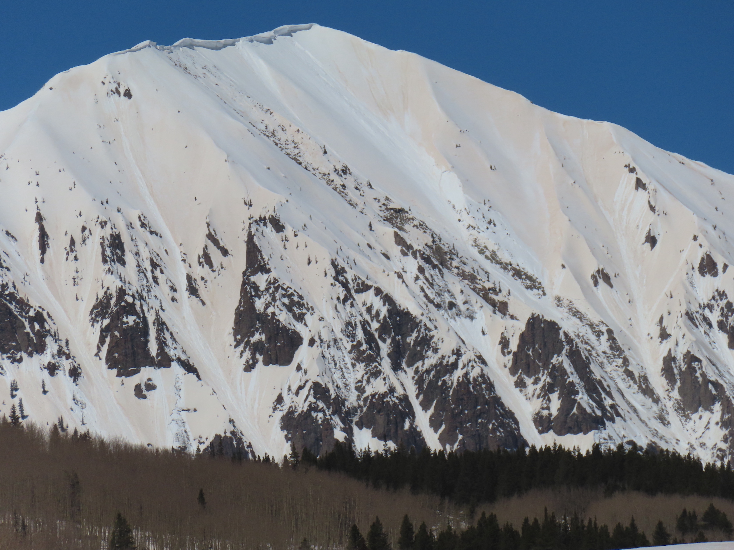
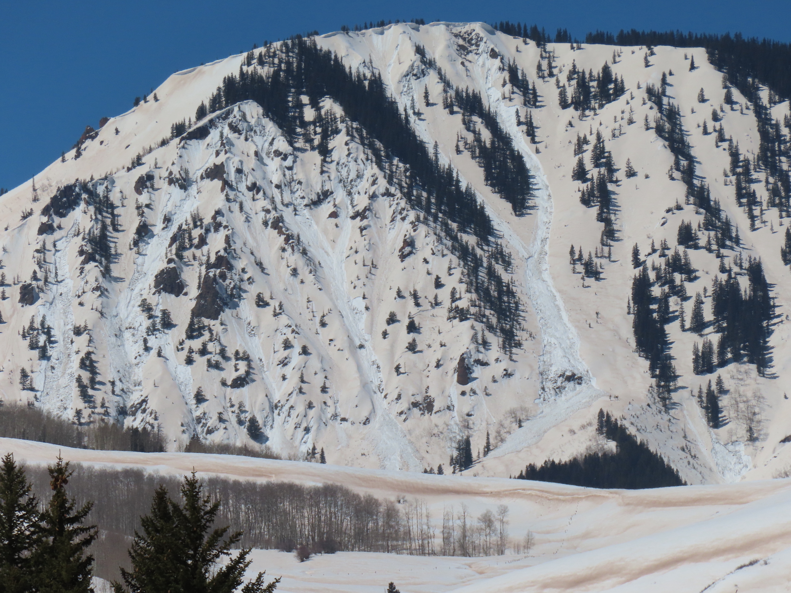
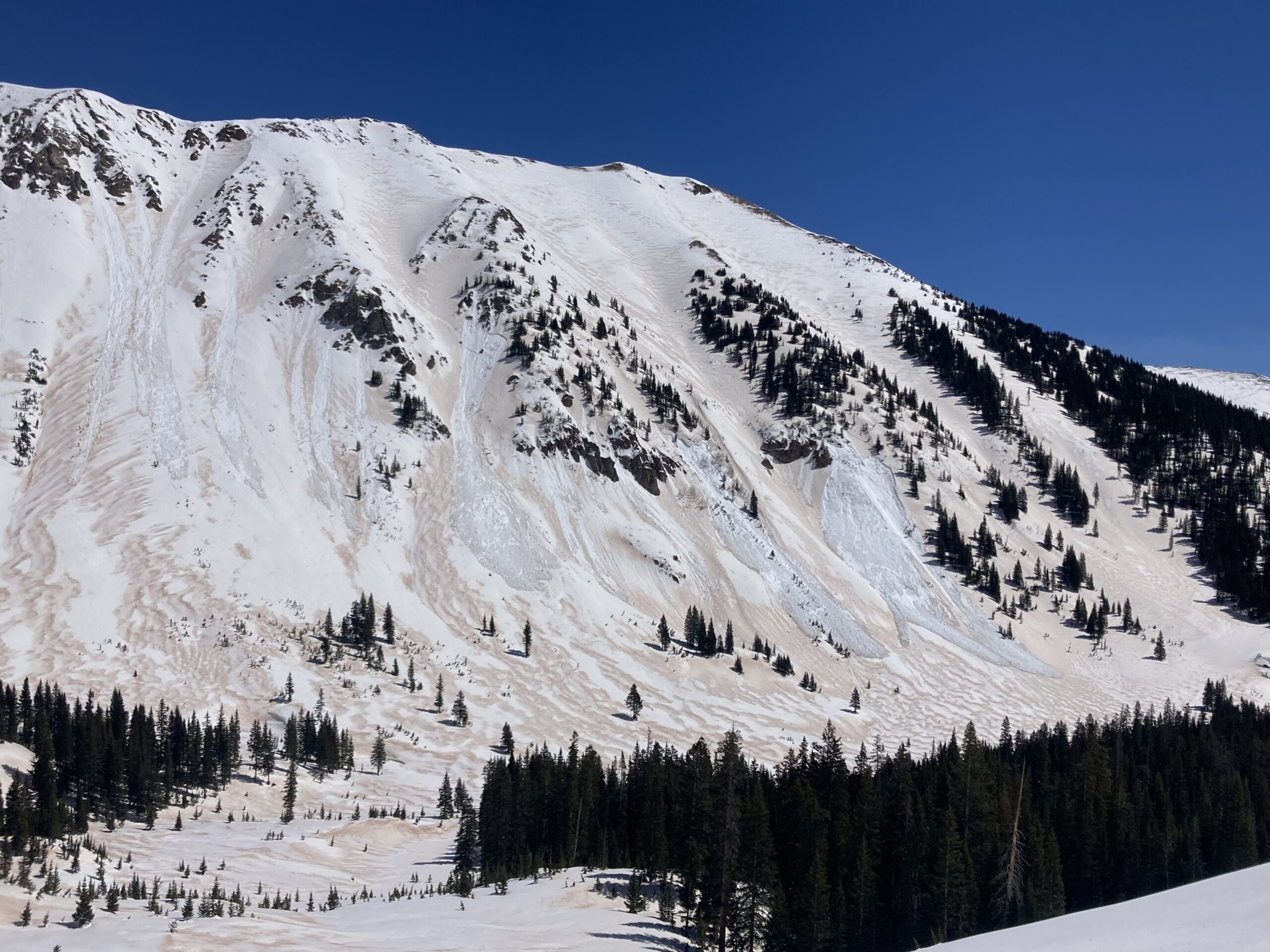
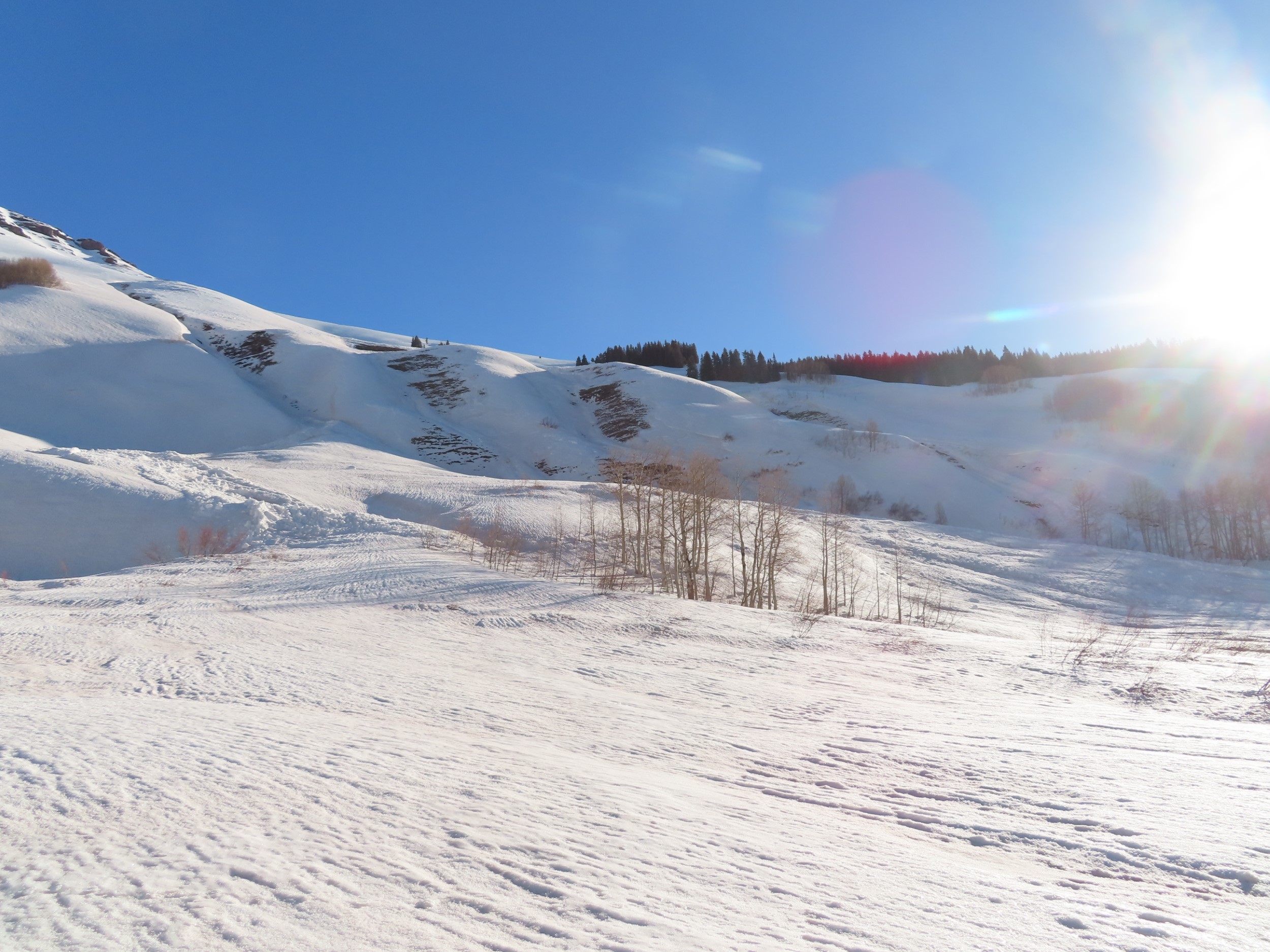
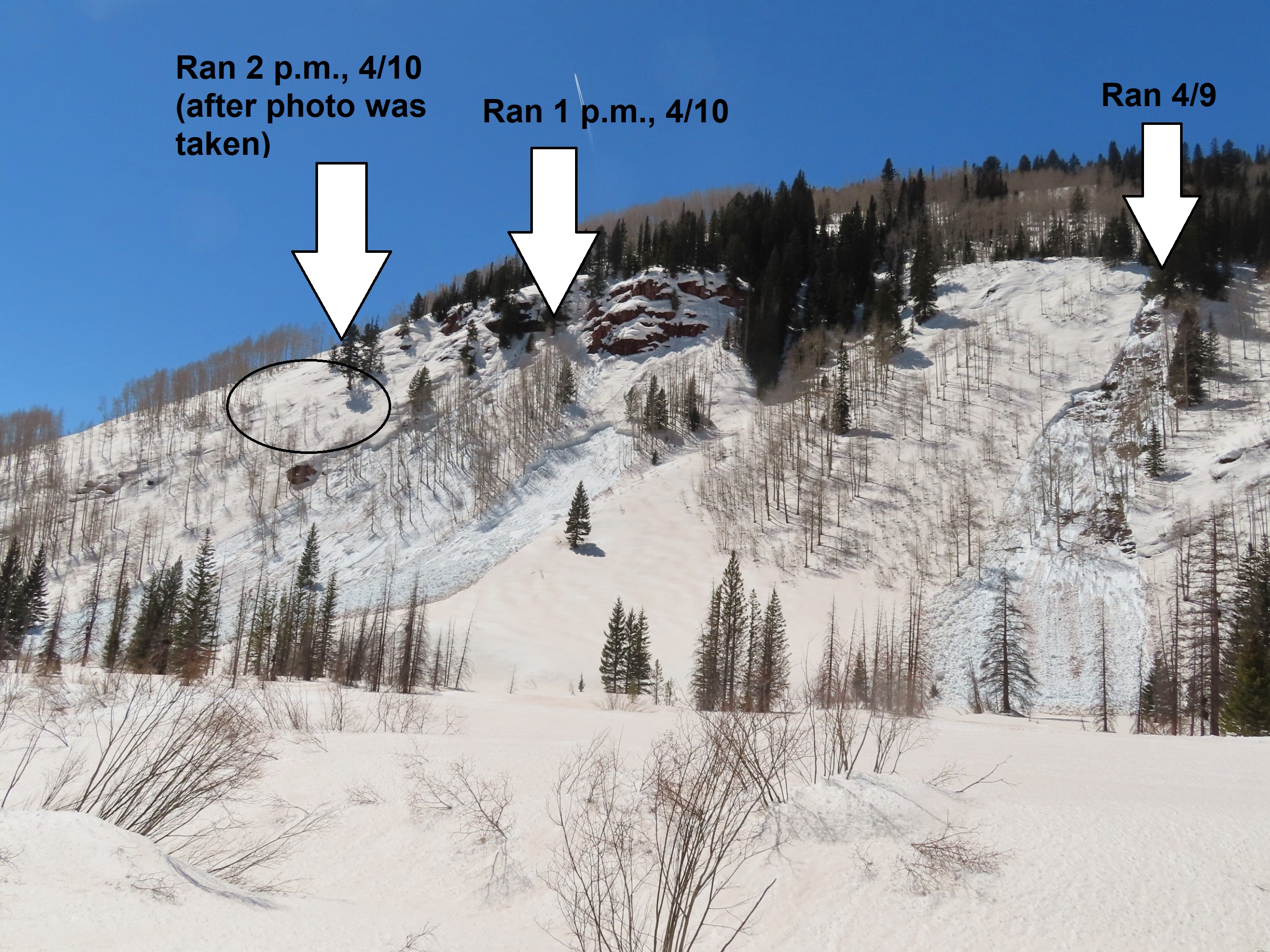
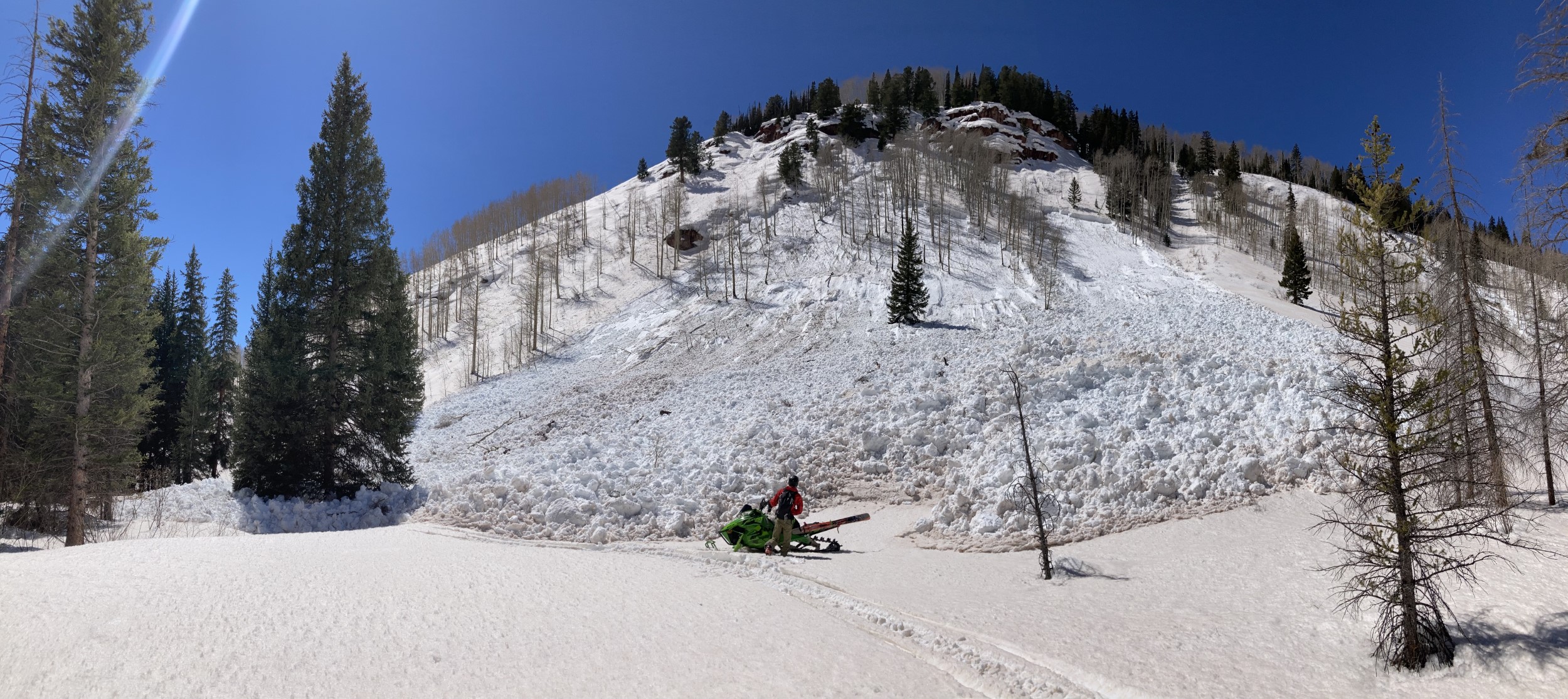
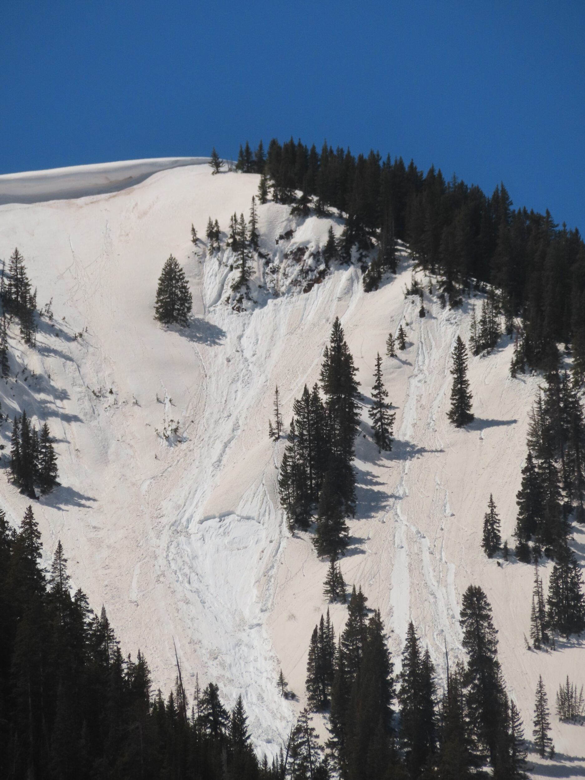
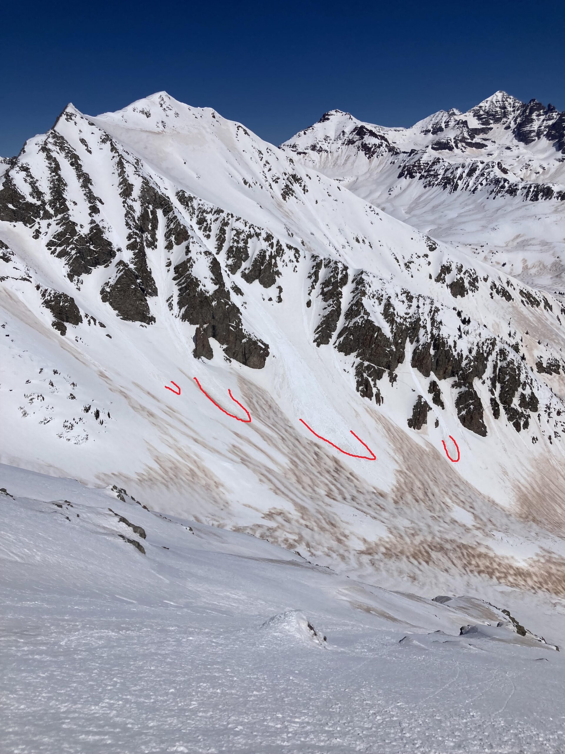
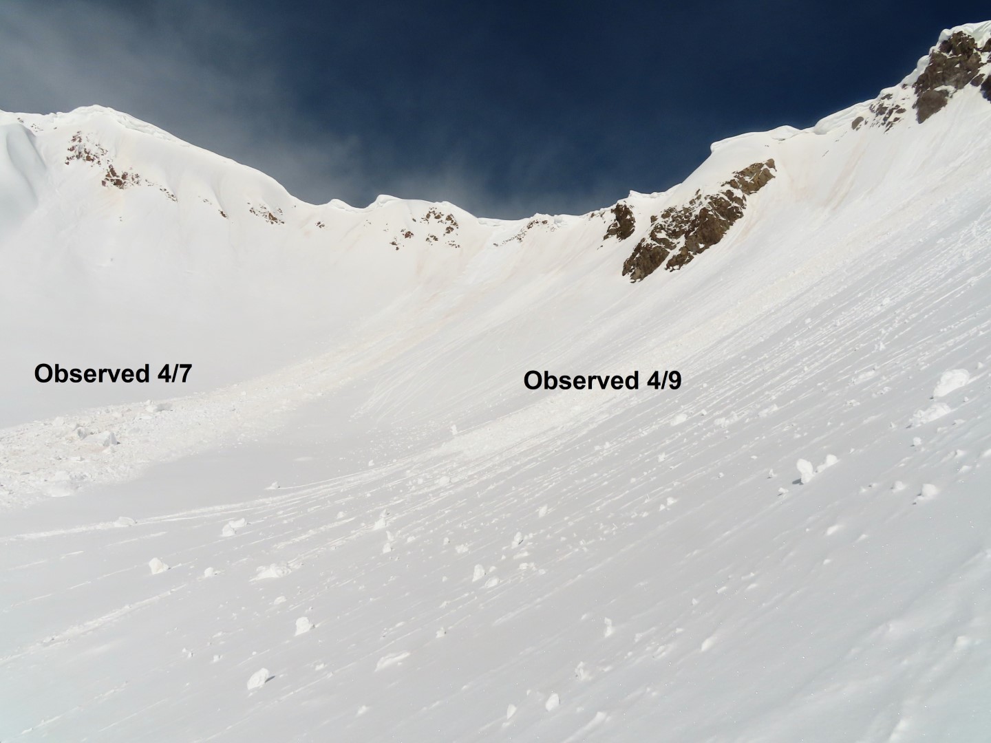
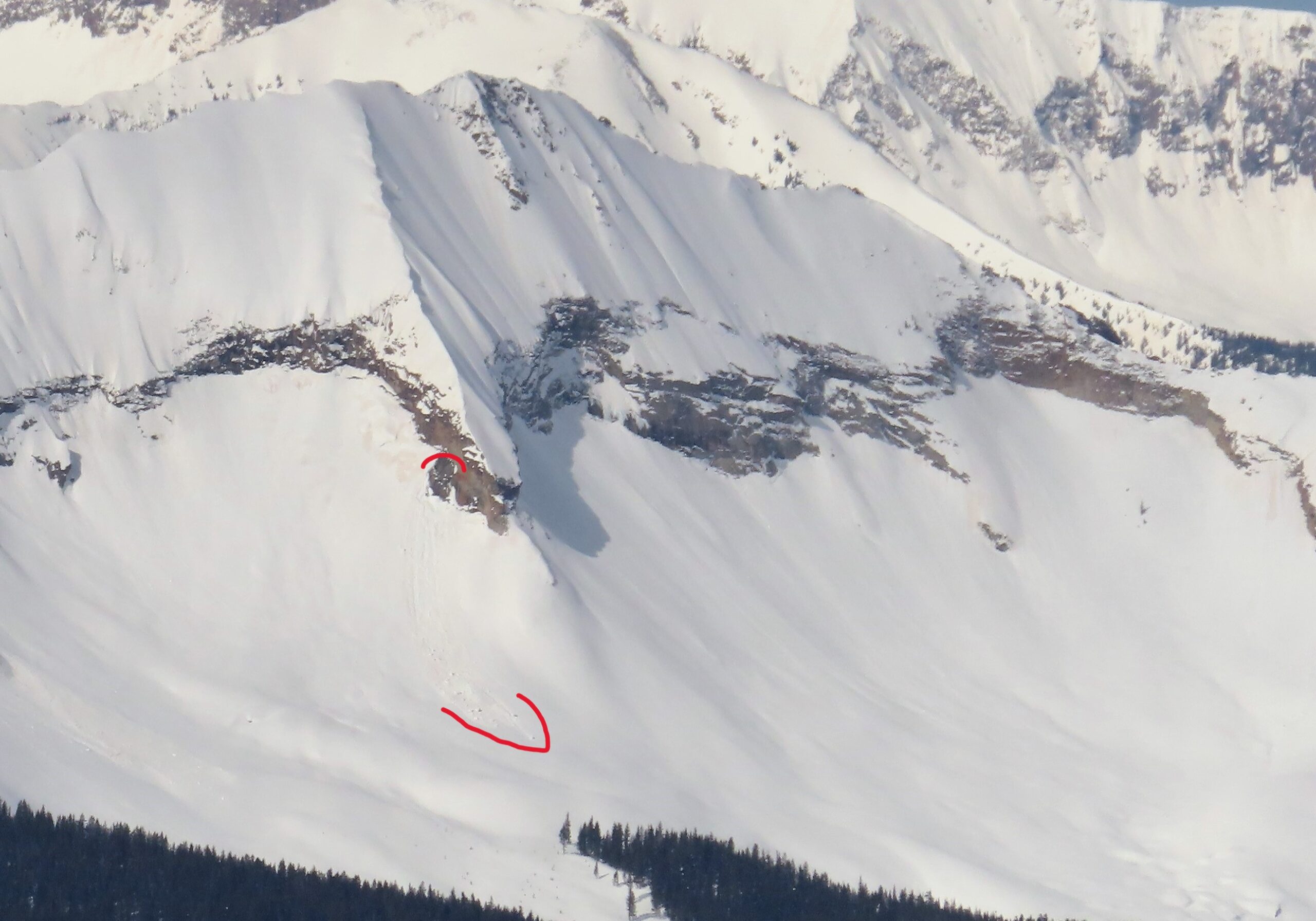
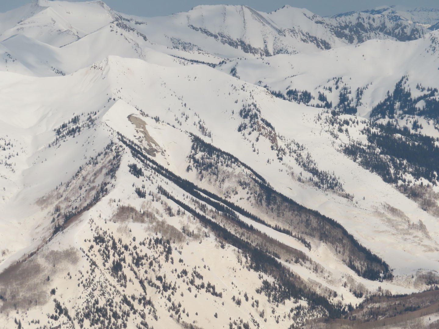
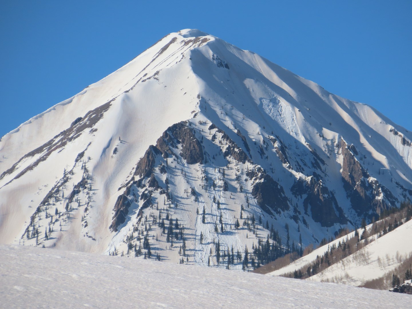
Avalanches: A few large wet slabs on Gothic ran today. A few large wet avalanches on Mt. CB ran yesterday evening.

Number of Avalanches: 2
Location
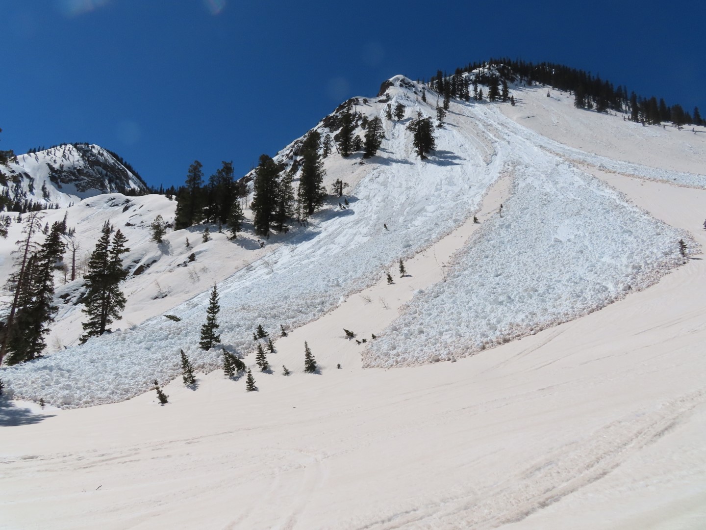
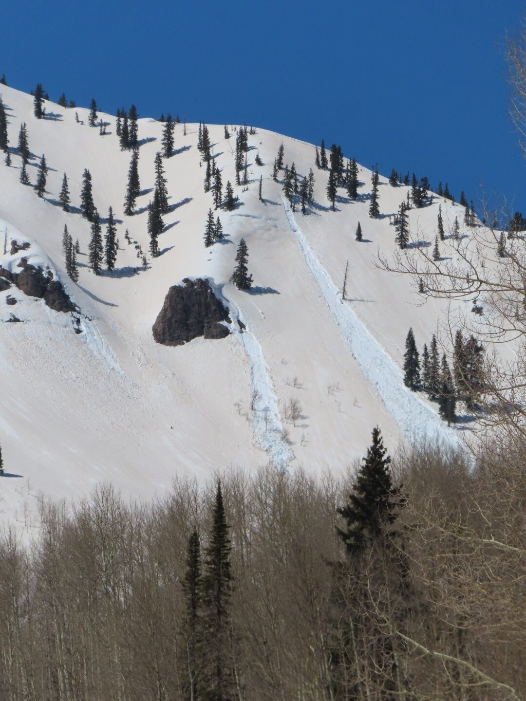
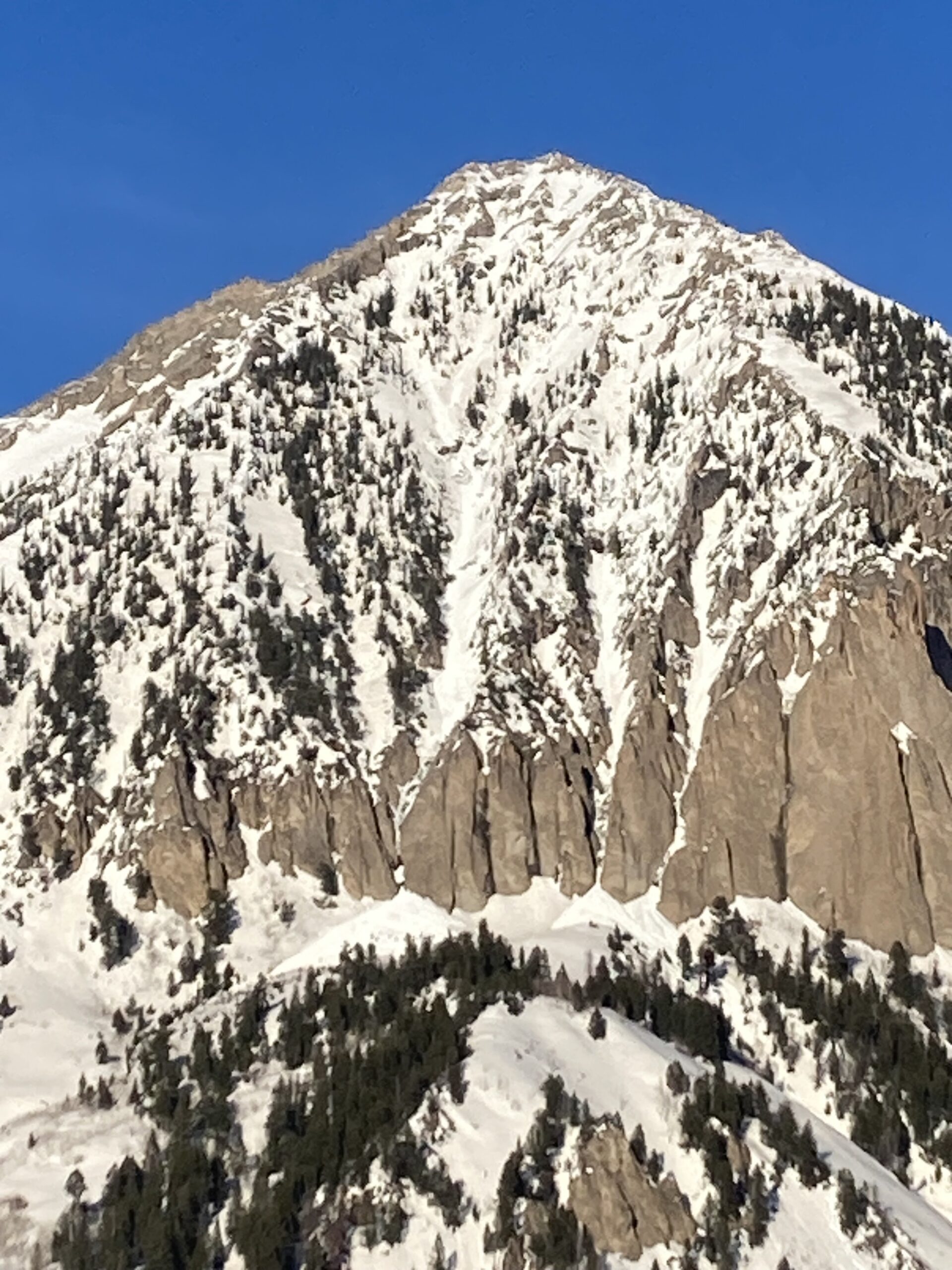
Location: Mount Crested Butte
Location Specific:
Start Zone Elevation: NTL: Near Tree Line
Aspect: S
Characteristics
Trigger: Natural
Trigger modifier:
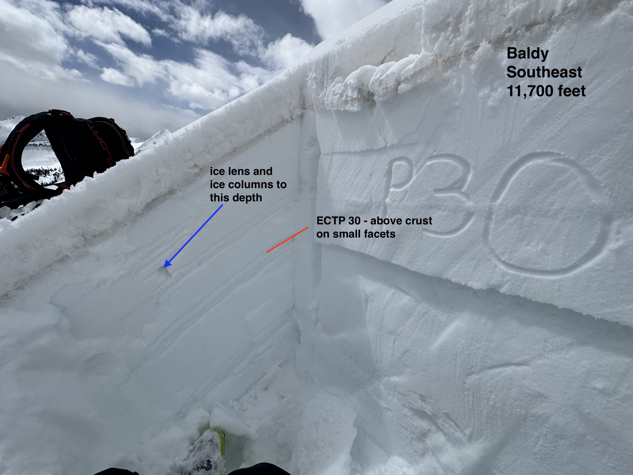
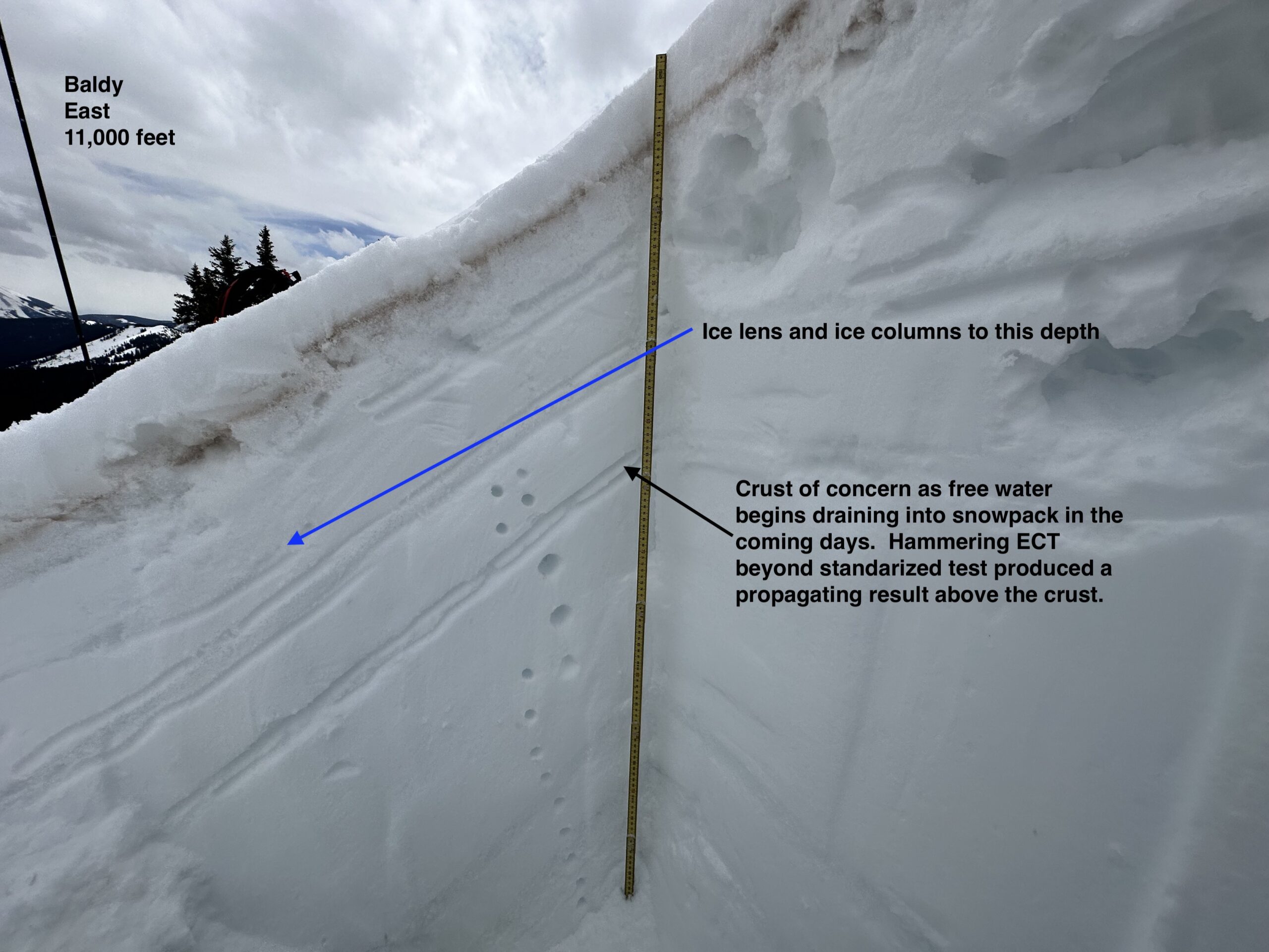
Type: Wet Slab
Failure Plane: Old snow
Size
Relative Size: R2 small
Destructive Size: D2 – could bury, injure, or kill a person
Avg. crown height (inches):
Avg. width (feet):
Avg. vertical run (feet):
Involvements
# of people caught:
# of partial burials:
# of full burials:
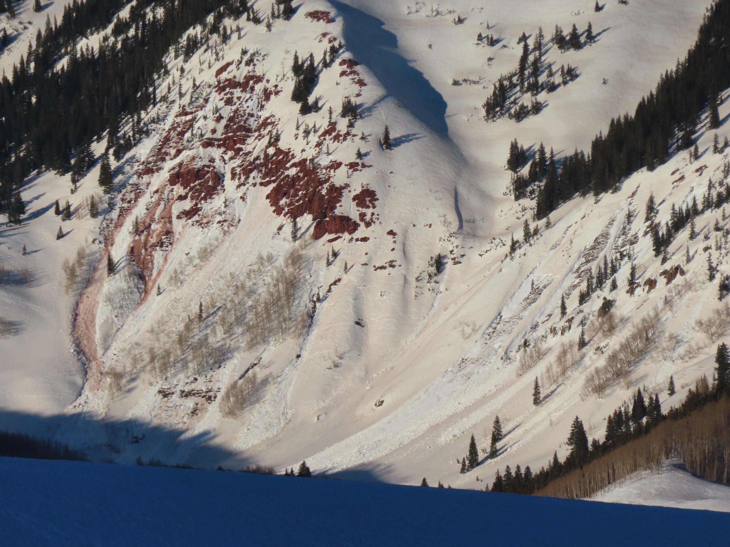
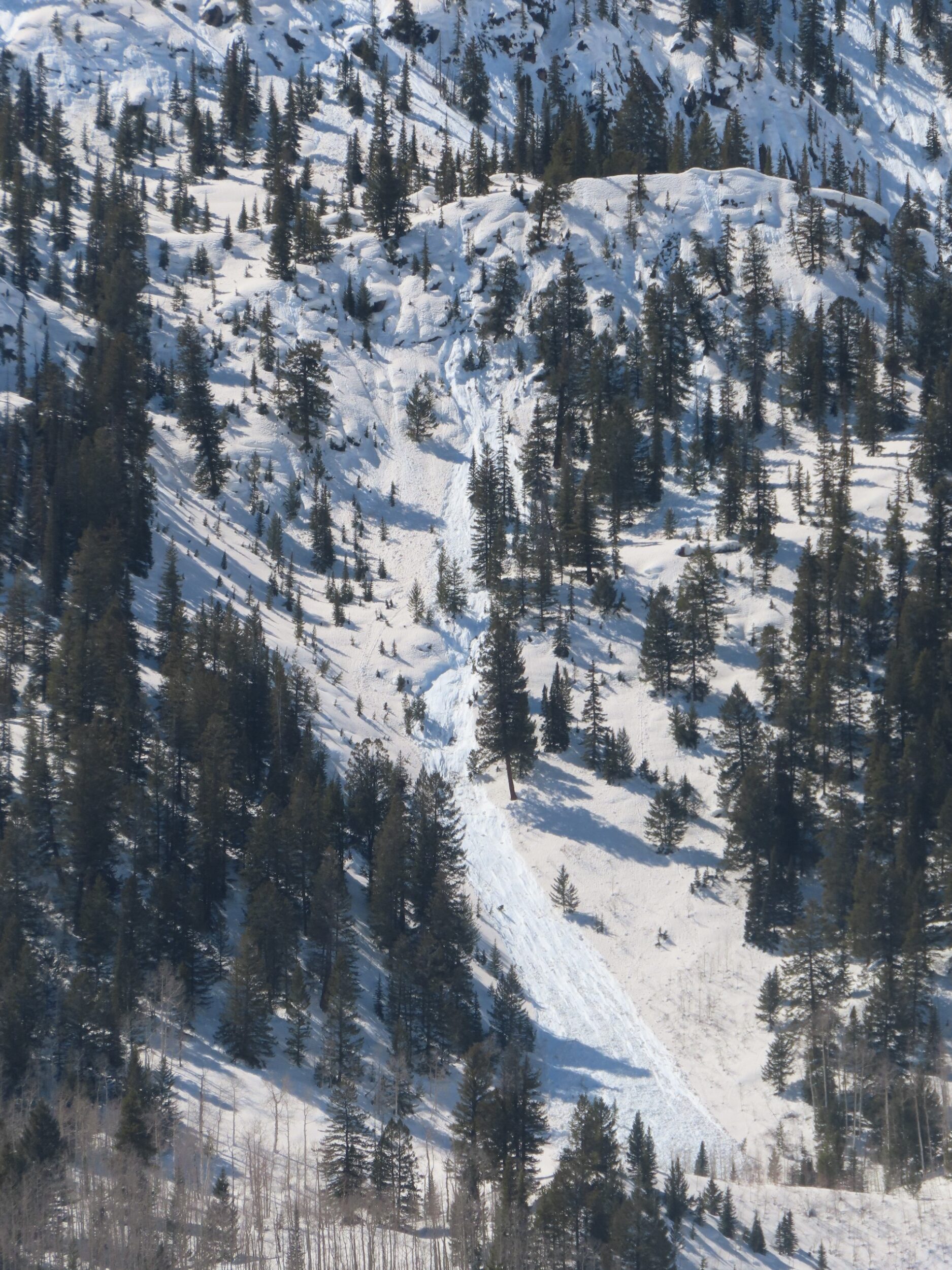
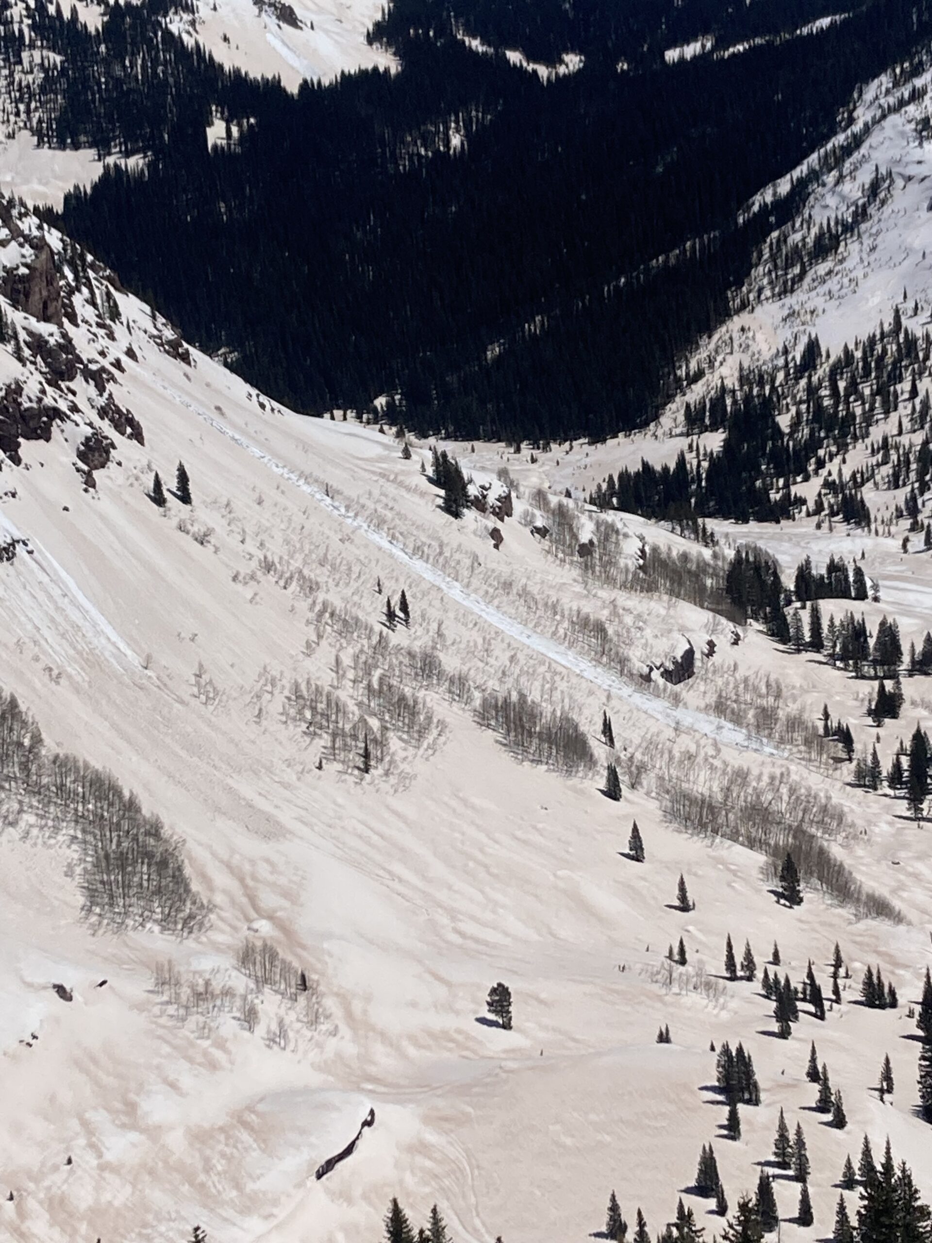
Additional comments: Lookers right of the Spoon
Number of Avalanches: 1
Location
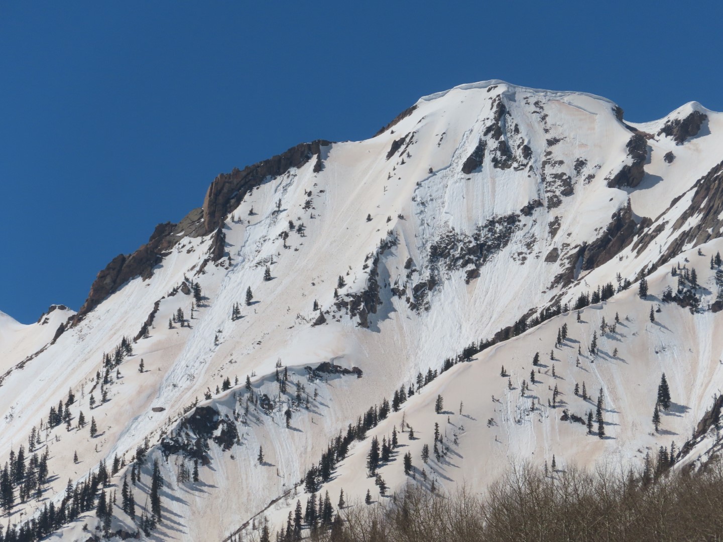
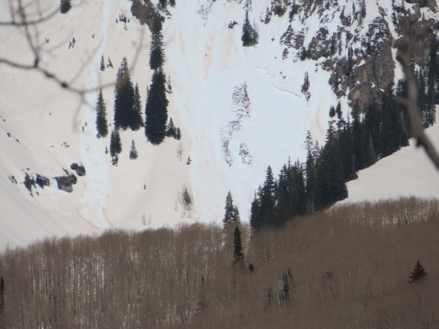
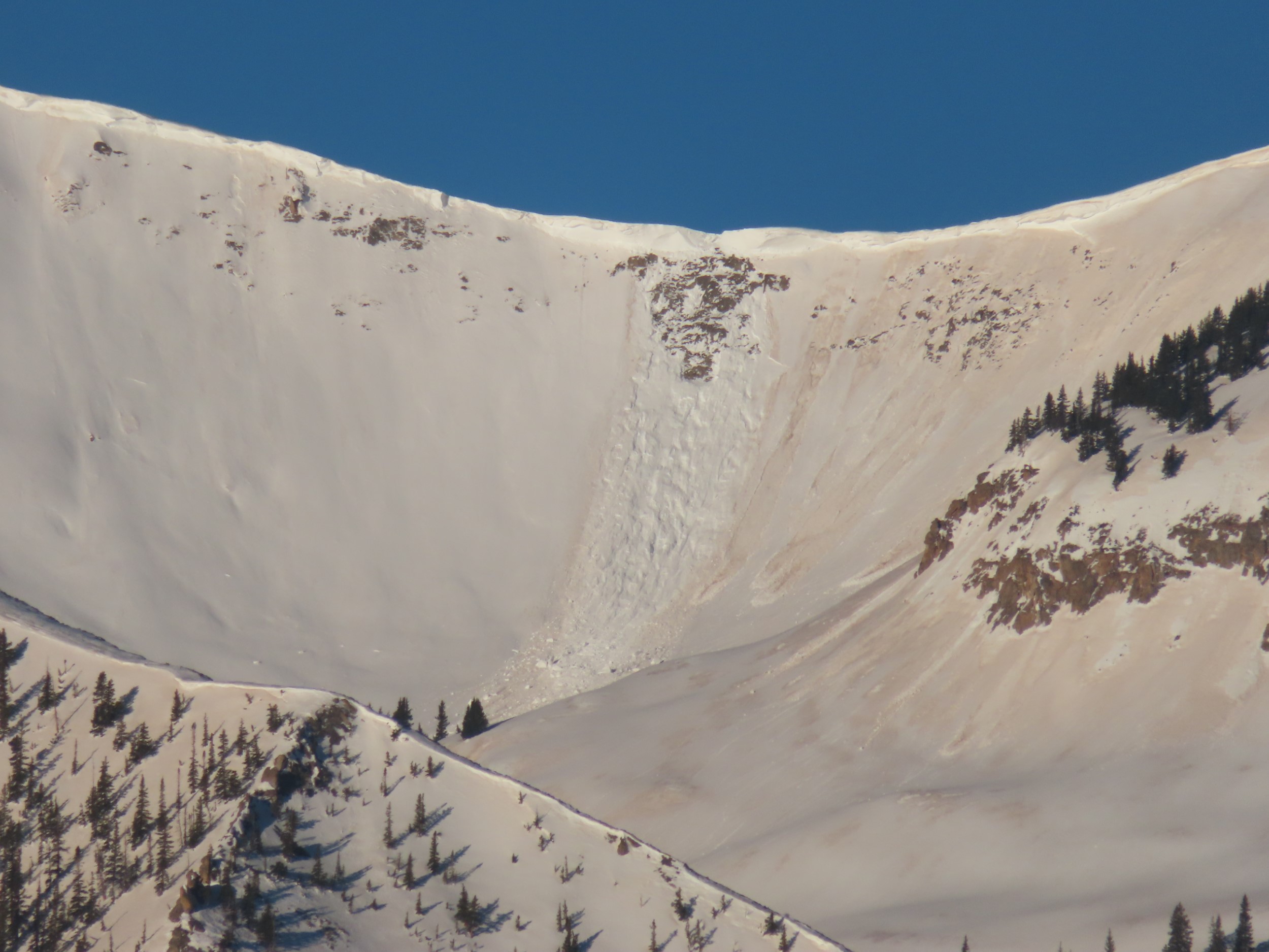
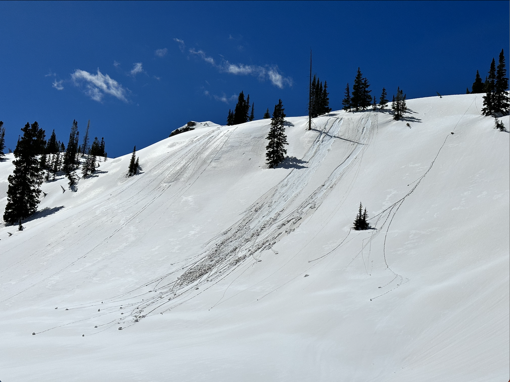
Location: Gothic Mountain
Location Specific:
Start Zone Elevation: ATL: Above Tree Line
Aspect: SE
Characteristics
Trigger: Natural
Trigger modifier:
Type: Wet Slab
Failure Plane: Old snow
Size
Relative Size: R2 small
Destructive Size: D2.5
Avg. crown height (inches):
Avg. width (feet):
Avg. vertical run (feet):
Involvements
# of people caught:
# of partial burials:
# of full burials:
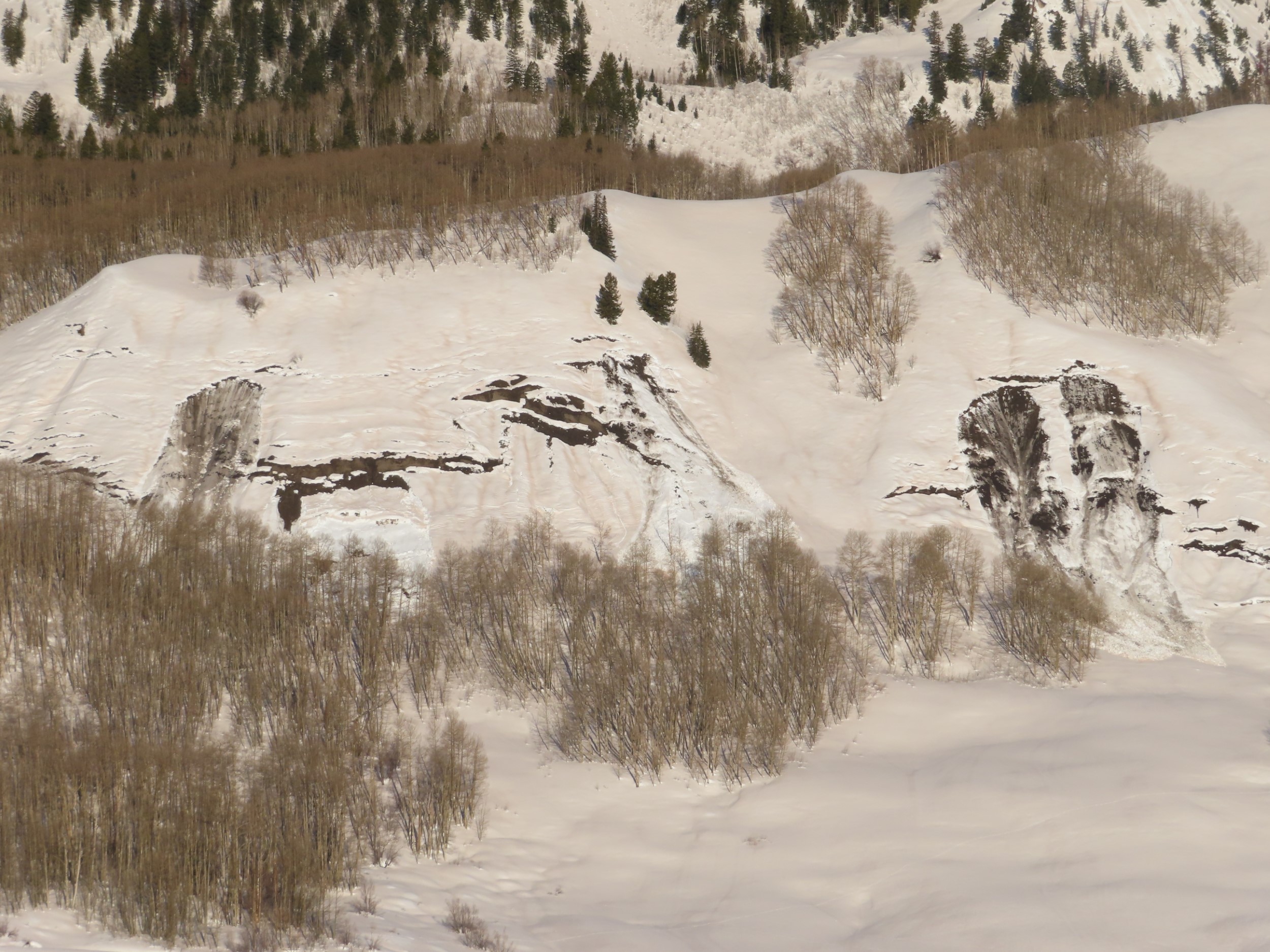
Additional comments: Spork. Couldn’t see runout, may be a D3 given large entrainment potential.
Number of Avalanches: 1
Location
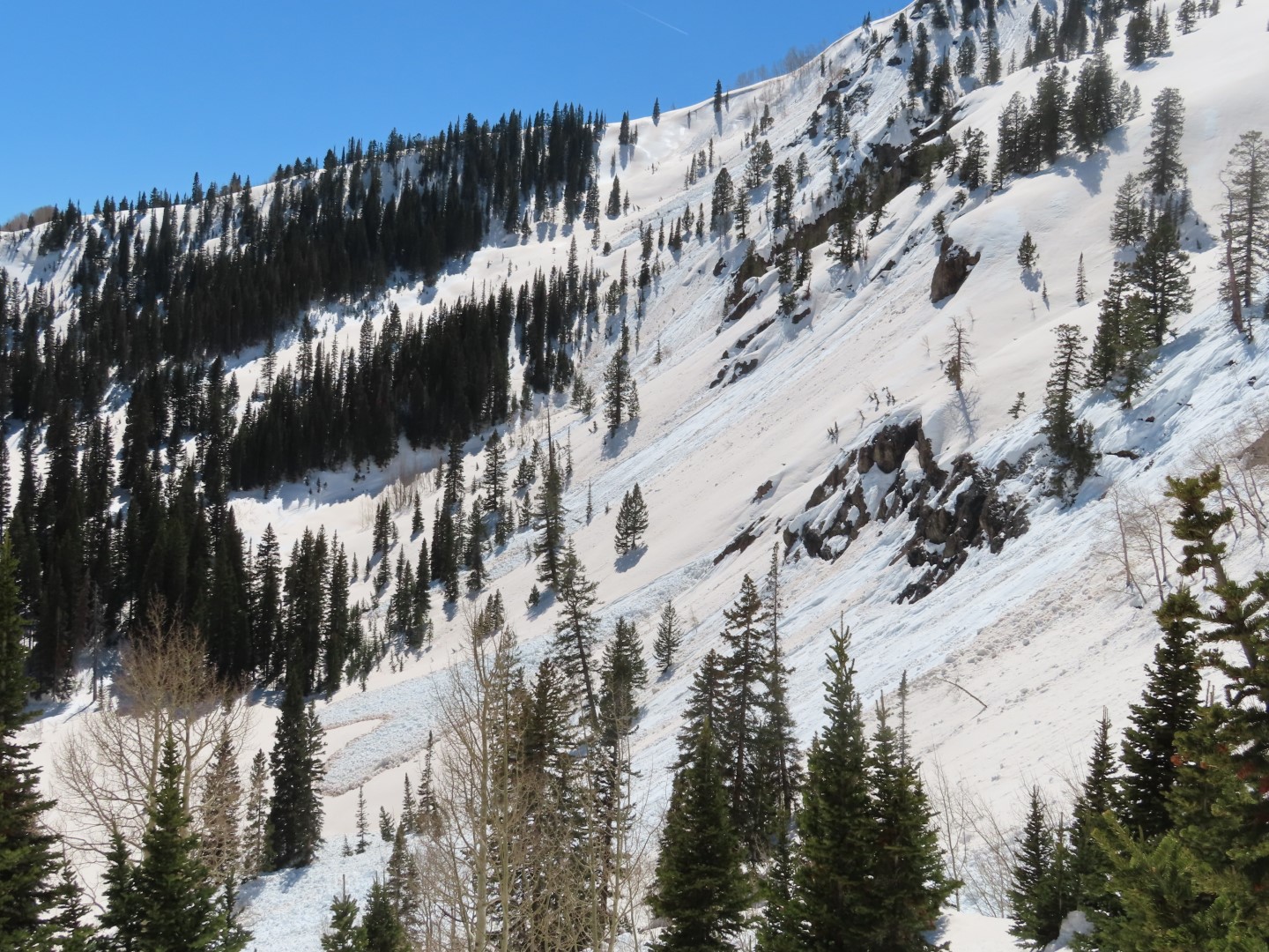
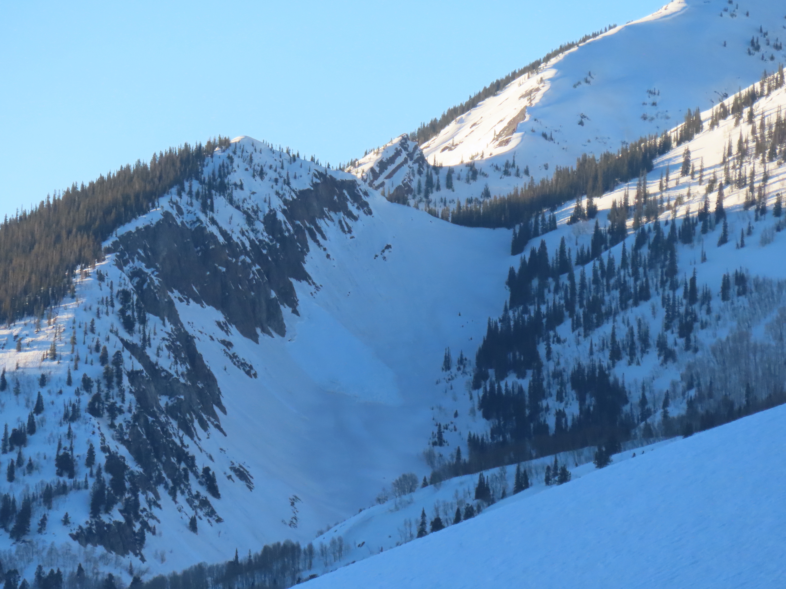
Location: Mount Crested Butte
Location Specific:
Start Zone Elevation: BTL: Below Tree Line
Aspect: W
Characteristics
Trigger: Natural
Trigger modifier:
Type: Wet Slab
Failure Plane:
Size
Relative Size: R2 small
Destructive Size: D2 – could bury, injure, or kill a person
Avg. crown height (inches):
Avg. width (feet):
Avg. vertical run (feet):
Involvements
# of people caught:
# of partial burials:
# of full burials:
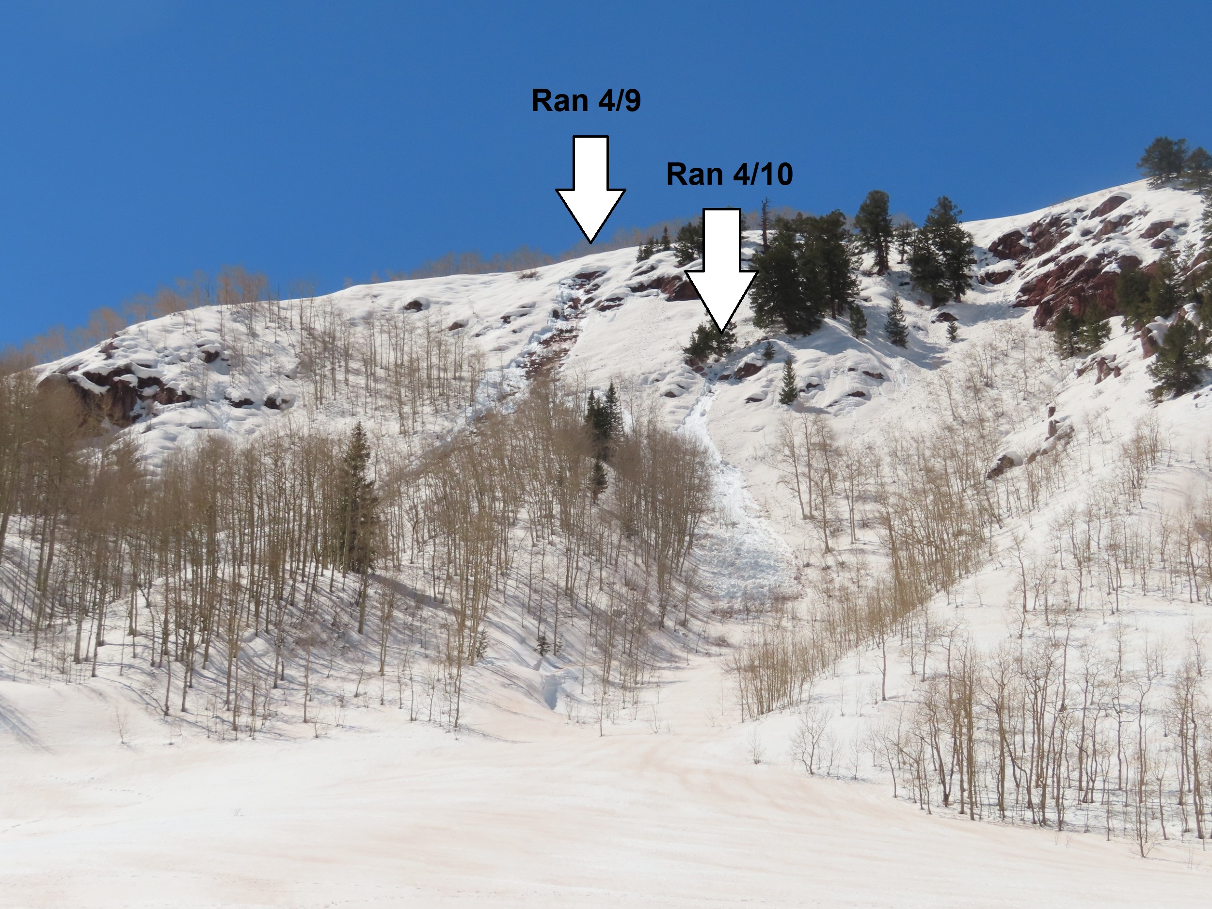
Additional comments: Below T1
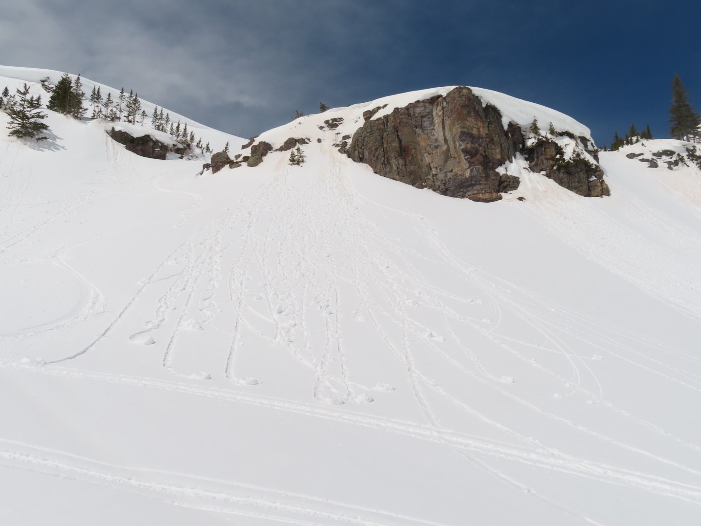
Number of Avalanches: 1
Location
Location: Mount Crested Butte
Location Specific:
Start Zone Elevation: NTL: Near Tree Line
Aspect: W
Characteristics
Trigger: Natural
Trigger modifier:
Type: Wet Loose
Failure Plane: Old snow
Size
Relative Size: R2 small
Destructive Size: D2 – could bury, injure, or kill a person
Avg. crown height (inches):
Avg. width (feet):
Avg. vertical run (feet):
Involvements
# of people caught:
# of partial burials:
# of full burials:
Additional comments: T2
Number of Avalanches: 1
Location
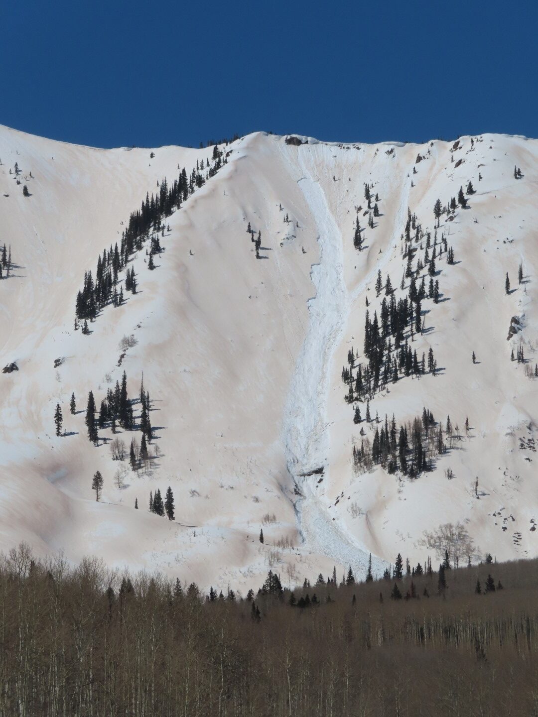
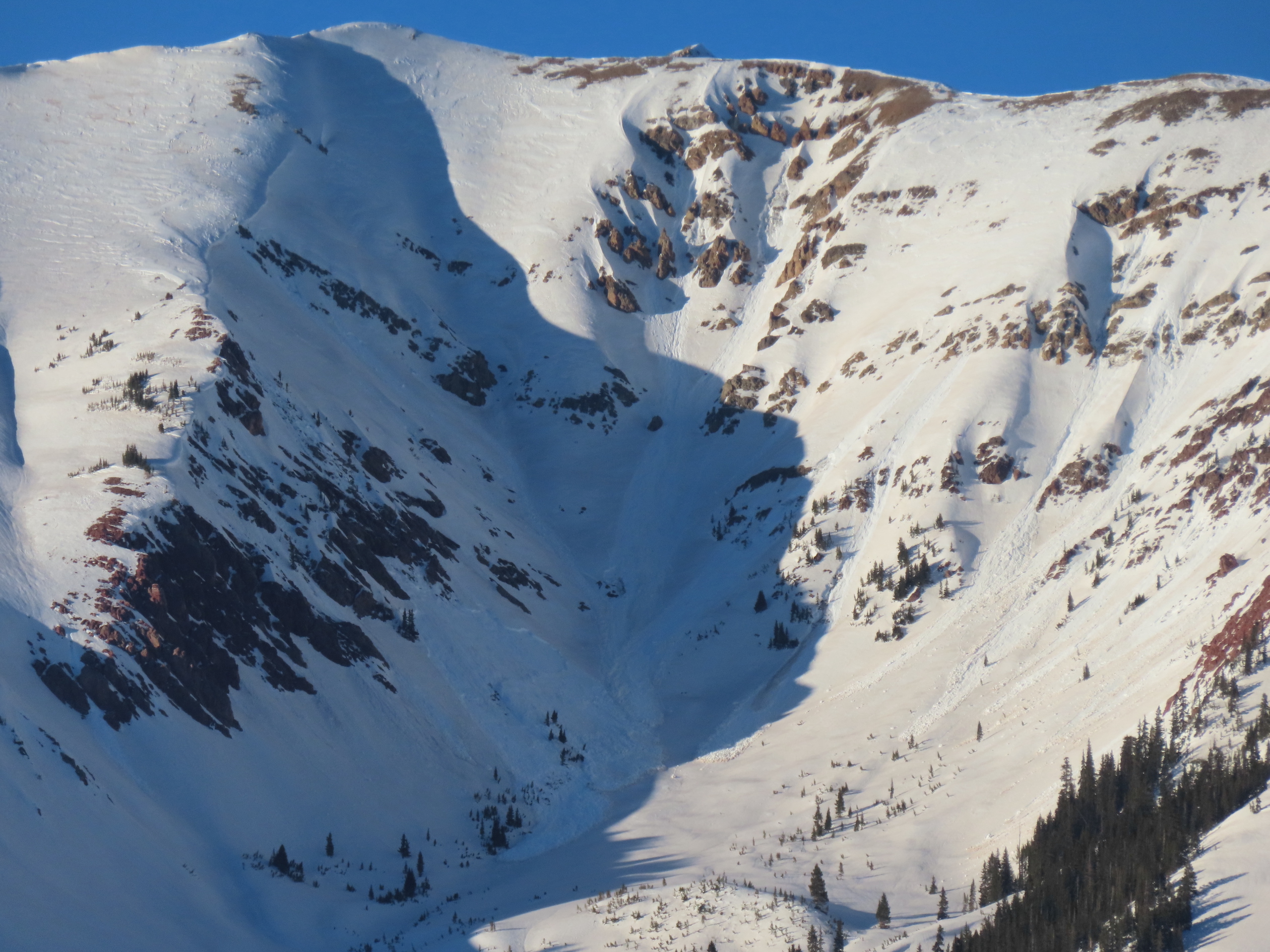
Location: Gothic Mountain
Location Specific:
Start Zone Elevation: NTL: Near Tree Line
Aspect: S
Characteristics
Trigger: Natural
Trigger modifier:
Type: Wet Loose
Failure Plane:
Size
Relative Size: R2 small
Destructive Size: D2 – could bury, injure, or kill a person
Avg. crown height (inches):
Avg. width (feet):
Avg. vertical run (feet):
Involvements
# of people caught:
# of partial burials:
# of full burials:
Additional comments: Lookers right of Spoon.