LOCATION: Crested Butte Area
DATE OF OBSERVATION: 02/23/2015
NAME: Zach Guy
SUBJECT: Natural and skier triggered avalanches in Slate River Basin
ASPECT: North, North East, East, South
ELEVATION: 9,000 -11,400 ft.
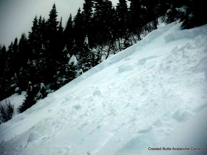
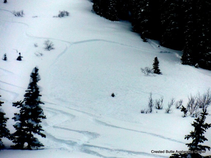
AVALANCHES: Observed ~10 natural soft slab avalanches failing on the storm interface (near surface facets) mostly below treeline and a few near treeline slopes on North and Northeast aspects. Slabs were generally 40 to 150 feet wide, 12″-16″ deep, and ran a couple hundred vertical, not large enough to bury someone. Observed slides in Schuykill Ridge, Climax Chutes, Happy Chutes, and Peeler Basin. (SS-N-R1-D1-I). One exception was a wider and longer running slide on Schuykill Ridge, maybe 300-400 feet wide and ran 1,000 vertical, D2 in size.
We skier triggered about 15 similar slides, all BTL on N/NE aspects on Schuykill Ridge. D1 in size on relatively small terrain features. Slides behaved like storm slabs in that they didn’t propagate beyond the steep rollovers and wouldn’t trigger remotely.
WEATHER: Overcast to broken skies. Calm winds. Very light snowfall (S-1) tapered by 10:00 a.m. Mild temperatures.
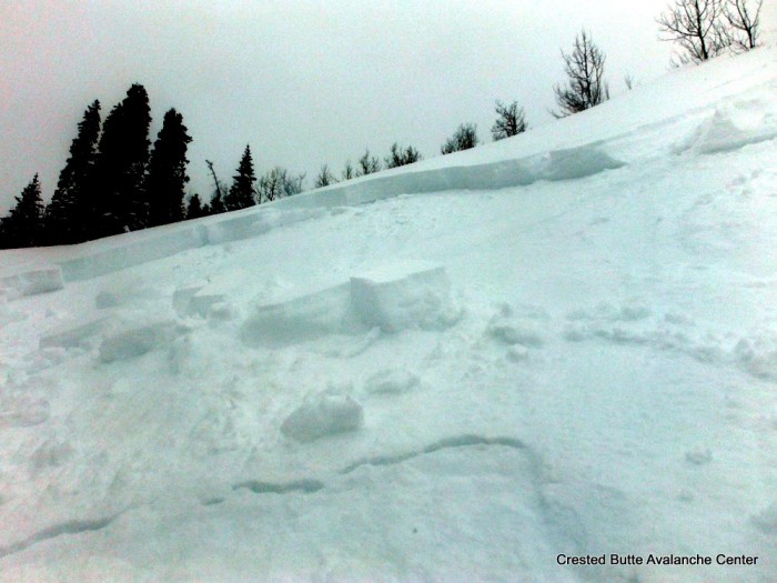
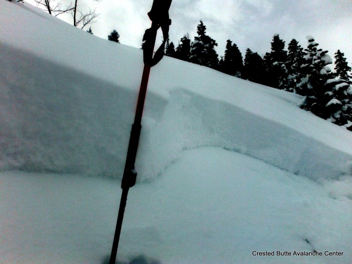
SNOWPACK: 12″ to 16″ of fist hard storm snow, zero wind affect. Formed a soft slab over widespread near surface facets on N/NE, thin crust over facets on E, and thick crust on S. Storm snow was very reactive anywhere that it was on near surface facets. Widespread shooting cracks up to 100 feet, some collapsing, and anything over 36 or 37 degrees was almost a sure bet it would slide. No signs of instability on south aspects and got one collapse on an east aspect, under the thin crust. Below the storm slab, the snowpack was faceted throughout, and didn’t feel persistent slab structure, even near ridgetop. However, we didn’t poke around under the large, windloaded start zones that are likely to be holding stronger mid or upper pack.
UPLOADS:
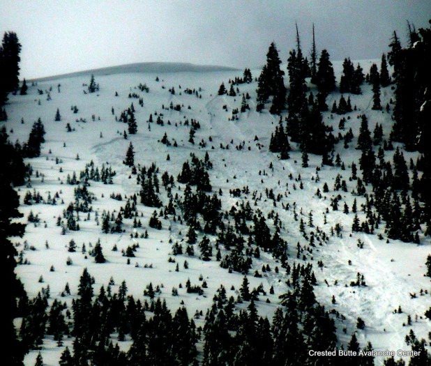
Schuykill Ridge. NE aspect SS-N-R1-D1-I
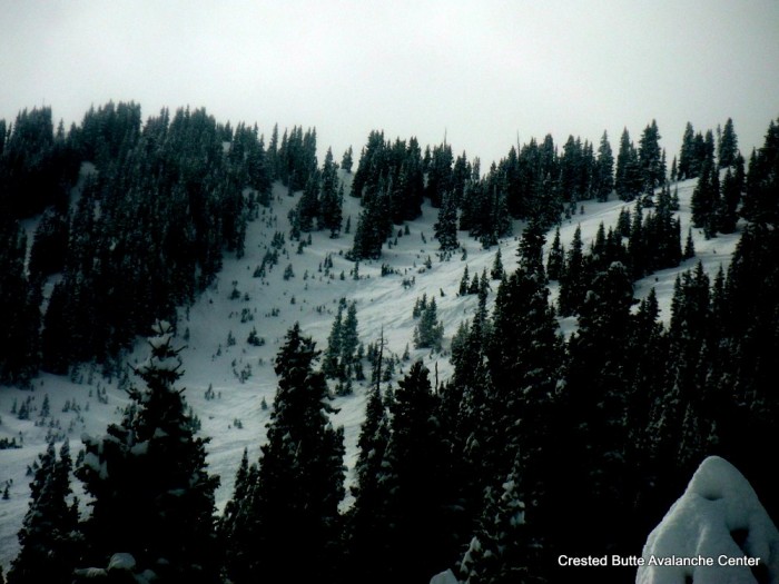
Schuykill Ridge, NE aspect. SS-N-R2-D2-I
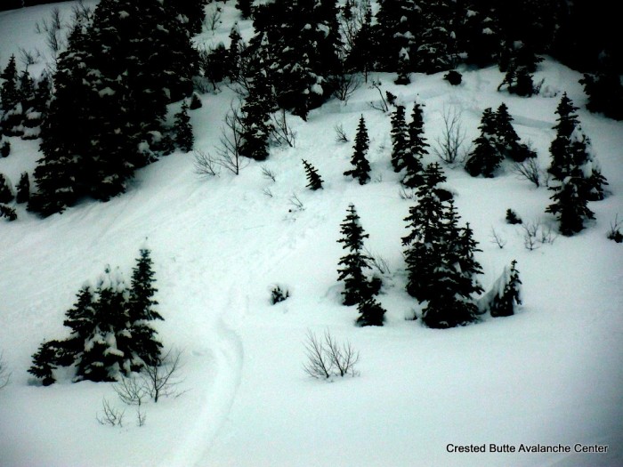
Skier triggered soft slab. Schuykill Ridge. N or NE aspect BTL
Skier triggered soft slab. Schuykill Ridge. N or NE aspect BTL
Skier triggered soft slab. Schuykill Ridge. N or NE aspect BTL
Skier triggered soft slab. Schuykill Ridge. N or NE aspect BTL
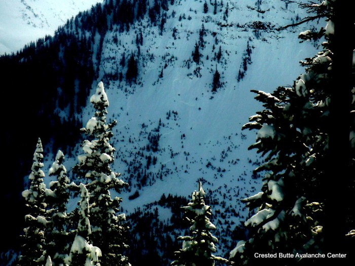
Natural soft slabs on Peeler Peak. SS-N-R1-D1-I
Skier triggered soft slab. Schuykill Ridge. NE aspect BTL


