Date of Observation: 12/02/2016
Name: Evan Ross/Ian Havlic
Aspect: North, East, South, West
Elevation: 11,200
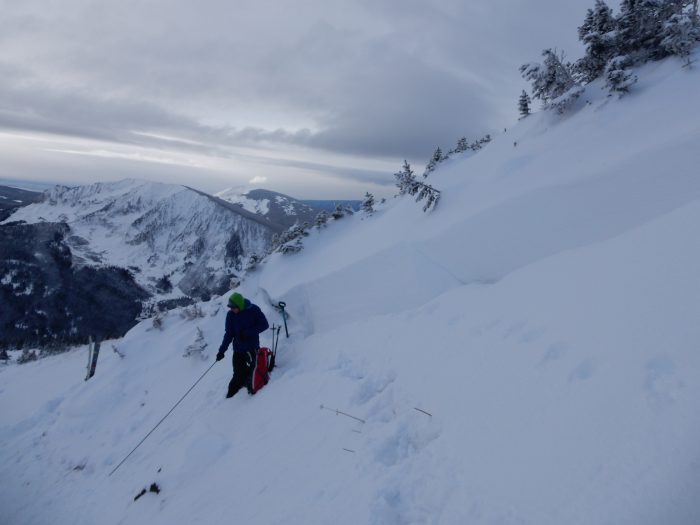
Avalanches:
Weather: Obscured and overcast sky. Snowfall rates were mostly in the S-1 to S1 range, but rates picked up for an hour here and there to around S2. Calm winds with no new drifting snow observed.
Snowpack: In general, the Thanksgiving Storm and following large storm around 11/26 were creating a nice looking homogeneous snowpack. Any layers of concern or potential layers of concern were near the ground, having formed during the shallow or non-existent snowpack before Thanksgiving. No obvious signs to instability while traveling through east to south to southwest facing slopes. Ski Pen around 25cm.
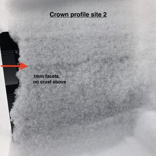
Dipped into the top of one north facing slope at 11,200ft. Nothing new, HS 130, progressively harder snowpack with depth (F to 4F+) over about 18cm of dry, large facets. The ground cover at the base of the snow pit wasn’t perfectly planner and had some variation in depth due to rock outcrops. Though thats probably representative of the ground cover across the terrain. ECTP 22 SC, ECTN.
East facing 34 degree slope at 11,200ft. HS 140. Same structure as above with the basal facet layer at about 10cm thick, 4F- hard, and both smaller and moist then on the north facing observation.