Mountain Weather for 11,000ft March 12th, 2018

CB Avalanche CenterWeather

Date: 03/12/2018

Looks like we have a beautiful day coming up, with a very weak disturbance passing this afternoon. Look for some clouds to build in the afternoon and westerly winds to pick up a little. Otherwise, winds have been light and variable and conditions generally mild. A High-pressure ridge will take hold after this little disturbance and keep the area high and dry until the midweek. Tuesday will really be a lovely spring day if you can make it out. The long range forecast has a big low-pressure system churning around out in the Pacific. What we don’t know about this big low-pressure system is what it will look like when it eventually moves inland, and how it will track across the US. What we do know about it, is that it will spin off waves of moisture before it moves inland. The first wave of moisture looks to bring increasing clouds Wednesday afternoon/evening and maybe a little snow.

  • Today

    High Temperature: 36
    Winds/Direction: 5 to 15, West
    Sky Cover: Increasing clouds
    Irwin Snow: 0
    Elkton Snow: 0
    Friend’s Hut Snow: 0

  • Tonight

    Low Temperature: 20
    Winds/Direction: 0 to 10, variable
    Sky Cover: Increasing clouds
    Irwin Snow: 0 to 1
    Elkton Snow: 0 to 1
    Friend’s Hut Snow: 0 to 1

  • Tomorrow

    High Temperature: 38
    Winds/Direction: 0 to 10, variable
    Sky Cover: Clear
    Irwin Snow: 0
    Elkton Snow: 0
    Friend’s Hut Snow: 0

two great day w/ the Choice Pass program

CB Avalanche Center2017-18 Observations

Location: Crested Butte Area
Date of Observation: 03/11/2018
Name: Ben Pritchett

Subject: two great days w/ the Choice Pass program, Snodgrass and Mt. Emmons

Weather: High thin clouds slowed warm up Saturday and Sunday, but it’s happening. Temps eeking above freezing at 11,000′, but crushing into the 40’s in the valley floors.
Snowpack: Definitely a line in the snow out there. Dry or wet.
At around due east or just north of east if the terrain is steeper, you can still find dry snow so long as the sun hasn’t kissed it. Shade is key right now for any hope of dry snow. Even lower-angled northerly terrain that doesn’t have a blocking ridge above is getting kissed and crusted. Snow surfaces on these shady aspects are gaining strength, though the weak layers below just don’t have enough overburden to change much at all. Surprisingly the depth hoar is still 4-Finger stiff and the grains are still crisp and sharp-edged. The weak layer structure is clearly not very different from a week ago, though the slabs are stiffening and clearly stubborn to human triggering. You still won’t find me center-punching 40+ degree near treeline right now, unfortunately. I’d like to see the weak layers get stronger / stiffer before really laying it out there.
On the other side of the line, snow surfaces on steep south aspects wetted Sunday up to near treeline. Below 11,000′ we found mud, dust, areas with 20-60cm of isothermal (wet all the way through) mush, and remnant dry snow – essentially very mixed bag and few continuous patches of dry weak layers remain between southeast and west below 11,000′. But above there, it’s still a dry snowpack even on the sunny side, though that dry snowpack is topped with a few cm of melt forms or crust depending on the time of day. Weak layers below still haven’t changed under the influence of water yet.
Only in very thin, and steep spots could I find water percolating more than 5-10cm from the surface, in most places the free water is still held in the top 5cm above 11,000′.

Mountain Weather for 11,000ft March 11th, 2018

CB Avalanche CenterWeather

Date: 03/11/2018

We’re back to hanging out on the line. On one side of the line, we’ll be swallowed by clouds and the other side of the line we’ll be on the clear sky side. Where will we end up today, I’m a little uncertain and afraid we could get swallowed. A weak disturbance is pushing moisture into Southern Colorado today bringing the chance for a little snow, but mostly clouds. Eventually, that moisture and other clouds upstream will push up and through our area but the timing for that looks to be later this afternoon and into tonight. We’re not looking at snow during this time, just clouds. Ooo fun. On Tuesday a high-pressure ridge slides back over the area as we look at a high and dry week. Spring baby. Just about the time we’re all fried out, there is a big low-pressure system a brewing out there in the Pacific for the uncertain long-range forecast.

  • Today

    High Temperature: 35
    Winds/Direction: 0 to 10, variable
    Sky Cover: Increasing clouds
    Irwin Snow: 0
    Elkton Snow: 0
    Friend’s Hut Snow: 0

  • Tonight

    Low Temperature: 20
    Winds/Direction: 0 to 10, variable
    Sky Cover: Partly Cloudy
    Irwin Snow: 0
    Elkton Snow: 0
    Friend’s Hut Snow: 0

  • Tomorrow

    High Temperature: 36
    Winds/Direction: 5 to 15, West
    Sky Cover: Decreasing clouds
    Irwin Snow: 0
    Elkton Snow: 0
    Friend’s Hut Snow: 0

Irwin Guides Observation

CB Avalanche Center2017-18 Observations

Location: Crested Butte Area
Date of Observation: 03/09/2018
Name: Alex Banas

Subject: Irwin Guides Observation
Aspect: North, North East
Elevation: 9,400′-11,100′

Avalanches:
Weather: igh clouds throughout the morning with a brief clearing trend around 1300. Warm temps. Calm gusting to moderate down-valley winds.
Snowpack: HS varied from 60-120cm. Persistent slab structure is present on the northerly aspects on Snodgrass, decreasing slab thickness as the aspect tilted more easterly. A few 50cm deep hand pits showed moderate to hard results failing above a stout MFcr. The 4f upper pack is comprised of rounding facets. No cracking, collapsing or avalanches observed today.

Photos:

Mountain Weather for 11,000ft March 10th, 2018

CB Avalanche CenterWeather

Date: 03/10/2018

The sprinkles held off last night but will the sprinkles do their sprinkle thing today? Don’t get too excited, but we still have a small chance of picking up a dusting of snow today. That means we’ll also be hanging out with mostly cloudy to partly cloudy sky across the forecast area. Drier air will start pushing in on northwest flow this afternoon while we see increasing moisture for southern Colorado. It looks like we’re staying on the dry side of the line and should see some nice weather on Sunday, but we could see some clouds push further north and into the area, most likely Sunday afternoon into Monday morning. Next week looks to move back to some high and dry beach weather. Can’t wait to tan the guns.

  • Today

    High Temperature: 32
    Winds/Direction: 10 to 20 West Northwest
    Sky Cover: Mostly Cloudy
    Irwin Snow: 0 to 1
    Elkton Snow: 0 to 1
    Friend’s Hut Snow: 0 to 1

  • Tonight

    Low Temperature: 20
    Winds/Direction: 5 to 15, Variable Northwest
    Sky Cover: Partly Cloudy
    Irwin Snow: 0
    Elkton Snow: 0
    Friend’s Hut Snow: 0

  • Tomorrow

    High Temperature: 36
    Winds/Direction: 5 to 15, Variable Northwest
    Sky Cover: Partly Cloudy
    Irwin Snow: 0
    Elkton Snow: 0
    Friend’s Hut Snow: 0
Eleven Cat Operation

CB Avalanche Center2017-18 Observations

Location: Kebler Pass Area
Date of Observation: 03/08/2018
Name: Eleven Cat Operation

Subject: Eleven Cat Operation
Aspect:
Elevation:

Avalanches:

1 x D 0.5 WL in Sonic at 1200

Weather: Max temp 37 at ST, but ridge stayed below freezing and cool with consistent, strong SW gusts. Plums off surrounding peaks most of the day. Sunny morning turned OVC by 1500.
Snowpack: Surface conditions warmed where protected from strong SW gusts. Definitely no water moving through snowpack yet. Sunny shoulder still supportive cream at 1300. Most aspects and terrain zippered again at 1500.

Photos:

RLB OBS

CB Avalanche Center2017-18 Observations

Location: Crested Butte Area
Date of Observation: 03/08/2018
Name: Chris Martin

Subject: RLB OBS
Aspect: South East, South
Elevation: 8,900-12,000

Avalanches:
Weather: Clear sky in the morning becoming slightly overcast as the day progressed. Light winds with strong gusts at red lady summit. Temps at 10am 2C valley bottom. Warming with strong solar AM down low and throughout the day but no enough for most of crust in RLB to become soft. Winds near summit kept air and snow cool. Overcast increasing late in day.
Snowpack: Bomber crust refreeze overnight at elevations (BTL) traveled today. Crusts and dry snow interspersed all aspects BTL. Crust quickly warmed but staying supportive BTL. Snow found in RLB was on the edge of being dry snow but quickly crusting, I think we caught the last day before full crustage. Nice supportable powder skiing. Avg HS 40-120cm. Skiers Left side of the bowl is holding around 260cm +/- in start zone.

@11400’ S aspect. HS 110cm ranging from F,4F,1F to ground with ranges from 1F- towards bottom of snowpack (Top-Bottom). Snowpack in this specific spot, consolidating.

Photos:

Mountain Weather for 11,000ft March 9th, 2018

CB Avalanche CenterWeather

Date: 03/09/2018

High clouds started increasing yesterday afternoon and have settled in overnight. With westerly winds steady in the 10 to 20mph range. Today will be interesting, not in the sense of pow, unfortunately, but as the Sun, clouds and high temperatures all jokey for a position. Cloud cover will move between partly to mostly cloudy sky from high clouds and increase in the afternoon. While temperatures are also forecasted to increase from yesterdays highs. Will the sun break through the clouds and create some green housing and help warm frozen snow surfaces, we will see. A low-pressure system is passing north and east of Colorado over the next 36 hours and bringing us this cloudy sky. New snow amounts, if any, during this period don’t look like much. Then the high-pressure ridge sides a bit further east and puts us back in the high and dry category for the end of the weekend into the start of next week.

  • Today

    High Temperature: 32 to 36
    Winds/Direction: 10 to 20 West
    Sky Cover: Mostly Cloudy
    Irwin Snow: 0
    Elkton Snow: 0
    Friend’s Hut Snow: 0
  • Tonight

    Low Temperature: 20
    Winds/Direction: 5 to 15, West
    Sky Cover: Mostly Cloudy
    Irwin Snow: 0 to 1
    Elkton Snow: 0 to 1
    Friend’s Hut Snow: 0 to 1

  • Tomorrow

    High Temperature: 30
    Winds/Direction: 10 to 20, Northwest
    Sky Cover: Mostly Cloudy
    Irwin Snow: 0 to 2
    Elkton Snow: 0 to 2
    Friend’s Hut Snow: 0 to 2

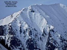
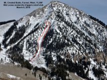
Another view of Gothic Fork and Mt. CB wet slides

CB Avalanche Center2017-18 Observations

Location: Crested Butte Area
Date of Observation: 03/08/2018
Name: Ben Pritchett

Subject: Another view of Gothic Fork and Mt. CB wet slides

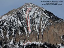
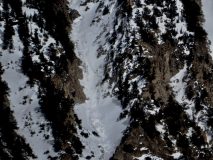
Avalanches: Gothic, the Fork; Mt. CB, the Funnel; Mt. CB, Terminator Chutes.

Weather: Warm afternoon with high, thin clouds. Nearby weather stations recorded that high temps reached 40 @ Schofield, 42 in Gothic, 36 on Snodgrass.
Snowpack: Water starting to play a role in avalanche activity. Still mostly confined to snow surfaces, but the spring snow transition has begun.

Photos:

Slide off Gothic

CB Avalanche Center2017-18 Observations

Location: Crested Butte Area
Date of Observation: 03/08/2018
Name: Alex Tiberio

Subject: Slide off Gothic
Aspect: East, South East
Elevation:

Avalanches:

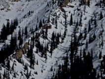
Watched a slide off “the fork” I believe it’s called on gothic this afternoon. Not the most obvious crown/triggerpoint, but grew on its way down. Ran about 2/3 of the way down the terrain trap below it.

Weather: A warm day
Photos: