We have a few exciting changes to announce as we gear up for winter, including a new forecast platform and new forecast zones!
Forecast Platform
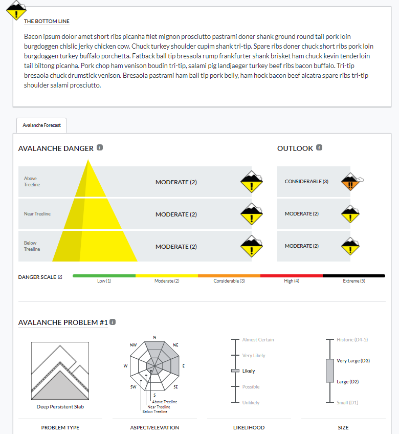
We are adopting the National Avalanche Center’s new forecast platform. The new platform has some great upgrades for our users to help us better communicate our safety messages to you.
- It’s mobile-friendly. More and more of our users are now accessing the forecast from their phones. The new forecast pages will now adjust to fit your phone or tablet, making it easier to read our forecasts on the go.
- Better media. We now have the ability to add photos, videos, and captions within portions of the forecast to help illustrate avalanche problems or travel advice more clearly to you.
- Bottom line and problem descriptions. While the basic layout of the forecast page will look similar to years past, this platform allows us to add a bottom line and problem descriptions. The bottom line will highlight the key points of the forecast, and the problem descriptions allow us to provide dynamic travel advice for each avalanche problem as conditions evolve.
- Conditions blog. We’re experimenting with a “Conditions Blog” tab that can accompany the forecasts. This is where we will provide weekly summaries and bonus material that supplements the forecast. More info for you at your fingertips!
- Consistency. There are about 8 or 9 other avalanche centers around the country that are adopting the same platform. If you go skiing or riding in the Sawtooths, or Cascades, or Sierras, or any number of other mountain regions around the West, you can expect to see avalanche information presented in the same format as ours. That makes it easier for you to digest the info and communicate with your partners.
New Forecast Zones

This map, which lives on our homepage, will show the daily avalanche danger rating for each of the two forecast zones. Clicking on a forecast zone will lead you straight to the forecast.
As most of our regular users know, the Crested Butte backcountry often develops into distinct snow climates: one with a deeper snowpack to the west and north of town, and one with a shallower snowpack near, east, and south of town. In the past, we often use the text to describe nuances between the snow-favored parts of the forecast area and the drier parts of the forecast area. Now, with our new forecast platform, we are integrating two forecast zones: the Northwest Mountains and Southeast Mountains. This change allows our forecasters to better highlight spatial differences in the avalanche danger, travel advice, or size and distribution of avalanche problems. We divided the zones based on our historical understanding of where the deeper and shallower snowpacks commonly develop. Our homepage has a map of the forecast zones to reference these boundaries. The Northwest Mountains include the snow belts of the Anthracite Range, Kebler Pass, Ruby Range, and Paradise Divide. The Southeast Mountains include the drier parts of our forecast area such as Cement Creek, Brush Creek, the Gothic area, and some terrain close to town such as Red Lady Bowl, Climax Chutes, Coneys, and Snodgrass. Our forecast team expects that there will be plenty of days where the forecasts for each zone will be exactly the same. However, there will also be days where we highlight important differences. For you, it’s simple. Click on the forecast map or select the forecast zone for the region that you plan to travel in for the day. That will lead you to the most current and relevant information. Our detailed forecast discussion will be the same across both forecast zones to simplify the material for those folks who enjoy following the progression of the snowpack on a daily basis. And as a reminder, these are regional forecasts that generalize conditions across a large area. Although they should serve as a starting point for planning your day, you are responsible for assessing conditions on a slope by slope basis to minimize your avalanche risk.
Feel free to shoot us a message if you have questions about any of these changes! cbavalanche@gmail.com
Zach Guy
CBAC Lead Forecaster


