Observations

01/18/23

We got something special going on

Date of Observation: 01/18/2023
Name: Evan Ross

Zone: Northwest Mountains
Route Description: AMR tour. N-NE-E. 10,000ft to 11,500ft

Observed avalanche activity: Yes
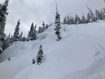
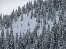
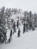
Avalanches: Small wind slab above Kebler Pass Rd. The wind-protected steep pitches on East Bowl where we skied, clearly had old storm slabs that had run through the terrain and disrupted the snow surface but would have been small in size.

Weather: NW flow had the final kick. Moderate snowfall throughout the day. Irwin recorded 5″ of new snow. Poor visibility and blizzard-like conditions at times as snowfall combined with strong winds and blowing snow. Obscured sky through the day as the sun tried to poke through, but the orographic cloud was in the way.

Snowpack: Every day is crazy deep. Abnormal conditions and something we are not used to. We skied steep slopes to around 40 degrees and primarily managed the terrain for wind slabs. We chose not to ski Big Chute due to the continuous cross-loading it was seeing. The top of Rock Chute had a thicker slab, again from cross-loading and we chose to simply steer around it. Where we dropped into East Bowl, we primarily encountered small sluffs, until we got down to the lower more open areas, where there were notable thick cross-loaded pillows. Other areas of East Bowl are of course heavily wind-loaded from the top.

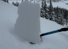
Stopped by Surface Hoar Meadow, north aspect at 10,550. HS 275. The 1/12 interface was down 70cm. 4 to 5mm SH at this location, below F hard snow. An ECT produced a hard result on a different SH layer down 110cm in 1F snow. No obvious signs of instability traveling through that area.

Photos:

5912

Read Full Observation
01/18/23

Gothic 7am weather update

Date of Observation: 01/18/2023
Name: billy barr

Zone: Southeast Mountains

Weather: Only scattered light snow yesterday and last night with 3½” new and water 0.29″. Cloudy with light wind that gusted at times but little snow transport, then cooling overnight down to 8F and currently 12 after a high of 29 for only a brief time. Currently cloudy with a light wind though occasional gusts to 10, but it is not snowing. Snowpack dropped from 71″ to 67½” as the new snow is setting up, but with a ways to go.

5911

Read Full Observation
01/17/23

Shallow slabs on East

Date of Observation: 01/17/2023
Name: Rob Strickland

Zone: Southeast Mountains
Route Description: RLG skinner maintenance…

Observed avalanche activity: Yes
Avalanches: Small slabs (4”) naturally released on East facing side of the bowl near the tree line, as seen from the windy ridge.
Only small point releases from tree bombs and stomping cornices just past the windy ridge. So I was surprised to see the slabs above there.

Weather: Snowy, low vis

Photos:

5910

Read Full Observation
01/17/23

🤯

Date of Observation: 01/17/2023
Name: Evan Ross

Zone: Southeast Mountains
Route Description: Snodgrass. 9,500-11,100ft. NE-E

Observed avalanche activity: Yes
Avalanches: Skier triggered and natural loose snow avalanches or sluffs in steep terrain. All small in size, and interestingly not accumulating much mass even on 40-degree slopes. Numerous storm slabs that had released at various times throughout the last couple of storms. Some to D1.5 in size. The most recent activity from last night maybe was all small D1.

I talked with another skier that dropped into a portion of California Bowl. This is a steep NE slope around 10,600ft. While skiing in an old bed surface they said they triggered a soft slab avalanche about 1.5ft deep. They said the resulting avalanche was small in size and they didn’t notice it had released until finishing the line.

Weather: Between 11am and 1:30pm the snowfall was generally light. There was a break in snowfall from around 1:30pm to 3pm. Snowfall rates seemed higher in the morning and later afternoon when I wasn’t out. Calm wind.

Snowpack: A few storm interfaces could be found in the upper 45-50cm of the snowpack with shovel tilt tests and some small column tests. Nothing would propagate in an ECT. Skied steep slopes in the upper 30-degree range to around 40-degree range with only small sluffs. Some of those slopes had previously avalanched and had a couple of feet of snow back in those bed surfaces, and others had the full seasons snowpack. Of course, no obvious signs of instability regarding the PSa problem while traveling through that terrain.

I didn’t find any SH at the ~1/14 interface higher in the terrain. I was able to find that SH down low near Gothic Road on a NE aspect at 10,500ft. That SH was small, surrounded by soft fist-hard snow, and produced an ECTN result.

I only made observations in the upper snowpack. In general, the upper snowpack looked good thanks to the relatively warm temperatures and fairly continuous snow. I suspect the storm slab avalanche problem has primarily been reactive during brief windows of peak precipitation rates.

Photos:

5909

Read Full Observation
01/17/23

CBMR avalanche observations

Date of Observation: 01/17/2023
Name: J. Mortimer

Zone: Southeast Mountains
Route Description: CBMR A/C Operations

Observed avalanche activity: Yes
Avalanches: • Avalanche observations from today and yesterday are listed here due to InfoEx not populating the Obs. into the email correctly under avalanche observations
• 01.16.23
High Exit – 3rd Bowl
SS-ASr-R1-D1.5-O/G This avalanche was remotely triggered by a patroller stomping snow at the base of a tree in a safe zone. A loud collapse and whooph was heard Multiple 2 lb. shots on snow had been deployed
• Funnel
HS-AE-R3-D3-O/G Large hard slab avalanche triggered with two simultaneous 4 lb. shots in snow. The avalanche ran full track. The depth of the debris was 75 to 155 cm
• 01.17.23 Bermuda Triangle
AE-SS-R3-D2-G
This avalanche was triggered with one 2 lb. shot in snow at 10,600’ on a NE aspect in Bermuda Triangle / Phoenix area
The avalanche occurred on a 55 degree slope was 200’ wide, vertical fall 800’ ran 800’
Crown depth was 5 to 6 feet

Photos:

5908

Read Full Observation
01/17/23

Gothic weather update

Date of Observation: 01/17/2023
Name: Billy Barr

Zone: Southeast Mountains
Route Description: Gothic townsite observations.

Observed avalanche activity: No
Avalanches:
Weather: Only light snow Monday, 2″, with a mid day pause, though solid clouds. Then steady moderately heavy snowfall all night with 11″ new but still a very light density 0.65″ so the 24 hour total is 13″ new with 0.77″ of water. Snowpack is at winter’s deepest of 71″. Wind is calm to light from the SW, no visibility and the temperature does not move, holding at 18F since midnight. Currently snowing very lightly. This recent snow is light on top of dense snow but there has been too much of it to stabilize quickly so at the least surface slides are likely. I wish one of them was my roof. billy
Snowpack:

5907

Read Full Observation
01/16/23

Good Pow

Date of Observation: 01/16/2023
Name: Zach Kinler

Zone: Northwest Mountains
Route Description: Kebler TH to Anthracites, standard skin track to ridge

Observed avalanche activity: No
Avalanches: Did not observe any fresh slides in the terrain we traveled, views of the surrounding terrain were very limited.
Weather: Cloudy, calm winds near and below the treeline, light snow showers throughout the day, and moderate snow beginning to fall around 4:00pm. 1-2″ of accumulation during the day.
Snowpack: There was 35-40cm of settled storm snow over the past 2 days. HS was 235cm at 10,600′ on a north aspect. No cracking or collapsing observed during the tour. We skied slopes up to ~35 degrees and jumped on several others of various aspects with no signs of instability. Ski cuts on steeper, unsupported slopes only produced minor sluffing in the upper few inches. Found 6 mm Surface Hoar on one particular open northerly slope at 10,600 ft that produced an ECTP9 under a soft 35 cm slab. Hasty pits and another Extended Column Test near ridgeline did not reveal sensitive surface hoar or produce propagating results.


[/gravityforms]

5906

Read Full Observation
01/16/23

Deeep in the Northwest Mountains

Date of Observation: 01/16/2023
Name: Eric Murrow

Zone: Northwest Mountains
Route Description: Slate River Road to Poverty Gulch and ski tour by Baxter Basin.

Observed avalanche activity: Yes
Avalanches: Visibility was marginal but I got reasonable views of Happy Chutes, Climax Chutes, Schuylkill Ridge, Cascade and some glimpses of Baxter Basin and Richmond Mountain. Loose Dry avalanches were common on very steep slopes near and below treeline. Most seemed to be from tree bombs or shedding cliff features. I did not see any significant propagation and the debris piles were small.
Weather: Light snowfall late morning through mid-afternoon that amounted to an inch or so. Winds remained light with very little evidence of drifting overnight or during the day. I occasionally was able to hear stronger winds at the ridge top. Storm total at 230 pm was 17″ with 1.3″ snow water equivalent at 10,700 feet.
Snowpack: Shovel Tilt Test’s revealed easy results in the top 6 inches and moderate results at the base of the storm snow. ECTN easy score at base of storm snow but no propagating results. Cracking in the new snow was limited to a ski length at most and was typically in top 6 inches with a few harder cuts cracking to base of the storm snow. Loose Dry avalanches were easy to initiate in the low-density snow. Test slopes produced no signs of slab instability. I looked in several places for buried surface hoar and did not find it. Snow depths in a wind-affected area at 10,600 feet ranged from 200 cm to 300+ cm.

Photos:

5905

Read Full Observation
01/16/23

Gothic Weather update

Date of Observation: 01/16/2023
Name: Billy Barr

Zone: Southeast Mountains
Route Description: Gothic townsite weather observations.

Observed avalanche activity: No
Avalanches:
Weather: Snowed most all day of the Sunday but lightly except for an hour mid afternoon, which was followed by an hour or so of moderate wind, which then let up. Hooray for that, though it moved a good bit of snow. There was 5″ new with 0.32″ of water. Light to moderate snow overnight becoming very light a couple hours before sunrise with 9″ new and water 0.49″, so the 24 hour total is 14″ new with total water a much more historical normal 0.81″ being 6% water content. The snowpack reached the winter deepest (and the current) of 63½”. Currently the cloud cover is- well, go ahead, guess, with light snow and no wind. Temperature range was a hgh of 36F and the low and current 17F. No visibility. billy
Snowpack:

5904

Read Full Observation
01/15/23

Slate

Date of Observation: 01/15/2023

Zone: Northwest Mountains
Route Description: Slate up to ATL

Observed avalanche activity: Yes
Avalanches: Innumerable point releases due to tree bombs. Some running up to 500 feet. Long running but slow sluffs under board.
Weather: Snowfall rates to 3 inches an hour, wow.
Cold front around noon
Winds building as of 5
Snowpack: Deep enough. primary concern was buried surface hoar which was rampant up to ~10000 the day prior. The intense graupel last night and warm Temps seem to have homogenized that buried layer into something less concerning

5902

Read Full Observation
The blog.