Observations

03/26/22

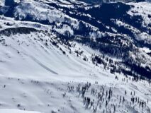
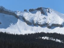
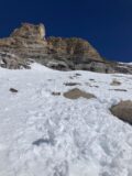
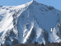
Wet loose expanding to northeast aspects

Date of Observation: 03/26/2022
Name: Zach Guy

Zone: Northwest Mountains
Route Description: Poverty Gulch and Slate River Road. Traveled on E, SE, and S aspects to 12,600 ft on Mineral Point.

Observed avalanche activity: Yes
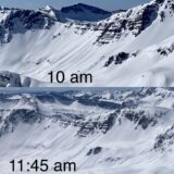
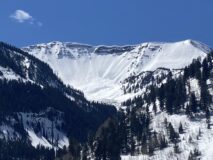
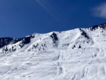
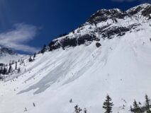
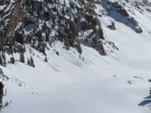
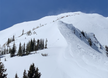
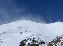
Avalanches: East-northeast aspects were fairly active by late morning for wet loose activity, with a handful of D1.5 near and below treeline, and a dozen or so D1s at all elevations. Also a handful of ~D1.5 wet loose on easterly and westerly aspects ran yesterday. A few of these were close, if not to D2 in size.
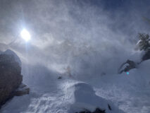
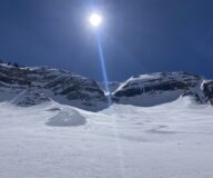
Weather: Warm, scattered to few clouds this morning. Light to moderate westerly winds at our high point.
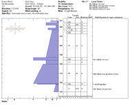
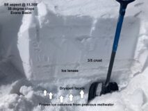
Snowpack: Surfaces were frozen and supportive this morning. By 11 or so, we saw natural wet loose activity on easterly aspects. By 11:45, south-facing terrain NTL was producing rollerballs, small wet sluffs to ski cuts, and becoming trap door. At noon, east-facing slopes NTL were producing large pinwheels and rollerballs in the top 10″ or so.
Surfaces are noticeably more hardened by last week’s wind event above treeline and that seems to be helping moderate the effects of meltwater into the snowpack where we traveled, along with a breeze today helping keep surfaces a bit cooler up high.

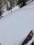
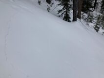
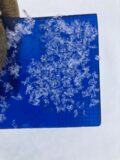
Photos:

5508
Read Full Observation
03/25/22

Wet loosies in the Beckwith Range

Date of Observation: 03/25/2022
Name: Zach Guy

Zone: Northwest Mountains
Route Description: Traveled on NE, E, SE and S aspects of West Beckwith to 12,000 ft, and took a bino tour along Kebler Pass Road from Lost Lake this afternoon around 3-4 p.m.

Observed avalanche activity: Yes
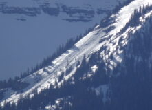
Avalanches: Fairly active wet loose day in the Beckwiths and on Mt. Gunnison. Quieter from what I could see in the southern Ruby Range. Natural wet loose activity was most common near and above treeline below rock bands on east to south to west aspects, with some N/BTL activity creeping into northeast aspects. Sizes were generally D1 to D1.5, with a couple that might be approaching D2 in longer terrain. No wet slabs observed so far.
Weather: Warm temps, clear skies, light westerly winds.
Snowpack: Surfaces refroze overnight into supportive crusts. By 11 a.m., ski pen was about a foot deep into wet grains on steep easterly aspects. Good corn on due south around noon. This afternoon, we dug a couple of holes at 10,500 ft on a steep east aspect. Water was pooling on the thin dusty crust that is capping the dryspell facets (2/16 crust), about 2 feet down. The top half of the slab was wet, the bottom half was moist. On northeast aspects BTL, the top 10″ was moist and producing rollerballs. On southeast aspects, wet loose activity was running on the 2/16 crust, which was only about a foot deep at this location; the crust remained intact and supportive to boot pen.

Photos:

5507

Read Full Observation
03/24/22

The wetting front was dancing with the sand box

Date of Observation: 03/24/2022
Name: Eric Murrow Evan Ross

Zone: Southeast Mountains
Route Description: MT Emmons, NE-E, 9,000-10,600ft.

Observed avalanche activity: No
Avalanches:  I glassed terrain from the pavement around 5pm and only observed a single wet avalanche on a southeast, near treeline slope on Peeler Peak.  It looked close to large size and originated beneath a very rocky area.

Weather: Few clouds, warm temps, and breezily light wind.

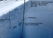
Snowpack: We targeted 3 pits to check on the progress of the wetting front. These were east-facing sites, 1 below 30 degrees, and 2 above 30 degrees, right around 10.500ft. In all 3 locations, the wetting front was within 1 to 2cm of the February Sand Box. Some of that free water was being held up and pooling on crusts higher in the snowpack. A couple of ECTN and ECTX results, and 1 CTH result on the Sand Box. Those facets are still 2mm in size and 4f hard, under small-grained 1F snow.

We were surprised to see the free water having progressed so far in this snowpack. We were traveling through the area between 1 and 3pm, but the light breeze helped keep a very thin crust on the snow surface and create the initial impression that things were not heating up from afar.

By the time we were traveling on these easterly-facing slopes, they seemed to have passed their prime for a loose wet avalanche problem. By the time we were headed out after 3pm a few westerly-facing slopes looked primed for some form of a loose wet avalanche problem.  A low elevation southeast slope, around 9,000 feet, started to feel punchy and was close to a trap door isothermal mess at 4pm (snow depth around 90cm).

Photos:

5506

Read Full Observation
03/24/22

The wind is fun

Date of Observation: 03/23/2022
Name: Eric Murrow

Zone: Northwest Mountains
Route Description: Washington Gulch to Elkton and tour around sunny side of Mount Baldy

Observed avalanche activity: No
Avalanches: no fresh avalanches were observed
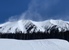
Weather: Clear skies and strong northerly winds. There was constant snow transport at upper elevations. Much of the blowing snow appeared to be blasted into the atmosphere, but isolated leeward features were forming hard slabs.
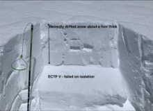
Snowpack: I went hunting for fresh Wind Slab formation on the south half of the compass and found many leeward features to be blasted by the wind and not forming fresh hard slabs. One small south-facing feature near treeline was well-drifted, around a foot deep, and produced propagating test results while I was isolating the column. This location had two distinct thin slabs (up to pencil hard) stacked above a melt-freeze crust. This feature was adjacent to a good-sized northerly fetch. Surprisingly, I was not able to trigger this slope by stomping around. In this area, I was able to identify drifted features by a smooth-ish appearance.
I also dug a quick profile on a west-facing near treeline slope to gather more data on the Persistent Slab problem. Here the slab was 70cm thick and up to pencil hard. No results in standard ECT, but when I removed most of the slab, I was able to get a propagating result. The weak layer was 4finger minus in hardness and 1-1.5mm in size and rounding.

Photos:

5505

Read Full Observation
03/23/22

Wiiiiiindy

Date of Observation: 03/23/2022
Name: Zach Guy

Zone: Southeast Mountains
Route Description: Inbounds CBMR

Observed avalanche activity: Yes
Avalanches: A D1, presumably windslab, ran this afternoon out of M Face on Whetstone.
Weather: Windy is an understatement. Impressive amount of blowing snow off of all peaks. Some plumes were blowing towards the southeast (White), some were blowing towards the southwest (Axtell, Bellview) and anything in between.
Snowpack: Seemed like a lot of ablating snow more than loading. Little eddies and concave features were getting drifted in with 3″ to 6″ of slabby snow. Abrupt road cuts had 12″ to 18″ localized drifts behind them.

Photos:

5504

Read Full Observation
03/22/22

Thin wind slabs and deep stronger weak layers.

Date of Observation: 03/22/2022
Name: Zach Guy

Zone: Northwest Mountains
Route Description: Baxter Basin. Traveled on NW to NE aspects to 11,800 ft.

Observed avalanche activity: Yes
Avalanches: Ski cut a handful of tiny wind slabs and one that was large enough to take you for a ride (6″ thick, 30 ft wide, D1 in size) in a cross-loaded NW facing chute.
Weather: Scattered clouds. Unseasonably cool temps. Light to moderate north winds where we traveled. Could see periods of blowing snow off of the high peaks.
Snowpack: Stability tests on a NW facing below treeline slope were unreactive on the dryspell layer, buried about 4 feet deep here. At this deeper location, the layer shows significant signs of rounding and strengthening compared to shallower parts of our forecast area. It was about .7mm in size and 1F hard under a pencil hard slab.
Fresh drifts from last night’s northerly winds were scattered about, ranging from a few inches thick to about a foot thick, 4F to 1F hard. It was easy to produce shooting cracks or localized collapses in the thicker or denser drifts.

Photos:

5503

Read Full Observation
03/22/22

Near Miss on Teocalli

Date of Observation: 03/22/2022
Name: Whit Gilliam

Zone: Southeast Mountains
Route Description: Went up to ski N Teo, but the wind was crazy! Opted to stay lower on the South face and drop in. Picked a line above some small cliffs to sneak through to the lower main S face. I made one test turn on the edge of the slope we planned to ski and the whole face cracked all the way up! Slab was about 6″ thick, but hard to tell for sure, we didn’t hang around to check. Let’s just say we confirmed the forecasted wind slab on S faces! Thankful for this outcome!!!!!!

Observed avalanche activity: Yes
Avalanches: Wind slab, S, ~12,900ft, didn’t run
Weather: Windy as heck

Photos:

5502

Read Full Observation
03/21/22

Unstable test results

Date of Observation: 03/21/2022
Name: Zach Guy

Zone: Northwest Mountains
Route Description: Pit digging in Evans and Elk Creek basins checking in on our persistent slab problem and looking ahead to potential wet slab weather this weekend. I targeted pits near treeline on east, southeast, and west aspects.

Observed avalanche activity: No
Weather: Scattered to broken cloud cover. Light to moderate northerly winds with a little bit of blowing snow near ridgetop.
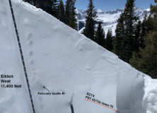
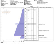
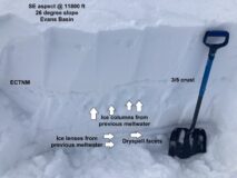
Snowpack: No signs of instability while sledding, but I got medium and hard propagating test results on east and west aspects, respectively, under 2 to 3-foot hard slabs. Where I dug on due east and due west aspects, the slabs and the dryspell sandbox layer have remained dry, apart from the 3/5 crust and some recent thin surface crusts (See profiles below).  Two pits on SE aspects and one on an ESE aspect showed frozen percolation columns and ice lenses below the 3/5 crust and in the sandbox layer. The upper half of the slab above the 3/5 crust has remained dry.
My biggest concern if we see a significant warmup later this week is on those transition aspects (east and west) if meltwater starts draining into the sandbox layer for the first time. With drainage already established through the layer on southeast aspects, that is less of a concern, at least where I dug. On those SE aspects, there may be potential for water to pool along the 3/5 crust and cause thinner wet slab issues, although I didn’t find an unstable structure above the crust that is particularly alarming (ECTN results).

Photos:

5501

Read Full Observation
03/20/22

Cement (aka Sandbox) Mountain

Date of Observation: 03/20/2022
Name: Zach Guy

Zone: Southeast Mountains
Route Description: Traveled on West to North aspects below treeline on Cement Mountain, up to 10,500 ft.  This is one of the shallowest parts of our forecast area.

Observed avalanche activity: Yes
Avalanches: Ski cut a small persistent slab on a small terrain feature facing NW. The slab was just under a foot thick and failed on the mid-February facets.
Weather: Thin overcast and mild temps made for good greenhousing midday, which moistened surfaces on northerly aspects. No wind where I traveled, but I could hear it higher up.
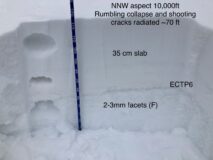
Snowpack: On northerly tilted aspects, the mid-February “sandbox” layer is uniformly weak and lousy; the key ingredient for instabilities here is the presence of a slab. At the lowest elevations, below about 9,700 ft, the slab is thinner and faceted out with ski pen consistently going through an unsupportive upper snowpack. I got numerous collapses, but cracks would only propagate 5 or 10 feet at most. As I gained elevation, the upper snowpack became more supportive and slabs were a bit thicker and denser (about 35 cm, 4F). I got widespread collapsing and shooting cracks, typically radiating 20 to 50 feet, and a couple up to 100 ft. Stability tests produced easy propagating results on the sandbox layer, which is 2-3 mm in size and fist hard. HS averaged 80 to 120 cm. The two pronounced start zones that I traveled near had already avalanched back in late February and the upper snowpack was all faceted on those terrain features with no concerns.
Snow surfaces got moist on northerly aspects and I skier triggered numerous rollerballs and pinwheels, but nothing gained enough volume to turn into a wet loose slide.

Photos:

5500

Read Full Observation
03/20/22

Hunter Creek

Date of Observation: 03/20/2022
Name: Ben Pritchett

Zone: Southeast Mountains
Route Description: Hunter Creek

Observed avalanche activity: No
Avalanches: We saw no recent avalanches other than some minor loose shedding out of very steep rocky slopes.

Weather: Chilly start with quick warm up late morning. Scattered high-thin clouds.

Snowpack: We found an average snowpack depth around 200cm in wind-sheltered terrain near treeline. Above treeline the snowpack is highly variable with many wind-swept areas only 100-150cm deep.
Surprisingly we only experienced one booming collapse on slab that was softer in the afternoon than when we travelled over it during the morning. This occurred with two sleds close together on a westerly-facing slope around 2:30pm. The slope was just too low angle to avalanche. Otherwise the snowpack stayed eerily quiet all day.
Snow surfaces moistened below 10,000′, but we found no fresh meltwater at the snow surface at upper elevations.

5498
Read Full Observation
The blog.