Wild avalanche conditions on Schuykill Ridge
Date of Observation: 12/09/2021
Name: Evan Ross and Zach Guy
Zone: Northwest Mountains
Route Description: Schuykill Ridge, traveled mostly on NE aspects to ridgeline at 11,400′.
Observed avalanche activity: Yes
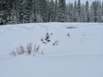
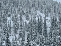
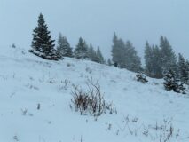
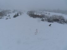
Avalanches: We skier triggered, remotely triggered, or sympathetically triggered numerous soft slab avalanches, D1 to D2 in size, and observed at least one natural. All of these were breaking on the 12/6 facet layer, 30 to 45 cm deep. Most gouged to the ground through loose facets as they descended, or in a few areas, stepped down to the ground through old slab. The most notable slides were: 1) A skier triggered D1 slab in Runaway Ski that sympathetically pulled out a D1.5 in the same path, which then sympathetically pulled out a D2+ in Thanksgiving Bowl. 2) Yogi’s ran naturally to the bench, D2 in size 3) From ridgeline, we remotely triggered a D2 slide in Thanksgiving bowl that looks like it sympathetically pulled out another D2 in Birthday Bowl. From this same location, or shortly after nearby, we also remotely triggered another D2 in Runaway Ski. We measured the debris pile below Thanksgiving Bowl at 2.5 meters deep, and it snapped a few small trees. All slides stopped at the midway bench. We also triggered a handful of smaller slides below the bench in areas that might surprise you because of how bushy it is.
Weather: Light to moderate snowfall throughout the day. Strong southwesterly winds at ridgetop were drifting snow.
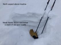
Snowpack: 10″ to 15″ of storm snow over the well-described 12/6 facet layer. Extensive shooting cracks on all open slopes that we traveled. Near windloaded ridgeline, slabs were 2 feet thick and we also got a couple of audible collapses there. Ski pen is close to the ground through the soft new snow and faceted old snow; HS is generally about 2 to 3 ft deep.
Photos:
-

-
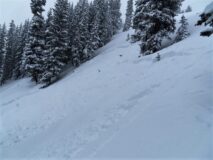
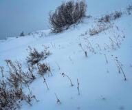
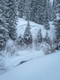
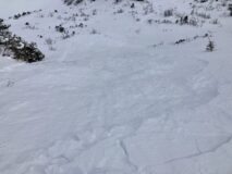
We skier triggered numerous small soft slabs like this one in the rolling terrain below the midway bench. They might surprise you because of how bushy it still looks.
-

-
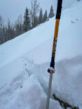
A large debris pile on the bench below Thanksgiving Bowl, from what we believe was two seperate events. The probe is 250 cm. The small tree on the right was snapped.
-

-
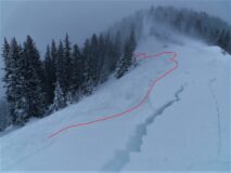
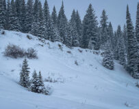
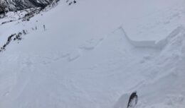
This slab in Runaway ski was remotely triggered from near the ridgetop, about 100 feet higher.
-

-
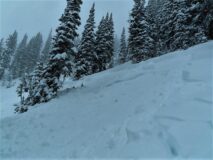
This slide in Thanksgiving Bowl appeared to be remotely triggered from around the corner as we approached it, about 250 feet away
-

-
A skier triggered slide in Runaway Ski that sympathetically released two aother avalanches, one in Runaway, and one in Thanksgiving Bowl
-

-
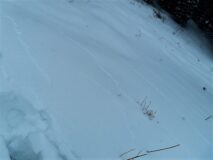
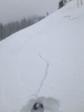
Spiderweb cracks like this were common on open slopes.
-

-
Avalanche conditions weren’t the only considerable hazards…
Avalanche Report #1
Estimated avalanche date: 12/09/2021
Number of Avalanches: 1
Location
Location: Schuylkill Ridge
Location Specific:
Start Zone Elevation: NTL: Near Tree Line
Aspect: NE
Characteristics
Trigger: Natural
Trigger modifier:
Type: Soft Slab
Failure Plane: New/Old interface
Size
Relative Size: R2 small
Destructive Size: D2 – could bury, injure, or kill a person
Avg. crown height (inches): 15
Avg. width (feet):
Avg. vertical run (feet): 1200
Involvements
# of people caught:
# of partial burials:
# of full burials:
Additional comments:
Avalanche Report #2
Estimated avalanche date: 12/09/2021
Number of Avalanches: 5
Location
Location: Schuylkill Ridge
Location Specific:
Start Zone Elevation: BTL: Below Tree Line
Aspect: NE
Characteristics
Trigger: Skier
Trigger modifier:
Type: Soft Slab
Failure Plane: New/Old interface
Size
Relative Size: R1 very small
Destructive Size: D1- Relatively harmless to people
Avg. crown height (inches): 12
Avg. width (feet): 40
Avg. vertical run (feet): 100
Involvements
# of people caught:
# of partial burials:
# of full burials:
Additional comments: A couple of these were remote triggered
Avalanche Report #3
Estimated avalanche date: 12/09/2021
Number of Avalanches: 2
Location
Location: Schuylkill Ridge
Location Specific:
Start Zone Elevation: BTL: Below Tree Line
Aspect: NE
Characteristics
Trigger: Skier
Trigger modifier: Sympathetic
Type: Soft Slab
Failure Plane: New/Old interface
Size
Relative Size: R2 small
Destructive Size: D2 – could bury, injure, or kill a person
Avg. crown height (inches):
Avg. width (feet):
Avg. vertical run (feet):
Involvements
# of people caught:
# of partial burials:
# of full burials:
Additional comments: Thanksgiving Bowl and Birthday Bowl. Likely sympathetic releases from other triggered slides.
Avalanche Report #4
Estimated avalanche date: 12/09/2021
Number of Avalanches: 2
Location
Location: Schuylkill Ridge
Location Specific:
Start Zone Elevation: NTL: Near Tree Line
Aspect: NE
Characteristics
Trigger: Skier
Trigger modifier: Remote
Type: Soft Slab
Failure Plane: New/Old interface
Size
Relative Size: R2 small
Destructive Size: D2 – could bury, injure, or kill a person
Avg. crown height (inches): 18
Avg. width (feet): 150
Avg. vertical run (feet): 1300
Involvements
# of people caught:
# of partial burials:
# of full burials:
Additional comments: Runaway Ski and Thanksgiving Bowl
Avalanche Report #5
Estimated avalanche date: 12/09/2021
Number of Avalanches: 1
Location
Location: Schuylkill Ridge
Location Specific:
Start Zone Elevation: BTL: Below Tree Line
Aspect: NE
Characteristics
Trigger: Skier
Trigger modifier: Sympathetic
Type: Soft Slab
Failure Plane: New/Old interface
Size
Relative Size: R2 small
Destructive Size: D1.5
Avg. crown height (inches): 15
Avg. width (feet):
Avg. vertical run (feet): 800
Involvements
# of people caught:
# of partial burials:
# of full burials:
Additional comments: Runaway Ski
5060


