Date of Observation: 01/10/2023
Name: Eric Murrow
Zone: Southeast Mountains
Route Description: Cement Creek trailhead to below treeline hills around Warm Springs.
Observed avalanche activity: No
Avalanches:
Weather: Light snowfall in the late morning and ending by noon. New snow a denser 5 inches. Westerly winds blowing at moderate speeds with some strong gusts transporting snow at upper elevations. Mild air temperatures.
Snowpack: While walking through flat terrain around a creek bottom I experienced frequent collapsing running up to 100 feet breaking on a mid-December weak layer (see images). The depth in this area was around 80cm with a 45cm 4-finger slab. Touring around I experienced collapsing on west through north through easterly aspects with northerly terrain being the least frequent. Snowpack tests showed moderate propagating results. In this area and elevation, the terrain facing southeast, south, and southwest generally was too shallow and lacked a slab for an avalanche problem.
-

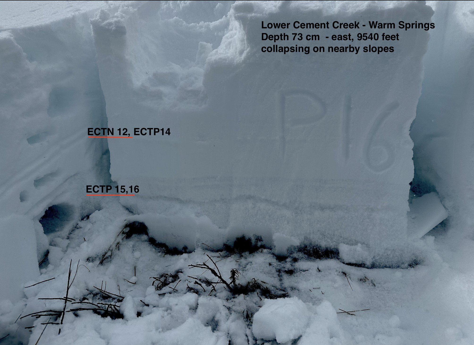
- A test profile from a northerly slope breaking on a thin layer of depth hoar near the ground.

-

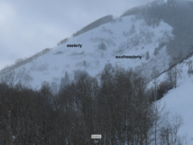
- Easterly slope with propagating results.
-

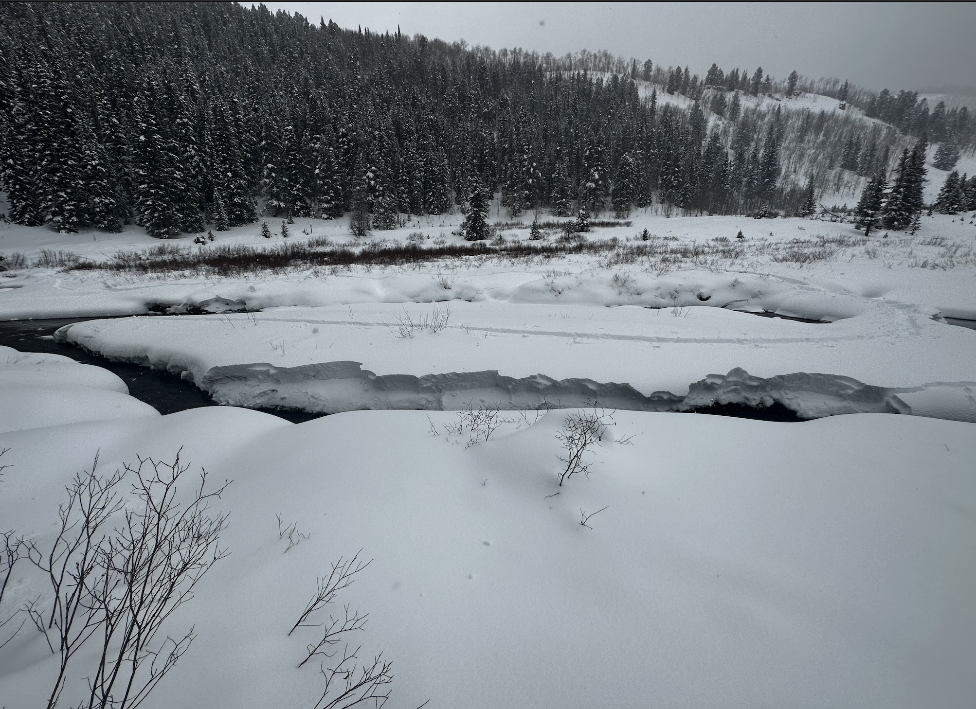
- One of many collapses at valley bottom breaking the edges of the slab into the river. You can see the expected slab size below treeline in this area.
-
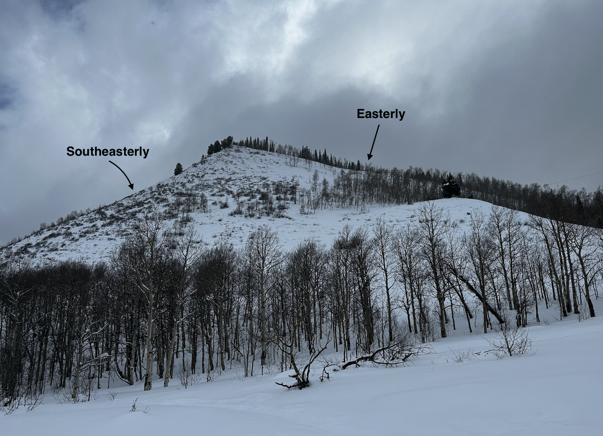
- This is the Walrod Powerline avalanche path that appears to have enough volume to reach Walrod Road. The southeasterly side does not look concerning, just the east-facing terrain looks to be able to produce a slab avalanche.

-

- Another example of the thin snow coverage on southerly terrain and the quick transition to slab formation on east aspects.