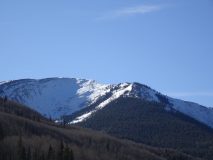
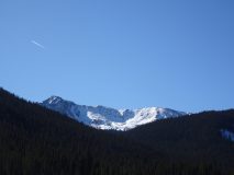
Location: Paradise Divide Area
Date of Observation: 11/22/2019
Name: Evan Ross
Subject: Shooting Crack, Mt Baldy.
Aspect: North, South, West
Elevation: 11,000-12,000
Weather: Nearby Cinnamon Weather station at 12,293ft recorded westerly winds averaging 25 to 15mph from 6am until noon. In the afternoon clouds were hanging on the peaks and there was absolutely no wind. A nice blue hole in the clouds rolled through for about an hour followed by overcast sky for the rest of the afternoon.
Snowpack: About 3″ of snow had accumulated from the recent storms on Wednesday and Thursday morning. The westerly wind was strong enough to drift that little bit of new snow about and create some wind texture on upper elevation exposed terrain.
The old October snow is variable in both its location and current type. In many areas that snow has been melted away or very wind effected with tightly packed small grains. Both of these setups posed the leased concerns. That old October Snow is concerning in areas more protected from the sun and from the wind events in late October/early November. In those areas, the old snowpack is faceted and weak, especially the NSF development in the upper 10-15cm of the old snow. This weak snow will take little load to become an avalanche problem in the future. South to Southwest to West at ~11,600ft. The October Snow is either completely melted away or a 5-15cm melt-freeze crust on the ground. Of particular note, the portions of these slopes that were shaded by tree stands held pockets of a weak faceted old snowpack.
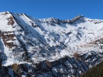
North to Northwest between 11,600-12,000ft. HS averaged about 50-60cm or around 2 feet. Some areas were disturbed by previous winds and the stacks of old wind slabs and wind-packed grains were less concerning. Otherwise, the snowpack in this area could be generalized as faceted and weak. The 11/20 interface was the most concerning with well developed 1-2mm faceted grains that were already becoming sensitive with the very shallow and soft slab forming over them. A .5cm melt-freeze crust was fairly widespread in this area and may help aid propagation in the future. Shooting cracks were observed on a portion of a 30-33 degree slope at 11,900ft.
Photos:


