Cement Creek Tour

CB Avalanche Center2018-19 Observations

Location: Cement Creek Area
Date of Observation: 01/17/2019

Subject: Cement Creek Tour
Aspect: North, North West
Elevation: 9800-10200 feet

Avalanches:

None observed.

Weather: Clear in the morning becoming slightly over cast as the day went on. Wind was calm, picking up to a slight breeze around mid afternoon, coming out of the NW. Cold in the valley bottoms and warming with elevation gain, though the shaded northern aspects stayed pretty chilly all day.

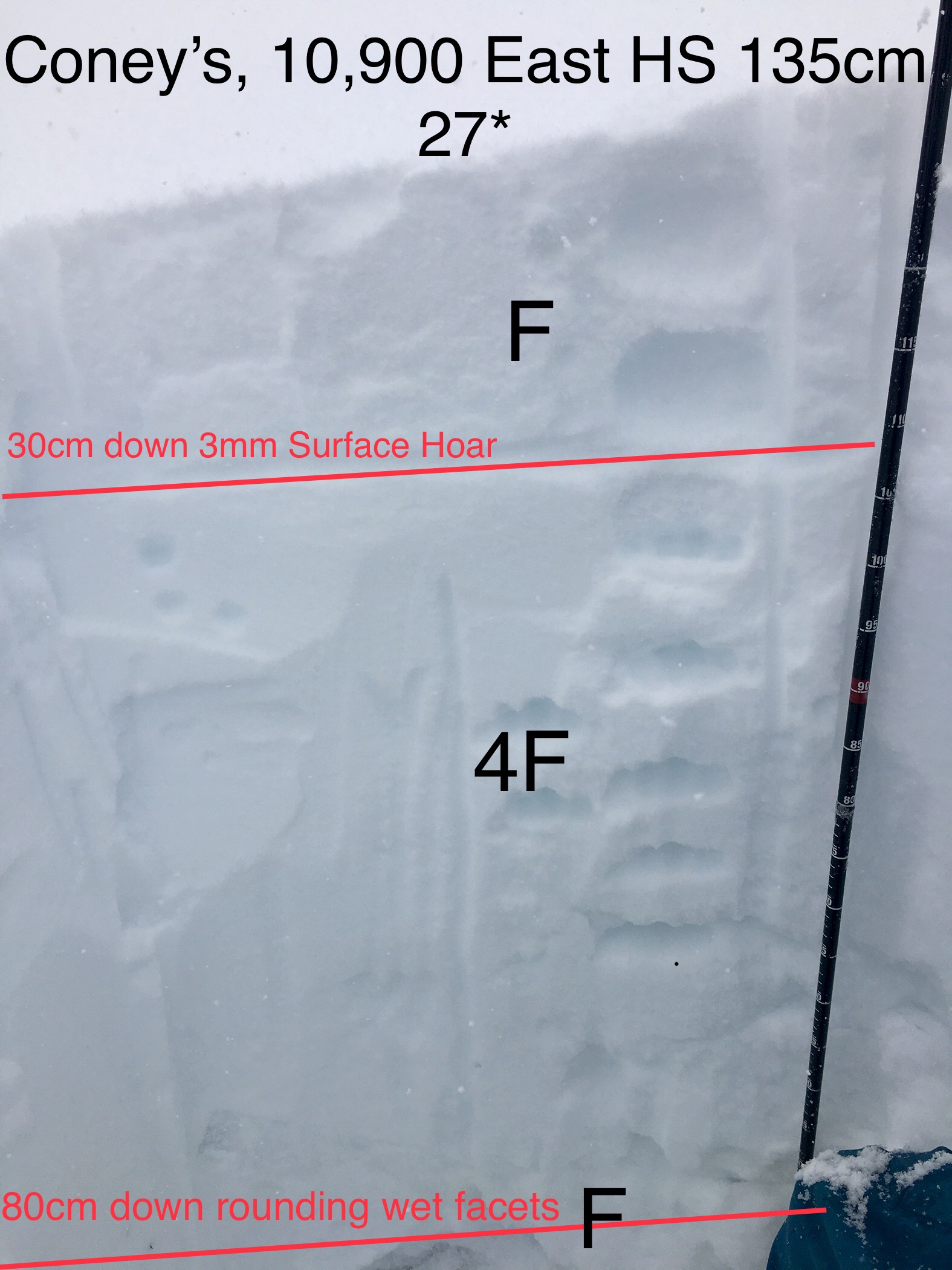
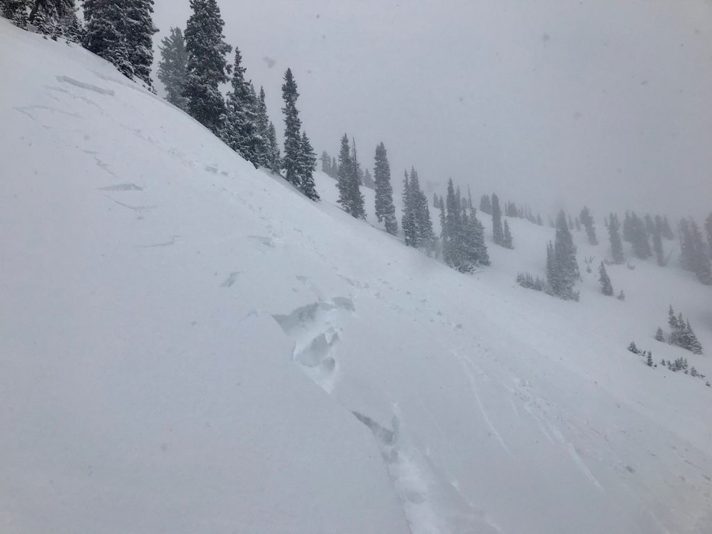
Snowpack: By and large the snowpack was not supportive to Rando skis until just below 10000 feet, and then it was supportive only intermittently. Experienced one large collapse at just over 10000′. Could not see any shooting cracks but collapse was large and loud enough to startle me. Only other collapses of the day were at lower elevations. These were much smaller feeling and did not seem to propagate more than a few inches past my ski tips. Dug a pit at 10200′ on NNW aspect BTL. Snow depth 100cm. Upper 20cm was new storm snow. Below that was soft “slab” 4-finger to fist hardness, softening with depth. At ~40cm above ground level it became coarse grained sugar from there on down. Compression test produced failure @ 20 cm below snow surface after 8 taps from the wrist. Failed again at about 50 cm below snow surface after 5 taps from the elbow, though second failure did not really sheer on any kind of bed surface. It was more like the “slab” just sort of crumbled.
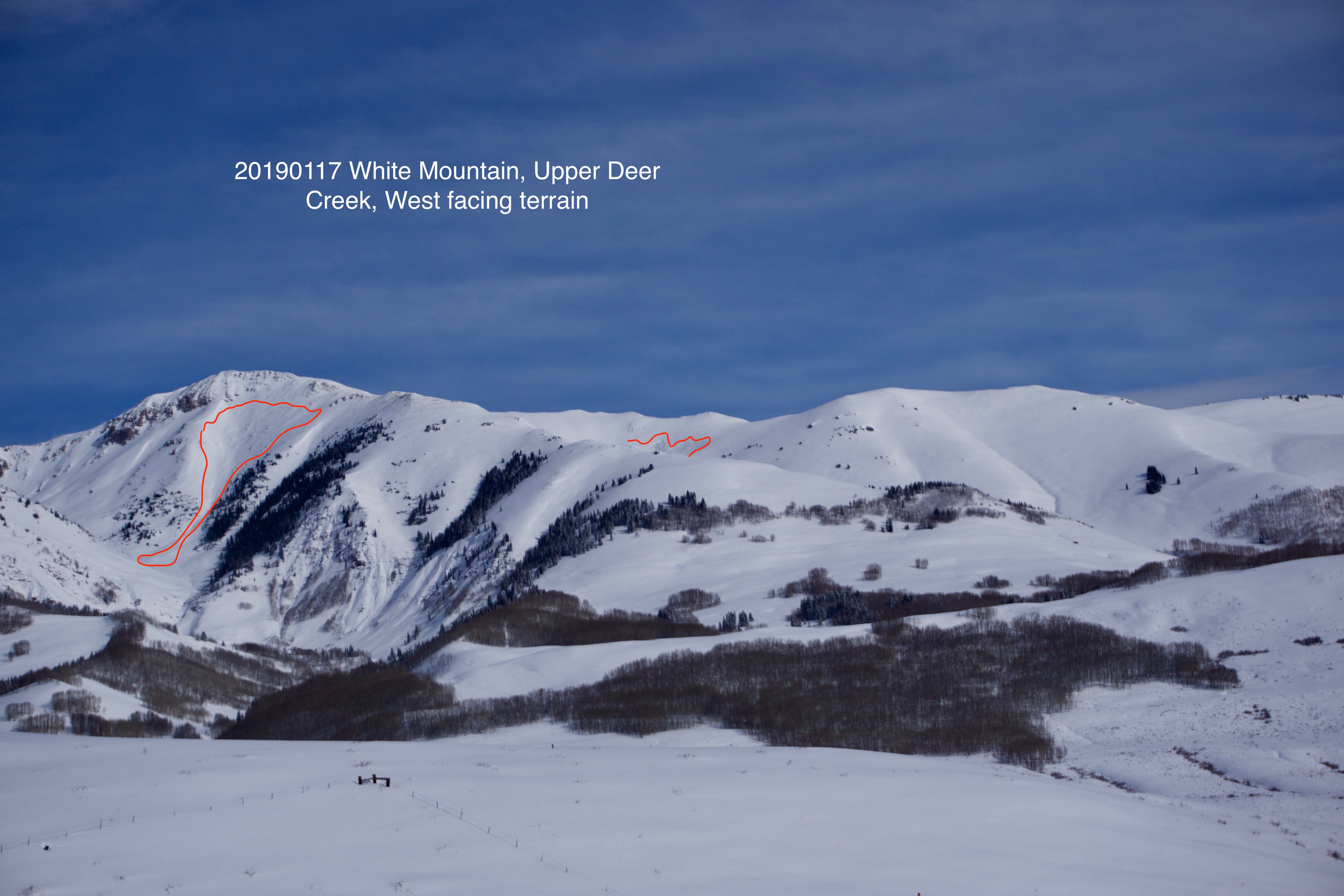
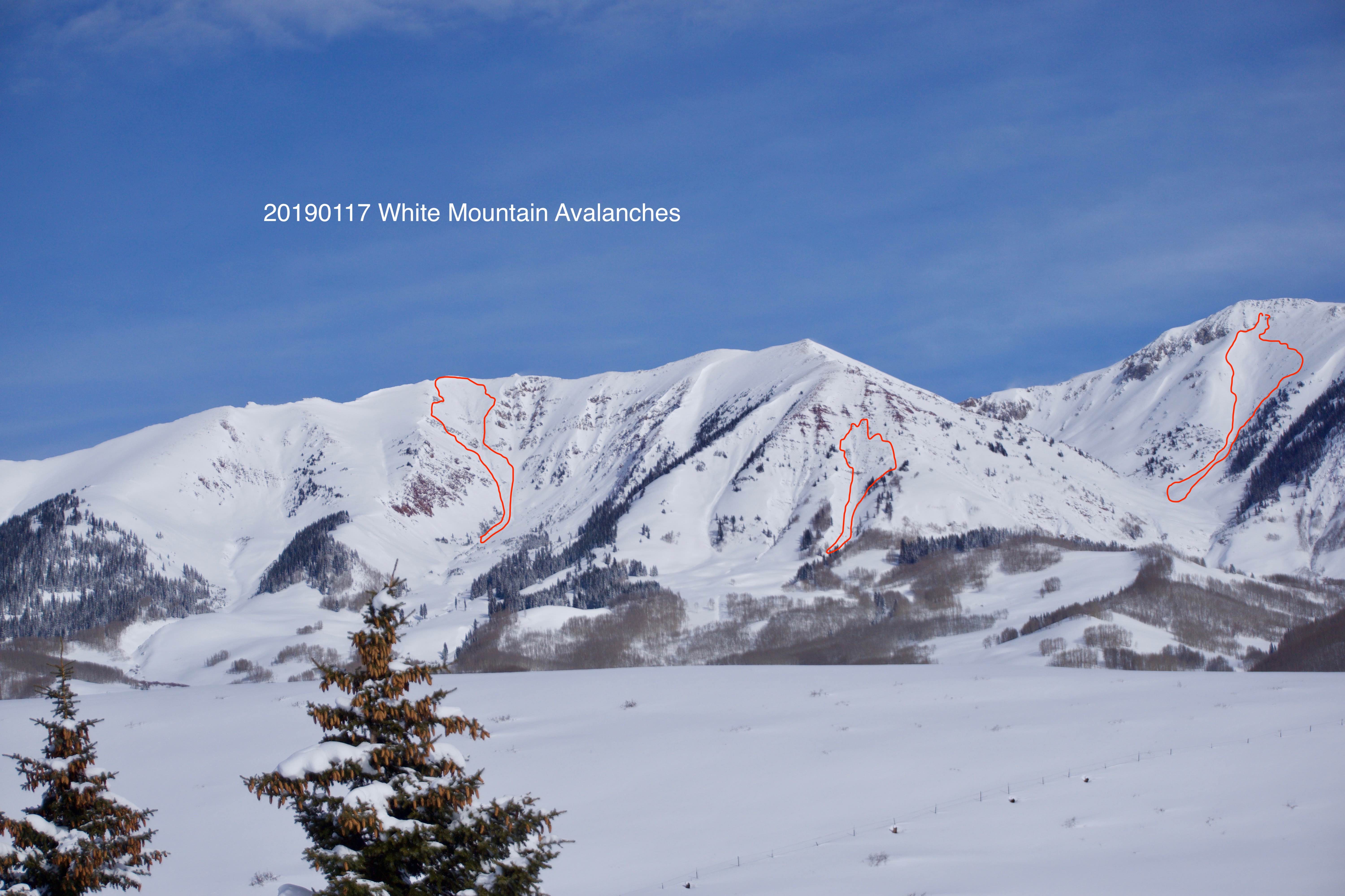
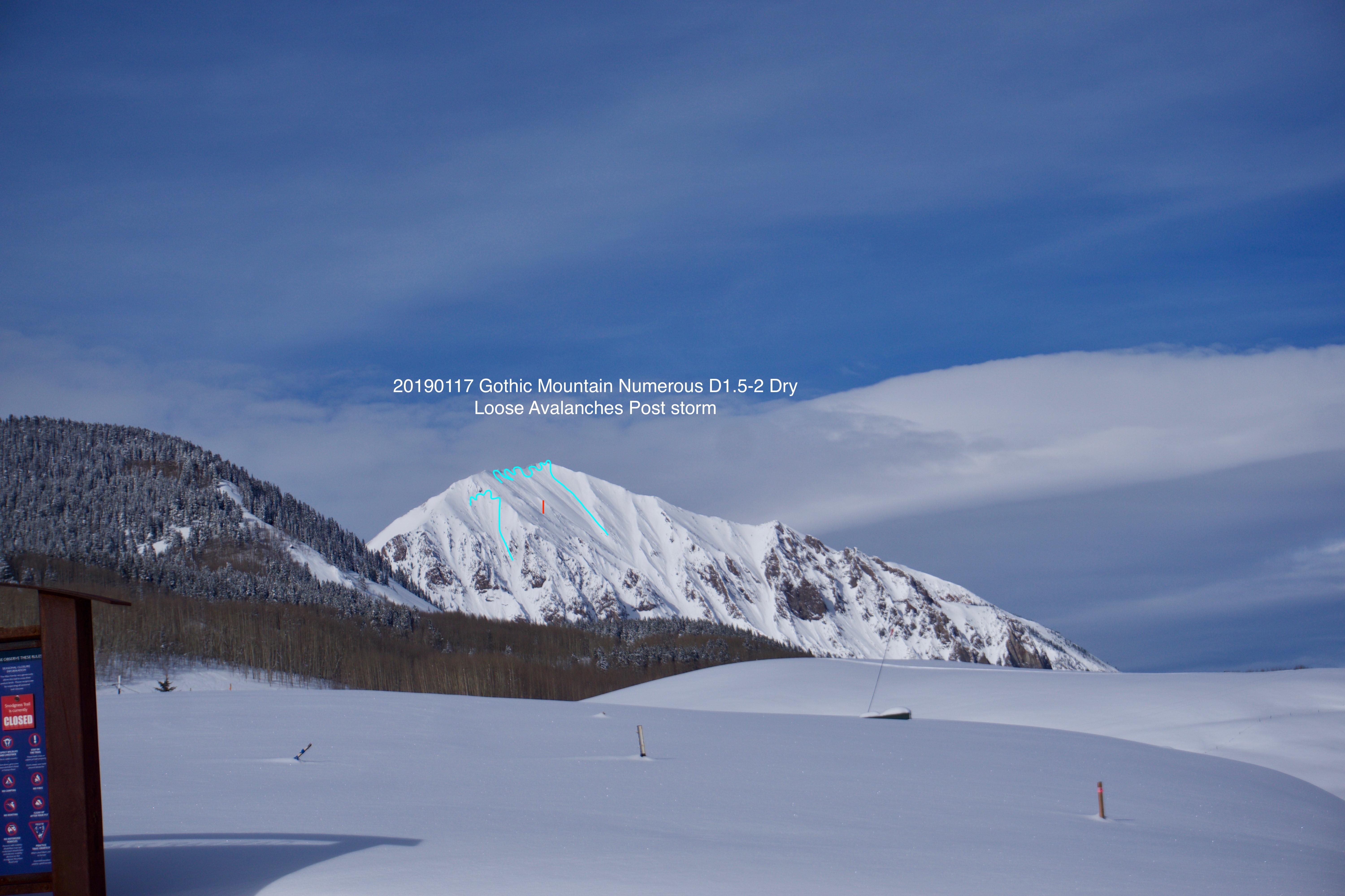
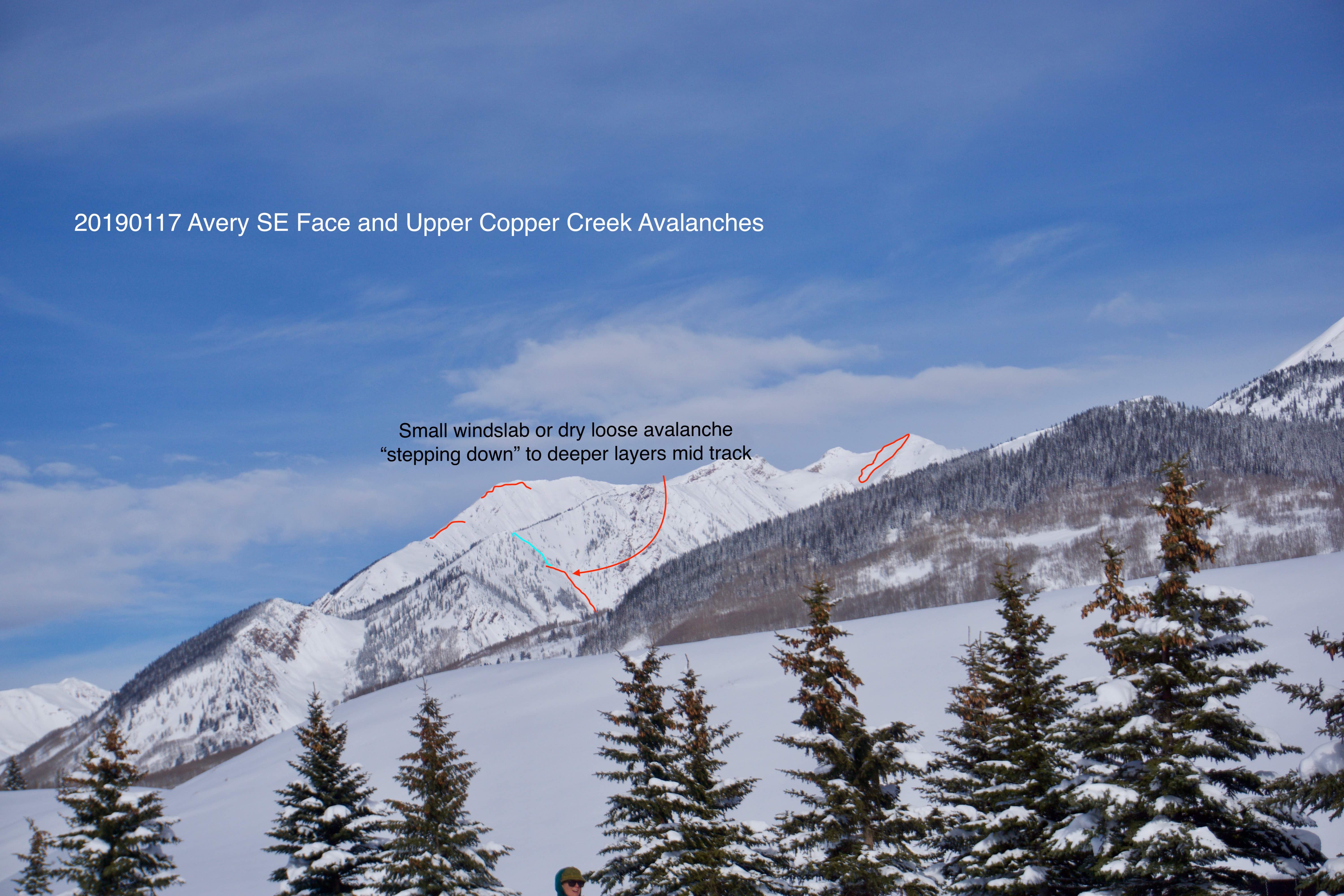
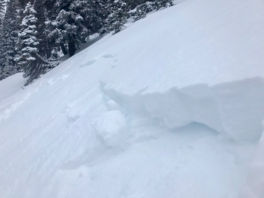
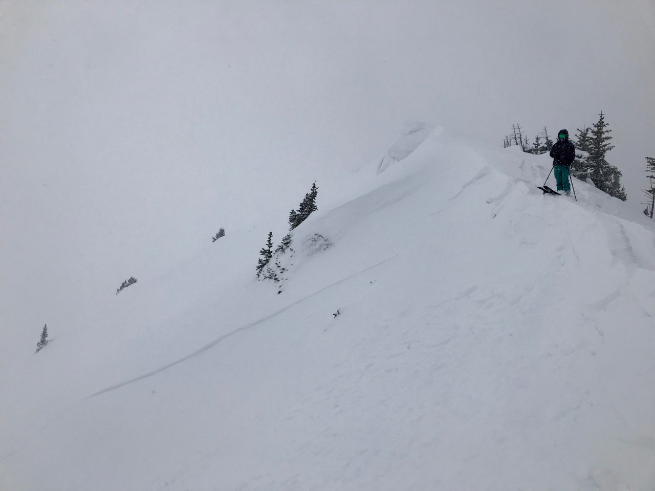
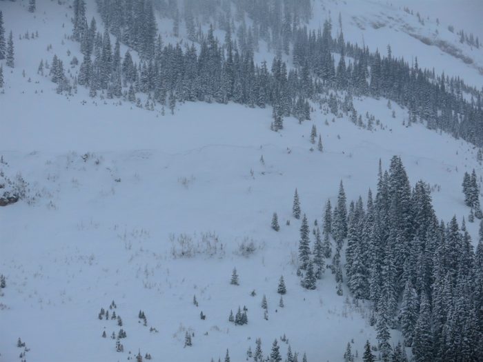
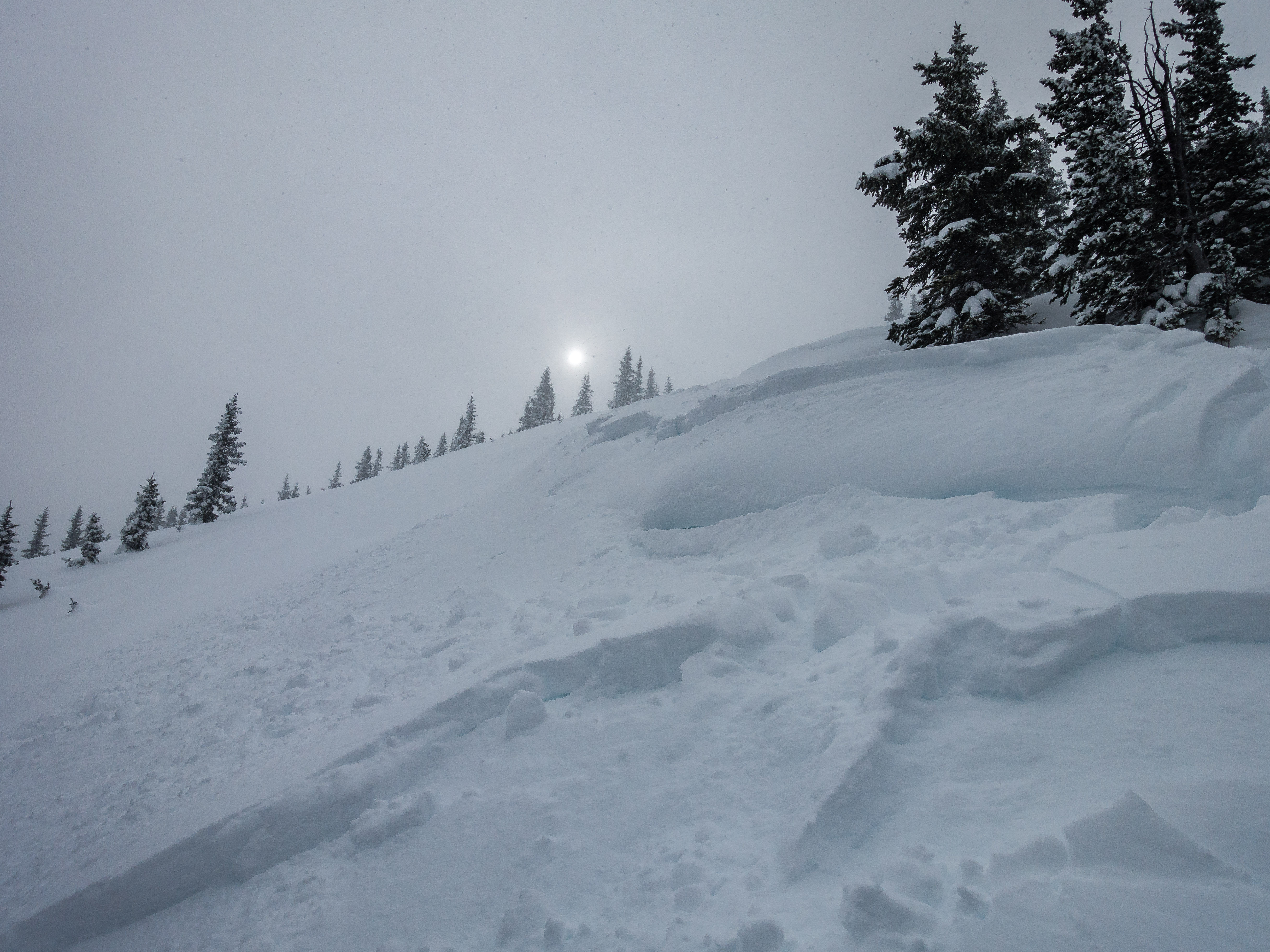
Photos:

Windshield Tour of Avalanches in Upper East River Basin

CB Avalanche Center2018-19 Observations

Location: Crested Butte Area
Date of Observation: 01/17/2019
Name: Ian Havlick

Subject: Windshield Tour of Avalanches in Upper East River Basin
Aspect: East, South East, South, South West, West
Elevation: 9-12500

Avalanches:

Several D3 avalanches observed deeper in the northern and eastern zones where 1-1.5″ snow water equivalent fell yesterday and strong winds at ridge top continued transporting snow. Surprised to see as many slides fail midstorm on southwest and west facing terrain. Aspects up to this point have lacked much avalanche activity. We are phasing out of those aspects offering safer passage in the backcountry I fear… especially with this next big wave of moisture tonight and tomorrow.

Weather: Increasing Clouds, partly cloudy, light breeze in valley, strong winds at ridgetop. Temps were milds.

Snowpack:

Photos:

Slate River Holding Up

CB Avalanche Center2018-19 Observations

Location: Paradise Divide Area
Date of Observation: 01/17/2019
Name: Evan Ross

Subject: Slate River Holding Up
Aspect: North East
Elevation: 9,000-10,600

Weather: Patly to mostly cloudy sky. The thick clouds didn’t move in until later afternoon. Calm winds where we were down in the valley. Blowing snow off the peaks. Winds had picked up in the valley at 4pm on the way home and where blowing snow.

Snowpack: Thick pow with no signs to instability. No cracks, noise, nothing. The deep snowpack is handling the ~15″ HST well. In the whole Slate River Valley and everything that can be seen further around, only one D 1.5 avalanche was seen from the last storm. That also goes for the thiner snowpack near Mt Emmons. The old crowns on the Climax Chutes could still be seen. The Climax Chutes had a few small loose snow avalanches in the steepest terrain. HS at 10,500ft averaged 165cm.

Irwin Cat Operation

CB Avalanche Center2018-19 Observations

Location: Kebler Pass Area
Date of Observation: 01/16/2019
Name: Irwin Cat Operation

Subject: Irwin Cat Operation
Aspect:
Elevation:

Avalanches:

Avalanche observations: Numerous SS-ASr-R2/3-D1.5-I on west facing terrain, these were shallow storm slabs running full track and remotely. Widespread propagation across numerous start zones (Thortons skirt trigger thru D&D).Triggering was very sensitive in the AM, but by 1400, slab was stiffening and triggering was a bit more stubborn but still remote in nature. Shooting cracks and slumping in Binge, but did not propagate.

Weather: Weather summary: Poor visibility, strong WSW gusts recorded at Scarp Ridge since 2Am, but winds were often gusting out of the east on slope. Gusts went over 50 since 2pm out of the WSW. S1-S2 snow showers.

Snowpack: 6″ of 9% started our morning with an 1″per hr till 1300. We picked up 3″ by 1400 at the Study plot. Storm was skiing soft, but surface was wind stiffened on exposed terrain. Ski pen ~25cms but stiffening towards end of day. West and East were loaded/cross loaded and south was more storm pressed. Old crust was visible in scoured chokes like Sonic, Candy’s and NC, But Jaybirds-Bender were loaded.

Photos:

Coney’s tour & remote trigger

CB Avalanche Center2018-19 Observations

Location: Crested Butte Area
Date of Observation: 01/16/2019
Name: Dave Bumgarner

Subject: Coney’s tour & remote trigger
Aspect: North East
Elevation: 10903

Avalanches:

On our 3rd lap I remotely triggered a slide in first bowl. It was in the typical spot that gets wind loaded, the debris ran to the prominent trees in the middle of the bowl. Photo of crown attached (not good quality).

Weather: Sky: overcast most of the day
Wind: was calm in the morning and picked up to moderate at ridge line.
Precip: S2 most of the day
Temp: mid 20s

Snowpack: Did not see any signs of instability for most of the tour.
25-30cm of new snow

Photos:

Coneys Hot Dogs, Storm Slabs getting strong!

CB Avalanche Center2018-19 Observations

Location: Crested Butte Area
Date of Observation: 01/16/2019
Name: Will Nunez

Subject: Coneys Hot Dogs, Storm Slabs getting strong!
Aspect: North East, East
Elevation: 10,900

Avalanches:

No signs of any instability in terrain under 35*
One small storm sluff NE nose of coneys.

Weather: Obscure, S1 and pulses of S2, mod wind with strong gusts NW, temps I. The 20s.

Snowpack: HS 90-135cm, New snow ranged from 4-12”, 30cm of F new snow resting on 3mm buried surface Hoar, 50cm 4FtoF rounding facets to the ground. New storm snow was becoming stronger throughout the day.

Photos:

Shallow Storm Slabs

CB Avalanche Center2018-19 Observations

Location: Kebler Pass Area
Date of Observation: 01/16/2019
Name: Evan Ross, Eric Murrow, Zach Kinler

Subject: Shallow Storm Slabs
Aspect: East, South East, South
Elevation: 9,500-11,600

Avalanches:

Several very wide propagating storm slabs were observed. A couple of these crown widths were estimated in the thousand or couple thousands of feet wide. While wide, these slabs were not very deep and only amounted to D1’s and D1.5’s. These natural avalanches were observed on South, East and West slopes.


Weather: Cloudy skies with light and variable winds in sheltered terrain and moderate SW winds in exposed areas and ridge lines. Temps in mid 20s. S-1 to S1 snowfall throughout day with 2-3” accumulations on tour.

Snowpack: At 9,500ft we measured 7″ of new snow at about 11am, and 9″ of new snow at about 3pm. Higher in the terrain, the 9″ felt about average for the day ending by 3pm. A shallow storm instability was the only avalanche concern observed. The storm slabs were failing just above the interface in the storm snow. Small amounts of wind-loading was confined to right at ridgeline in this area and did not extend far down slope. HS was around 120 on southerly slopes and increasing to about 150 on the more easterly tilted and cross-loaded slopes

Photos:


anthracites storm instabilities

CB Avalanche Center2018-19 Observations

Location: Kebler Pass Area
Date of Observation: 01/16/2019
Name: MR

Subject: anthracites storm instabilities
Aspect: North
Elevation: 10,000-11,500

Avalanches:

storm slab instabilities – cracking and stuffing – on any and all terrain over 35 degrees or so. One wind roll at the top of big chute had already released and we easily got the other to pop rolling up to it. Minimal propagation or entraining, but we didn’t see or ski any bigger terrain.

Weather: storm day! From 8am-1pm – snow varying from s1-s3, stronger toward end of day, winds picking up throughout the day. Warm and wet

Snowpack: 4 inches new snow at base of anthracites at 8 am, 6-8 inches up high at 9 am. Dense snow. By the time we got back to the sleds at 1 there was an additional 4-5 inches.

Photos:

Anthracite Mesa-Coneys-AM Tour

CB Avalanche Center2018-19 Observations

Location: Crested Butte Area
Date of Observation: 01/16/2019
Name: ADB

Subject: Anthracite Mesa-Coneys-AM Tour
Aspect: East
Elevation: BTL

Avalanches:

NA due to low visibility.

Weather: Obsucred skies; S2 snowfall primarily. Ridge tops winds were moderate while valley winds were light.

Snowpack: Between 4 and 7 inches had fallen within past 12 hours.
New skin tracks: a few collapses on 1F snow about 7 inches below the surface (F and 4F snow on top of the 1F crust).
2 inch soft slabs were forming on the ridge top and the leeward side of the ridge.
After ski, observed 1 inch of new snow in the valley bottom skin track used by 4 tourers.

Gothic 7am Weather Update

CB Avalanche Center2018-19 Observations

Location: Paradise Divide Area
Date of Observation: 01/16/2019
Name: billy barr

Subject: Gothic 7am Weather Update

Weather: 7am report
Snow starting a couple hours after midnight moderate to heavy with 8″ new and water a light 0.48″ as snow pack reaches winters deepest of 43½”. Currently obscured cloud cover with heavy snowfall and no wind (hooray for that one) and 22ºF.