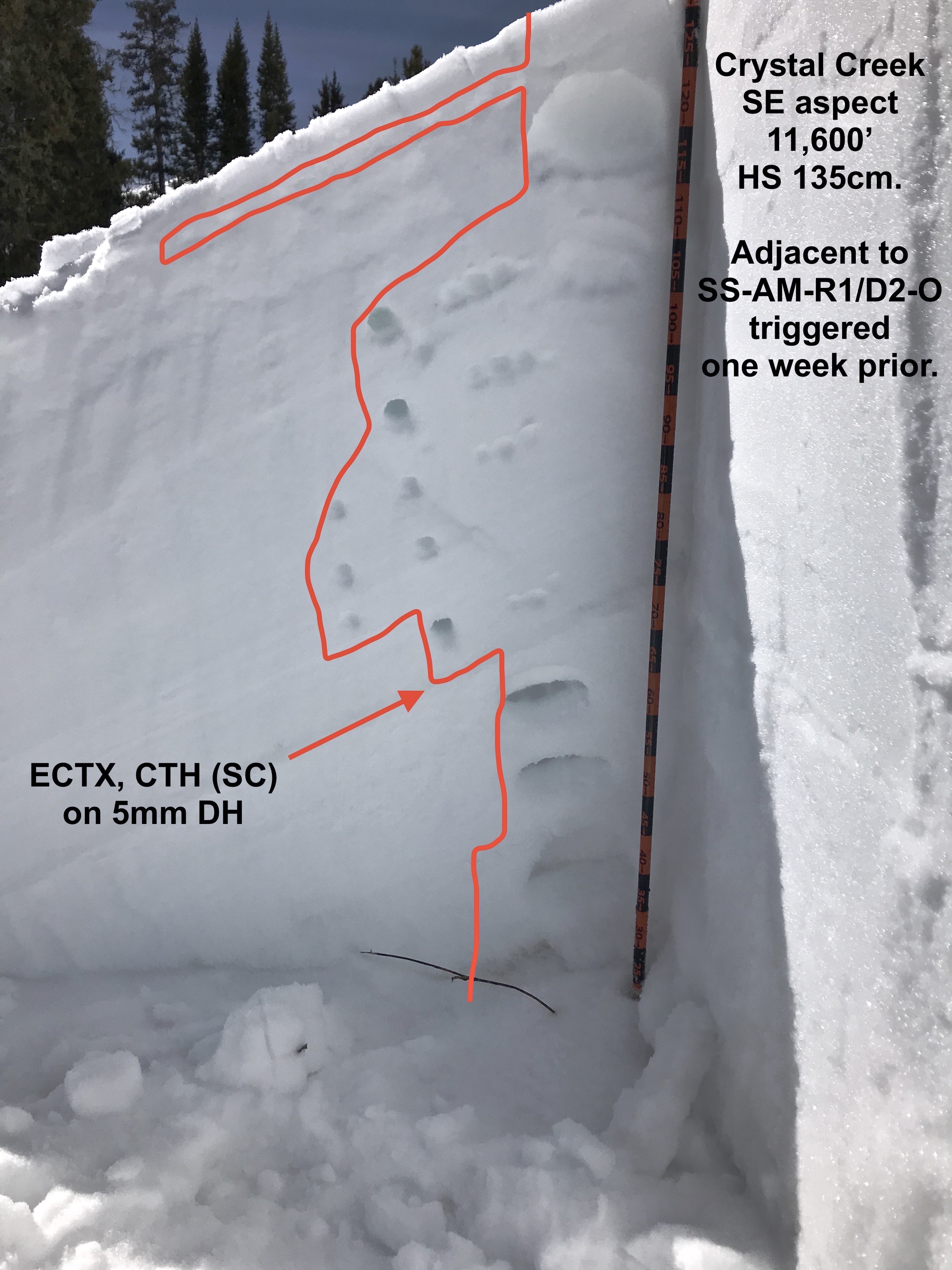
Location: Crested Butte Area
Date of Observation: 03/11/2018
Name: Karin Pocock/Billy Rankin
Subject: Level 2 Avy Course Tour days Sat/Sun
Aspect: North, North East
Elevation: 9,400′ – 11,100′
Avalanches:
Weather: Sat: Partly cloudy, L-M breeze from the NW, cool to start the day, then temps warm enough to moisten snow surfaces below 10,200ft in the afternoon.
Sun: High clouds throughout the day. No wind. Warming temps during the day. A solid refreeze had occurred overnight leaving a variable thickness mfcr up to 3cm in places that did not noticeably soften until 11:30am.
Snowpack: HS 80-120cm. Several pits dug by each touring group each day. Overall, very few signs of instability notes while skiing: no cracking or collapsing, no new avalanches noted. Pits consistently showed a 65-80cm persistent slab 4F-P in hardness sitting on 20-40cm of 4F FC/DH up to size 4. On the most northerly aspects that we looked at the midpack slab was more facetted and tended towards 1F at it’s hardest.
All pits showed roughly the same tests results on both days:
CT’s 12 thru 22 SC dwn 80 failing on DH size 4.
ECTX
PST 20-35/100 end dwn 80 failing on DH size 4.
We consistently showed the definition of “spooky moderate” to our students, few signs of instability while traveling and skiing coupled with pit tests that indicated the construction for avalanches that would be dangerous to skiers if triggered.
Photos: