Date of Observation: 03/01/2023
Name: billy barr
Zone: Southeast Mountains
Route Description: Gothic townsite
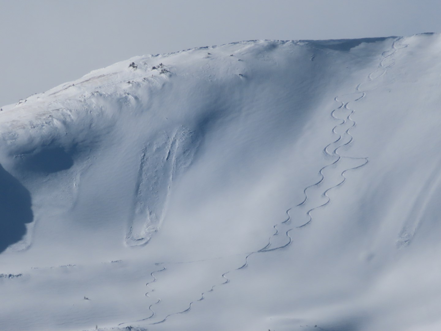
Observed avalanche activity: No
Weather: Snow Tuesday ran until mid afternoon and then held off until after midnight with 24 hour total of 5″ new and water content 0.44″. Only light but dense snow in the past few hours. The wind stayed strong yesterday but has stopped and there was even a bit of clearing before midnight as the temperature dropped to -7F but with the clouds it is currently back up to 8. Currently obscured and calm with a few flakes of snow. Snowpack is at 66½”
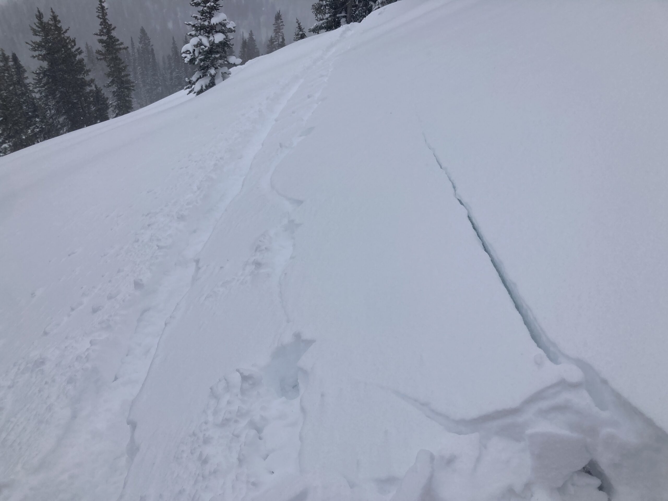
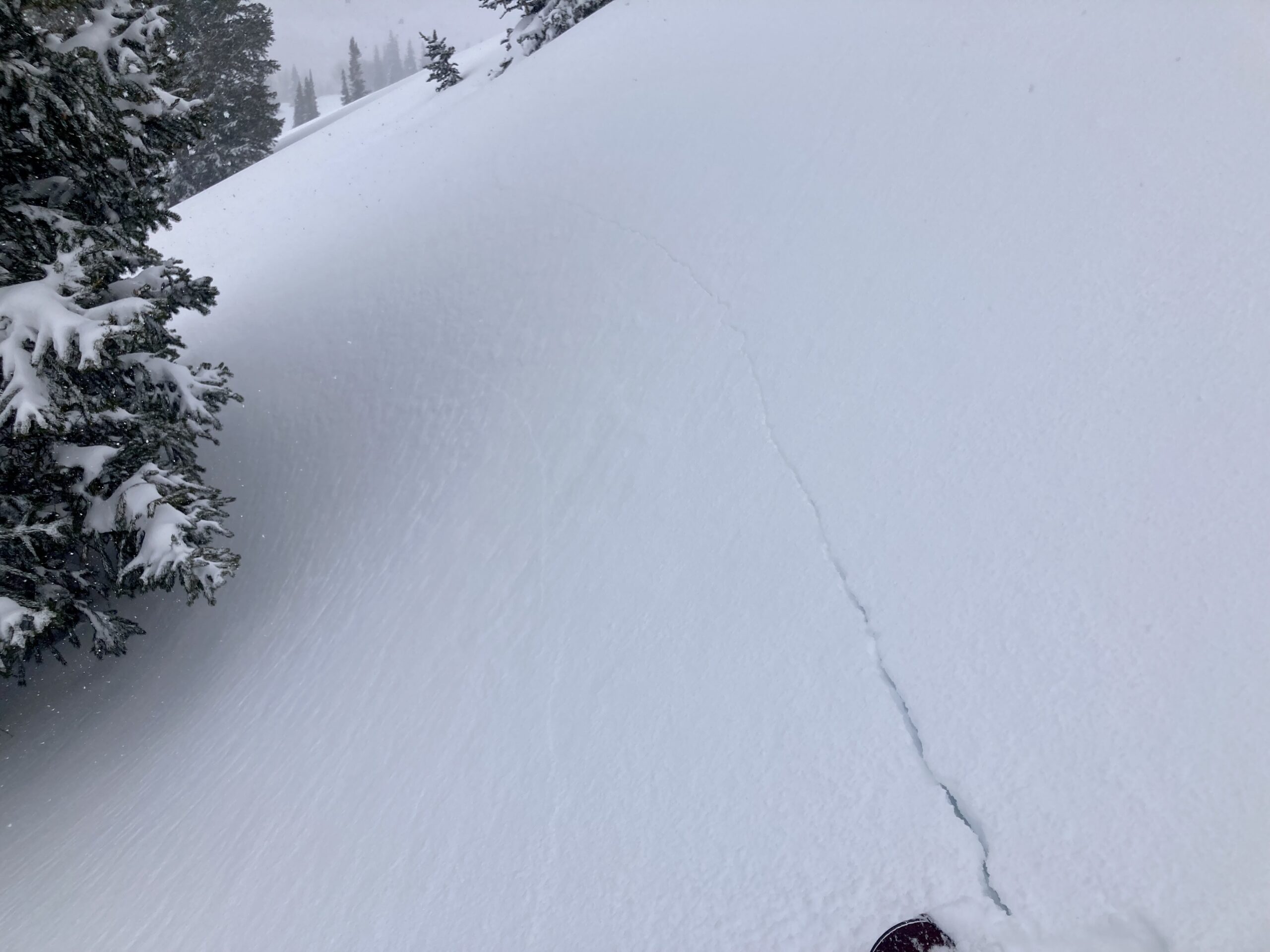
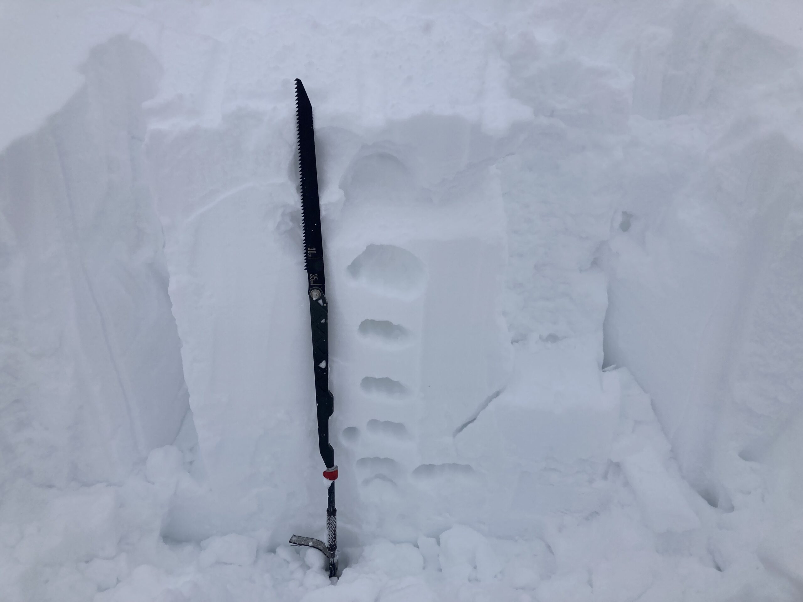
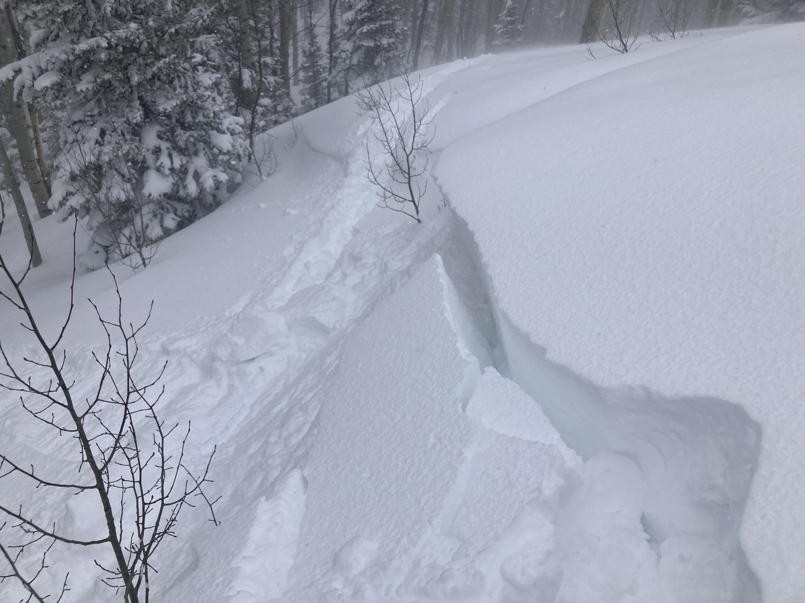
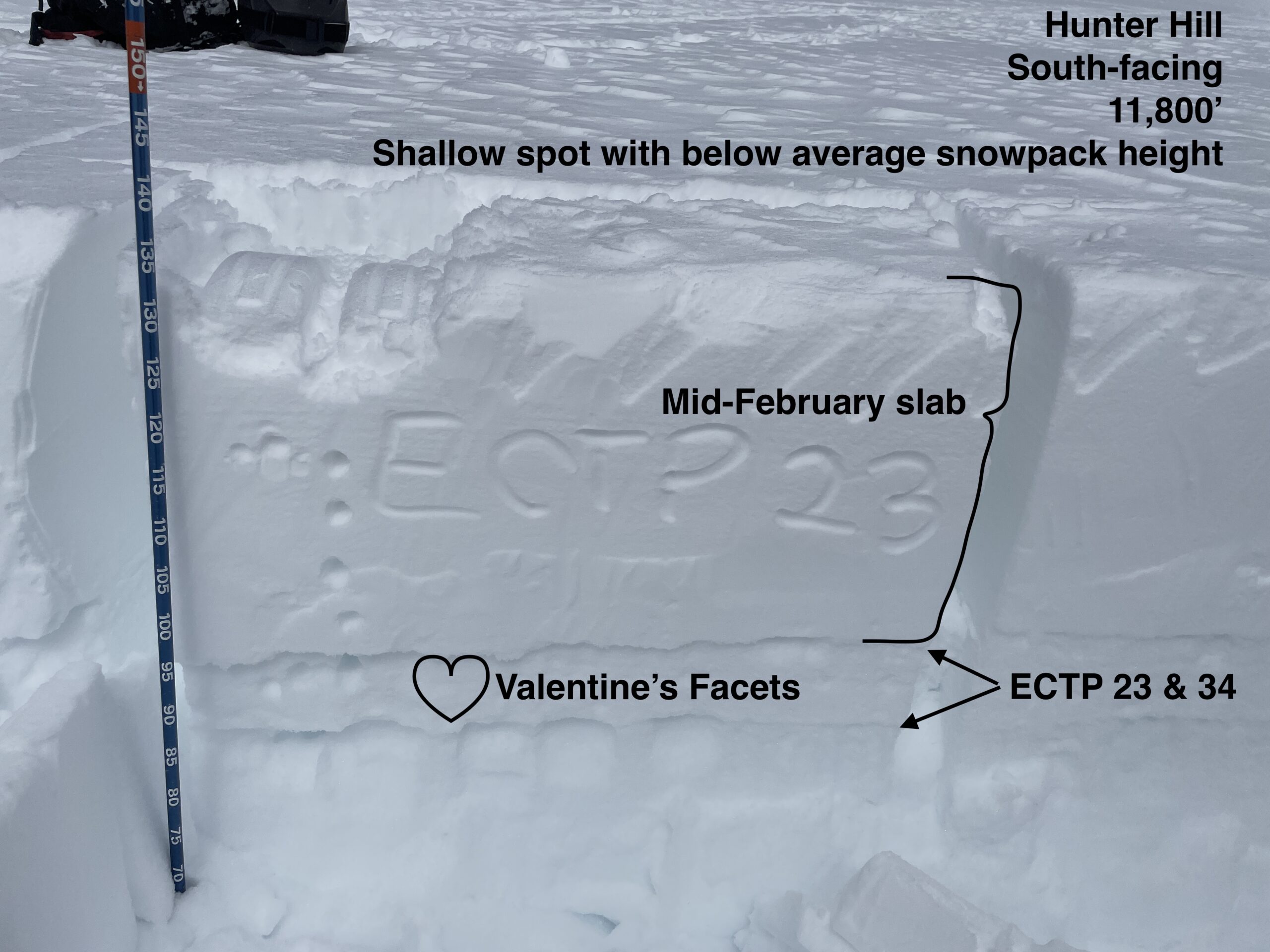
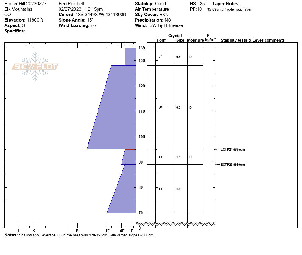
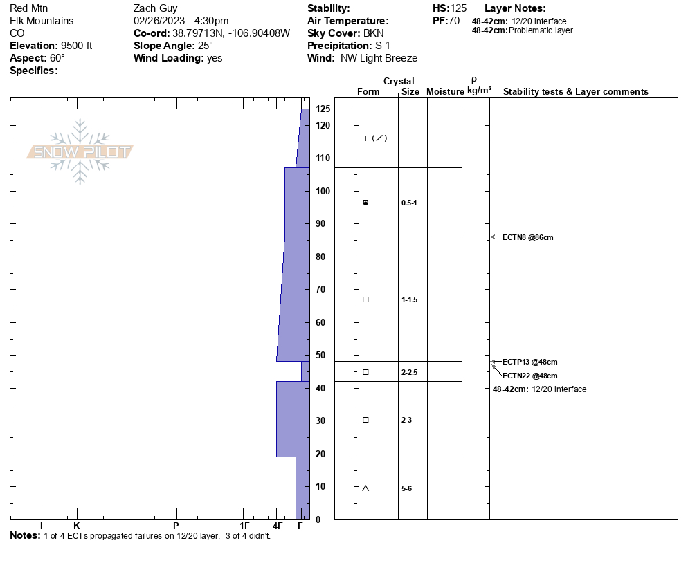
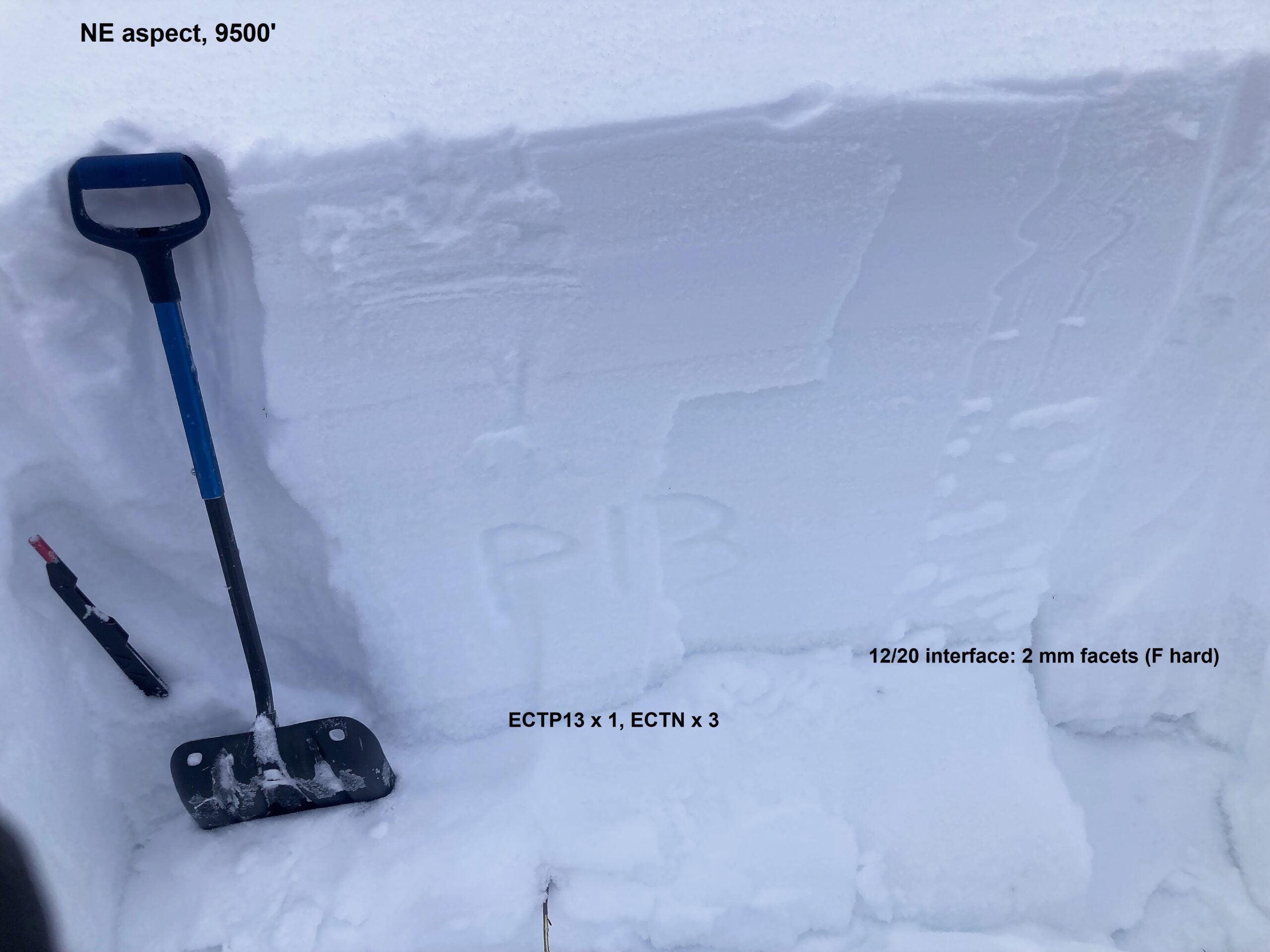
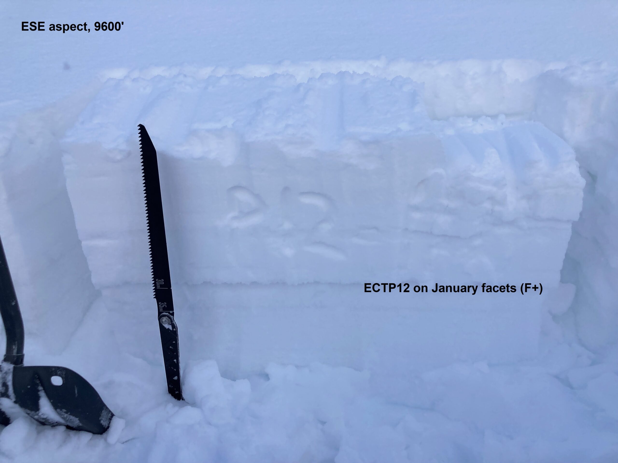
Snowpack: