Location: Kebler Pass Area
Date of Observation: 02/26/2020
Name: Evan Ross
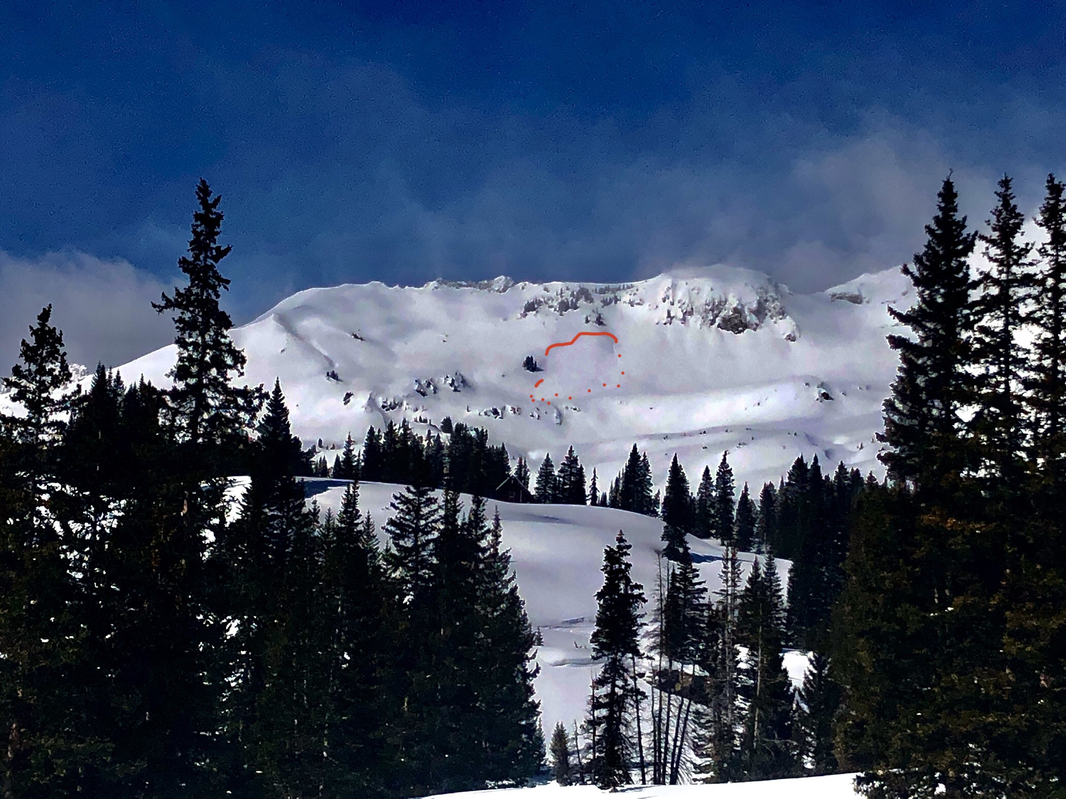
Subject: Near Gothic Mountain
Aspect: East, South
Elevation: 9,500-11,500
Weather: Clear sky in the morning, with increasing clouds and a few flakes in the afternoon. Winds remained light for our area. Didn’t notice much blowing snow.
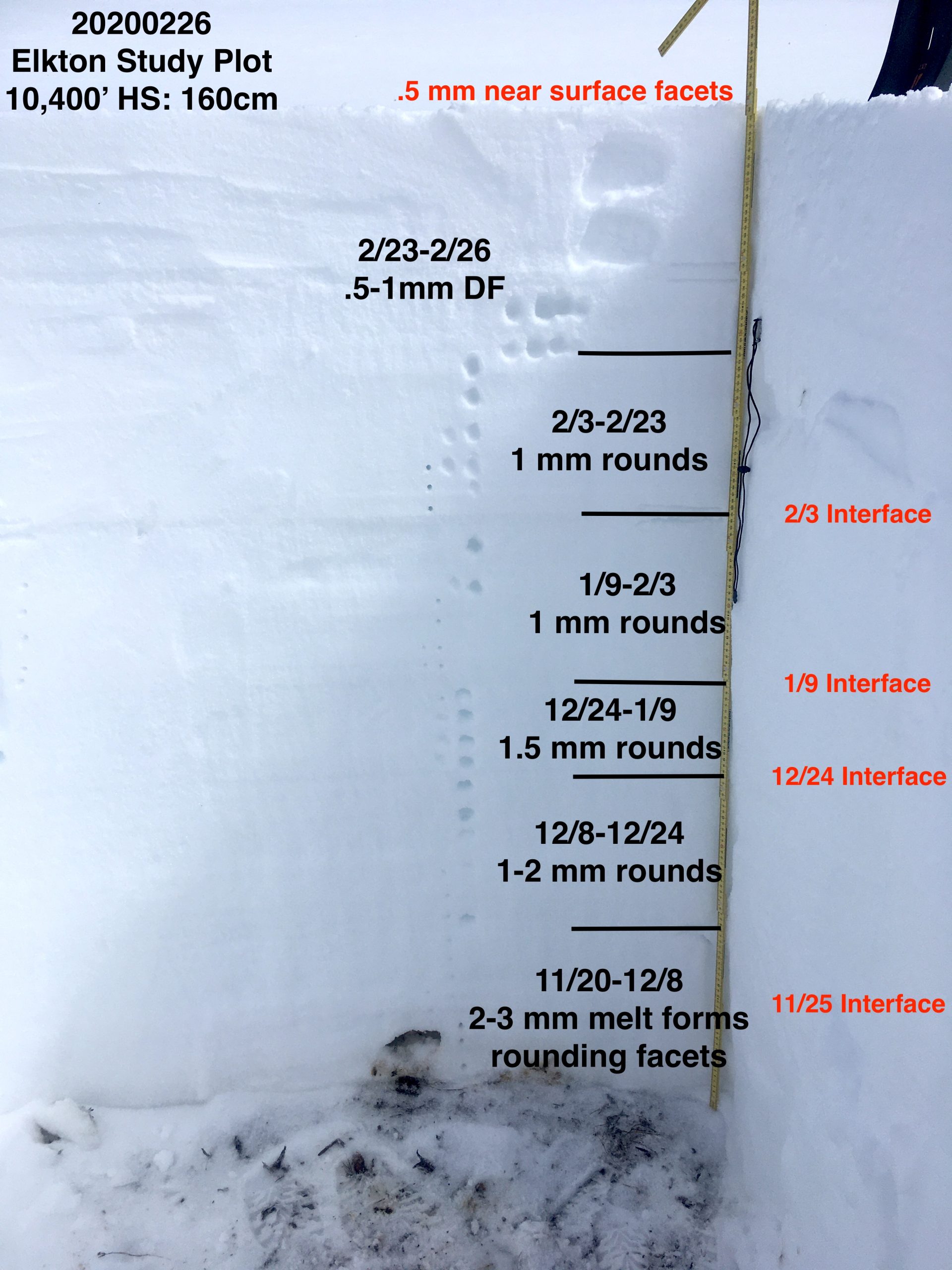
Snowpack: Spent a good bit of time on SE in the 11,000-11,500ft elevation ban. 20cm of recent snow from last Sunday over a supportable crust. The early February Crusts could be felt with a prob about 45cm down. Those lower crusts felt well insulated and would need a heavy load to be effected. All in all, no current concerns were found in this terrain. HS was in the 145-150cm range.
Easterly terrain dropping toward the Gothic Valley was all messed up from the recent northerly winds. Those slopes had little cross-loading and had ugly wind effected snow surfaces. Unloading was the observed theme on these slopes, the same as on northerly slopes traveled on yesterday.
Looking around the area, the typical down valley winds didn’t appear to have formed from the recent northerly winds and cross-loading in the normal areas wasn’t observed.