Date of Observation: 03/23/2023
Name: Dave Kozlowski
Zone: Northwest Mountains
Route Description: Ruby Peak
Observed avalanche activity: Yes
Avalanches: natural avalanche on Ruby Peak.
Weather:
Snowpack:
Date of Observation: 03/23/2023
Name: Dave Kozlowski
Zone: Northwest Mountains
Route Description: Ruby Peak
Observed avalanche activity: Yes
Avalanches: natural avalanche on Ruby Peak.
Weather:
Snowpack:
Date of Observation: 03/23/2023
Name: Eric Murrow
Zone: Northwest Mountains
Route Description: Washington Gulch TH to Elkton Knob area.
Observed avalanche activity: Yes
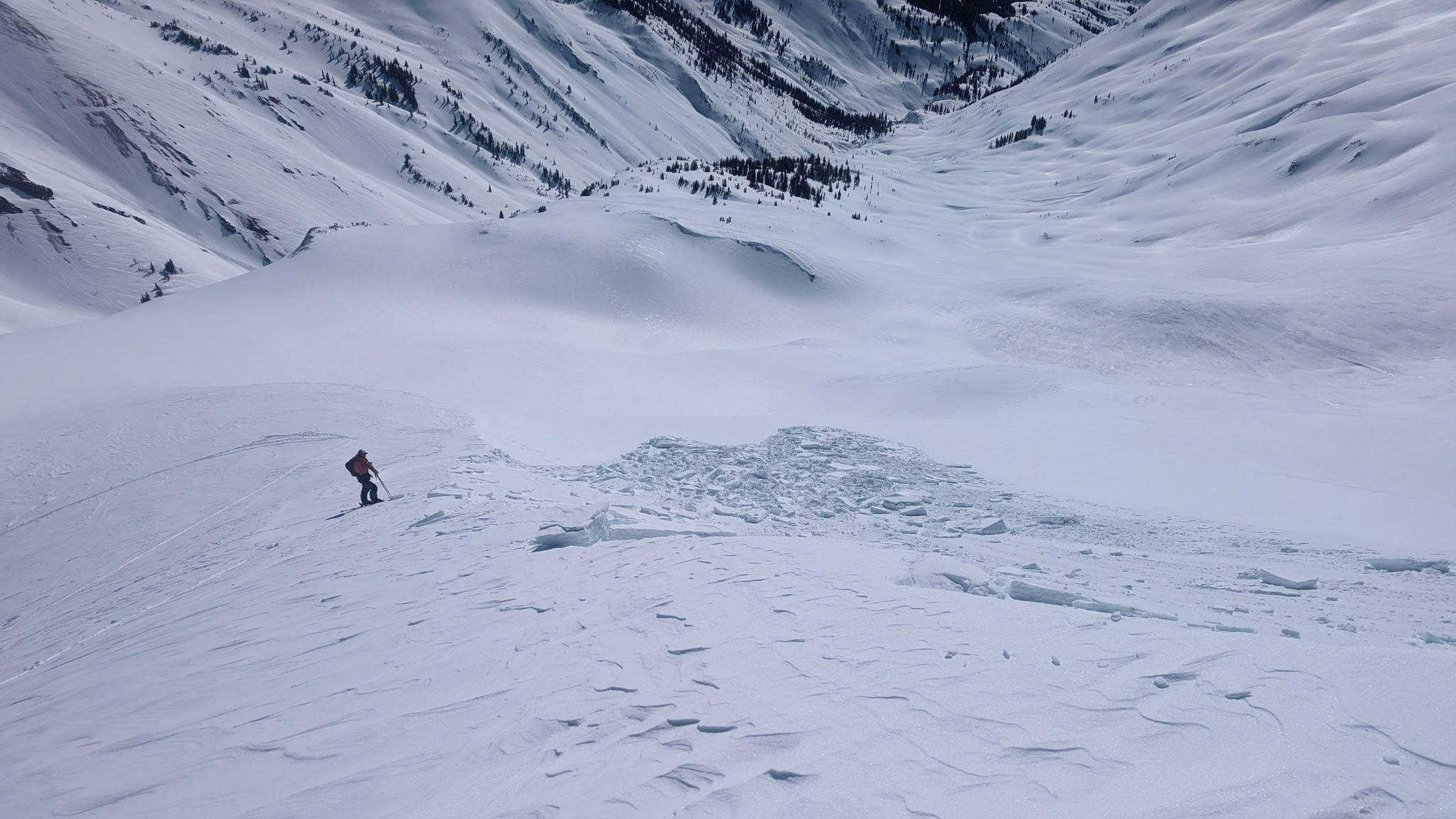
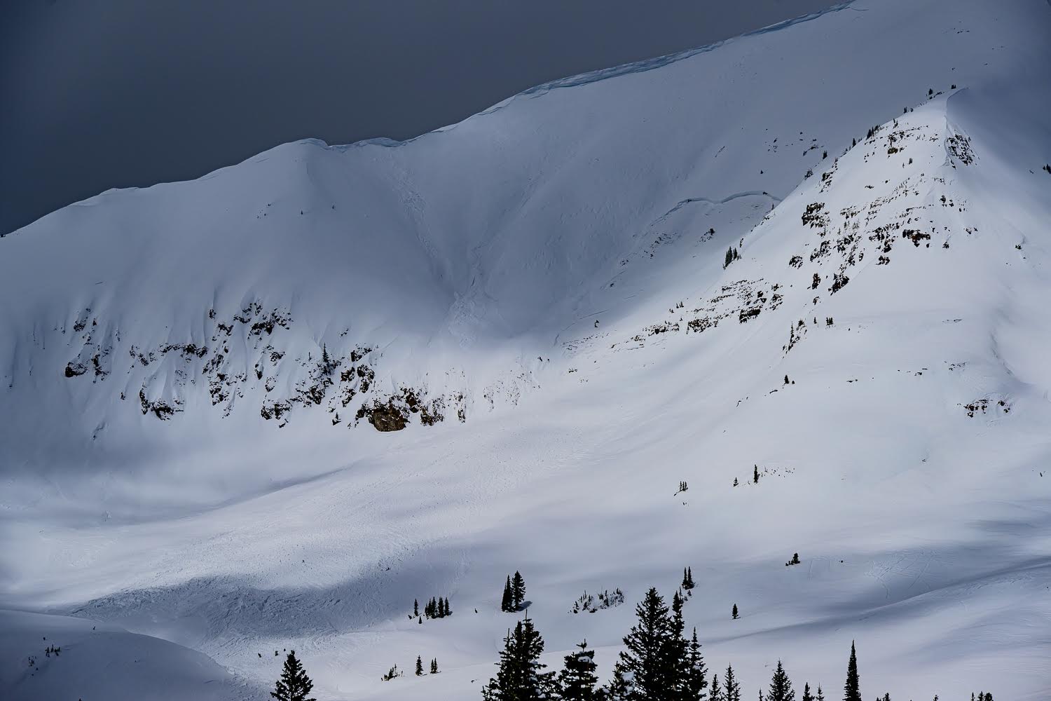
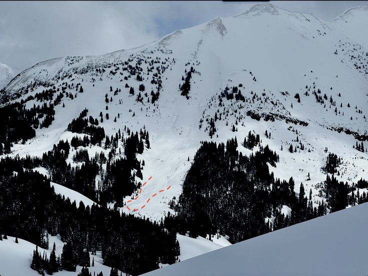
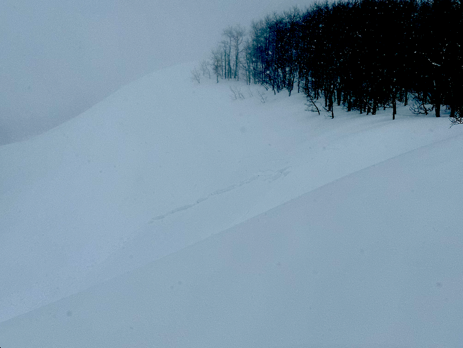
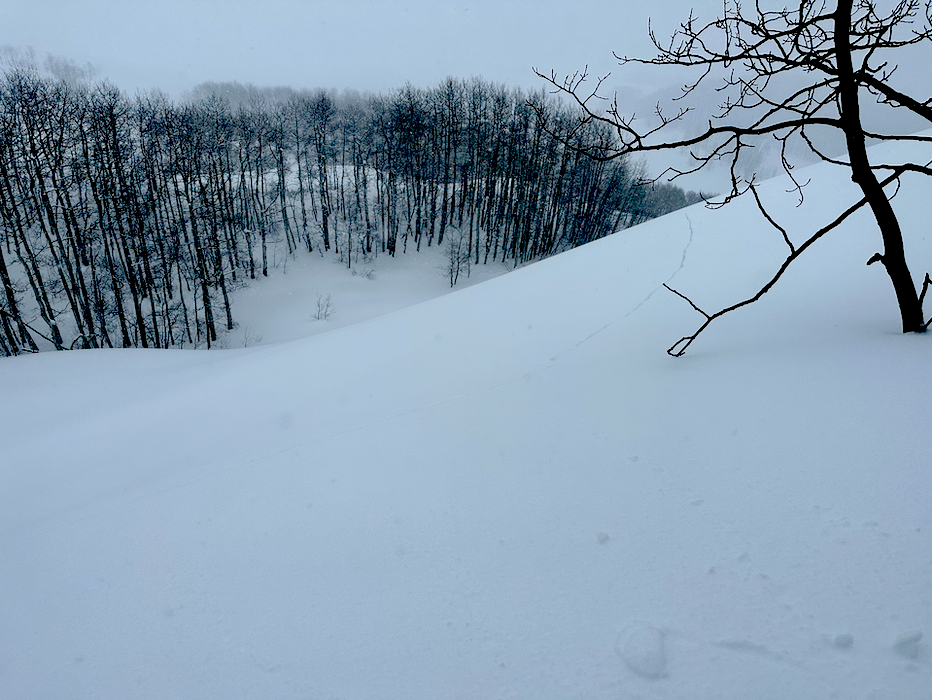
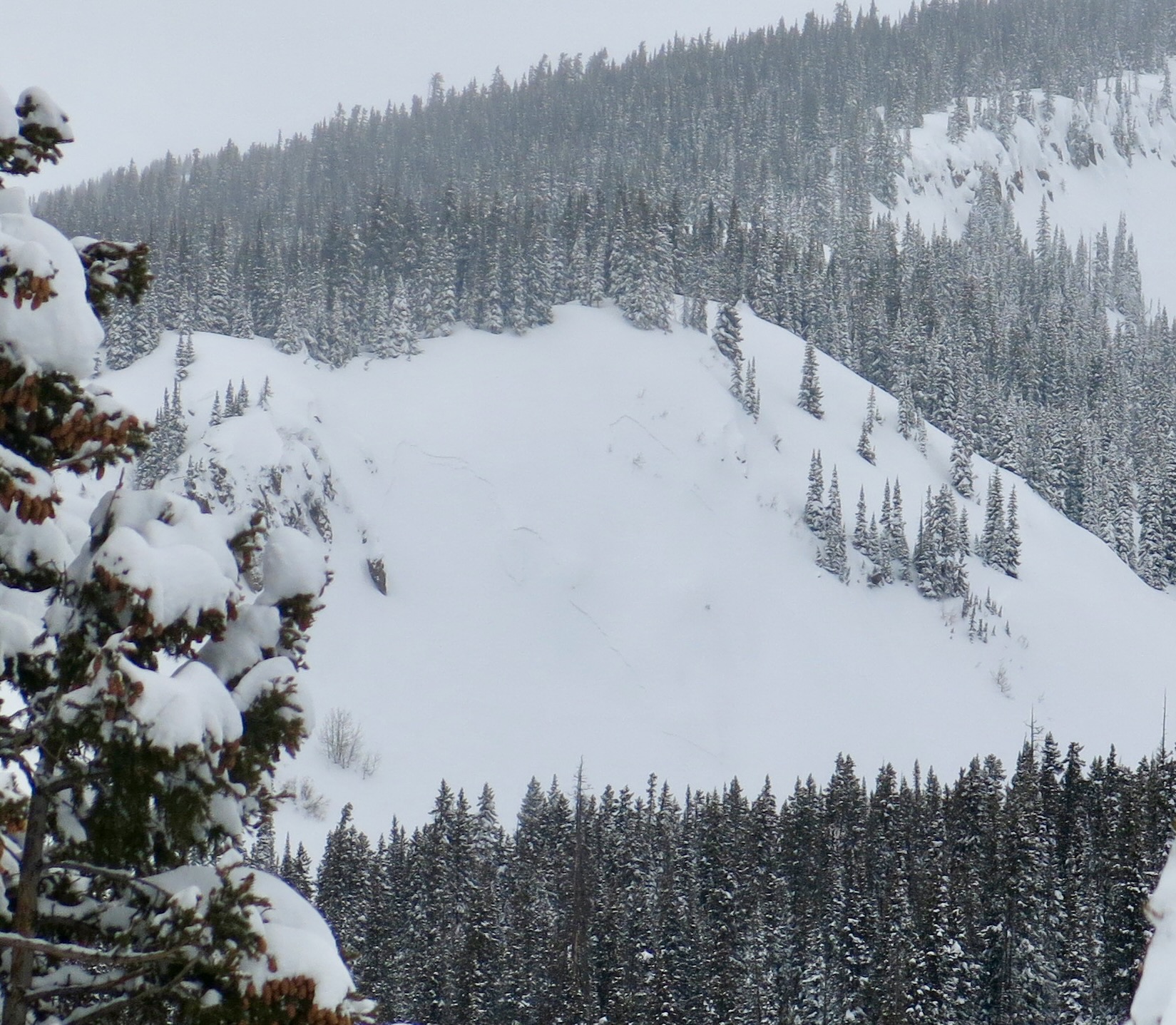
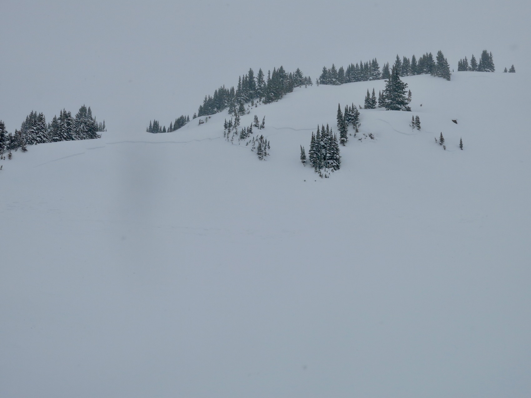
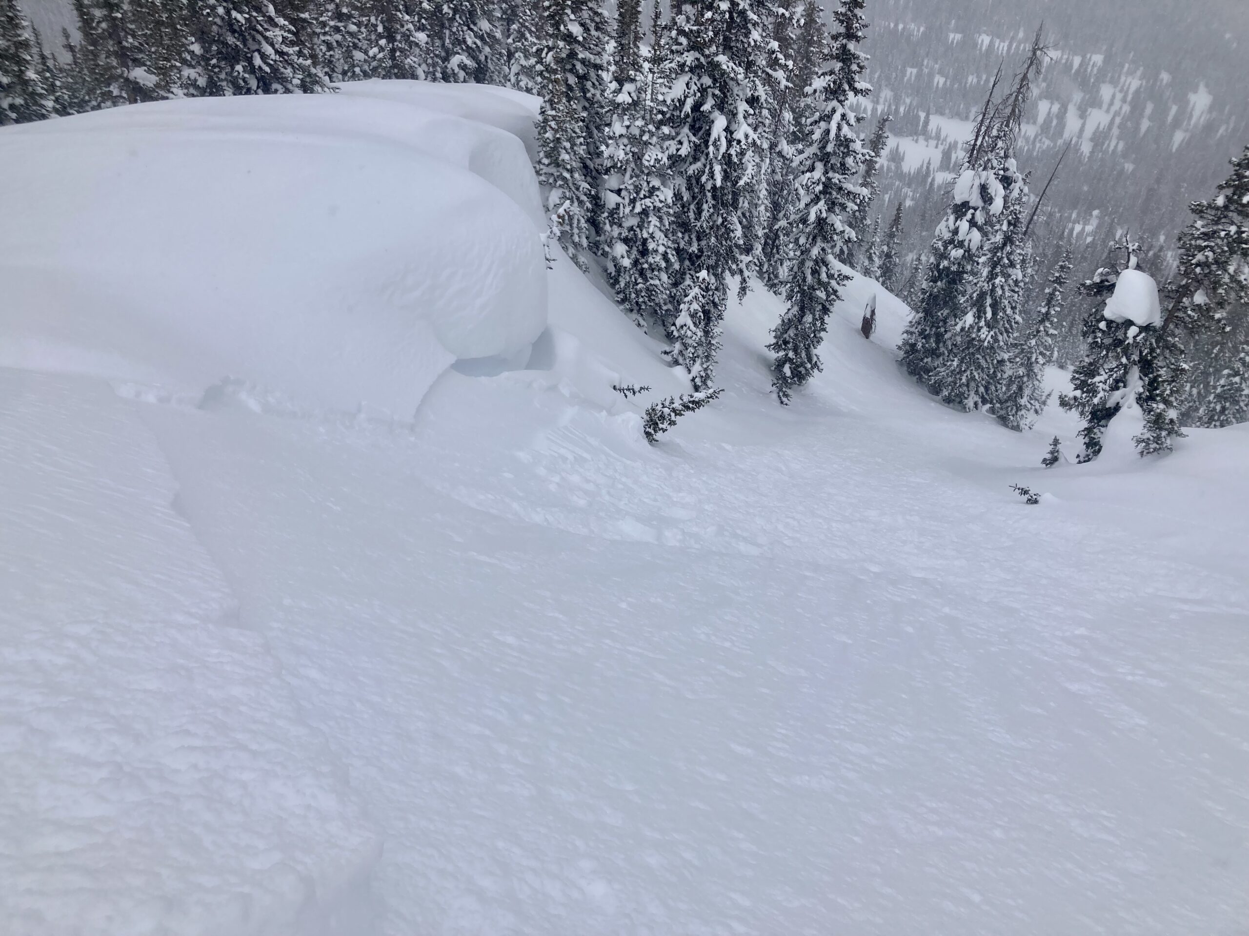
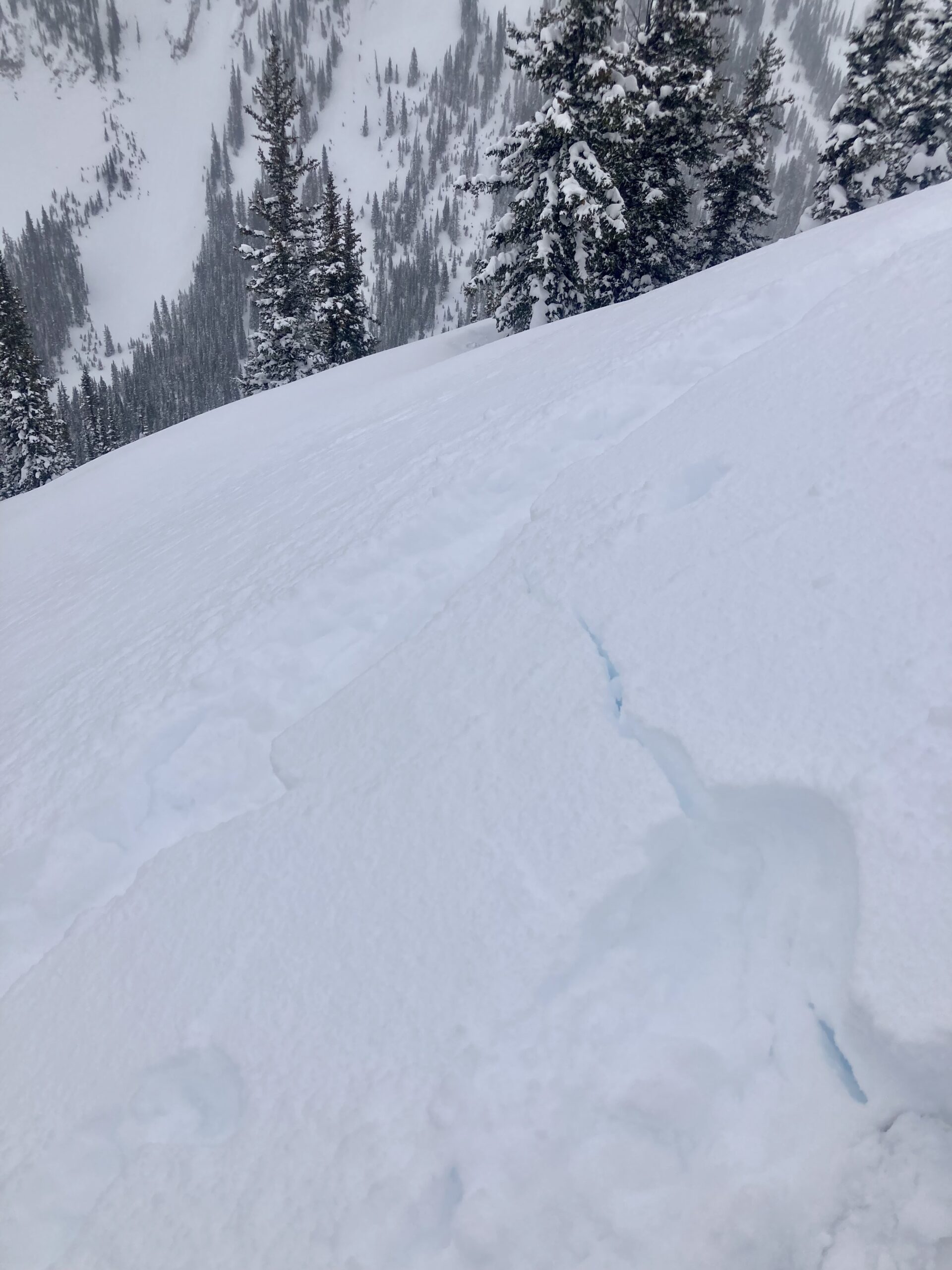
Avalanches: I will put most avalanche coding and photos in another ob. No natural avalanche activity near TH. View from the top of Elkton Knob was marginal but buffed debris was visible (few crowns) all over the alpine terrain in the Northwest Mountains and covered many aspects; this drifted over natural activity involved storm snow only. Once on top of Elkton Knob there were a lot of widely-propagating crowns visible in the Upper Slate corridor near Pittsburg and on Purple Ridge below treeline. Easterly aspects seemed to be the bullseye below treeline. HIGH danger occurred at all elevations on Wednesday in the Northwest Mountains.
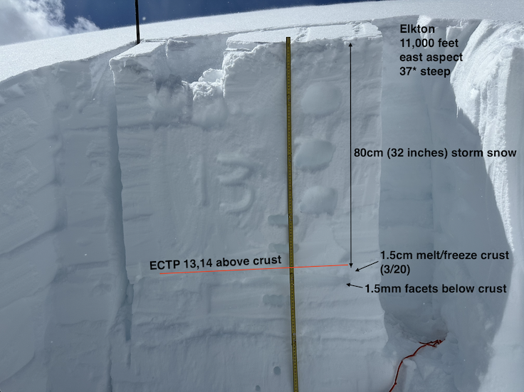
Weather: Mostly cloudy skies with periodic snow showers; no accumulations. Temperatures were seasonally cool, but solar radiation was enough to moisten snow surfaces on sunny aspects. Winds remained light with some moderate gusting up to 11,200. I saw a few periods of blowing snow across the highest terrain during the day. Settled storm totals up to 32″ at 11,000 feet.
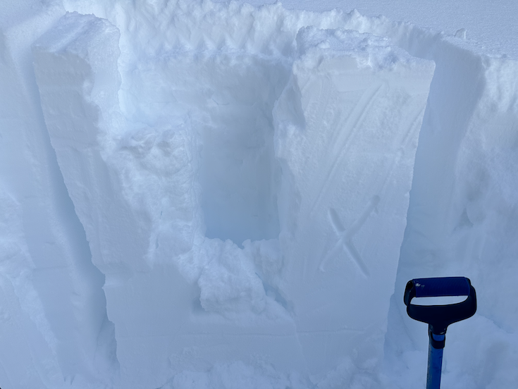
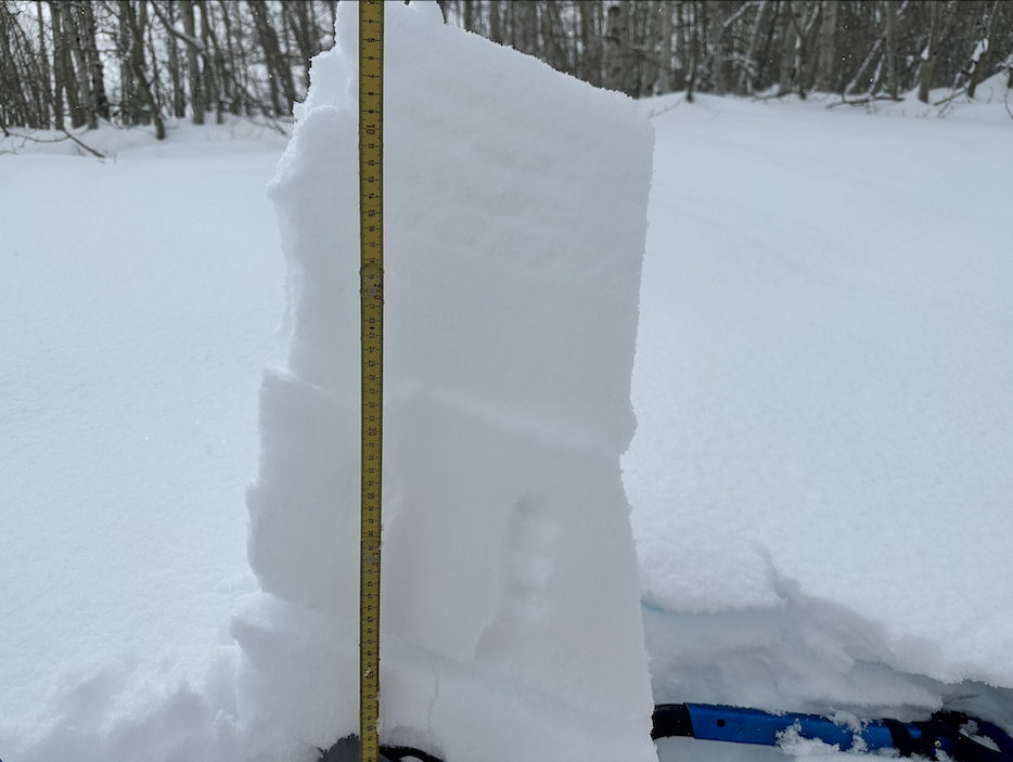
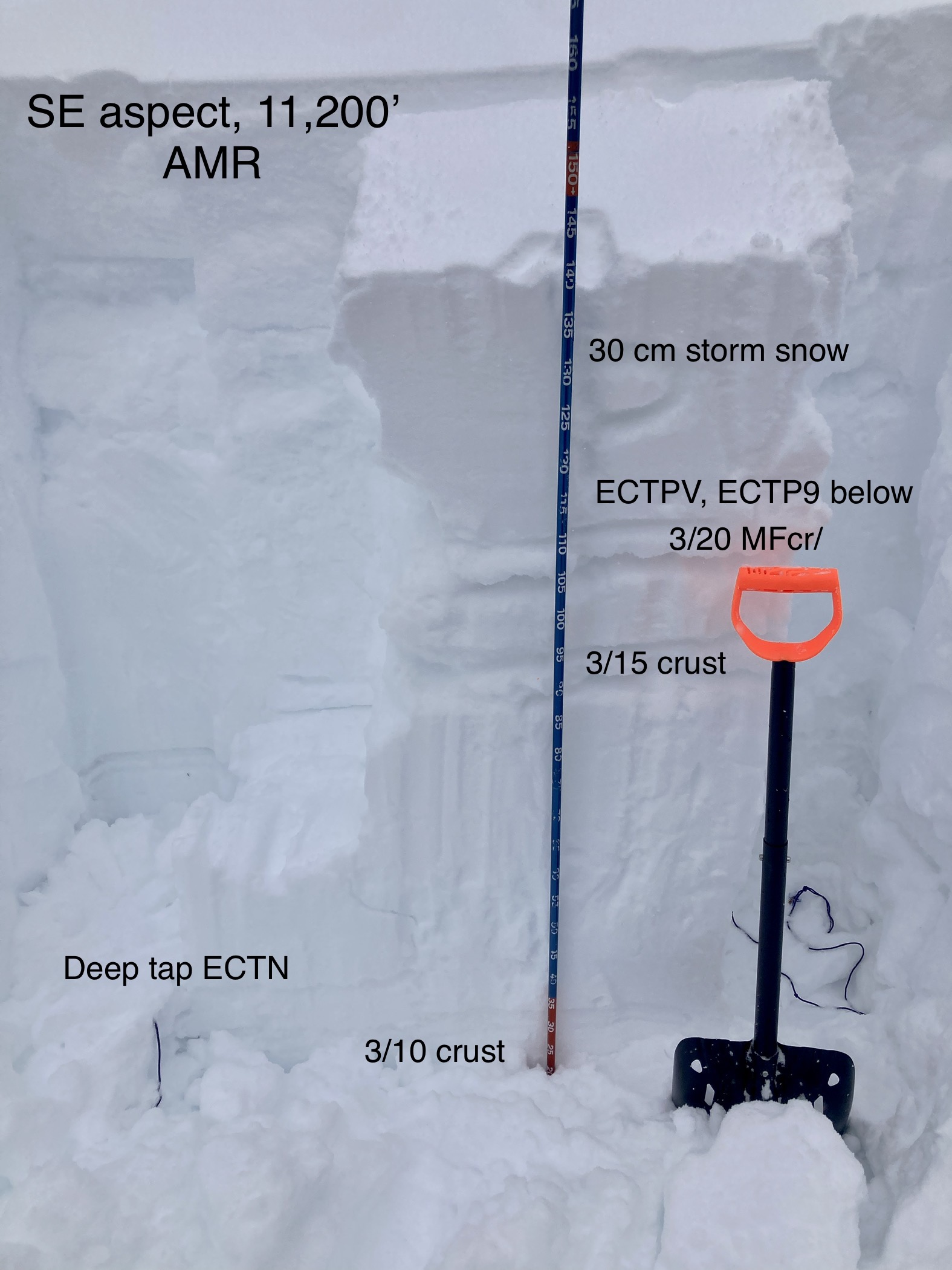
Snowpack: The recent storm snow was thick and supportive to skis on all aspects with ski penetration around 7 to 10 inches. I experienced a few muffled collapses that did not travel far. Periodic sunshine moistened snow surfaces on E-S-W slopes below 11,000 feet but failed to warm enough to make loose avalanches an issue. Snowpack tests on easterly slopes produced moderate propagating results (see image) above the melt/freeze crust at the new/old interface. I traveled near several pieces of avalanche terrain trying to get a remote trigger without result; the storm slab is far too supportive and thick to consider ski cutting anything so I kept a safe distance from steep terrain. A profile on a northerly slope did not produce propagating results on the faceted new/old interface (1-1.5mm facets); I was fairly surprised by this given how weak this interface is.
Date of Observation: 03/23/2023
Name: Billy Barr
Zone: Southeast Mountains
Route Description: Gothic Townsite
Observed avalanche activity: No
Avalanches:
Weather: Heavy snowfall Wednesday morning but only light in the afternoon and evening, stopping by midnight. The 24 hour total was 10″ new, with 0.88″ of water content. Wind became off and on, generally moderate with gusting but let up towards sunrise today. Snowpack reached 97″ deep- the deepest on record for March 22. Currently cloudy but calm and not snowing. The 24 hour high was 33 and the low and current 13. Snowpack dropped all the way down to 96½” (at this rate we should hit bare ground by October). billy
Snowpack:
Date of Observation: 03/22/2023
Name: Irwin Guides
Zone: Northwest Mountains
Route Description: Irwin cat-ski tenure.
Observed avalanche activity: Yes
Avalanches: Several, SS-ASc-D1 storm slabs 8-14″ thick on W and S aspects. Party hats L SS-ASc-R2-D2-I. W aspect NTL 14-16″ X 100′ X 800′ Failed on the 3/20 MFC interface.
Weather:
Snowpack: We did not travel E aspects today due to visibility. In the AM storm slabs on W
aspects tittered between stubborn and reactive. 6-8″ storm slabs grew to 12-16″ as the day progressed with
isolated loaded areas up to 24″ thick. By the afternoon avg. crown heights were in the 12-14″ range and
trended towards very touchy with remote triggers up to 25′ away. S aspects reacted vary similar to W BTL/ NTL
today. All were failing on the 3/20 MFC interface. The MFC produced repeat offence avalanches in our tenure
as guides skied certain slopes after snow safety passes.
Date of Observation: 03/22/2023
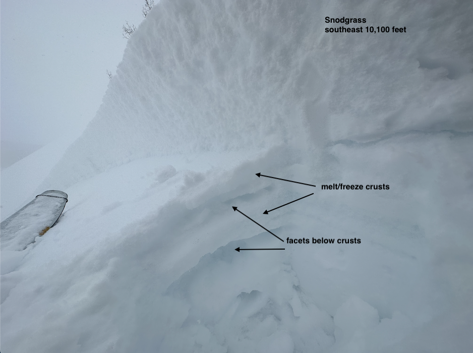
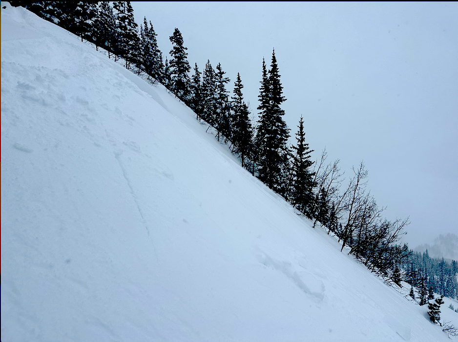
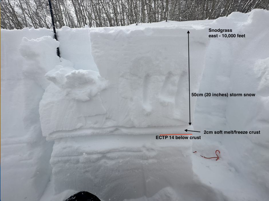
Name: Eric Murrow
Zone: Southeast Mountains
Route Description: Snodgrass TH up standard skinner with detours to nearby steep terrain features.
Observed avalanche activity: Yes
Avalanches: I remotely triggered two avalanches on a southeast-facing feature below treeline; slides ran on the melt/freeze crust at the storm interface in low density storm snow from the start of the storm. I ski-cut a large Storm Slab that broke on a mid-storm weak layer on an east aspect; as the avalanche ran it propagated wider and down to the storm interface. This avalanche may have collapsed the soft melt/freeze crust beneath the storm snow on east aspects.
Weather: Overcast skies with increasing winds during the day. Strong winds penetrated down to valley bottom during the afternoon. Storm totals ranged from 20-22 inches. From 1030 to 130 snowfall rates were commonly in the 1 to 2-inch-an-hour range. Visibility was obscured all day so I never got a view of the surrounding terrain.
Snowpack: Avalanches in the storm snow were very easy to trigger with some occurring remotely. Low-density snow from the start of the storm remains sensitive to human triggers in sheltered areas. South and southwest-facing slopes below treeline had thick melt/freeze crusts around 4 inches thick below the storm snow and did not appear to cause concern for collapsing. Southeast and east-facing slopes crusts were thinner and may pose a threat for triggered avalanches after issues in the storm snow settle out. I experienced one collapse on an east-facing slope and a nearby test profile suggests that the crust below the storm snow is near its breaking point. I initiated a Loose Dry avalanche down a north-facing slope that gathered a lot of mass, but surprisingly, it failed to release a slab (maybe this slope avalanches the day before). Faceted grains were obvious beneath the storm snow in a north-facing test profile but no propagating results.

Date of Observation: 03/22/2023
Name: billy barr
Zone: Southeast Mountains
Route Description: Gothic
Weather: Only very light snow off and on during the day yesterday (½”) but steady light to moderate overnight snow with total of 7½” new and water content 0.65″. The snowpack is at the winter’s deepest of 93″ which if this holds (or increases) by sunset (i have always kept my own records sunset to sunset) it will be the deepest on record for this date, by 2″ over 1980 but a far cry from the 117″ all time high. The wind picked up just after midnight and is steady 5-10 West with gusta to 20 and very warm as it reached 32F overnight. It is currently at 28 with moderate snow and moderate but gusting wind and no visibility.
I saw 1 foot fractures run yesterday from just that recent new snow so expect more of that today. I think the safest thing is to stay under the covers. Until June.
Date of Observation: 03/21/2023
Name: Evan Ross
Zone: Northwest Mountains
Route Description: Indy and Elk Basins. 9,000-12,000ft.
Observed avalanche activity: Yes
Avalanches: Many small storm slab avalanches at BTL and NTL elevations. Poor visibility ATL. Those avalanches failed last night or during the early AM hours. 40+ avalanches. All failing in 40+ degree terrain. There were fewer avalanches on due south-facing slopes and I didn’t see much for north-facing terrain. I didn’t notice any avalanche activity near the Kebler Road or on the lower northerly facing slopes of Mt Axtell.
Weather: Overcast. S-1. Calm wind.
Snowpack: HST averaged in the 25 to 35cm range. The storm slabs were failing just above the 3/20 crust in low-density storm snow and stellars. Hand pits still produced clean shears on the interface, but I otherwise didn’t observe any signs of instability on small test slopes. There was wind-affected snow at upper elevations, but I didn’t encounter any notable thick wind drifts and of course, also didn’t enter the most suspect terrain. On E-SE and W aspects The 3/20 crust was 2cm thick on average. There wasn’t enough load to start collapsing that crust into the weaker snow below. The crust on due south is thicker and stronger.
Photos: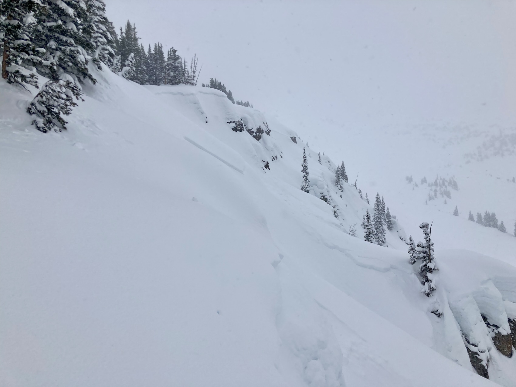
Date of Observation: 03/21/2023
Name: Zach Guy
Zone: Northwest Mountains
Route Description: Rec tour in the Anthracites, the usual stuff, avoided East Bowl.
Observed avalanche activity: Yes
Avalanches: Ski cut a storm slab in Ziggens. NE aspect BTL. The slab was 10″ thick and about 50′ wide, breaking on low density snow that fell earlier in the storm yesterday. Some small natural activity off the drifted feature on East Bowl.
Had some decent vis into the playground, Ruby Peak, Axtell, and Whetstone this morning and didn’t see any persistent slab activity.
Weather: S-1. Light ridgetop winds; signs of previous drifting near treeline.
Snowpack: 12″ of top heavy storm snow produced cracking up to 5′ long on test features, both on storm layers (northerly) and storm interface (southeast).
A quick pit on a wind-sheltered southeast aspect produced easy propagating results (ECTPV, ECTP9) in facets below the 3/20 crust. The crust was about 2-3cm thick, strong enough that I didn’t get any collapses on it while walking around on a few similar slopes. No results on the 3/10 crust here, and like elsewhere, the weak layer was not obvious. Probed around on a few NE facing slopes to verify the absence of the 3/10 crust…nothing on NE or ENE here.
Date of Observation: 03/20/2023
Name: Evan Ross
Zone: Northwest Mountains
Route Description: Skykill Ridge, Near OBJ. 9,000ft to 11,300ft. NE-E-S
Observed avalanche activity: No
Weather: S-1 most of the afternoon. Starting to pick up in the later afternoon as we were headed out. Calm wind.
Snowpack: Great skiing on NE with some sluffing in steep terrain. The crusts at the old snow interface on East were breakable and not good skiing. Not enough snow yet, for any storm slab problems. The most notable weak layer was the 3/20 interface that was buried this morning. On E and SE it was about 2cm thick, collapsible into weak snow below, and ready to aid in propagation once there is enough load. On south, that crust was 6cm + thick and strong.
Targeted a test pit on a ENE slope at 9,700ft. Slope 34 degrees. HS 250cm. The 3/10 interface didn’t produce any ECT, CT or DT tests. The 3/15 crust and 3/20 NSF each produced ECTN results. The layer of concern at this location was the 3/20 NSF once there is a slab, and if something did step down to the 3/15 crust it wouldn’t be much deeper at this location.
Date of Observation: 03/19/2023
Zone: Northwest Mountains
Route Description: Yule Creek area
Observed avalanche activity: Yes
Avalanches: A few small triggered and natural wind slabs from northwesterly winds channeling down valley. A large persistent slab on the east side of Justice looks like it ran during the last storm.