Date of Observation: 03/24/2023
Name: Evan Ross
Zone: Northwest Mountains
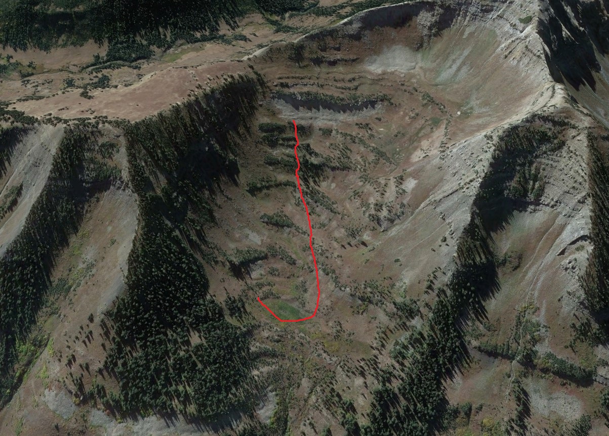
Route Description: Slate River. Variety of aspects. Mostly stayed within 500 hundred feet of the valley floor.
Observed avalanche activity: Yes
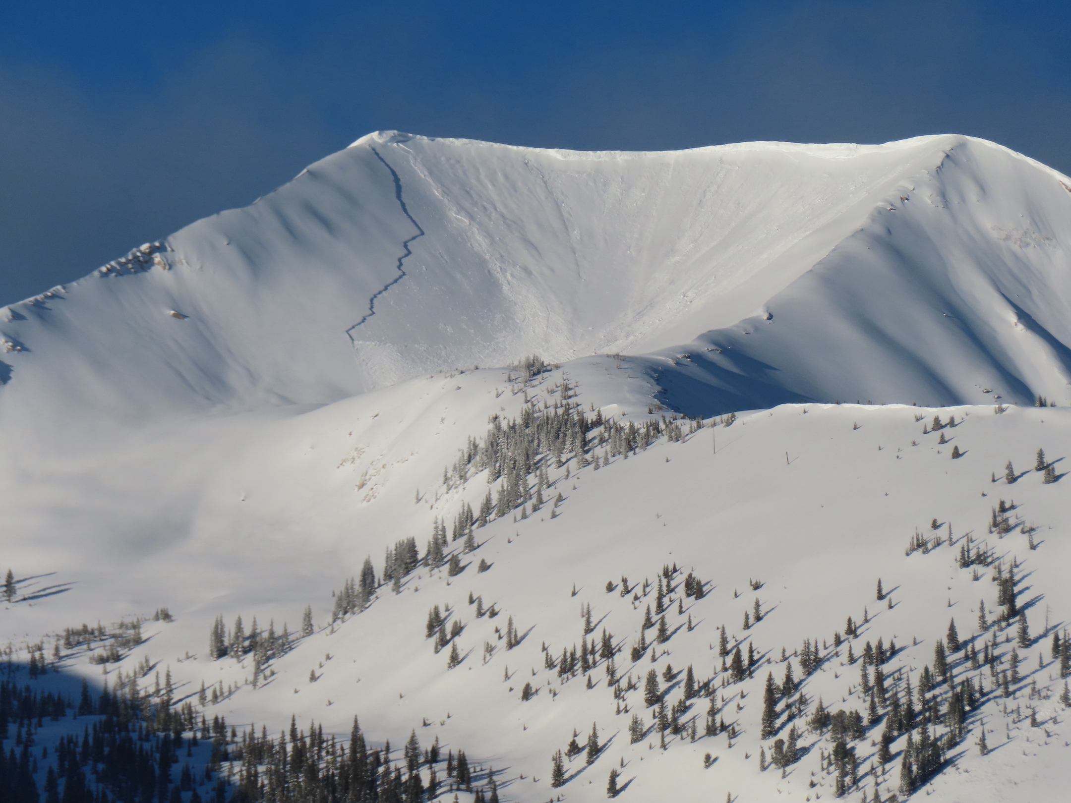
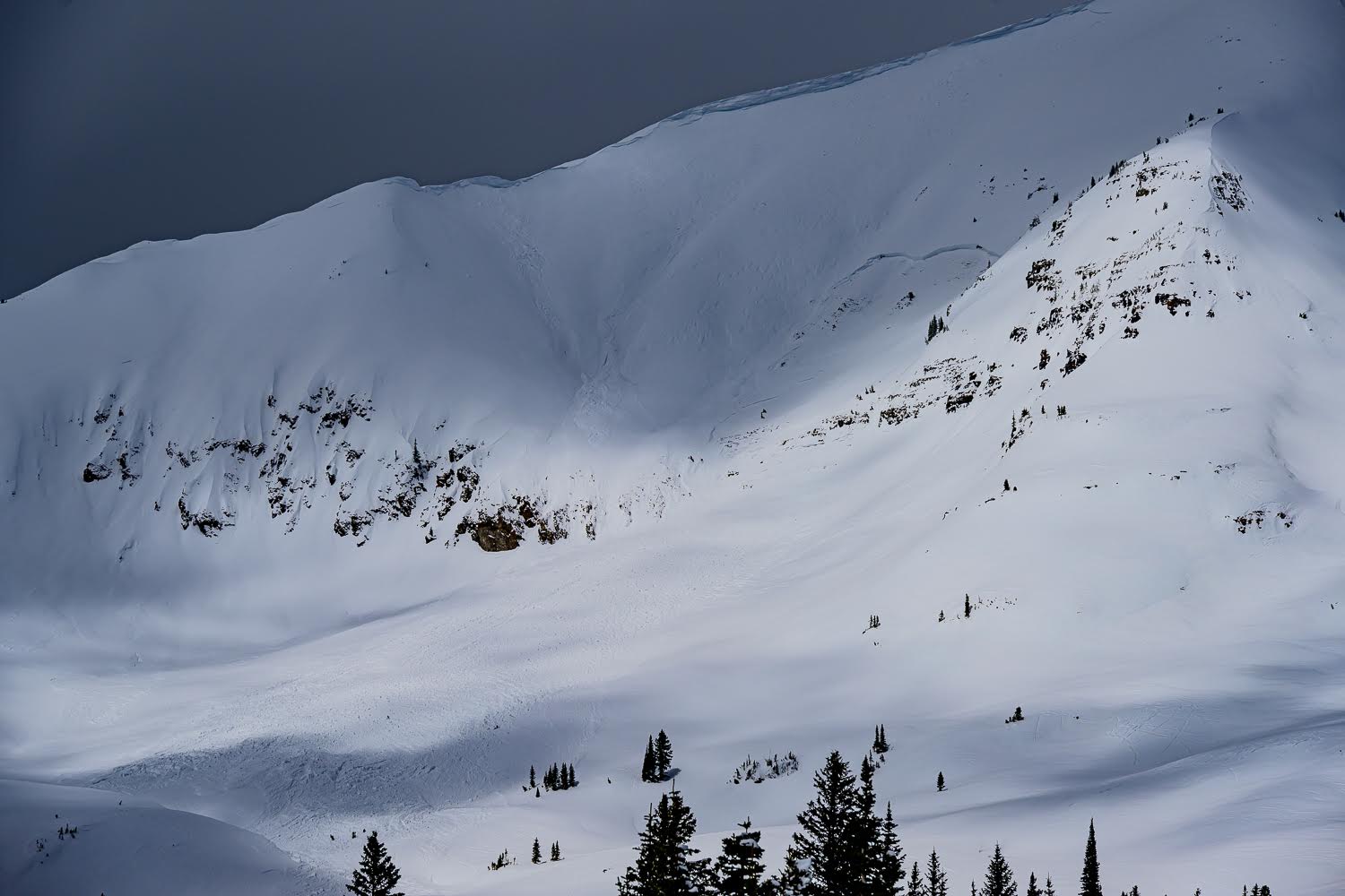
Avalanches: Many of the avalanches in the Slate and upper Slate have already been documented. I targeted specifics on those weak layers and that info is below. Avalanches on easterly aspects had the largest propagation and the most number of avalanches. However Northerly and westerly aspects had their share. The crowns in the alpine appear to be drifted back over or not visible with the recent weather.
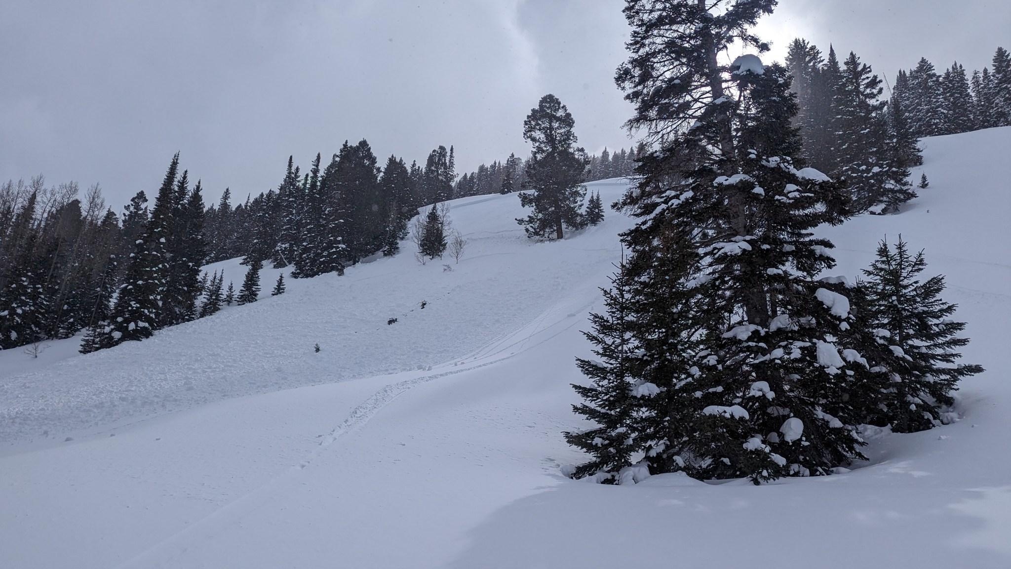
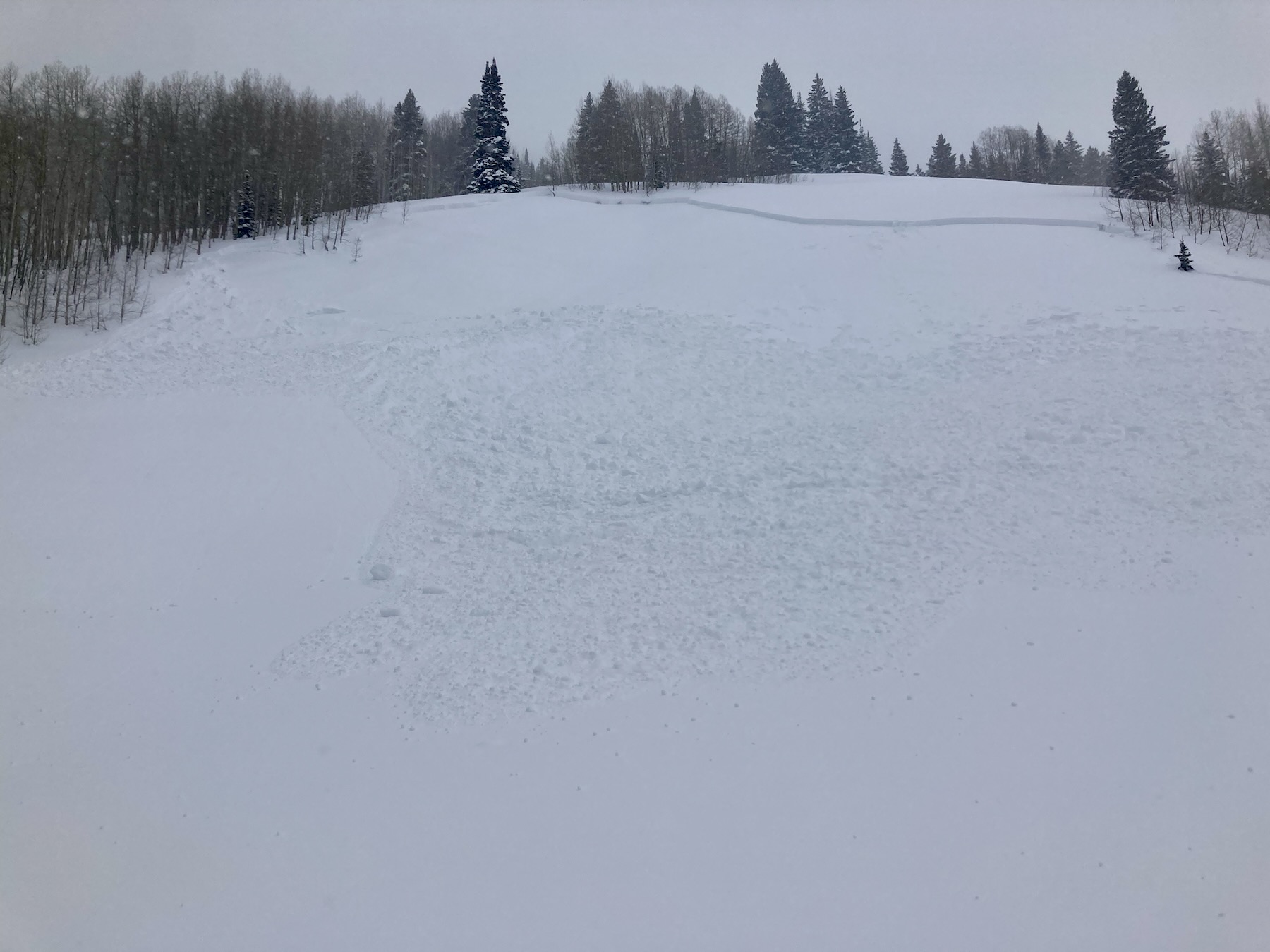
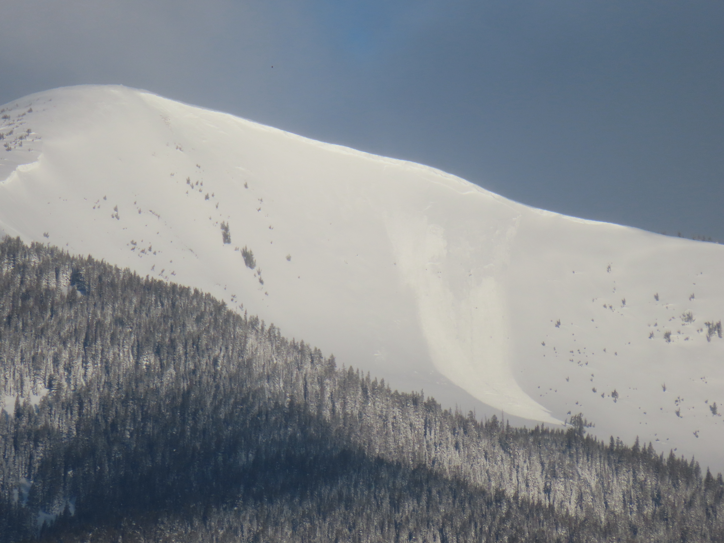
I remotely triggered one large slab avalanche from a few hundred feet away, while traveling on a low-angled slope below. The avalanche ran on a west-facing aspect at 9,700ft. Later that day I found a D1 natural that ran today on another West aspect. These avalanches appeared to run on top of the 3/20 crust.
The NE to E Happy Chutes and Climax chutes had a handful of D1.5 to D2 slab avalanches from the last storm. The crowns were most commonly on the steep 40 to 40+ degree rollers in the terrain.
Weather: Calm to light wind in the valleys. Notable blowing snow off the high peaks in the later afternoon. Mostly cloudy and warm.
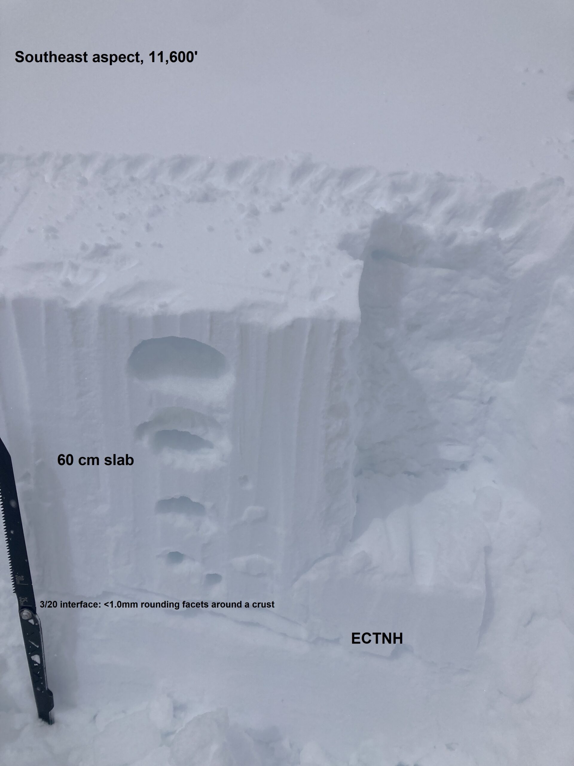
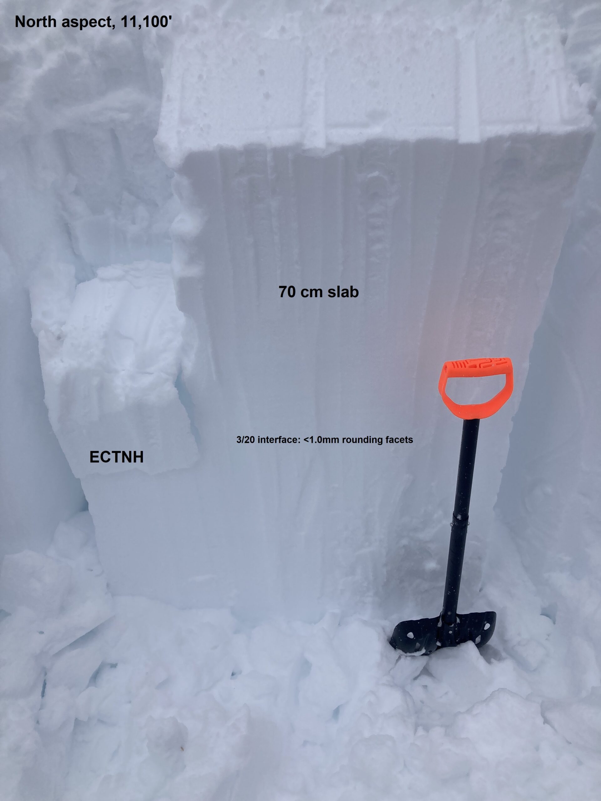
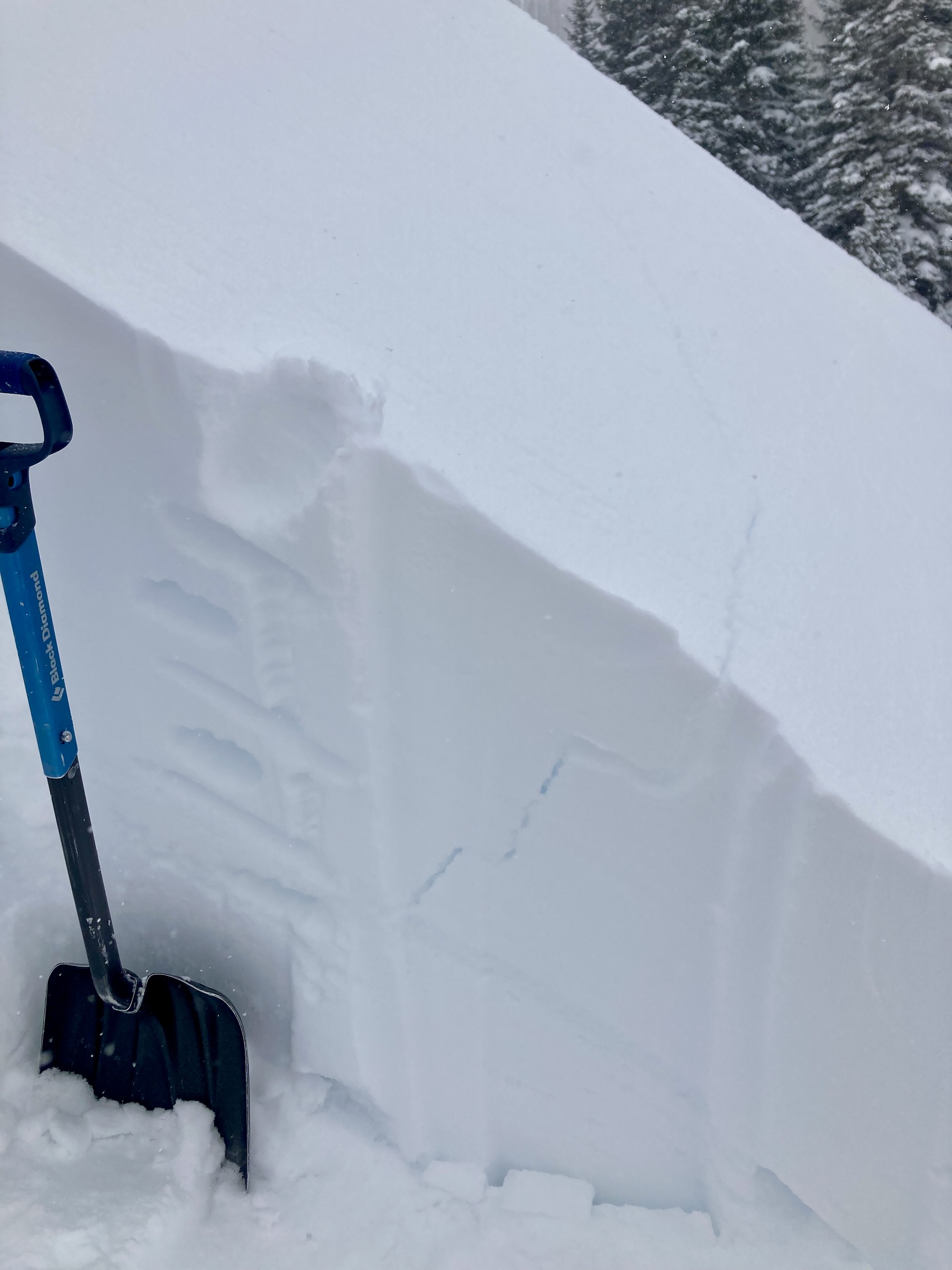
Snowpack: I targeted several old avalanche crowns to get a better sense of whether the recent avalanche cycle was breaking in non-persistent storm snow or the well-documented persistent weak layers in the upper snowpack. In each crown I checked out, the avalanche had broken on or below the 3/20 interface, before using the 3/15 interface as a bed surface.
On Easterly facing slopes, the 3/20 interface is a collapsible crust about 1cm to 3cm thick, and the avalanche activity on these aspects had propagated widely across the terrain. The 3/15 interface just made for a nice bed surface on all these avalanches. The crown heights were typically 45 to 65cm.
Where the 3/20 interface was NSF, on northerly facing slopes, the avalanches didn’t propagate as wide.
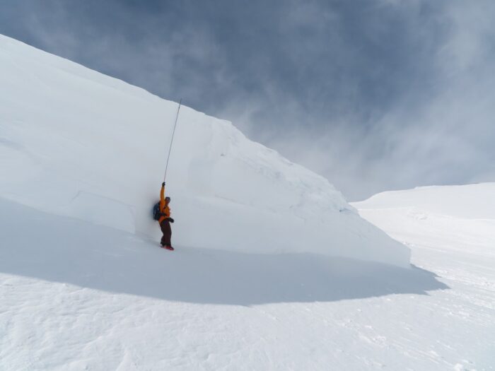
On westerly aspects, the upper snowpack structure is similar to that found on east aspects. I targeted one test pit on a west aspect 10,500ft, and got an ECTP 23 result on the 3/20 interface. Later I got the remotely triggered avalanche on another west aspect and saw the small nature on another west aspect.
I didn’t observe any obvious signs of instability. The upper slab has settled and gained strength.
Photos:
-
-
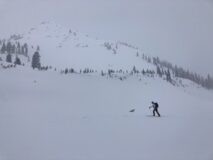
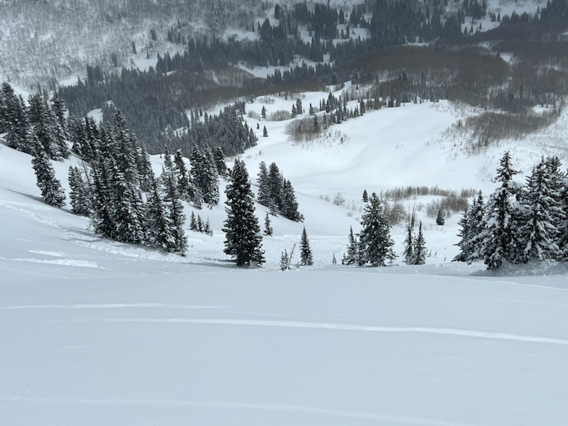
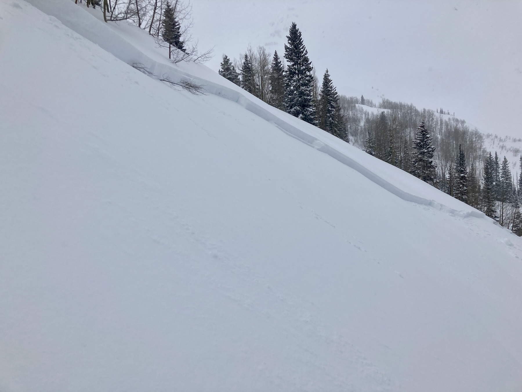
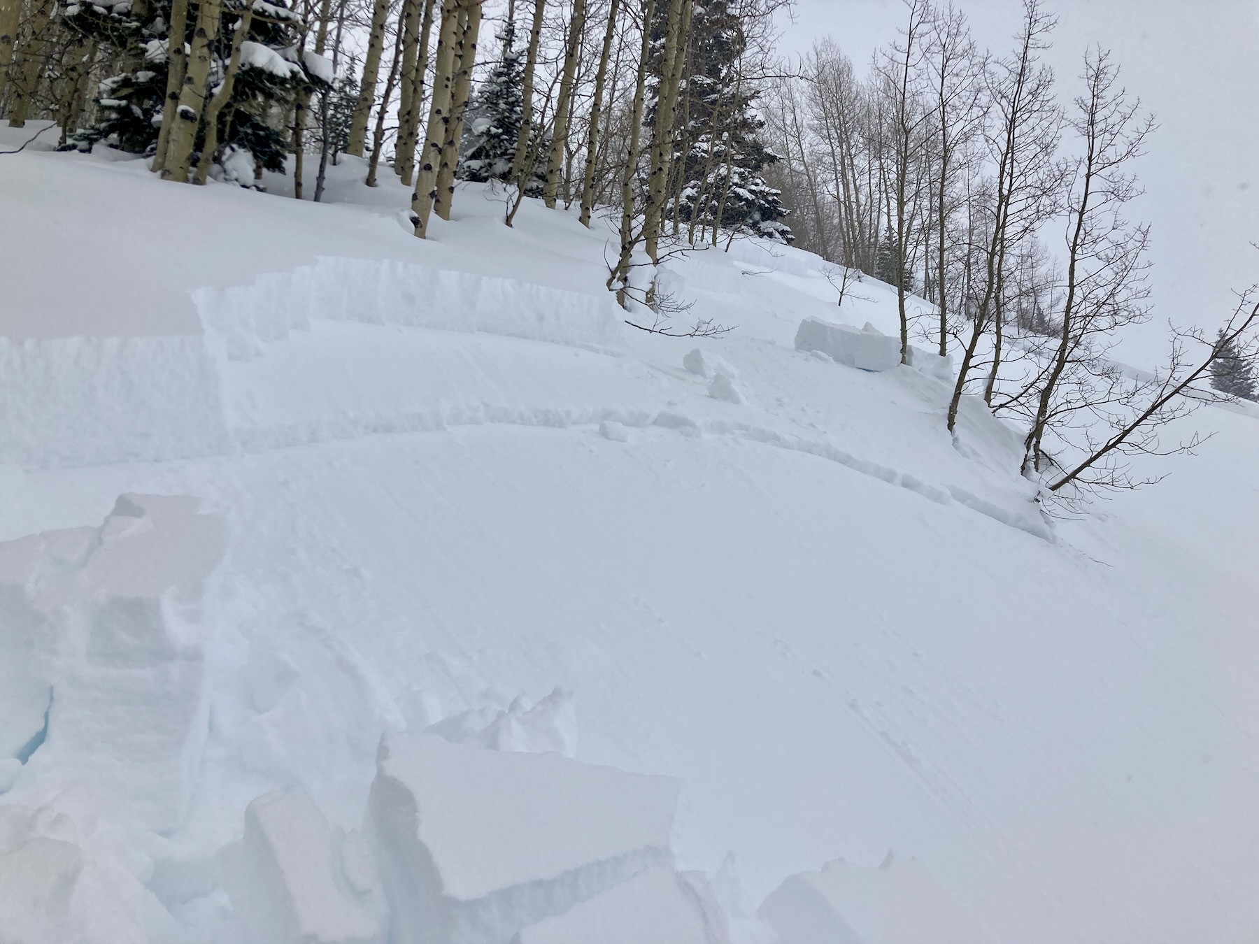
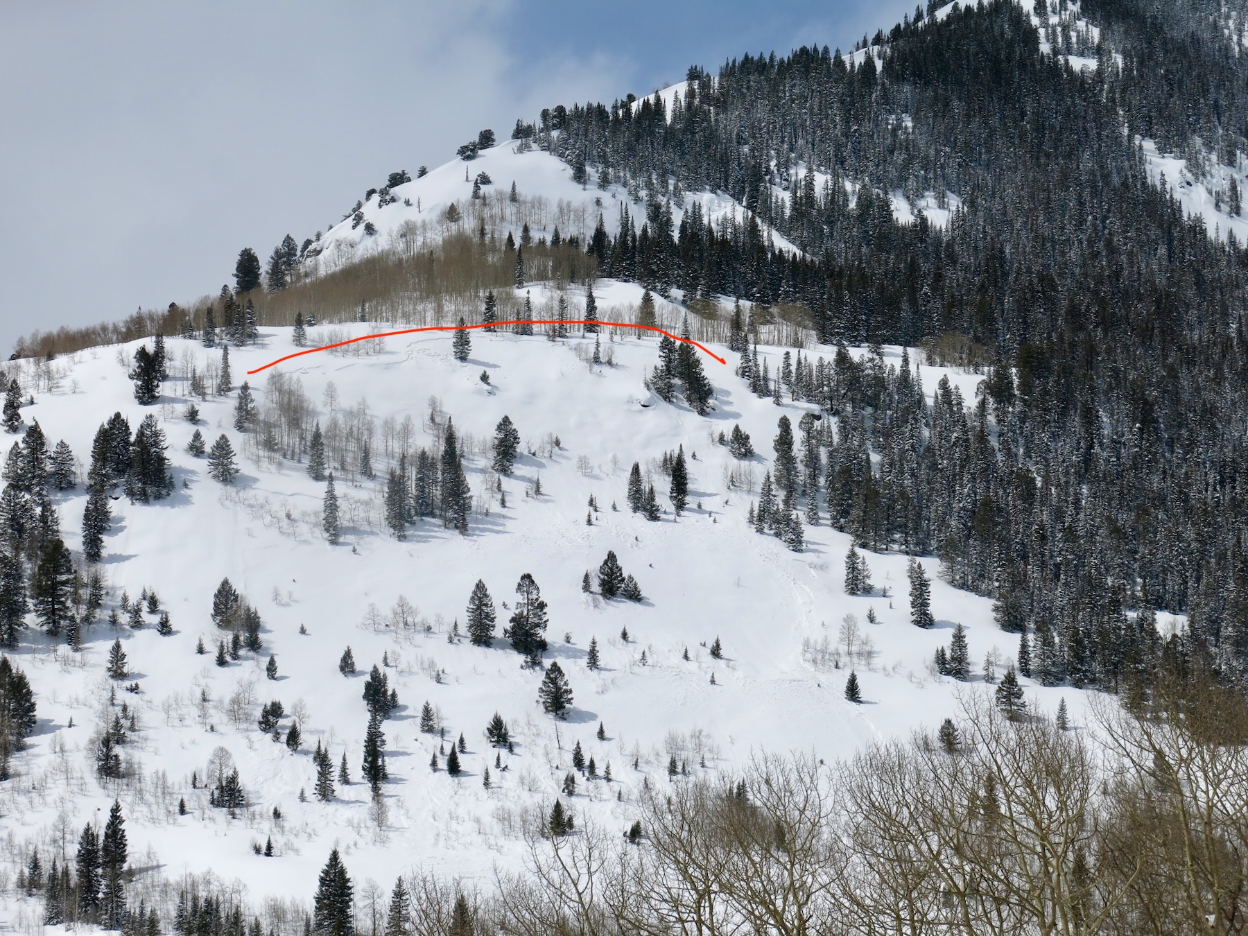
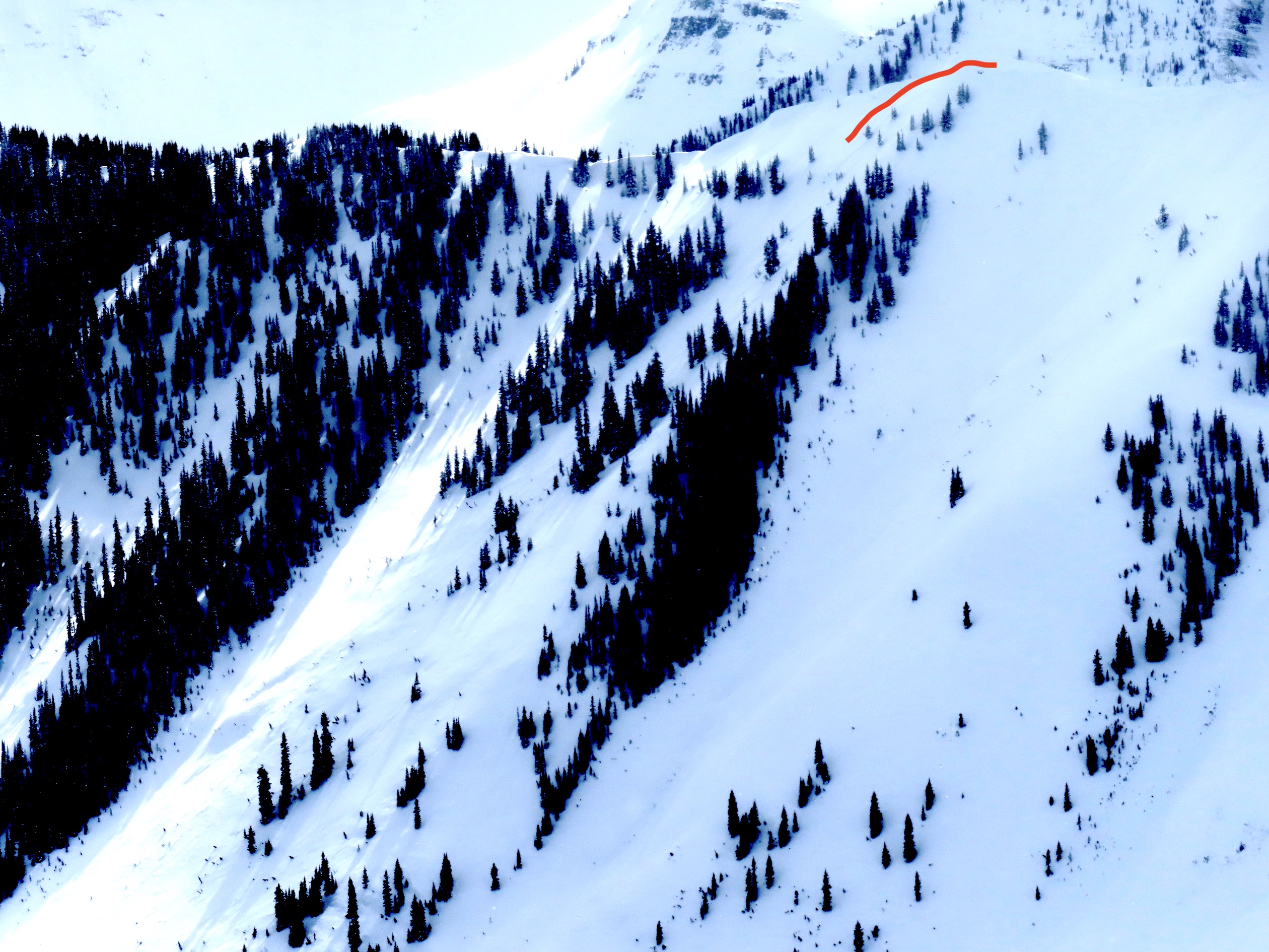
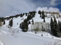
Remote Trigger from here. The avalanche ran on a west aspect below treeline.
-

-
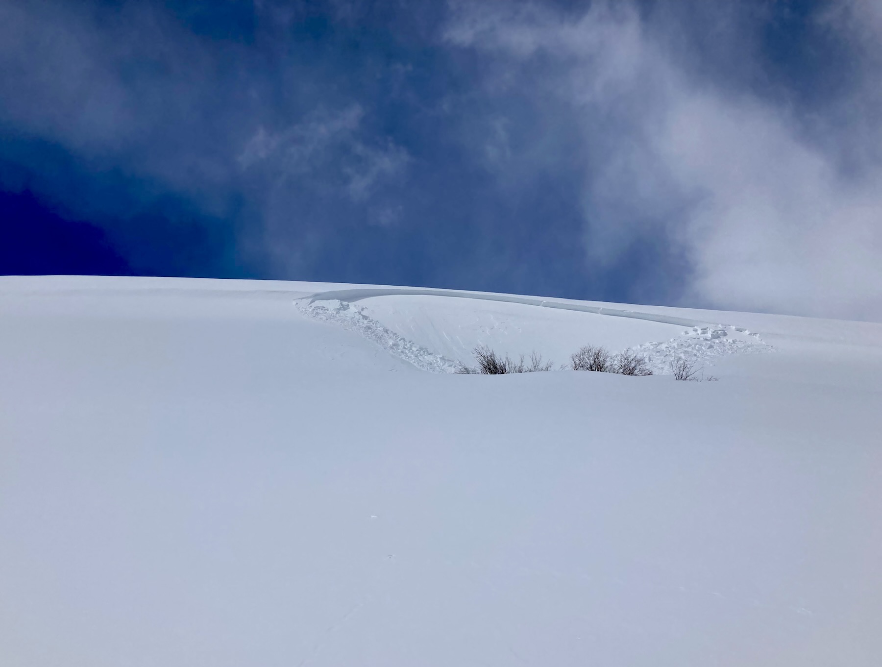
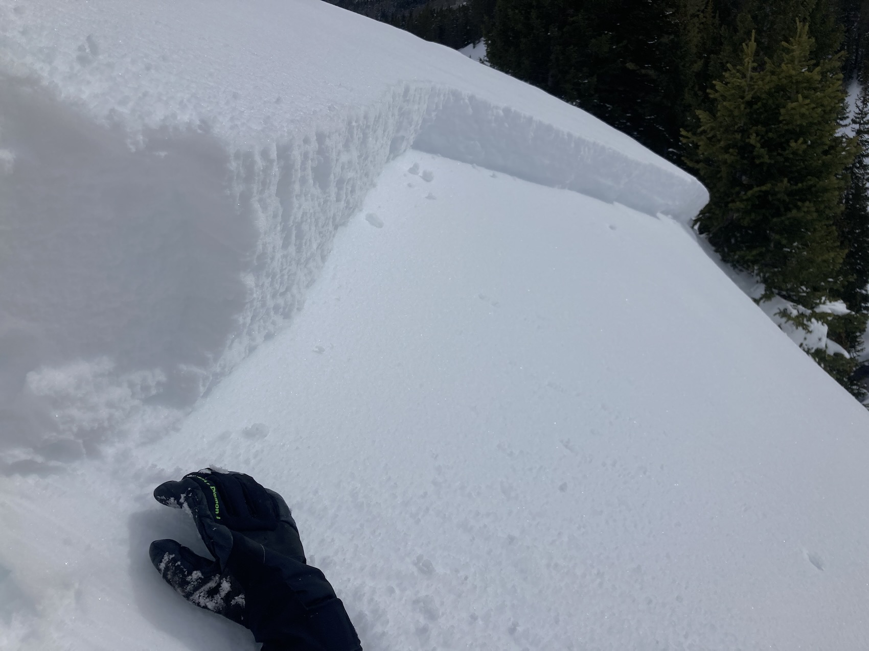
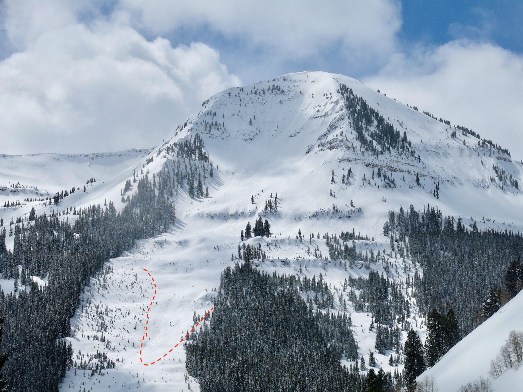
10,500ft West aspect. ECTP 23 on the 3/20 crust.
-

-
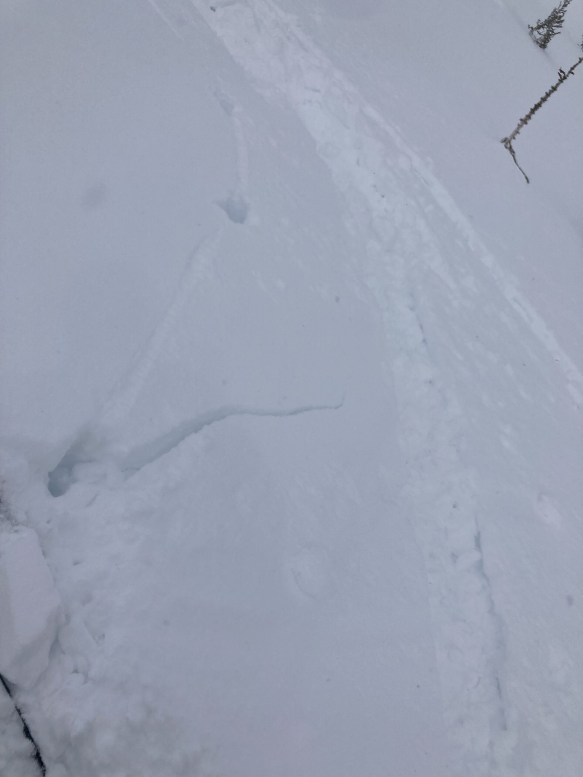
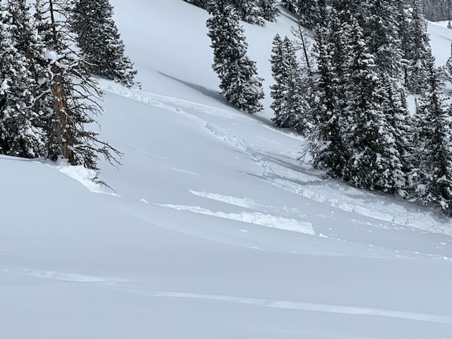
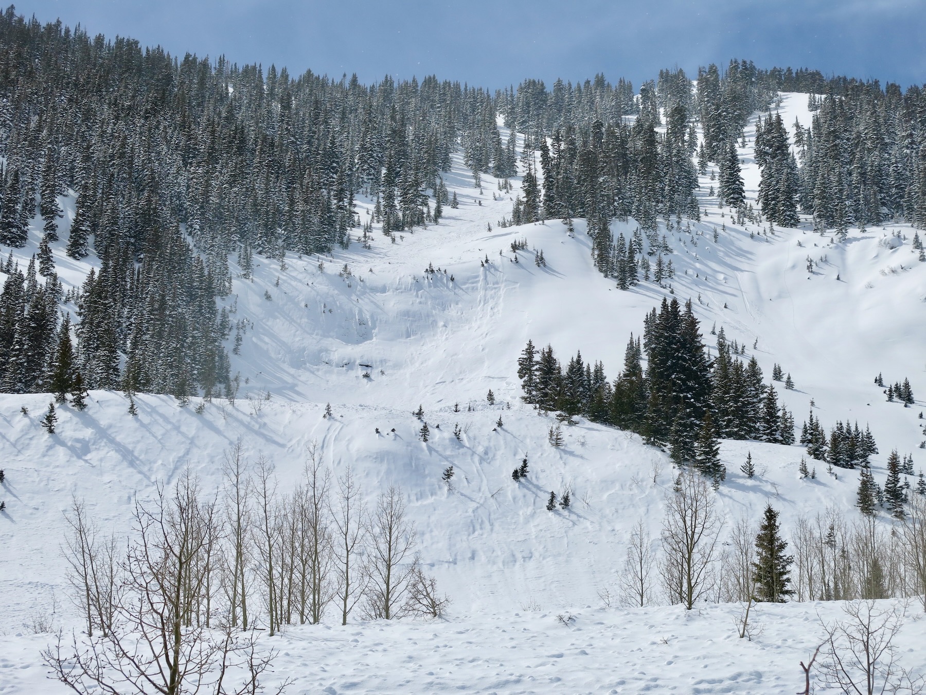
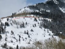
A small natural avalanche that ran today on a steep unsupported west aspect. Ran on the 3/20 crust. 9,100ft.
-

-

-

-
Purple Palace
-

-
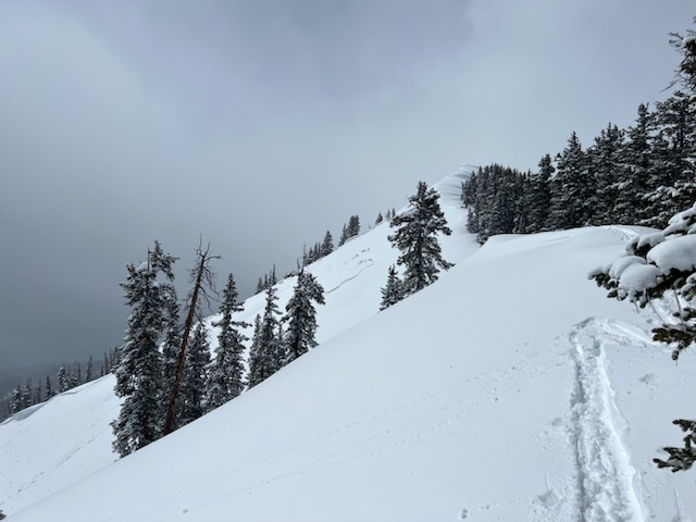
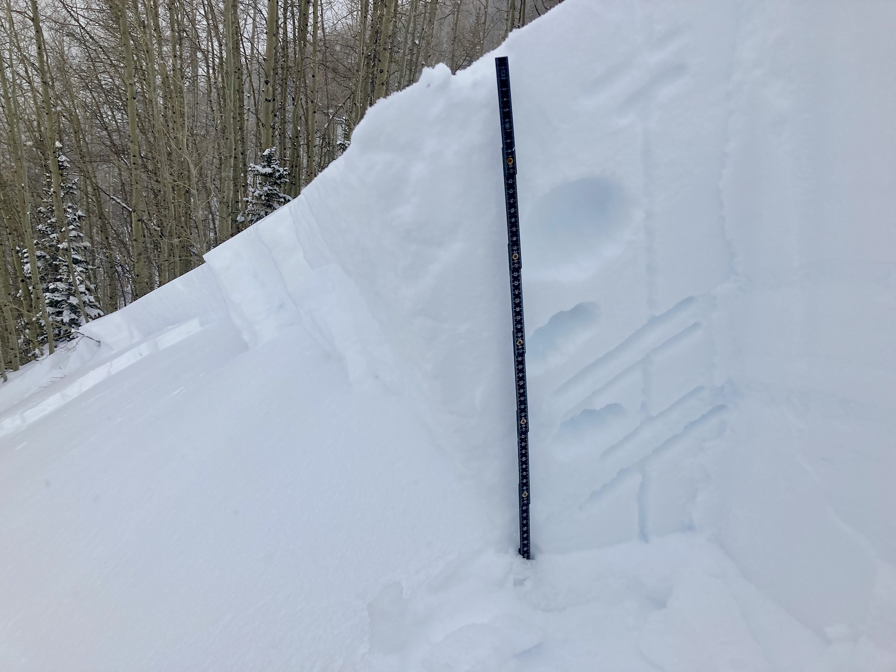
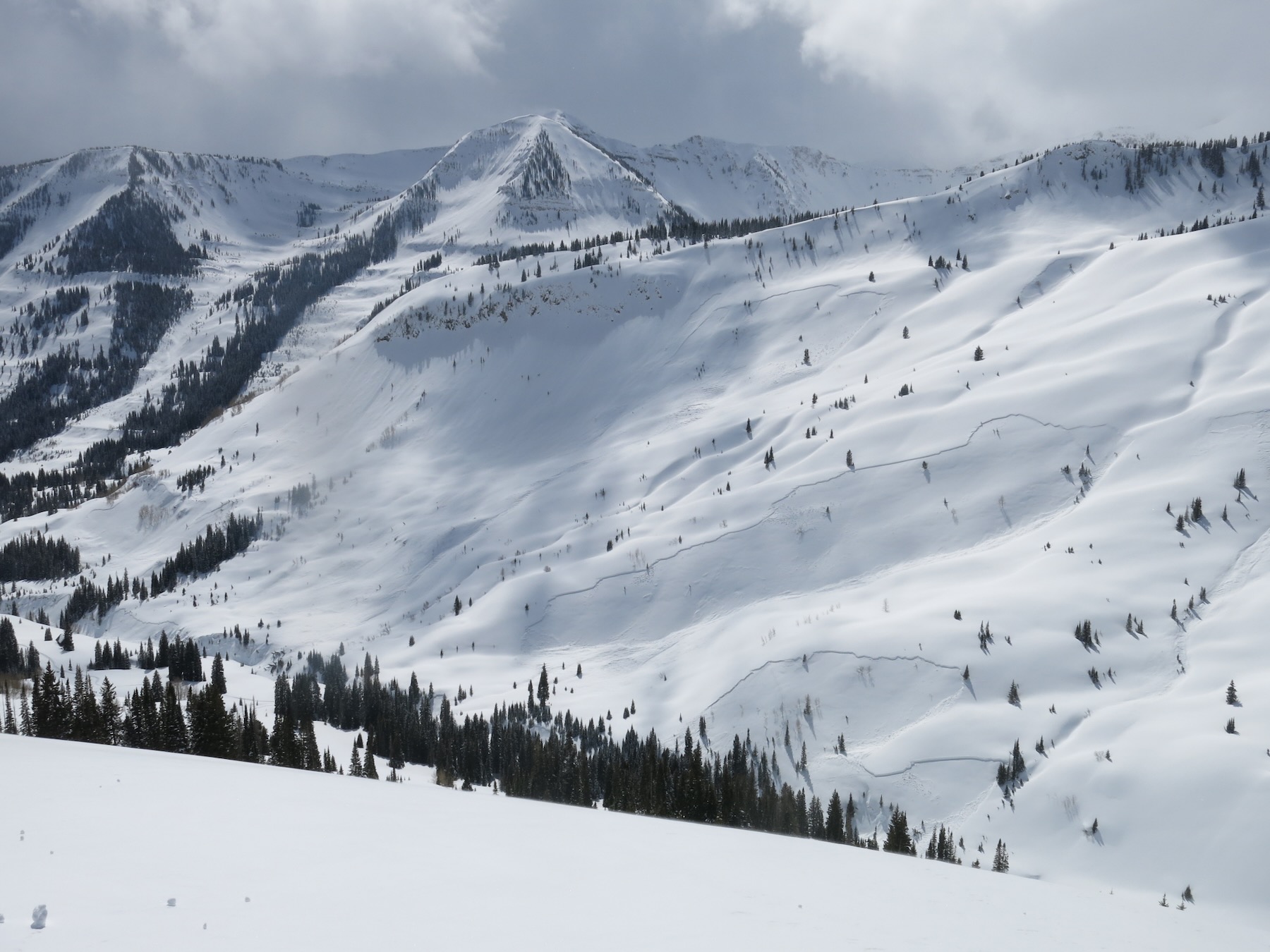
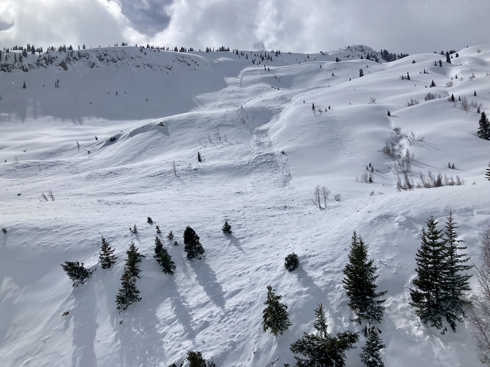
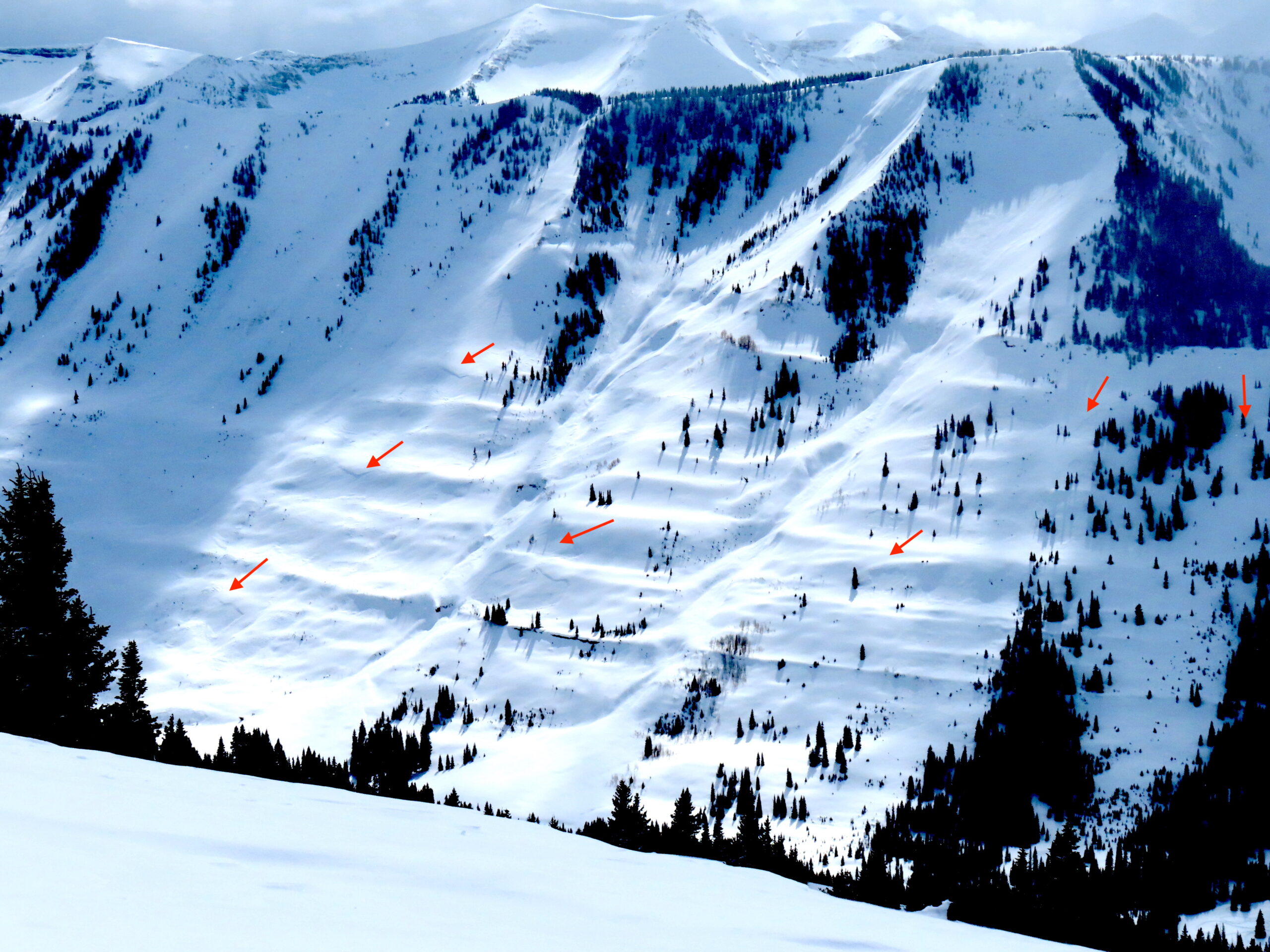
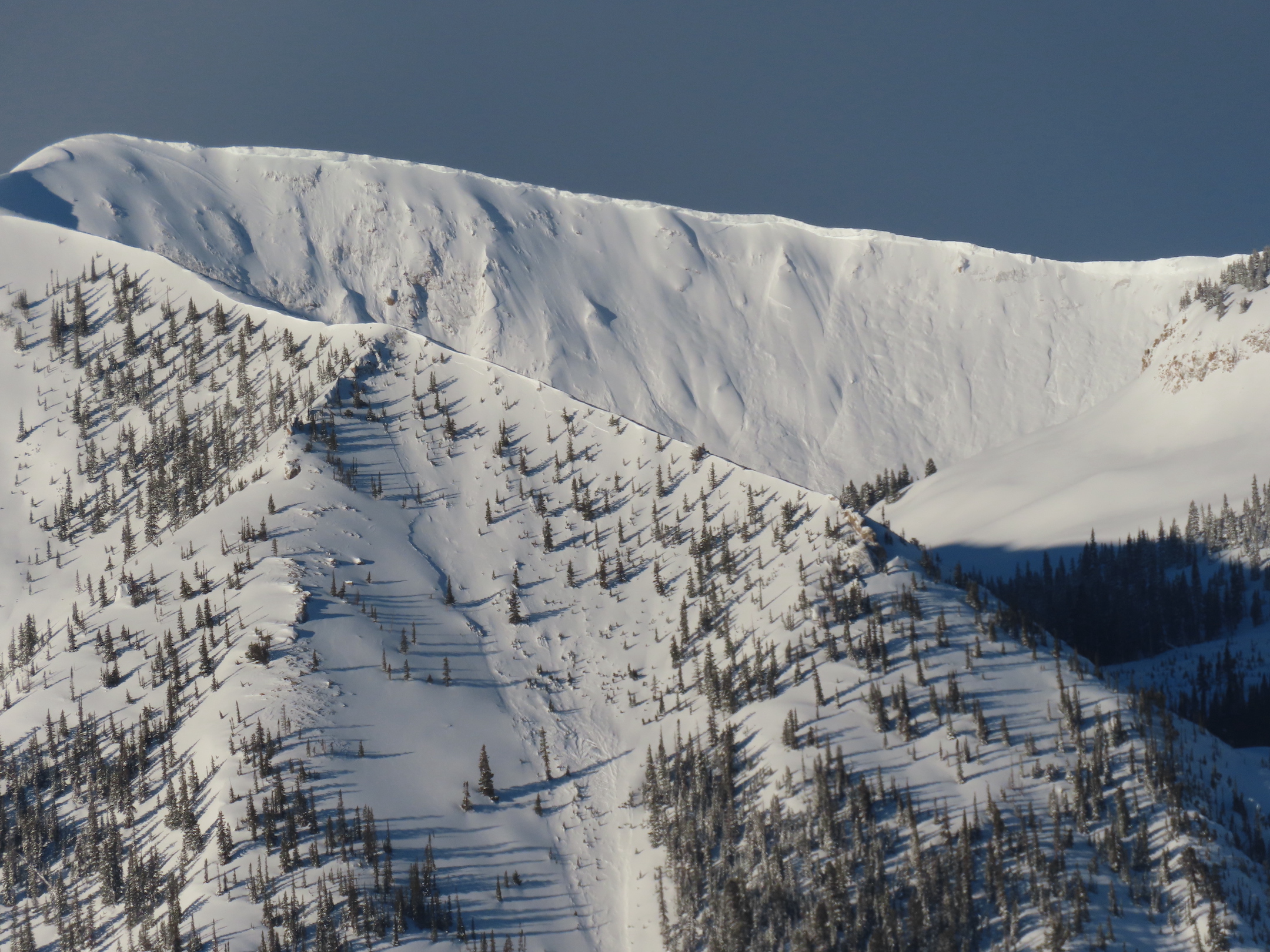
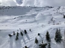
Wide propagating slabs below Purple Ridge.
-

-
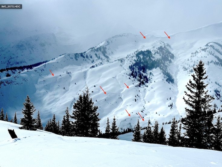
Several old avalanches near Gunsight.
-
-
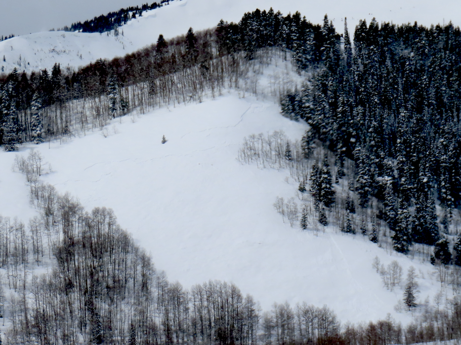
Wide avalanche near OBJ. East.
-

-
Far-running avalanche debris above Pitsburg. NE.
-

-
Far-running avalanche on Schuylkill Ridge. I couldn’t see the crown.
-
-
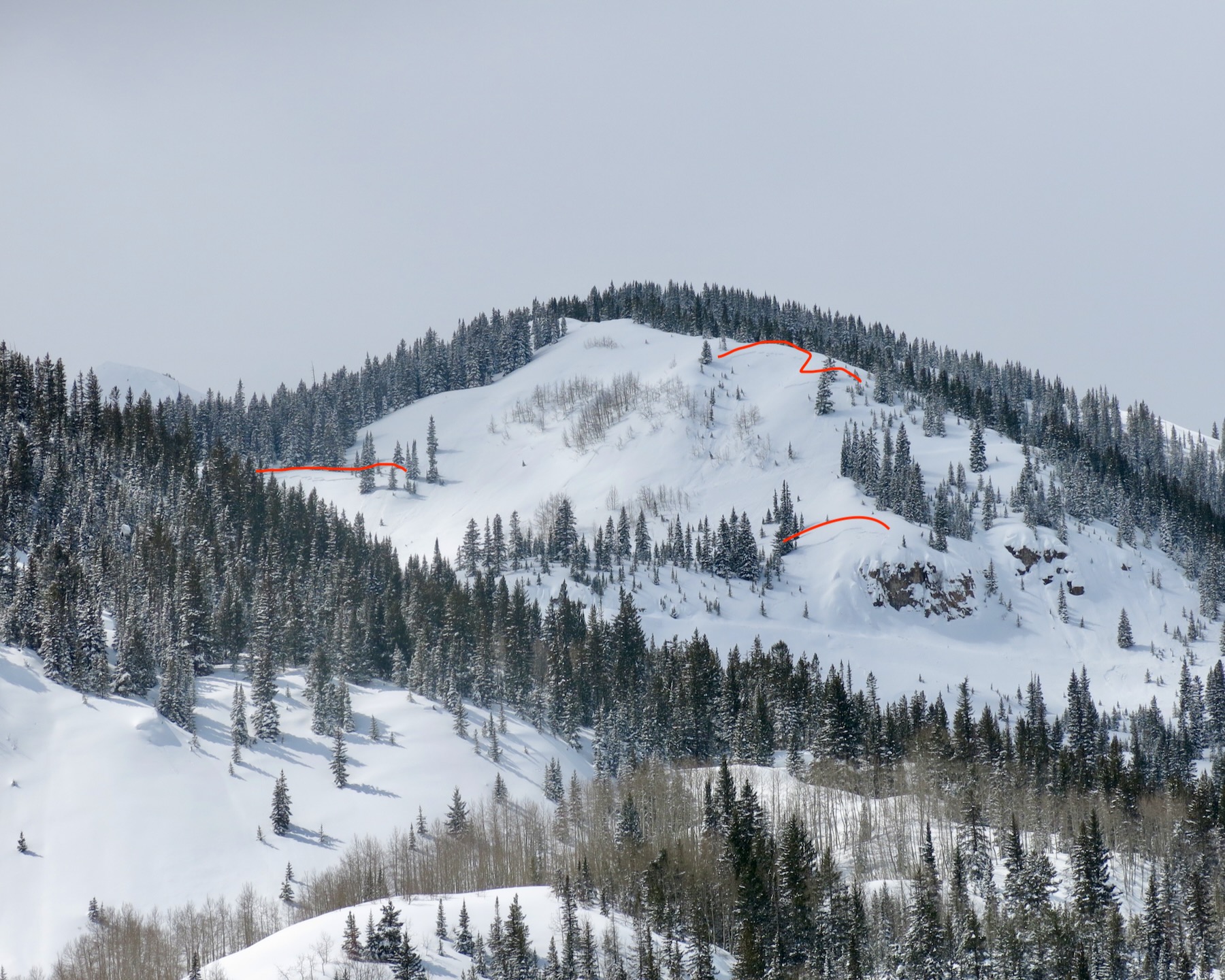
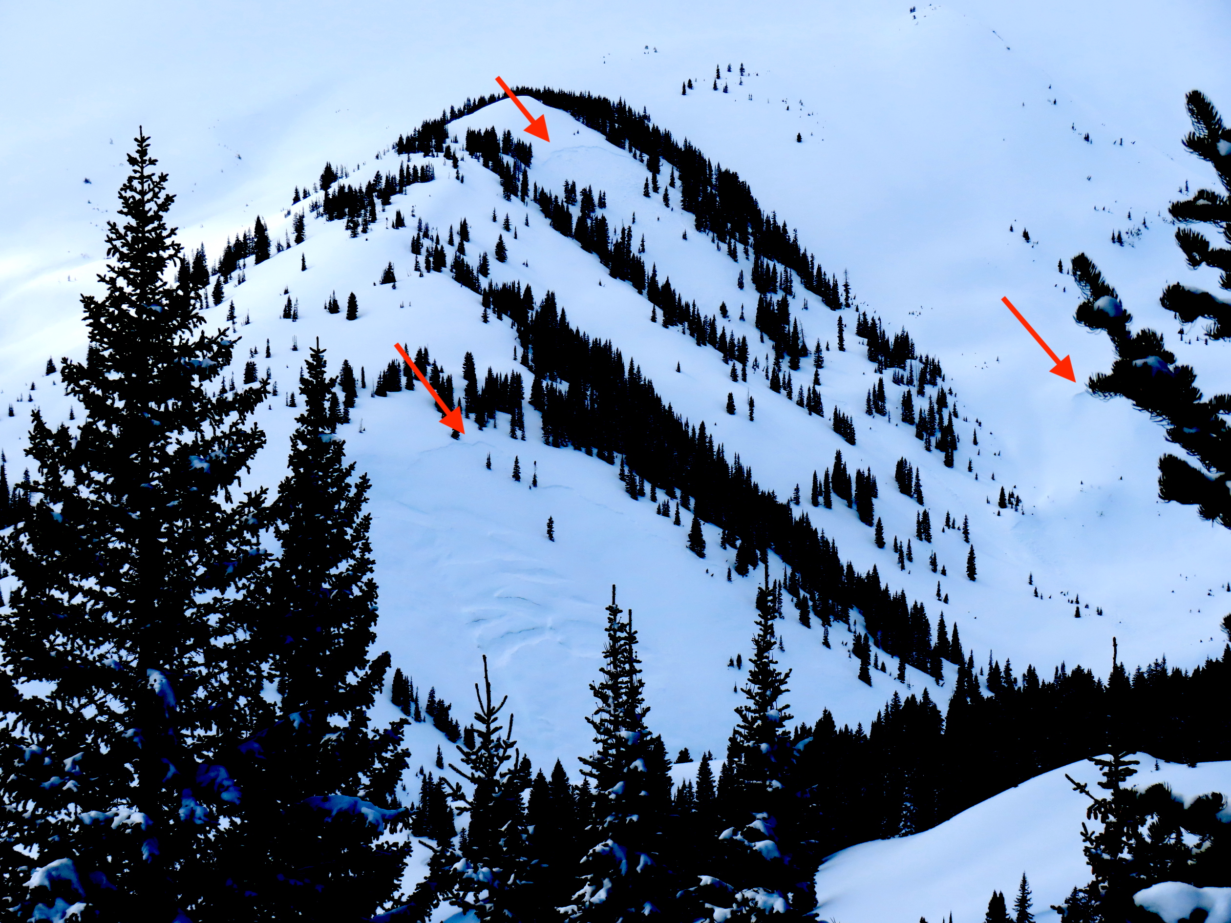
Random avalanche below Purple Ridge.
Estimated avalanche date: 03/24/2023
Number of Avalanches: 1
Location
Location: Upper Slate (Purple, Yule Pass, Paradise Divide)
Location Specific:
Start Zone Elevation: BTL: Below Tree Line
Aspect: W
Characteristics
Trigger: Snowmobiler
Trigger modifier: Remote
Type: Soft Slab
Failure Plane: Old snow
Size
Relative Size: R1 very small
Destructive Size: D2 – could bury, injure, or kill a person
Avg. crown height (inches): 24
Avg. width (feet):
Avg. vertical run (feet):
Involvements
# of people caught:
# of partial burials:
# of full burials:
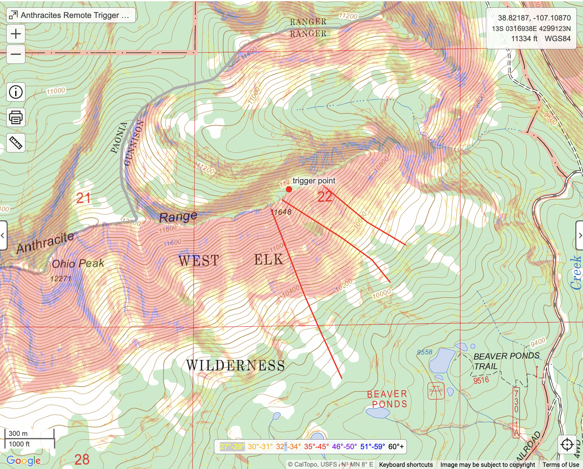
Additional comments: Remote from several hundred feet away.
6156