Date of Observation: 01/29/2021
Name: Ben Pritchett
Zone: Southeast Mountains
Location: Long Lake area
Aspect: North, North East, North West
Elevation: 9500-10000
Avalanches: No new slab avalanches seen. Dry loose sluffing in steep northerly facing terrain that has grown completely faceted.
Weather: Ridgeline Wind Speed: 20-30 mph
Ridgeline Wind Direction: SW
Wind Loading: Light
Temperature: 35 F
Depth of New Snow: 1 cm
Depth of Total Snow: 85 cm
Weather Description: Cloudy, warm. Pre-frontal winds picked up and began to transport snow early afternoon.
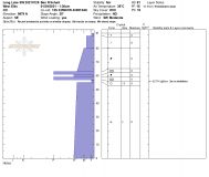
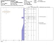
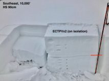
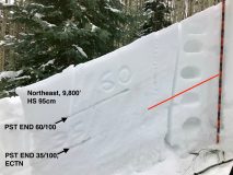
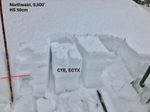
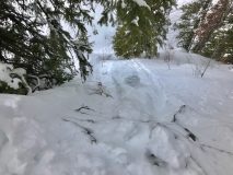
Snowpack: Went hunting for weak snow. Dug numerous holes in this transitional zone on the periphery of the deep snow belt. This area is often representative of weaker parts of the zone, but not as shallow as Spring Creek or Taylor. Height of snow varied from 40-120cm. No collapsing or cracking observed today while traveling in areas of weak snow. Add another 20-30 cm of slab (in the deeper snowpack areas or at higher elevations) and I would expect isolated / stubborn collapsing and the potential for human-triggered avalanches if you find just the right spot. South and west facing slopes have durable, supportive crusts below the most recent storm snow. No current avalanche problem, and not likely to become dangerous with this incoming storm. Northwest and North are thin, and thoroughly faceted. Very little slab structure. Easy to push loose dry avalanches that gouged to near the ground. Sluffing in the deeper parts of the zone can be expected with more than 6-8″ of new snow. Northeast and east have the thickest slabs. Southeast is the touchiest with the stiffest layers (thin crusts) above recently buried and basal facet layers. Northeast through east to southeast remain the bullseye for Persistent Slab avalanches. With Saturday’s loading these slopes will remain the areas of greatest concern.
Photos:


