Date of Observation: 12/21/2022
Name: Eric Murrow
Zone: Northwest Mountains
Route Description: Washington Gulch Road to Elkton Knob and the southerly side of Baldy.
Observed avalanche activity: No
Avalanches: none observed
Weather: Around 3 inches of new snow by 3pm. Continuous light snowfall during the day amounted in very little accumulation. Most new snow fell overnight. Moderate WSW winds at ridge top, some gusts were strong.
Snowpack: While traveling through several drifted near treeline features, we produced cracking up to 15 feet in the storm snow. Cracks were in lower-density storm snow as most leeward features near treeline had stiff old snow surfaces from previous winds. Wind drifts up to 10 inches were observed immediately below cornices/terrain breaks but quickly diminished to just a few inches on a feature scale. I suspect you could have triggered small avalanches in the storm snow at upper elevations but the size would have generally been harmless to a person.
In sheltered areas facing the north half of the compass, the old snow surface was comprised of small grain facets, generally less than 1 mm, and looked weak enough to not tolerate significant loading before small avalanche activity begins.
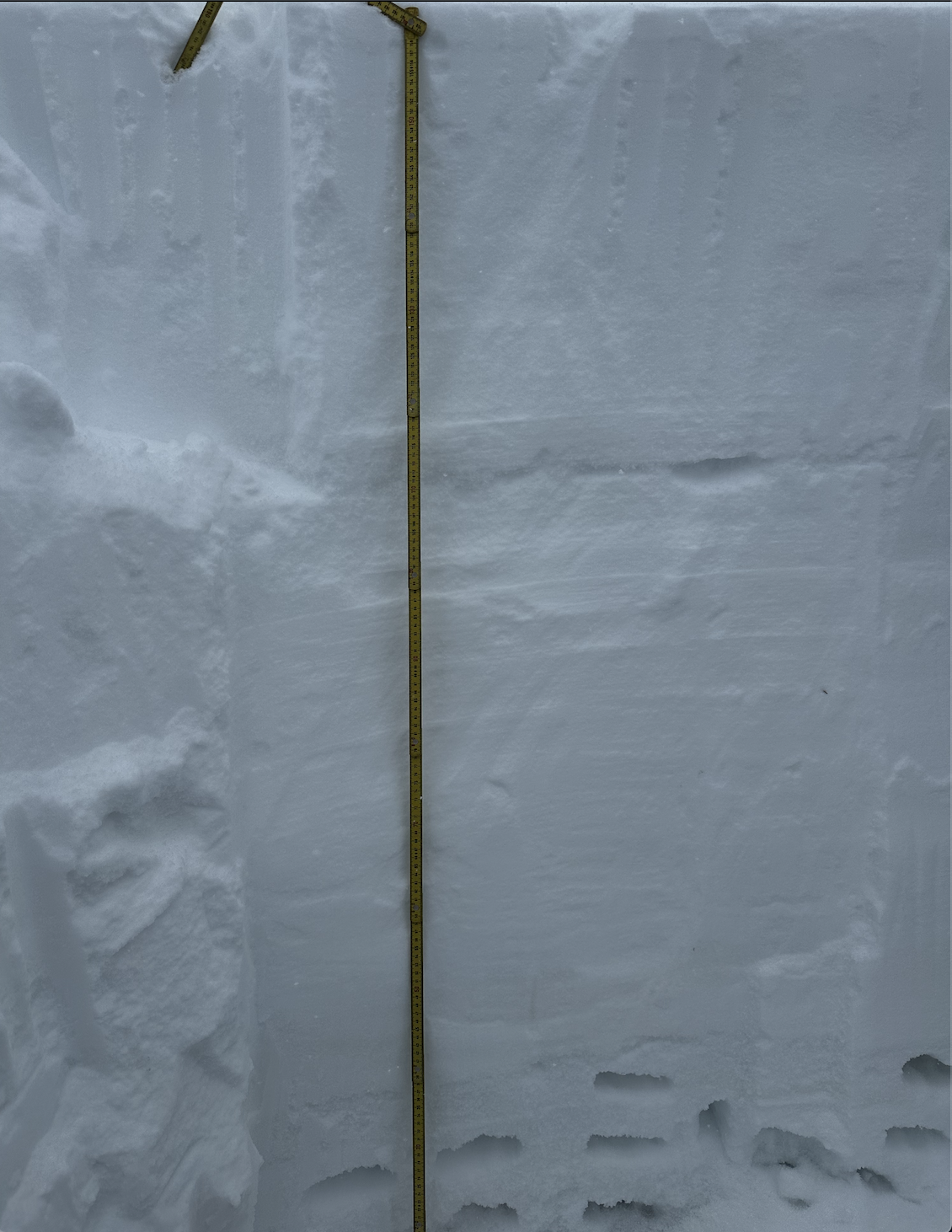
I dug a single profile in a leeward northeast-facing feature at 11,300 feet to look at the basal facets. I chose to dig here as it would demonstrate a best-case scenario for improvement in basal facets as the depth was around 150cm with 125cm of slab resting above. The basal facets were 4-finger hard (softer end of 4-finger harness) and showed clear signs of rounding, but remain far softer than the hard, drifted slab above. It still appears possible to trigger an avalanche in basal weak layers where snow depths are variable leaving thinner slabs above the weak layer.
-

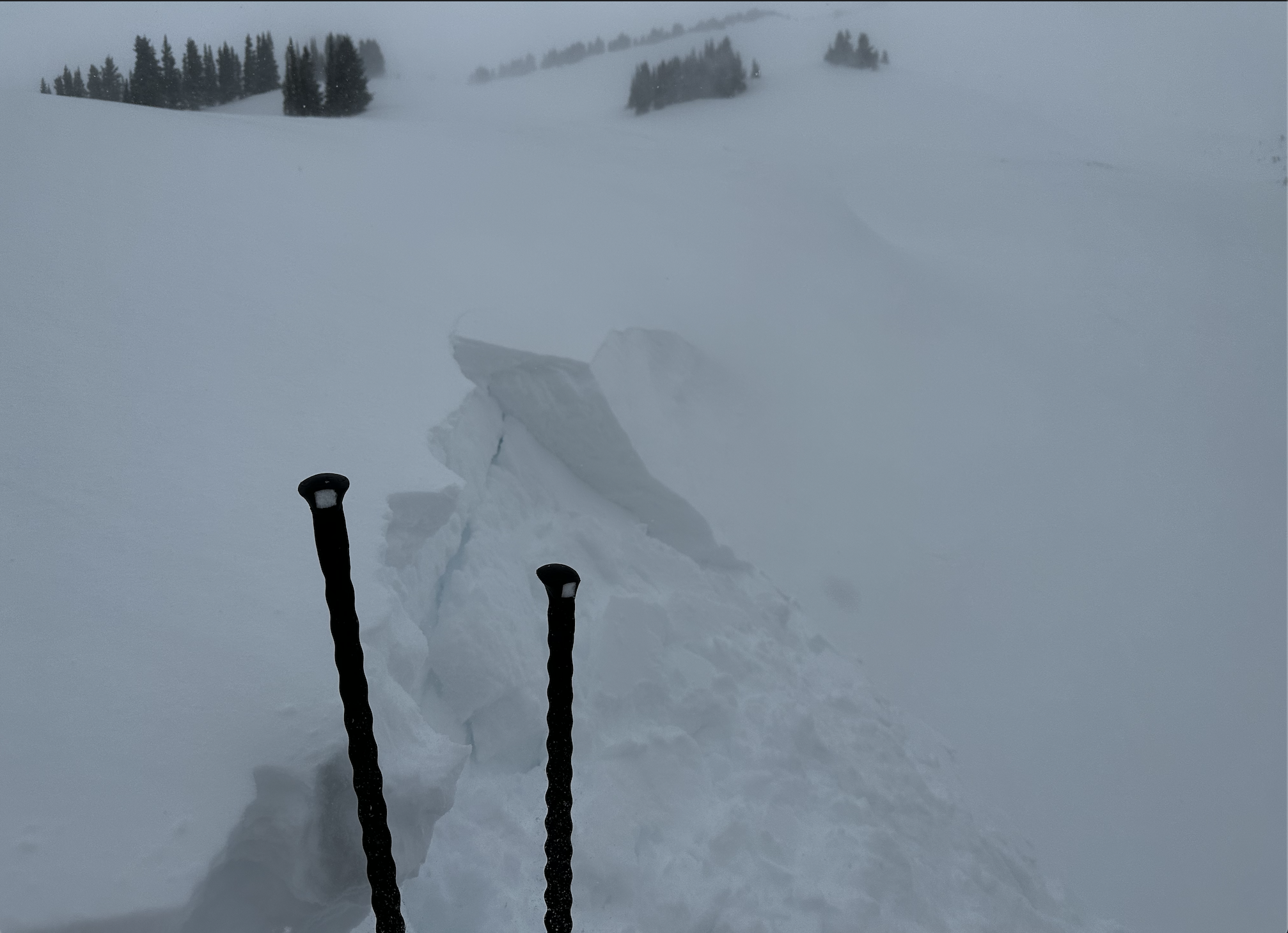
- Storm snow beginning to drift onto leeward terrain features forming fresh cornices and slabs.

-

- A shooting crack around 15 feet long on a leeward terrain feature. Cracking and storm snow is only a few inches thick.

-

- A good example of the drifting near treeline. New slabs remain isolated to below ridge tops or below cornices and quickly thin out below terrain breaks. Fresh slabs may increase in size overnight as more snow accumulates and drifts.
-

- A quick look at a well-drifted northeast slope near treeline. The slab is well over a meter thick capping the early-season weak layer. The basal weak layer has increased in strength but remains far softer than the slab above. Finding the wrong spot in a shallow area could release the season’s snowpack.