Date of Observation: 02/20/2022
Name: Ben Pritchett
Zone: Northwest Mountains
Route Description: Mt. Emmons, Redwell Tour
Observed avalanche activity: Yes
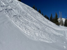
Avalanches: We pushed numerous Dry Loose avalanches in steep, north through east-facing wind-sheltered terrain below treeline. The couple of inches of settled recent snow seemed to prime these particular features, where they would collapse and run before I pushed on the steep part of a roll-over. It was almost like a close-proximity remote trigger Dry Loose avalanche – just an indication of how very weak the near-surface snow is going into this storm.
Weather: Ridgeline Wind Speed: 10-20 mph
Ridgeline Wind Direction: W
Wind Loading: None
Temperature: 20 F
Sky Cover: Few
Depth of Total Snow: 170 cm
Weather Description: Cool, breezy morning, but air temperatures were climbing quickly.
Snowpack: A grab-bag of faceted surfaces. Some were normal, mid-winter faceted surfaces, and others were outrageously weak.
The weakest snow we found was near and below treeline in wind-sheltered northeast and east-facing terrain. Here you can still trigger long-running Dry Loose avalanches, and the these slopes will become dangerous early this week as new snow totals reach around 8 or 10 inches.
Alpine northerly-facing terrain is covered in plenty of weak snow, but these slopes will take more load to grow dangerous.
Southerly-facing terrain is capped by a variety of faceted crusts.
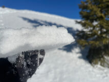
- We found thin sun-crusts capping small facets on near treeline, southeast-facing slopes. These will hold a bit of weight before breaking into the facets below as soft slabs develop later this week. February 20, 2022.
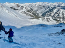
- This north facing gully often sees a lot of wind, but it’s particularly haggard from the sustained northwest to northerly winds of the last week. February 20, 2022.
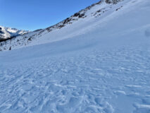
- These wind-etched snow surfaces are weaker than they appear. Often these textures indicate a settled supportive surface, but several inches of large-grained, very weak snow rests just below these dappled textures. Ski penetration through here was boot deep. Northerly-facing alpine slopes like this hold quite continuous weak snow below the snow surface, despite the varying wind textures. Slopes like this will be come dangerous as they accumulate a foot or two of snow this week. February 20, 2022.
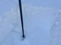
- In wind sheltered areas with out recent wind errosion, the large-grained, faceted snow is about 10 or 12 inches deep. North-facing, February 20, 2022.
- We easily triggered many small Dry Loose avalanches on north through northeast, to near east-facing slopes. Slopes facing south-of-east were just crusted enough to not sluff. February 2022.


