By Arden Feldman CBAC Intern
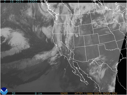
The week started off balmy on February 10th with warm, moist southwest flow issuing in record high temperatures for the second day in a row. billy barr’s Gothic weather station recorded a record high of 48 degrees. A closed low off of the California coast began streaming unusually warm Pacific moisture into Colorado during the evening of the 10th. This caused increasing clouds and precipitation to filter into the region with strong winds. The freezing level was around 10,000 feet, so downtown Crested Butte and many below tree line slopes received rain, while higher elevations received dense snow. Winds on the 10th averaged 24 mph and gusted up to 89 mph at 11,000 ft. On the evening of the 11th, a cold front passed overhead sparking heavy snowfall and allowing temperatures to finally drop below freezing throughout the forecast area. By the morning of the 12th, 3” of SWE and 19” of snow had accumulated at Schofield Pass, and 14” of snow was reported at CBMR.
On the 12th, the atmospheric flow split around Colorado with the main flow to our north and the cut off low to our south. The low was still sending some leftover moisture into our area with a southerly flow, causing light snow showers.. The flow then began to dry out, beginning a clearing and warming trend through the rest of the week. On the 14th there was a high of 22F at 11,000 ft but by the 16th, there was a high of 44F with beautiful clear skies.
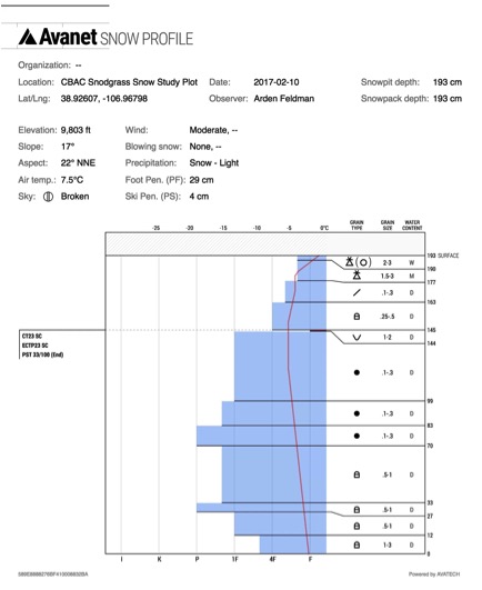
Persistent slabs on buried surface hoar layers on northerly and easterly aspects remained a problem this week. This week’s storm added a significant new load to the snowpack and tested the persistent weak layers, and we observed a handful of natural avalanches failing on buried surface hoar or facets again. The instabilities became increasingly isolated and stubborn through the week, but they were still present and sadly consequential, resulting in Colorado’s first fatality of the season in the Flat Tops. The storm also resulted in storm slab concerns, but few were reported likely due to the limited visibility during the storm.

2/14/17 – Persistent slab avalanche in the Flat Tops zone that resulted in the first avalanche fatality of the season in Colorado.
The warm temperatures and low elevation rain during the week resulted in wet avalanche problems. Relatively small but potentially consequential natural (here, here, here) and skier triggered wet loose avalanches were observed throughout the week, and with the rain below tree line, and several wet slab avalanches were also observed.


