


Avalanche Terrain Map for Crested Butte
We’re excited to release an Avalanche Terrain Exposure Scale (ATES) map of the Crested Butte forecast area to help you with tour planning. ATES is a scale used to categorize the severity of avalanche exposure, strictly based on the landscape, regardless of snowpack conditions. The ATES scale classifies terrain into five categories based on slope angle, forest density, slope shape, terrain traps, avalanche frequency/magnitude, starting zone size and density, runout zone characteristics, interaction with avalanche paths, and route options for managing exposure. See the draft definitions of the five-level scale (V.2) below.

For this year-long project, we partnered with OnX and Beacon Guidebooks to categorize terrain around Crested Butte as Simple (Class 1 = Green), Challenging (Class 2 = Blue), Complex (Class 3 = Black), and Extreme (Class 4 = Red). We used an automated model approach called AutoATES, and calibrated the release areas and runout models using historical data from our avalanche records and local experience to tweak model inputs such as tree density and alpha angles. Although models are never perfect, the map should provide a useful resource for route planning and identifying what terrain is relatively more or less exposed to avalanche hazards. Remember that this map is independent of snowpack conditions; some days it is safe to travel in complex terrain, and other days it is dangerous. And you can still get into trouble in simple terrain under certain conditions. This map is available for free on our website here, or under the “Resources” tab on our website menu. Bookmark it as another tool! You can also use this map offline in the field using the OnX app (subscription required).
“When snowpack is the question, terrain is the answer!”

End of Season Party!
Join CBAC staff and friends on Friday, April 7th at the Talk of the Town to celebrate another great season. Enjoy a free beer and music by Atmospheric Whiskey River. The party starts at 5:00 pm and the music starts at 6:00 pm.

Observation Contest: Win a pair of Weston Skis
Help CBAC forecasters and your fellow backcountry community by submitting observations from your tour. The person with the most observations submitted at the end of the season will win a free pair of Weston Skis.

Fireside Chat February 9th
The Fireside Chat is back on Thursday, February 9th with Dr. Jeff Deems. Jeff is the Co-Founder, CTO, and Formulation Lead for Airborne Snow Observatories, Inc as well as a scientist at the CIRES National Snow and Ice Data Center. He explores spatial variability in mountain snowpacks using lidar remote sensing, physical modeling, field measurements, and of course, climbing skins and skis. He has spent many hours flying over and touring the snowpack of the Upper Gunnison Valley in an effort to understand the nature of mountain snowpacks. In this Fireside Chat, we will look at using Airborne Snow Observatories data to get accurate inventories of basin snowpacks and explore some emerging best practices for using digital mapping tools to navigate avalanche terrain and risk. We will be at Tully’s in CB South, starting at 7:00 pm but feel free to show up early to grab a drink, some delicious food, and catch up with your buddies.

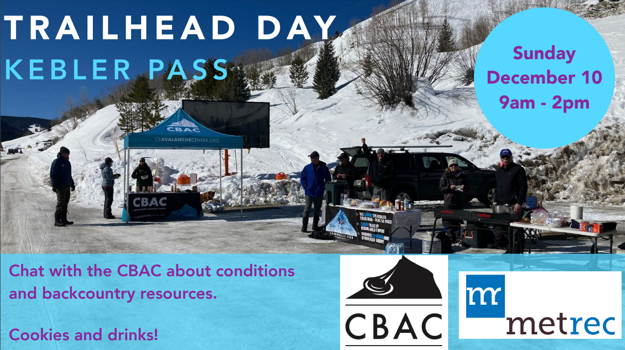
Trailhead Day at Snodgrass
Snow looks to return to the Gunnison Valley this weekend, stop by and chat with CBAC staff for the latest info on the changing avalanche conditions as well as maps, stickers, rescue cards and some snacks for your adventure.

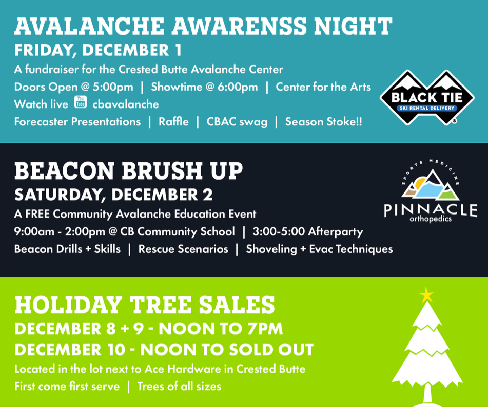
Trailhead Day-Ohio Pass Trailhead
CBAC staff will be at the Ohio Pass Trailhead this Saturday, January 14th providing up-to-the-minute reports and conditions from the backcountry. Stop and say “hey” and grab a free map, snacks, rescue cards and stickers.

New Encyclopedia on Avalanche.org
We’re excited to announce the release of a completely new encyclopedia on avalanche.org. We think it’s a great resource for learning or refreshing your avalanche knowledge, with over 250 terms organized into sections relating to avalanches, snowpack, terrain, weather, and human factors. CBAC lead forecaster Zach Guy authored this project with contributions and revisions from the National Avalanche Center, the Sawtooth Avalanche Center, and the Chugach National Forest Avalanche Center. The American Avalanche Association and the National Avalanche Center orchestrated and funded the project.
Here’s the link, which is also under our resources tab: https://avalanche.org/avalanche-encyclopedia/

New Accidents Map
We just published an interactive accidents map that allows users to explore and read reports of avalanche fatalities, injuries, and burials in the Crested Butte forecast area as a learning resource. You can access the map under the “Resources” tab on our website, or at this link. Although we did our best to dig up old accident accounts, some of our records may be incomplete.
